Harstad i okolice
Jak już wspomniałem ostatnio, wyjazd na Lofoty to nie była jakaś tam spontaniczna wycieczka, a wydarzenie związane z przybyciem do Norwegii po dwumiesięcznej podróży z Chin, jednostki Havfarm. Razem z pozostałymi członkami zespołu, mogliśmy na żywo podziwiać projekt, nad którym część z nas pracowała przez ostatnie lata, w planie były również oficjalne spotkania z inżynierami z NSK Ship Design oraz zwiedzanie nowej przetwórni rybnej firmy Nordlaks, po której oprowadzał nas sam prezes, Inge Berg.
Ale zaraz, być na Lofotach i nic nie pozwiedzać, nie wejść nawet na jedną małą górkę? O nie!
Na szczęście mieliśmy też trochę wolnego czasu do wykorzystania, głównie w niedzielę i to wtedy postanowiłem wybrać się na wędrówkę po górach. Byliśmy zakwaterowani w hotelu w Harstad i z powodu braku własnego środka transportu, miałem niestety ograniczony wybór możliwości dokąd się udać. Poprzedniego wieczoru zasięgnąłem języka wśród miejscowych i polecono mi szczyt Middagsfjellet (604m n.p.m.), wznoszący się tuż za centrum miasta.


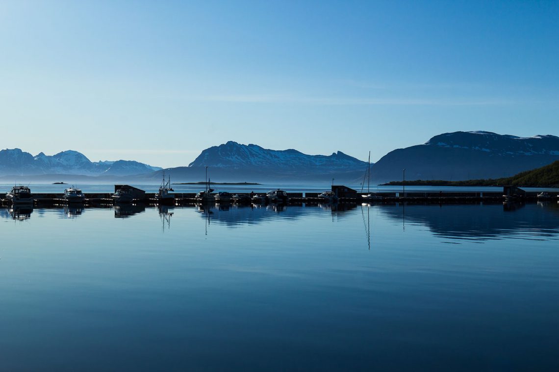
Po skonsumowaniu skromnego śniadania wyruszyłem w drogę. Pogoda nie była już tak idealna jak w poprzednich dniach i w drodze na początek trasy złapał mnie przelotny deszcz. Ale byłem przecież na Lofotach i nic mnie nie powstrzyma przed wejściem chociaż na jedną górę, myślałem. Deszcz rzeczywiście był przelotny i skończył się tak nagle jak nagle się zaczął. Natrafiłem na odpowiednią ścieżkę, konsultując się z apką ut.no na komórce. Trasa przecinała początkowo teren strzelnicy i odpowiednie tablice informowały, aby nie kontynuować marszu, kiedy na maszcie wywieszona jest czerwona flaga. Rzecz jasna żadnego masztu nie było wdać więc zaryzykowałem. Dopiero potem go dostrzegłem i poczułem ulgę nie dostrzegając na nim flagi. Teren delikatnie się wznosił, dzięki czemu spoglądając za siebie mogłem ujrzeć piękne, wynurzające się z morza, wysokie góry, pokryte śniegiem. Miałem nadzieję na znacznie lepszy widok, gdy już dojdę na szczyt.
Moje nadzieje legły w gruzach niedługo potem, gdy natknąłem się na głębokie zaspy śniegu, zalegające na ścieżce i wartkie potoki roztopowych wód, spływające po szlaku. Nie miałem na sobie butów trekkingowych, a jedynie lekkie obuwie do chodzenia na co dzień, choć pewnie i w swoich górskich butach miałbym problemy, aby się przebić przez te zwały śniegu. Najgorsze było to, że nie dotarłem nawet w pobliże szczytu. Nie uszedłem chyba jeszcze połowy drogi całej trasy. Więc skoro już tutaj ciężko mi iść dalej, a buty mam przemoczone, to co będzie dalej? Z bólem serca powziąłem decyzję o powrocie.
Znów przechodziłem przez teren strzelnicy i tym razem widziałem wędrującą po maszcie czerwoną flagę. W porę zdążyłem wrócić na bezpieczną drogę i uniknąć przypadkowego postrzału.
Nieoceniona apka ut.no, wskazała mi inny szczyt w okolicy, znacznie niższy, dzięki czemu istniała szansa, że nie będzie na nim śniegu. Znajdował się jakieś dwa kilometry dalej i nagle poczułem, że jeszcze nie wszystko stracone. Ruszyłem w tamtą stronę. Górka nosiła nazwę Gasåsen i miała zaledwie 180 metrów wysokości. Aby do niej dotrzeć musiałem przedrzeć się przez miejskie zabudowania i ruchliwą drogę 83 (na szczęście mogłem skorzystać z kładki). W końcu, nieco już zmęczony dotarłem na początek szlaku.
Sam szlak jest mało wymagający i dość krótki. Czego się jednak spodziewać po tak małej górce. Zbocza są całkowicie zalesione i jedynie wierzchołek oferuje jakieś widoki. Na szczęście owe widoki rekompensują wszystkie niedogodności. Panoramę Harstad ma się jak na dłoni. Poza tym można przyjrzeć się rewelacyjnie prezentującym się górom na wyspach w okolicy miasta. Widziałem stąd też mój niedoszły cel wędrówki, górę Middagfjellet, i całe mnóstwo śniegu na jej zboczu.
Na szczycie Gasåsen ustawiono ławeczki piknikowe, lunetę widokową a nawet wiatę chroniącą przed deszczem i wiatrem. Jest też miejsce na rozpalenie ogniska. Górka zapewne jest wobec tego niezwykle popularna jako miejsce rodzinnych spacerów i nawet podczas mojego krótkiego na niej pobytu, minąłem się z kilku – kilkunastoma osobami.
Powrót do hotelu zajął trochę czasu. Stopy protestowały w zmuszone do tak długiego marszu w obuwiu przeznaczonym do krótkich spacerów. W dodatku słońce znów zaczęło mocno grzać. Cieszyłem się jednak, że udało mi się zaliczyć na tych Lofotach jakąś górkę. Kto wie czy nie najmniejszą w całym archipelagu ale zawsze to jednak coś.


As I mentioned recently, a trip to Lofoten was not a spontaneous, but an event related to arriving in Norway after a two-month journey from China, the Havfarm unit. Together with the other team members, we were able to watch live the project that some of us have been working on over the past years. The plan also includes official meetings with engineers from NSK Ship Design and a tour over the new Nordlaks fish processing plant, together by the CEO, Inge Berg.
But wait, be in Lofoten Islands and do not go sightseeing, not even climb a small hill? No way!
Fortunately, we also had some free time to use, mainly on Sunday, and that’s when I decided to go hiking in the mountains. We were accommodated in a hotel in Harstad and due to the lack of any car I could use, I had a limited choice of where to go. The evening before, I asked the locals about some recommendation and I was sent to Middagsfjellet (604m a.s.l.), rising just outside the city center.
After consuming a modest breakfast, I set off. The weather was no longer as perfect as in the previous days and on the way to the beginning of the route a rain caught me. But I was in Lofoten Islands and nothing was going to stop me from climbing even one mountain, I thought. The rain was fleeting and ended as suddenly as it suddenly began. I came across the right path by consulting the ut.no app on my mobile. Initially, the route crossed the shooting range and appropriate boards advised not to continue walking when the red flag was displayed on the mast. Of course, there was no mast, so I took the risk. A short while later I noticed the mast and I felt relief not seeing the flag on it. The terrain rose gently, and when I looked back I could see beautiful high mountains range emerging from the sea, covered with snow. I was hoping for a much better view when I get higher.
My hopes were crushed shortly afterwards, when I came across deep drifts of snow lying on the path and swift streams of snowmelt flowing down the trail. I was not wearing trekking shoes, only light footwear for everyday walking, although I would have problems in my mountain boots to break through these heaps of snow. The worst thing was that I didn’t even get near to the summit. I haven’t been in halfway of the entire route, I thought. So since it’s hard for me to go on here and my shoes are all wet inside, what will happen next? With a heartache, I decided to return.
I was passing through the shooting range again and this time I saw a red flag wandering up the the mast. I managed to get back to the safe road in time and to avoid accidental shooting.
The invaluable app ut.no showed me another peak in the area, much lower, so there was a chance that there would be no snow on it. It was about two kilometers away and suddenly I felt that all was not lost. I headed that way. The hill was called Gasåsen and it was only 180 meters high. To reach it I had to go through the city’s buildings. Finally, a bit tired I got to the beginning of the trail.
The trail itself is undemanding and quite short. What to expect, however, after such a small hill. The slopes are completely forested and only the top offers some views. Fortunately, these views compensate for all the inconveniences. The panorama of Harstad is clear. In addition, you can look at the sensational mountains on the islands around the city. I could also see my unrealized destination, Middagfjellet, and all the snow on its slope.
Picnic benches, a viewing binoculars and even a shelter protecting against rain and wind were set up on the Gasåsen summit. There is also a place to light a bonfire. Therefore, the mountain probably is extremely popular as a place for family walks and even during my short stay there, I missed a few or a dozen people.
Return to the hotel took some time. Feet protested for such a long walk in footwear designed for short trips. In addition, the sun started to warm up again. However, I was glad that I managed to include a hill on these Lofoten Islands. Who knows if the smallest in the whole archipelago but it is always something.


Moja bieganina po mieście miała taki oto przebieg:


