Okolice Åndalsnes
Wybierając się do Åndalsnes miałem w planach więcej niż tylko przejście Romsdalseggen. Na niedzielny poranek zaplanowałem nieco krótszą trasę, tak, by jeszcze przed nocą zdążyć powrócić do domu. Okazało się jednak, że z tych dodatkowych opcji nic ostatecznie nie wyszło. Zamiast tego odwiedziłem parę miejsc, które nie wymagały kilkugodzinnej wspinaczki. I o nich chcę dziś opowiedzieć.
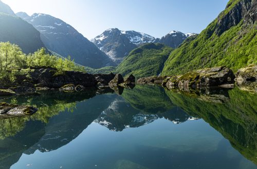
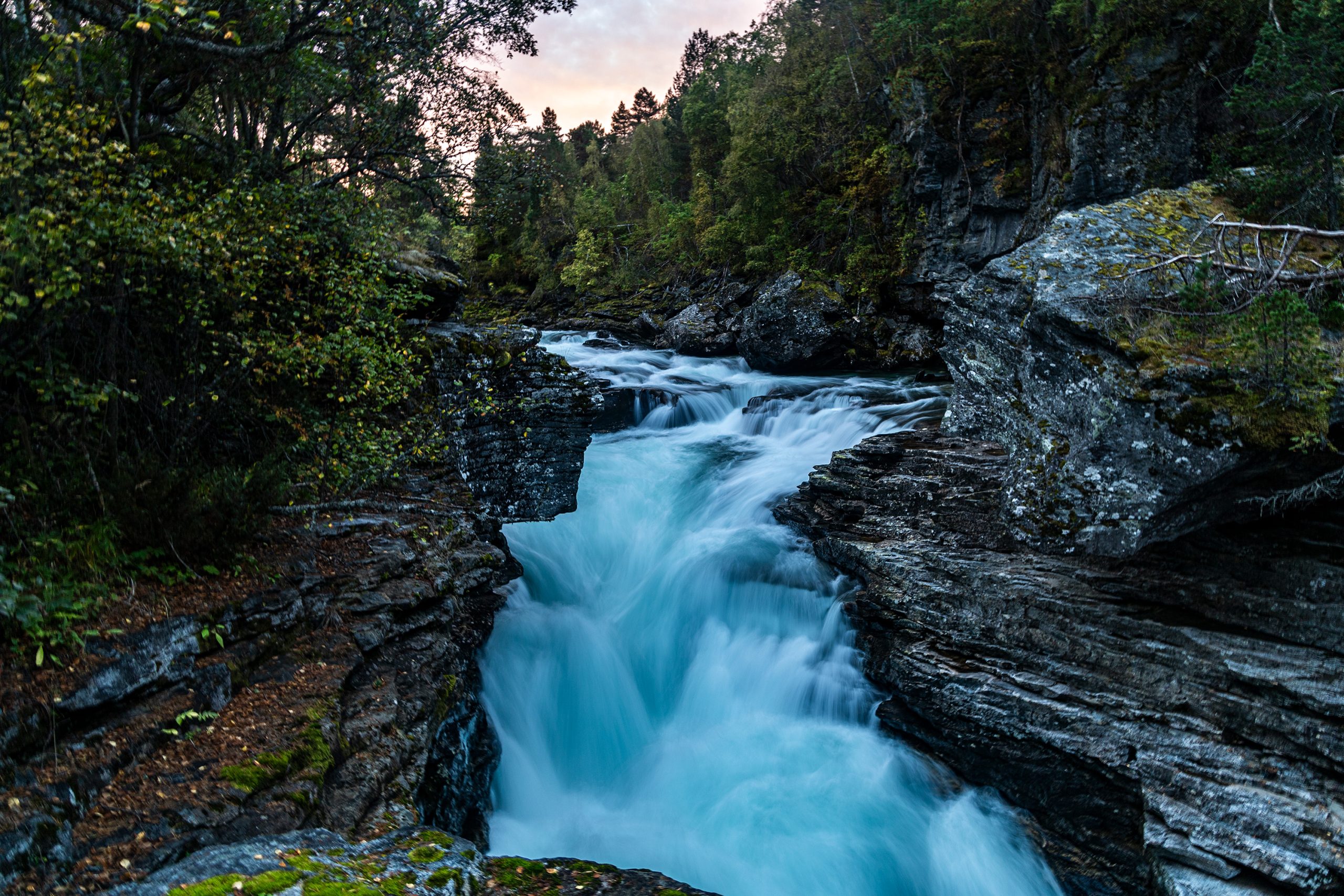
W sobotni poranek, gdy dopiero dojeżdżałem do Åndalsnes i swoją przygodę z Romsdalseggen miałem jeszcze przed sobą, wjechałem w zatoczkę z parkingiem przy wodospadzie Slettafossen. Bardziej byłem zainteresowany opróżnieniem pęcherza niż jakąś dodatkową atrakcją. Tym bardziej, że termometr w aucie wskazywał zaledwie kilka stopni powyżej zera. Miniona nocka była dość zimna jak na połowę września. Gdy jednak załatwiłem najpilniejszą potrzebę i założyłem kurtkę, postanowiłem rozejrzeć się nieco przed dalszą drogą. Parking usytuowano nad krawędzią wąwozu, dnem którego przewalała się z rykiem rzeka Rauma. Barierki wzdłuż klifu pozwalały na podejście całkiem blisko krawędzi, kilkunasto-metrowej przepaści, a w paru miejscach widok na spienioną rzekę był naprawdę imponujący. Na drugą stronę wąwozu prowadzi most. Tuż za nim znajduje się niewielka kafejka i sklep z pamiątkami, ale tamtego poranka obiekt ten był jeszcze zamknięty (a może w połowie września było już całkiem nieczynne). Z mostu widok na rzekę i wodospad jest jeszcze lepszy niż z punktów wzdłuż klifu. Sam wodospad, wg danych z Wikipedii ma aż 18 metrów wysokości.
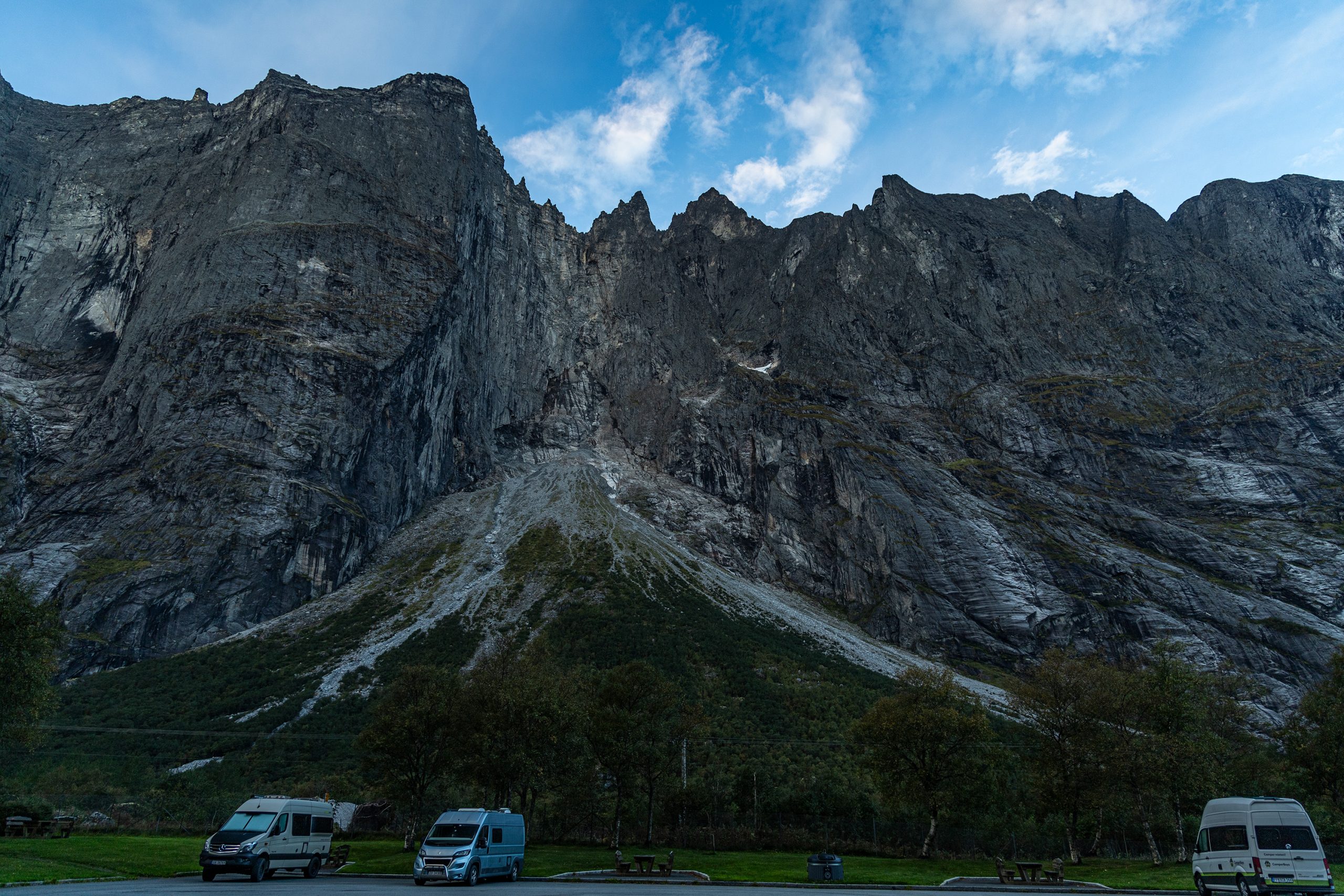
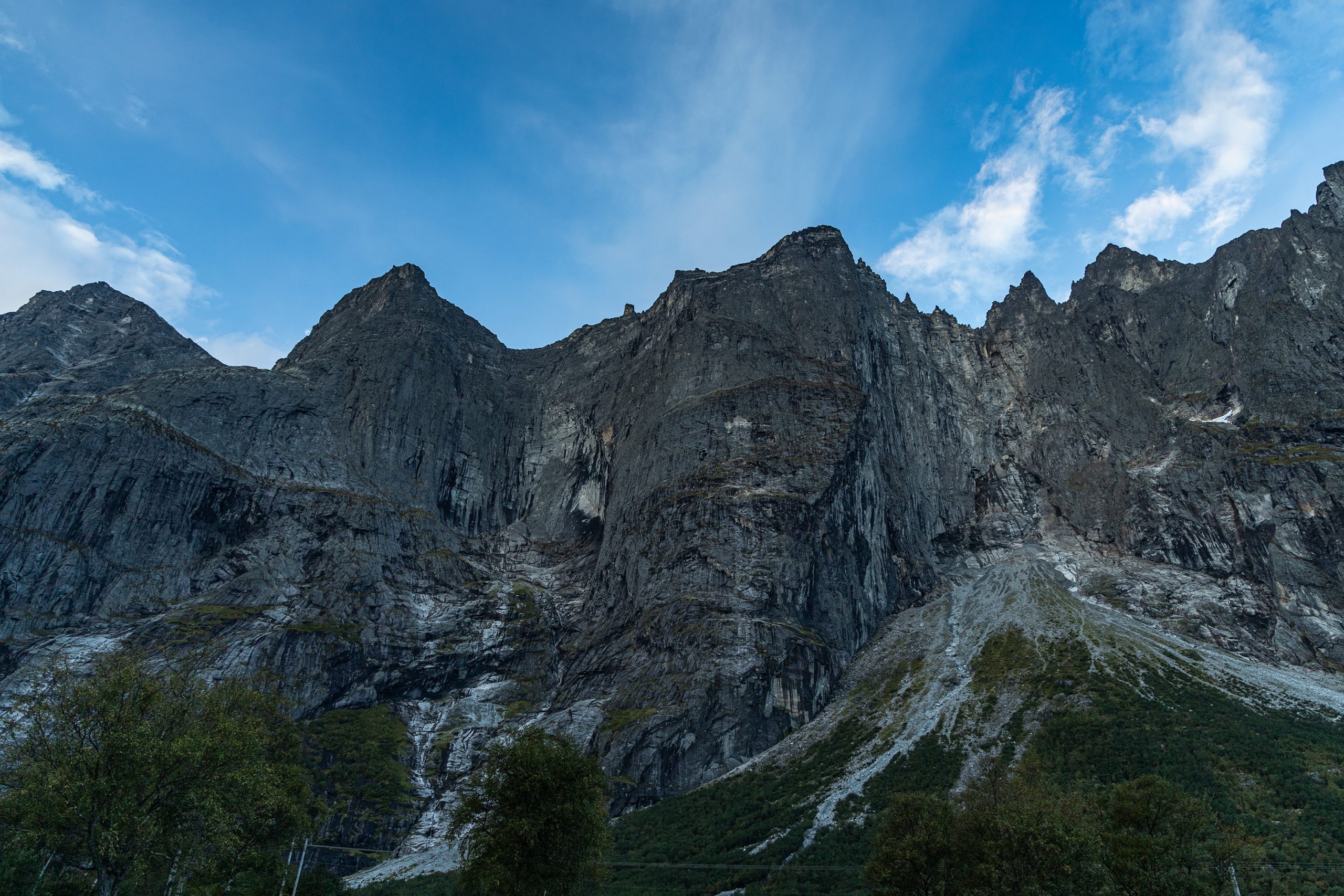
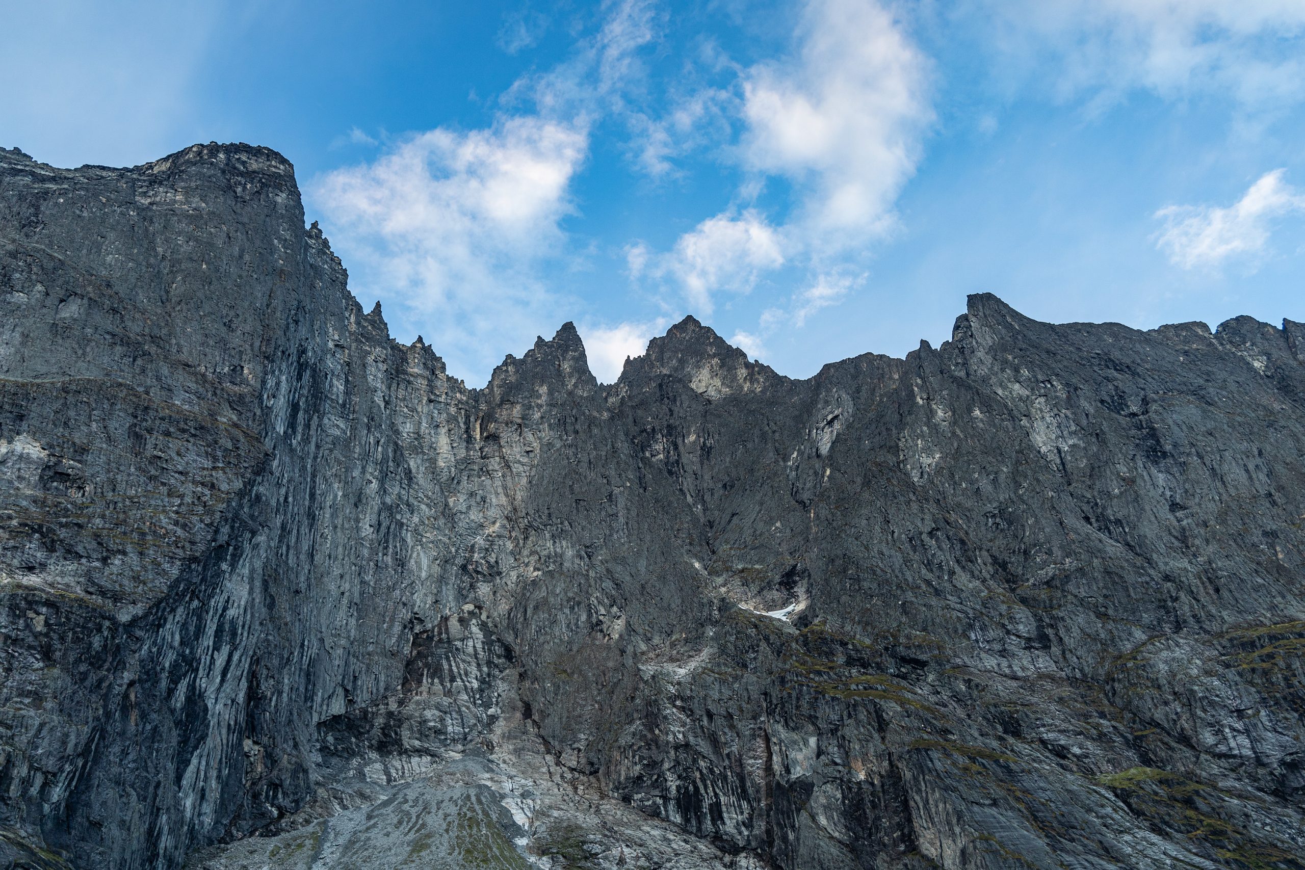
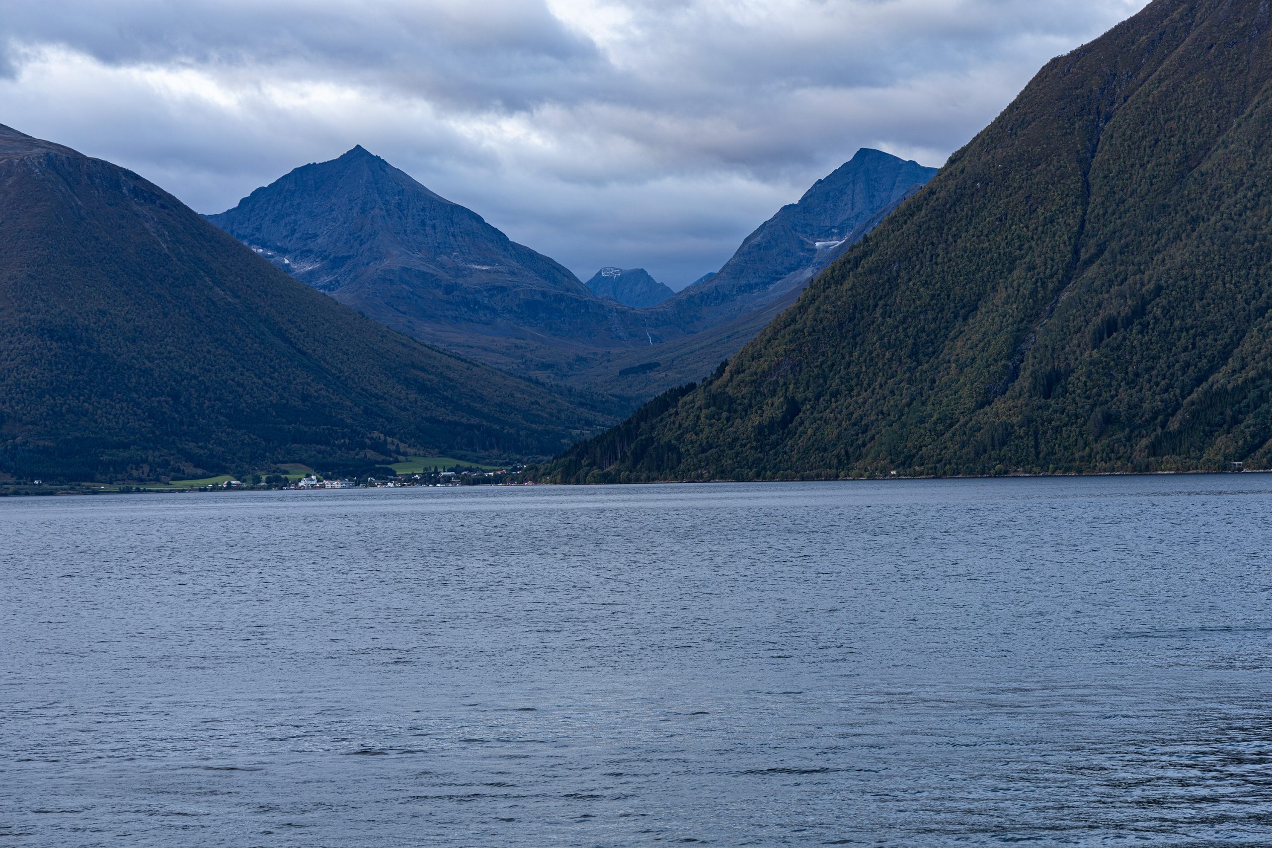
Zanim dotarłem na parking przy szlaku Romsdalseggen, zatrzymałem się jeszcze przy centrum turystycznym Trollveggen. Ono również było o tej porze zamknięte, ale za to miałem okazję przyjrzeć się sławnej Ścianie Trolli z poziomu drogi. Pionowa, wznosząca się ponad 1000 metrów kamienna ściana o poszarpanych wierzchołkach robi piorunujące wrażenie. Planując ten wyjazd rozważałem także wędrówkę nad krawędź Trollveggen, ale szlak wiedzie od drugiej strony masywu, gdzie wije się Droga Trolli, a ta niestety była właśnie remontowana i była wyłączona z ruchu. Trasa ta musiała więc poczekać na inną okazję, kiedyś w przyszłości.
Pojechałem dalej i w końcu dotarłem do Åndalsnes. Przeszedłem główny punkt programu, czyli Romsdalseggen, a po powrocie do auta, 10 godzin później, zacząłem rozważać opcje noclegowe. Miałem ich trzy, ale z uwagi na niewielką ilość czasu pozostałą do zachodu słońca, musiałem zdecydować się na tylko jedną, nie sprawdzając wcześniej pozostałych. Mój wybór padł na górę Kvitfjellet, wznoszącą się nad wsią Eidsbygda, niecałe pół godziny jazdy na północ od Åndalsnes. Szczyt był na mojej niedzielnej liście i pomyślałem, że jeśli udałoby mi się rozstawić namiot gdzieś w połowie drogi do wierzchołka, nazajutrz miałbym mniejszy dystans do przejścia i byłbym w powrotnej drodze znacznie szybciej.
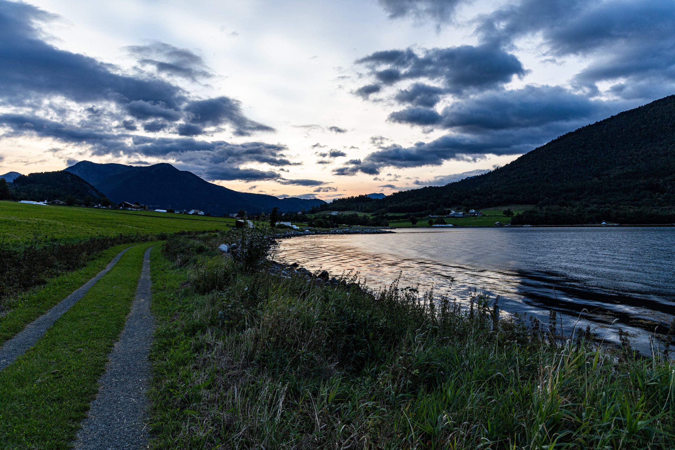
Dojechałem na miejsce i zaparkowałem przy ładnym, drewnianym, pomalowanym na biało kościółku. Był tam akurat parking dla tych wybierających się na najbliższe szczyty: Kvitfjellet i Hælberbet. Przepakowałem się szybko, wciskając do dużego plecaka niezbędny sprzęt i ciepłą odzież do przetrwania nocy i wyruszyłem. Zanim dotarłem na szlak, musiałem minąć kilka domów i gospodarstw rolnych. Przy jednej stodole zaczepiła mnie jakaś kobieta. Widząc, że targam na plecach spory plecak, zapytała na którą górę się wybieram i przyznała, że to dobry wybór. Poleciła mi też inny szlak, który sama niedawno odkryła (mieszkała bowiem na stałe w stolicy i tylko czasem odwiedzała rodzinny dom w Eidsbygda), krótką trasę na przedłużeniu drogi, którą dojechałem do wioski. Obiecałem ją sprawdzić następnego ranka. Poszedłem dalej i wkrótce zacząłem piąć się pod górę szutrową drogą, pozostawiwszy ostatnie zabudowania za sobą. Dotarłem do skrzyżowania dróg i stanąłem. Według mapy na ut.no, mój szlak biegł dokładnie na wprost, już jako zwykła ścieżka. Tymczasem na żywo widniała przede mną ściana lasu. Po lewej i prawej ciągnęła się droga, ale na wprost nie było nic. Po bliższym przyjrzeniu się dostrzegłem coś, co mogłoby uchodzić od biedy za ścieżkę, ale było to tak bardzo zarośnięte, że obładowany dużym plecakiem, zmęczony po całodziennym marszu, mając w świadomości, że zmierzch jest bliski i nie mam czasu na przedzieranie się przez chaszcze sprawdzając, czy rzeczywiście biegnie tam jakiś szlak, odpuściłem. Przerażały mnie też czające się w gęstwinie kleszcze (tak, mam chyba jakąś fobię na ich punkcie). Przez chwilę rozważałem swoje pozostałe opcje na nocleg. Zaczynało się już pomału ściemniać a ja wciąż nie miałem żadnej miejscówki na rozstawienie namiotu. Od biedy mógłbym ścisnąć się jakoś na tylnej kanapie samochodu, ale lepszym rozwiązaniem było rozłożenie namiotu tuż obok auta, na trawie.
Wróciłem więc do kościółka we wsi. Po drodze znów spotkałem Norweżkę przy stodole i poinformowałem ją, że z tym szlakiem na Kvitfjellet jest coś nie tak. Powiedziałem jej też, że w związku z tym zamierzam się rozstawić z namiotem przy kościele i czy nie będzie to żaden kłopot. Zapewniła mnie, że sąsiedzi są mili i nikt nie powinien mieć żadnych obiekcji. Wróciłem więc do auta, przygotowałem miejsce do spania, zjadłem coś i gdy zrobiło się już ciemno (i chłodno), wsunąłem się do śpiwora.
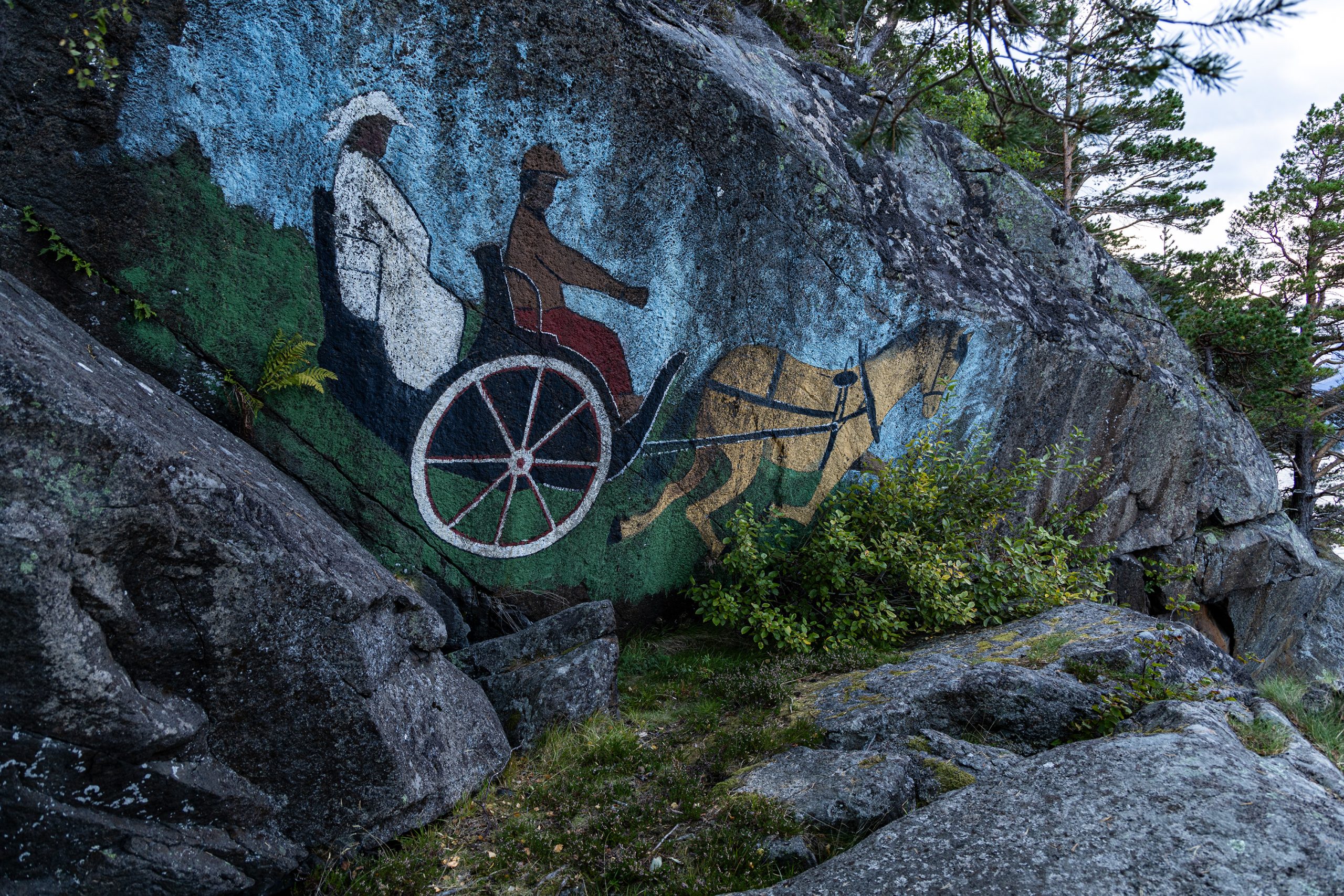
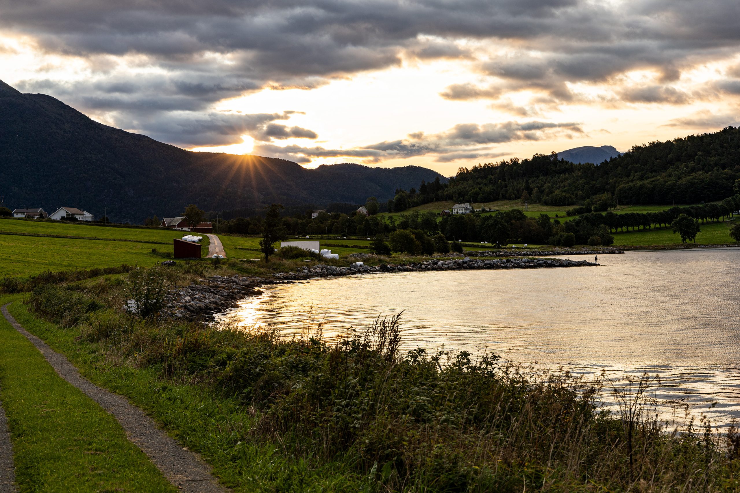
W nocy zerwał się silniejszy wiatr, więc nie dospałem do rana. Ale gdy tylko zrobiło się na tyle jasno, że można było zwiedzać dalej, opuściłem parking. Postanowiłem zobaczyć miejsce, o którym wspominała spotkana poprzedniego wieczora Norweżka. Dojechałem na koniec drogi, zaparkowałem samochód i poszedłem dalej pieszo. Według jej słów miałem dotrzeć na brzeg fiordu, gdzie znajdowało się malowidło na skale. Podobno dawniej wpływały tu duże wycieczkowce i obraz na skale namalowano tak, by był widoczny z pokładu statku na fiordzie. Byłem ciekaw co takiego tam namalowano, a że trasa wydawała się krótka, mogłem obrócić raz-dwa w obie strony i nie tracić zbyt dużo czasu. Droga prowadziła początkowo wzdłuż brzegu fiordu, potem skręcała w las i odbijała na zasłane krowimi plackami pastwisko. Udało mi się je przejść nie zabrudziwszy jakoś specjalnie butów. Na koniec znów zagłębiłem się między drzewa i wąską ścieżką zszedłem na skaliste wybrzeże, płosząc przy okazji jakąś wiewiórkę.
Przyznam, że tak zachwalane przez kobietę malowidło jakoś mnie nie zachwyciło. Przedstawiało dwie osoby siedzące w powozie zaprzężonym do konia. Może i była to miejscowa atrakcja, ale raczej żadne arcydzieło. Wróciłem na ścieżkę a następnie na drogę z krowimi plackami. Po około 40-tu minutach byłem z powrotem przy aucie i mogłem jechać dalej.
W okolicy znajduje się jedna atrakcja, przy której warto się zatrzymać. Jest to Rødven stavkirke, drewniany kościółek z XIV wieku. Napiszę o nim kiedyś w osobnym wpisie.
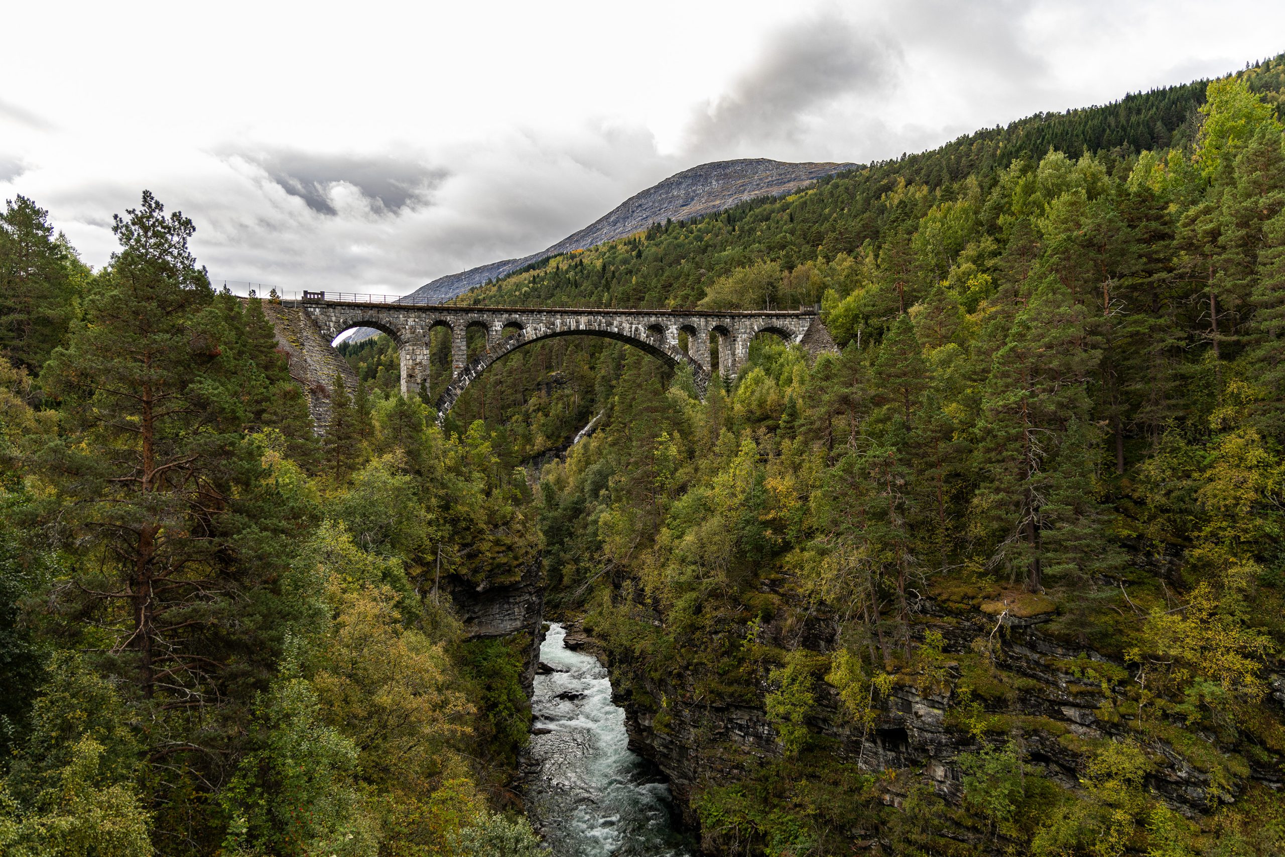
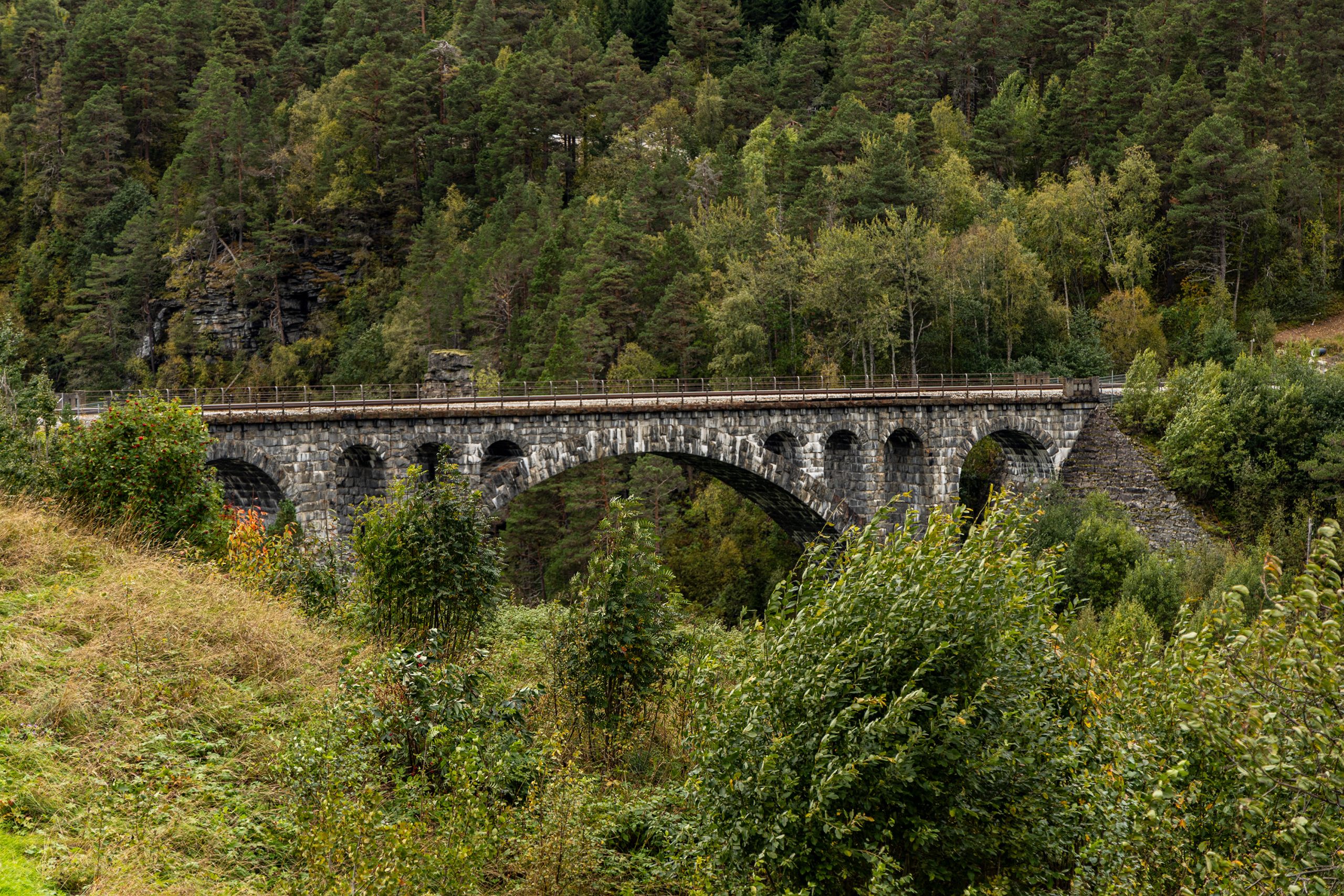
Uznałem, że nie będę już dziś zdobywał żadnych szczytów, i że czas zbierać się do domu, bo droga daleka. Pomyślałem jednak o odwiedzeniu jeszcze jednego miejsca przed podróżą (właściwie znajdowało się ono już po drodze). Niedaleko Slettafossen znajduje się kamienny most kolejowy, Kyllingbrua (po naszemu to Kurczakowy Most). Ta intrygująca nazwa wzięła się zapewne z pobliskiej farmy Kylling. Most zbudowano w 1923 roku z kamienia i jest częścią linii kolejowej Rauma łączącej Åndalsnes i Dombås. Długość mostu wynosi 76 metrów (długość głównego przęsła wynosi 42 metry) a jego wysokość nad poziomem rzeki to 59,3 metry. Kyllingbrua wraz z tunelen Stavem tworzy układ zwrotny z podwójną pętlą, który umożliwia pociągom pokonanie dużej różnicy wysokości między dnem doliny a płaskowyżem Stuguflåten.
Duża tablica przy drodze E136 informowała o parkingu dla chcących zobaczyć most, tuż przy lokalnym sklepiku i dystrybutorach z paliwem. Następnie trzeba było przejść na drugą stronę drogi i zejść szutrową drogą w dół, w kierunku wąwozu. Ścieżka dalej prowadziła na punkt widokowy, skąd można było zrobić parę fotek. Niestety to jedyne miejsce, skąd można obfotografować tę konstrukcję. Należy pamiętać, że most wciąż jest częścią działającej linii kolejowej i zbyt bliskie zbliżenie się do niego może być niebezpieczne.
Była to już ostatnia atrakcja tego weekendu. Pozostała mi już tylko długa i monotonna jazda powrotna na południe.
When I went to Åndalsnes, I had planned more than just hiking Romsdalseggen. I planned also a shorter route for Sunday morning, so that I could get home before nightfall. However, it turned out that nothing came of these additional options in the end. Instead, I visited a few places that did not require several hours of walking. And I want to tell you about them today.
On Saturday morning, when I was just approaching Åndalsnes and my adventure with Romsdalseggen was still ahead of me, I drove into a bay with a parking lot by the Slettafossen waterfall. I was more interested in emptying my bladder than in some additional attraction. Especially since the thermometer in the car showed only a few degrees above zero. Last night was quite cold for mid-September. However, after I had taken care of the most urgent needs and put on a jacket, I decided to look around a bit before continuing my journey. The parking lot was located on the edge of a gorge, at the bottom of which the Rauma River roared. The railings along the cliff allowed you to get quite close to the several meters drop, and in a few places the view of the foaming river was truly impressive. A bridge leads to the other side of the gorge. Just behind it there is a small café and a souvenir shop, but that morning it was still closed (or maybe in mid-September it was already out of the season). From the bridge the view of the river and the waterfall below is even better than from the viewing points along the cliff. According to Wikipedia, the waterfall itself has 18 meters high.
Before I reached the parking lot by the Romsdalseggen trail, I stopped at the Trollveggen tourist center. It was also still closed, but I had the opportunity to look at the famous Troll Wall from the road level. The vertical stone wall, rising over 1000 meters with jagged peaks, makes a stunning impression. When planning this trip, I also considered hiking to the edge of Trollveggen, but the trail leads from the other side of the massif, where the Troll Road winds, and unfortunately it was being renovated and closed to traffic. So this route had to wait for another opportunity, sometime in the future.
I continued on and finally reached Åndalsnes. I walked the main point of the program, Romsdalseggen, and after returning to the car I started considering accommodation options. I had three of them, but due to the small amount of time left until sunset, I had to decide on just one without checking the others. I chose Kvitfjellet mountain, rising above the village of Eidsbygda, less than half an hour’s drive north of Åndalsnes. The peak was on my Sunday list and I thought that if I could pitch my tent somewhere halfway to the summit, the next day I would have a shorter distance to walk and I would be on my way back much faster.
I arrived at my destination and parked by a pretty, wooden, white-painted church. There was a parking lot there for those heading to the nearest peaks: Kvitfjellet and Hælberbet. I quickly repacked, stuffing the necessary equipment and warm clothes to survive the night into a large backpack, and set off. Before I reached the trail, I had to pass a few houses and farms. A local woman stopped me at one barn. Seeing that I was carrying a large backpack on my back, she asked which mountain I was going to and agreed that it was a good choice. She also recommended another trail that she had recently discovered herself (she lived permanently in the capital and only occasionally visited her family home in Eidsbygda), a short route on an extension of the road that I had taken to the village. I promised to check it out the next morning.
I continued on and soon began climbing up the gravel road, leaving the last buildings behind. I reached a crossroads and stopped. According to the map on ut.no, my trail ran straight ahead, already as a regular path. Meanwhile, in real life, I could see a wall of forest in front of me. On the left and right, there was a road as it should be, but there was nothing straight ahead. After a closer look, I saw something that could pass for a path, but it was so overgrown that, burdened with a large backpack, tired after a whole day’s walk, aware that dusk was near and I didn’t have time to fight my way through the undergrowth to check if there really was a path there, I gave up. I was also terrified by the ticks lurking in the thicket (yes, I think I have some kind of phobia about them). For a moment, I considered my other options for the night. It was starting to get dark and I still didn’t have a place to pitch my tent. If necessary, I could squeeze into the back seat of the car, but a better solution was to pitch the tent right next to the car, on the grass.
So I returned to the church in the village. On the way I passed the Norwegian woman by the barn again and informed her that there was something wrong with the trail to Kvitfjellet. I also told her that I was going to set up my tent by the church and ask if that wouldn’t be a problem. She assured me that the neighbors were nice and no one should have any objections. So I went back to the car, prepared a place to sleep, ate something and when it got dark (and cold), I crawled into my sleeping bag.
A stronger wind came up during the night, so I didn’t sleep until morning. But as soon as it got light enough to continue sightseeing, I left the parking lot. I decided to see the place that the Norwegian woman I met the previous evening had mentioned. I drove to the end of the road, parked the car and continued on foot. According to her, I was supposed to reach the shore of the fjord, where there was a painting on a rock. Apparently, large cruise ships used to come here and the picture on the rock was painted so that it could be seen from the deck of a ship. I was curious what was painted there, and since the route seemed short, I could turn go there and back and not waste too much time. The road initially led along the fjord shore, then turned into the forest and turned off onto a pasture covered with cow patties. I managed to cross it without getting my shoes too dirty. Finally, I went back into the trees and down a narrow path to the rocky coast, scaring a squirrel in the process.
I must admit that the painting so praised by the woman did not impress me. It showed two people sitting in a horse-drawn carriage. It may have been a local attraction, but it was hardly a masterpiece. I returned to the path and then to the road with the cow patties. After about 40 minutes I was back at the car and could continue driving.
There is one attraction in the area that is worth stopping at. It is Rødven stavkirke, a wooden church from the 14th century. I will write about it in a separate post sometime.
I decided that I would not be conquering any more peaks today and that it was time to go home, because it was a long way. However, I thought about visiting one more place before my journey south. Not far from Slettafossen is a stone railway bridge, Kyllingbrua (in our language it means Chicken Bridge). This intriguing name probably comes from the nearby Kylling farm. The bridge was built in 1923 from stone and is part of the Rauma railway line connecting Åndalsnes and Dombås. The length of the bridge is 76 meters (the main span has 42 meters) and its height above the river is 59.3 meters. Kyllingbrua together with the Stavem tunnel forms a double-loop switchback system that allows trains to overcome the large difference in height between the bottom of the valley and the Stuguflåten plateau.
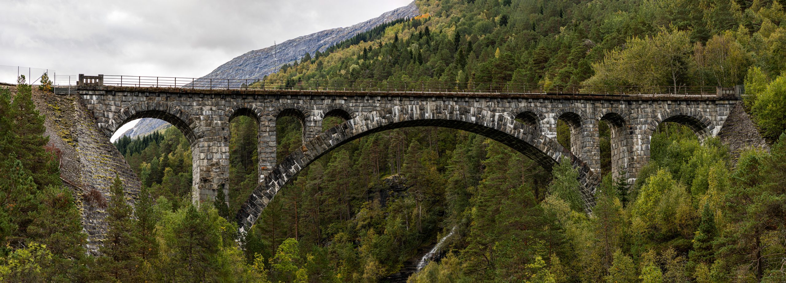
A large sign on the E136 road directed to a parking lot for those who wanted to see the bridge, right next to the local shop and petrol pumps. Then it was time to cross the road and walk down a gravel road towards the gorge. The path continued to a viewpoint from where I could take a few photos. Unfortunately, this was the only place from which I could take photos of the structure. It is important to remember that the bridge is still part of an operating railway line and getting too close to it can be dangerous.
This was the last highlight of the weekend. All that was left for me was the long and monotonous drive back south.