Tylko dla orłów czyli wejście na Skutshorn
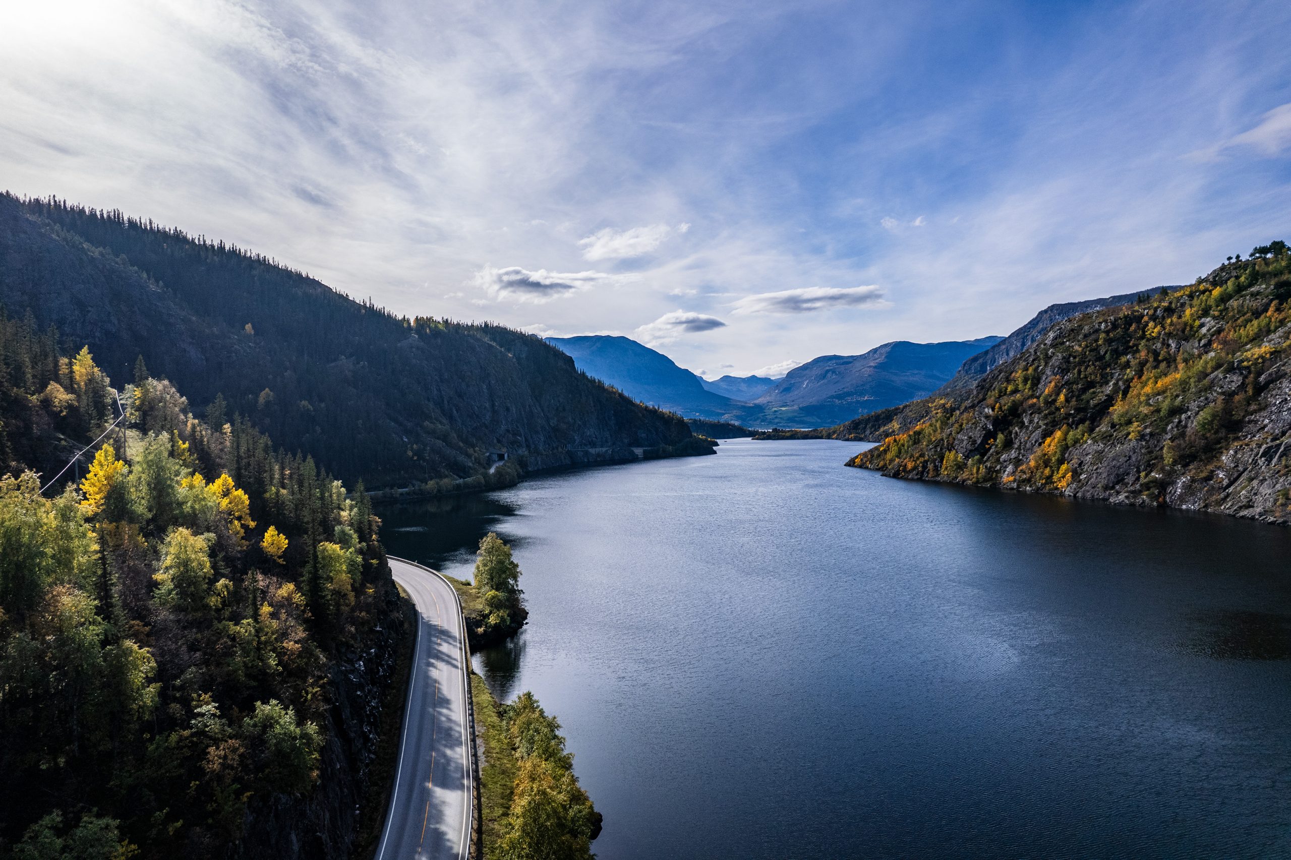
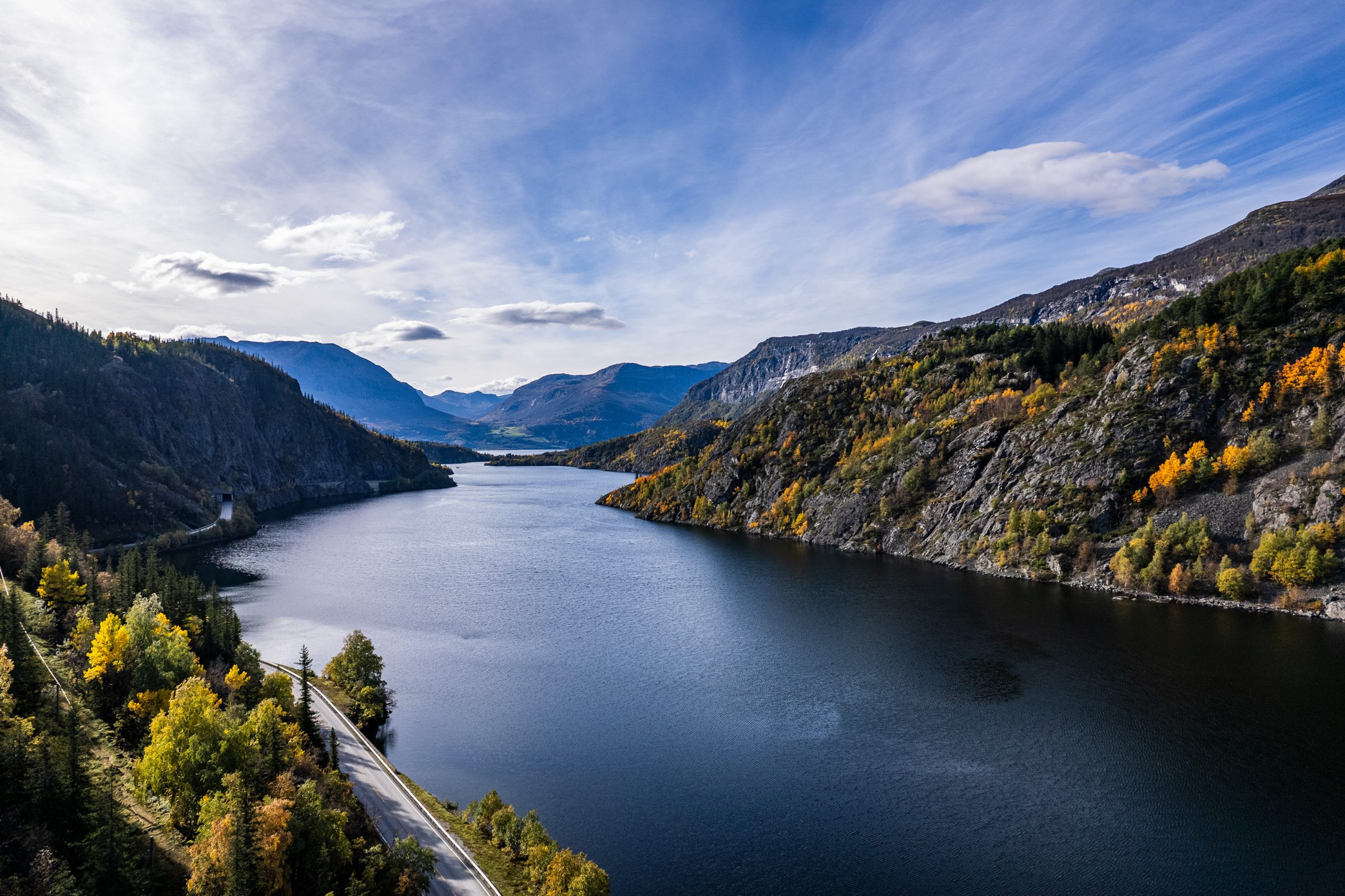
Skutshorn to dość spora góra wznosząca się nad północnym brzegiem jeziora Vangsmjøse, tuż przy wylocie doliny Sanddalen. Kiedy poprzedniego dnia znaleźliśmy się przy starej farmie Sparstadstølen w sercu doliny, strome zbocze tej góry budziło niemały respekt. Tym bardziej, że zamierzaliśmy się właśnie tędy wspinać następnego dnia. Hasan poinformował mnie dodatkowo, że Skutshorn to jedna z tych norweskich gór, gdzie spory fragment wierzchołka odrywa się od masywu i grozi odpadnięciem. Szczelina dzieląca część góry z każdym rokiem się poszerza i jest stale monitorowana przez geologów. Potężna bryła może w każdym momencie spaść kilkaset metrów w dół, w wody jeziora, wywołując ogromną falę. Skutki tego mogą okazać się niewyobrażalne dla lokalnej społeczności i okolicznych gospodarstw ulokowanych wokół Vangsmjøse. Podobnych miejsc w całej Norwegii jest dziesięć, a sami Norwegowie swego czasu nakręcili nawet film katastroficzny o przebiegu potencjalnego scenariusza takiego wydarzenia („Bølgen” z 2015 roku). W roku 2019 miało miejsce osuwisko na górze Mannen w dolinie Romsdalen, czego skutkiem były silne wstrząsy sejsmiczne zarejestrowane na obszarze od Bergen do Trondheim.
W niedzielny poranek, po noclegu na sąsiednim szczycie Røgnshovda i powrocie do farmy Sparstadstølen, byliśmy gotowi by zmierzyć się ze Skutshorn. Pogoda poprawiła się, ciężkie chmury zasłaniające niebo w nocy i o świcie były już tylko wspomnieniem, a promienie słońca zaczęły wkradać się w dolinę.
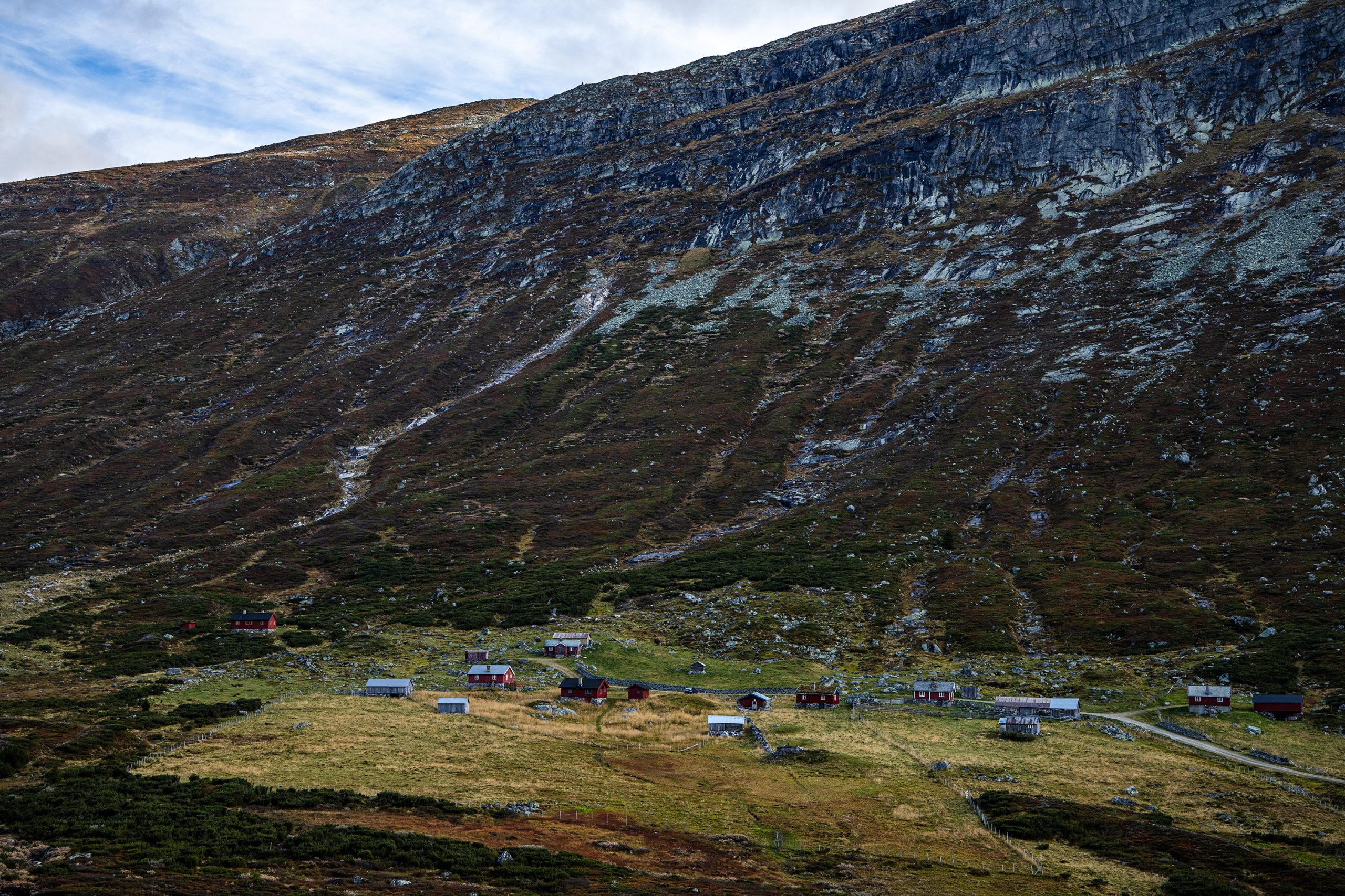
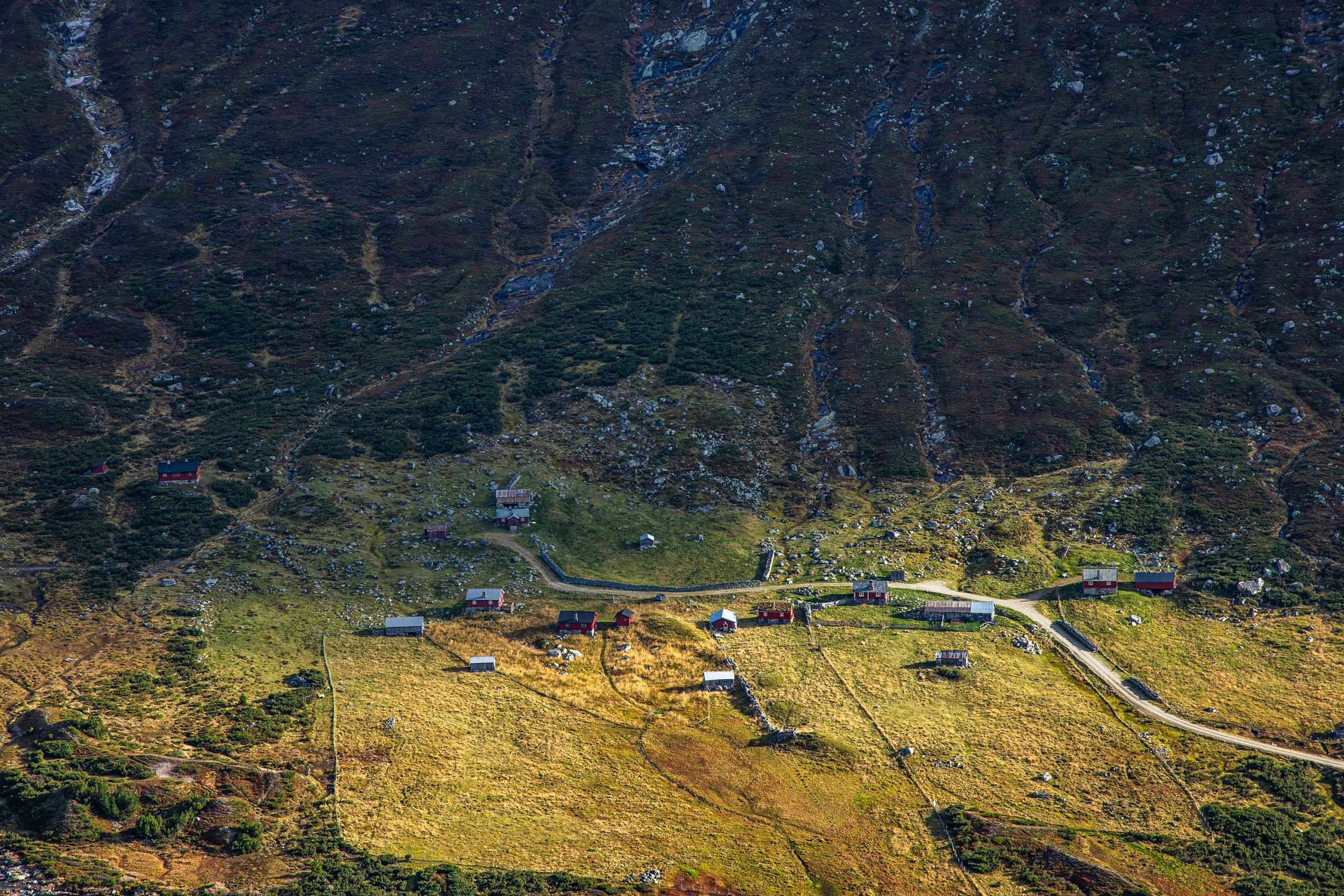
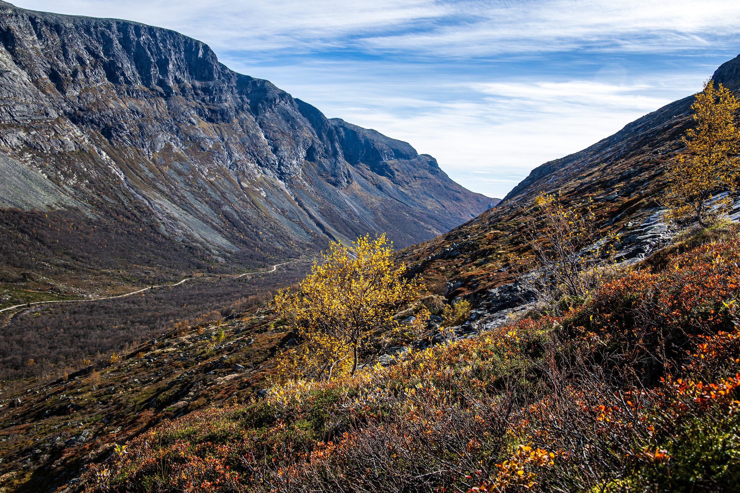
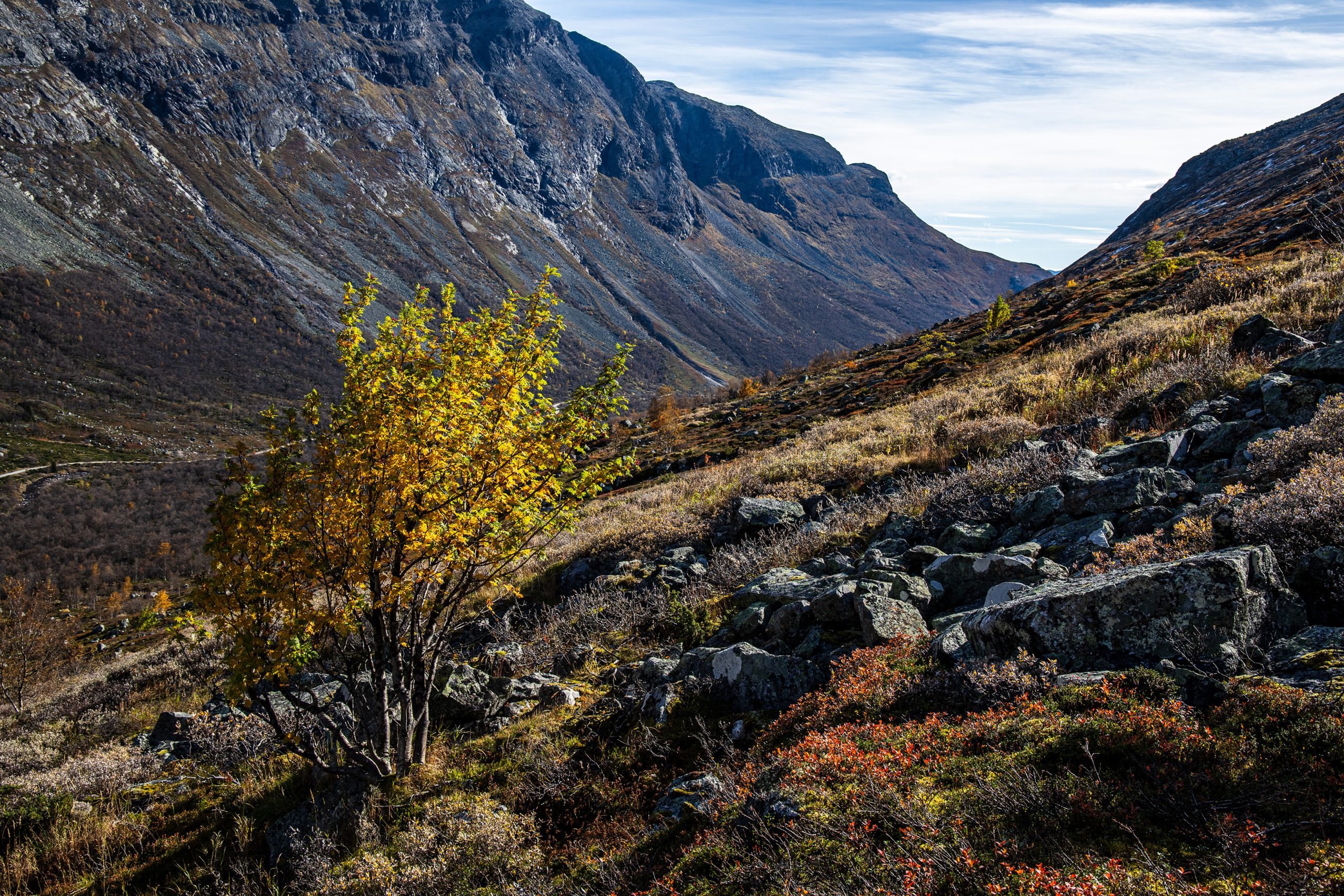
Zjedliśmy pośpiesznie śniadanie, zamieniliśmy plecaki na lżejsze i ruszyliśmy. Przeszliśmy przez drewniany most na rzece Leineåne i kawałek podmokłego terenu, aż do podnóża góry. Wąska ścieżka prowadziła w górę. Początkowo nawet nie było tak źle, ale już po paru minutach trzeba było zrzucić z siebie polar.
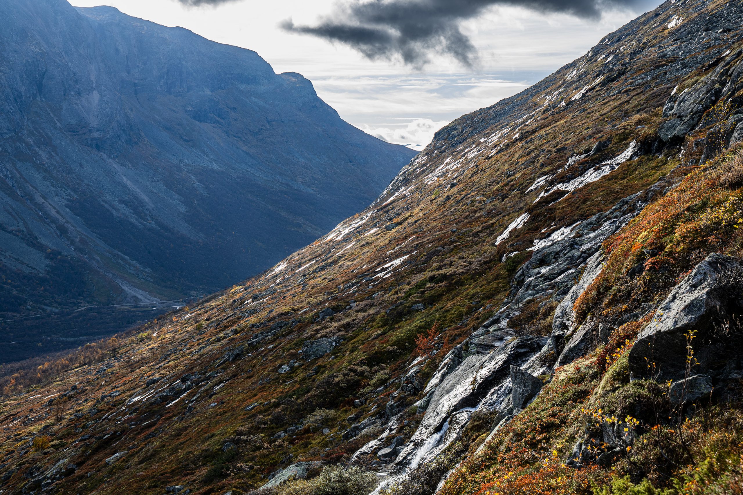
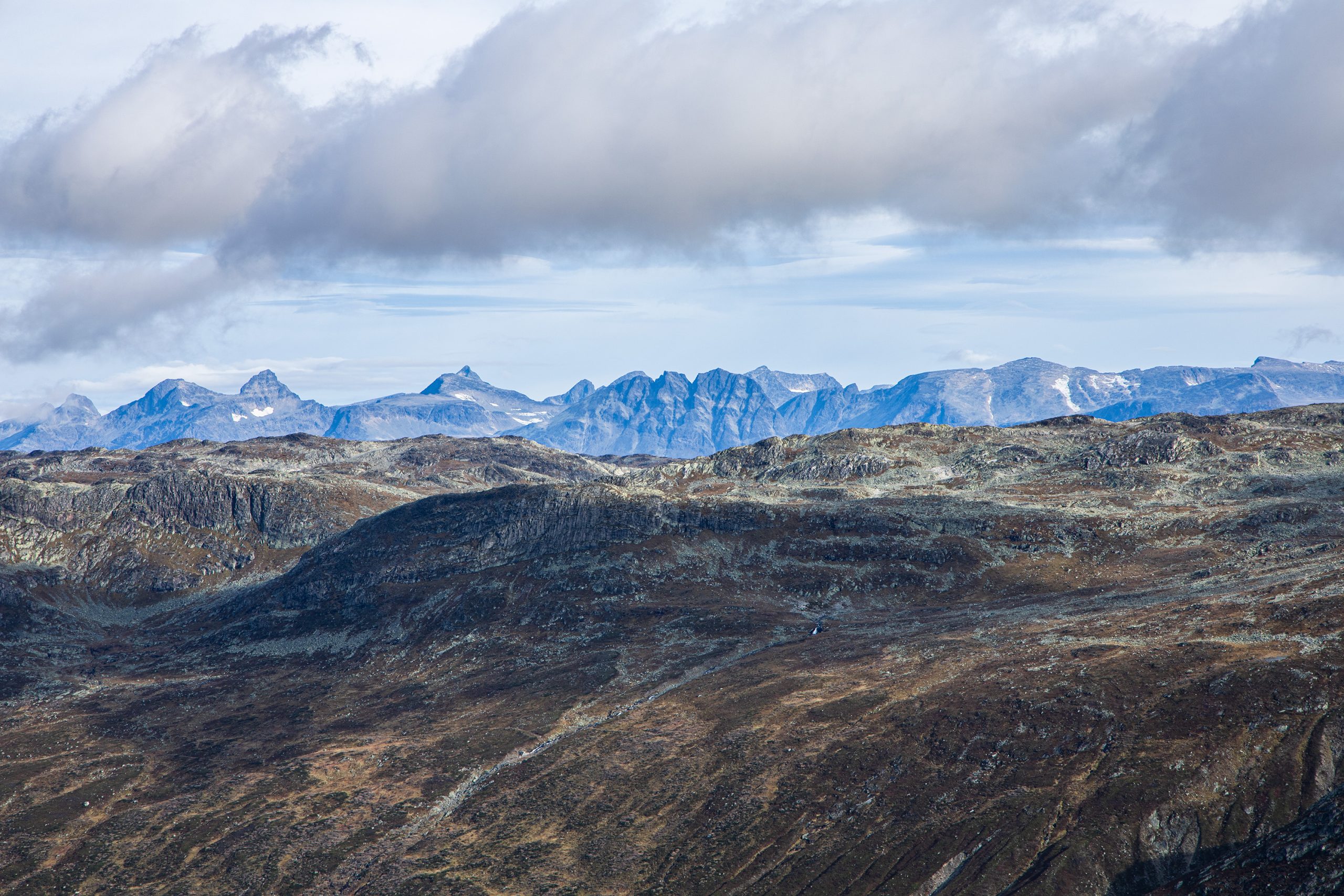
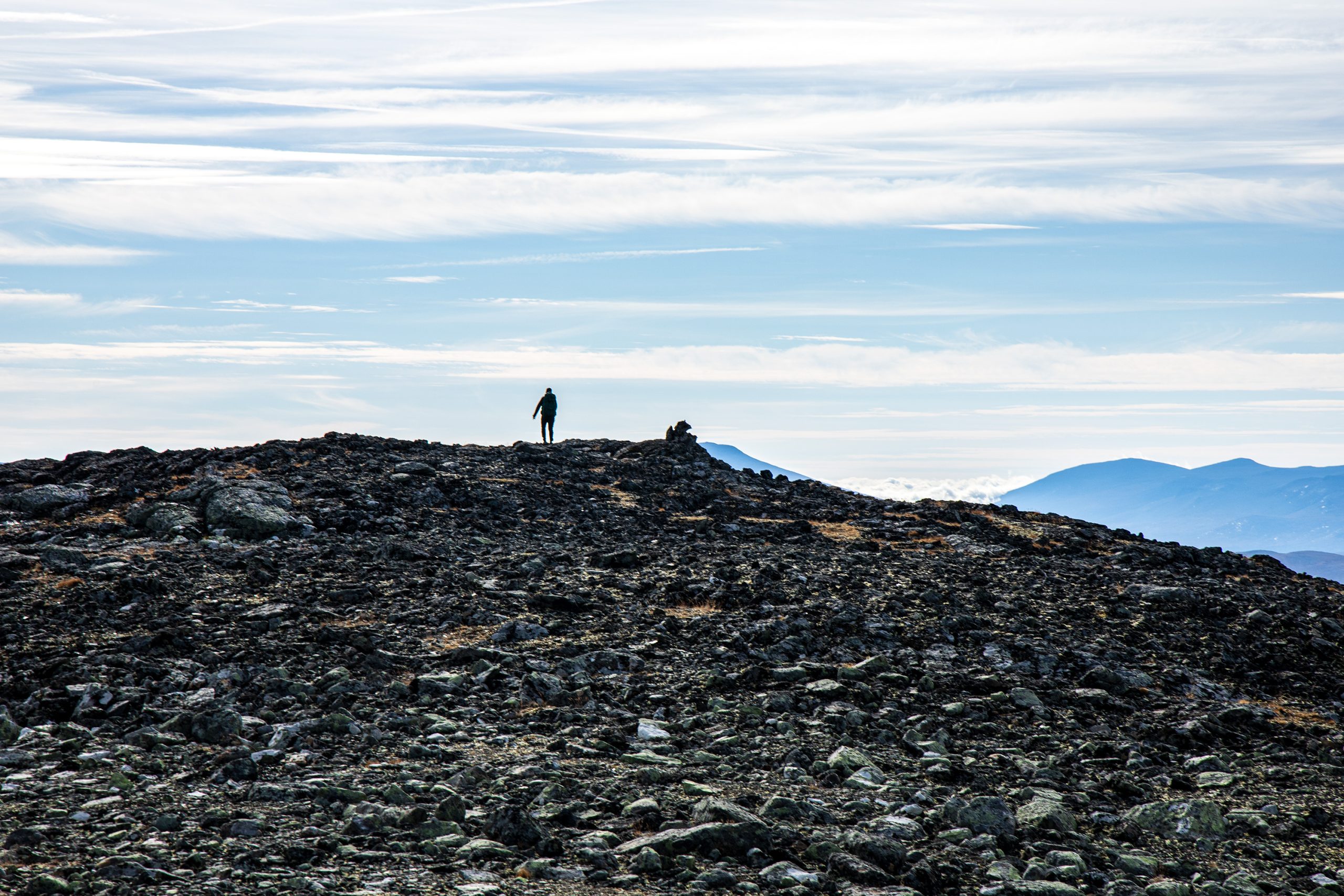
Pięliśmy się w górę a zabudowania Sparstadstølen, gdzie zostawiliśmy samochód zdawały się coraz mniejsze i mniejsze. W pewnej chwili dostrzegliśmy kilka pasących się jakieś 100 metrów poniżej reniferów. Jak się wdrapały na tę górę? Cóż, od północy zapewne było łagodniejsze podejście. Zdawało mi się, że im wyżej się wspinamy tym bardziej jest stromo. Z czasem znośna ścieżka została zastąpiona przez zwały większych i mniejszych kamieni, co czyniło wędrówkę jeszcze trudniejszą. Białe litery V oznaczające szlak, malowanie na szarych kamieniach, były mało widoczne, ale jakoś posuwaliśmy się do przodu (czy też raczej w górę). Potem doszło kolejne utrudnienie. Cała ta kamienna, nierówna przestrzeń, po której się poruszaliśmy pokryta była poranną rosą. Buty ślizgały się przy każdym nieostrożnym kroku, więc trzeba było jeszcze bardziej wzmóc czujność. Miałem wrażenie, że moi towarzysze są daleko przede mną i tylko ja tak się grzebię, ale okazało się, że i oni mają podobne problemy i że nie odskoczyli ode mnie aż tak bardzo.
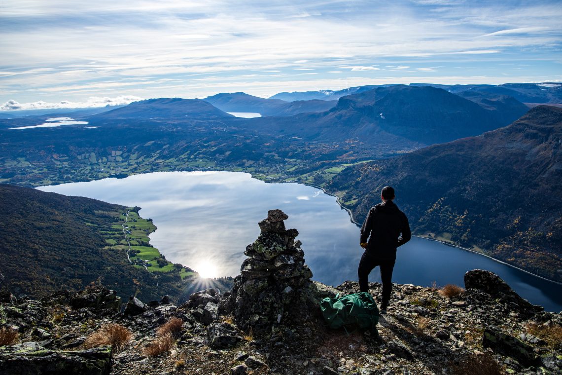
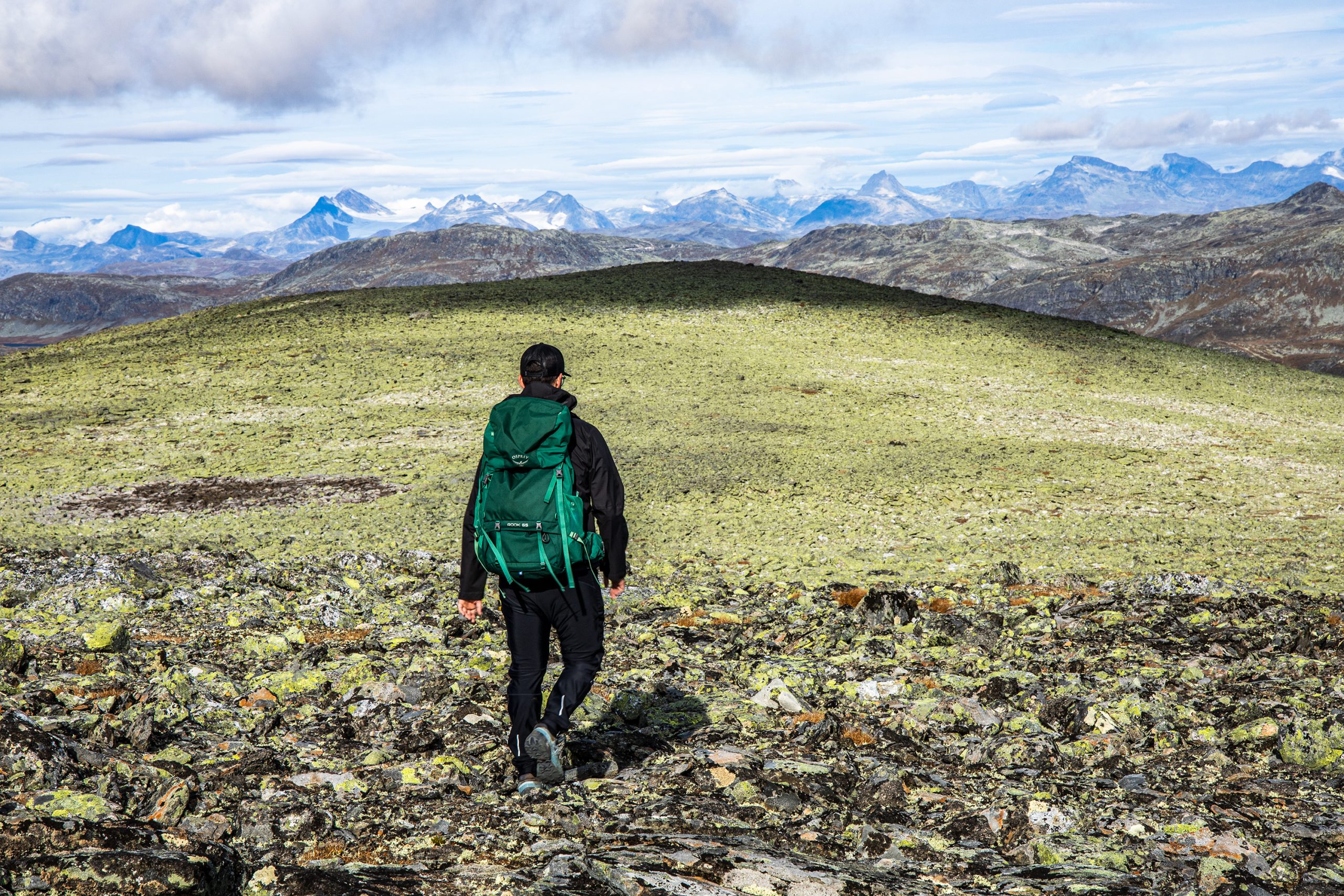
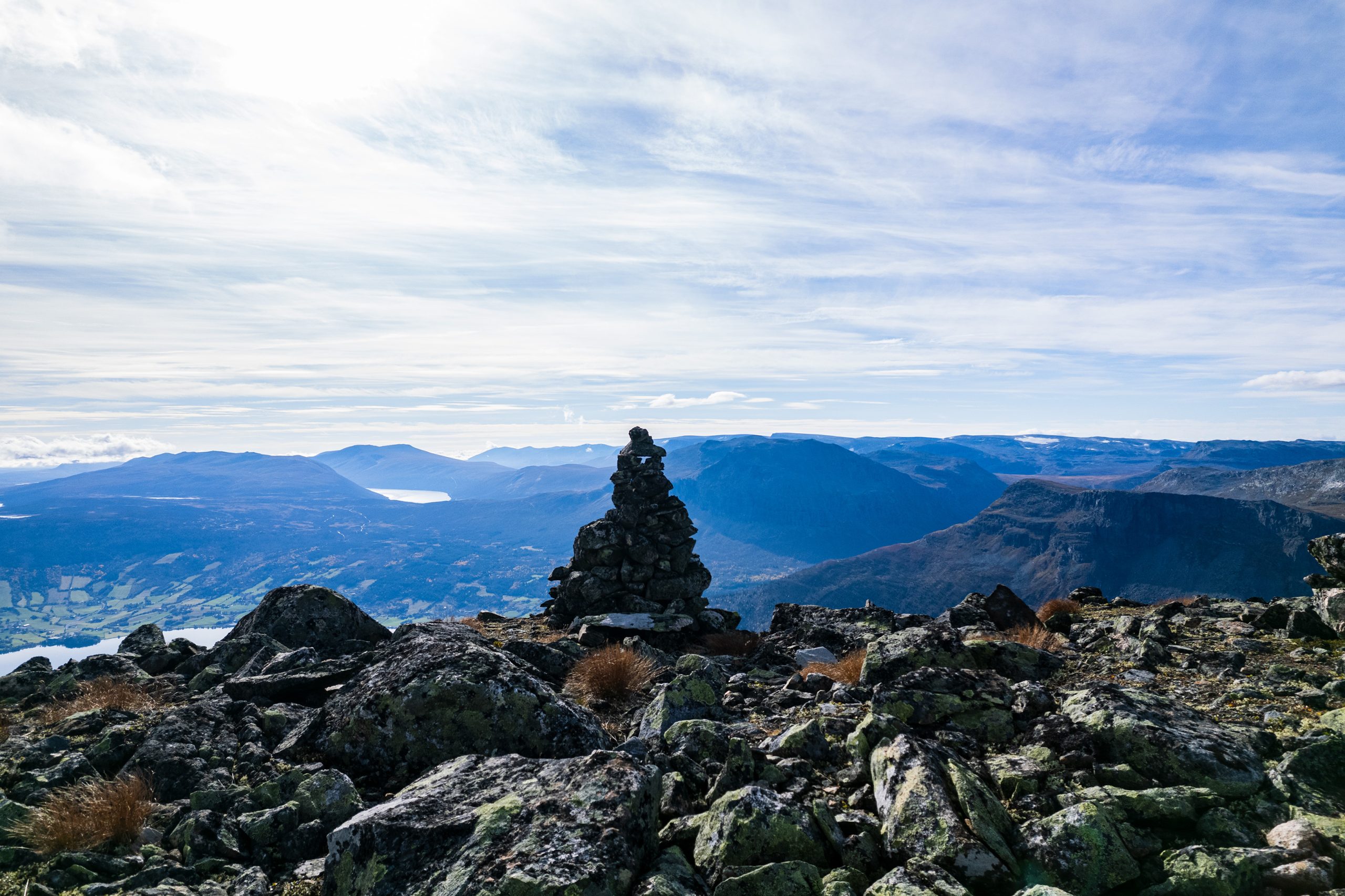
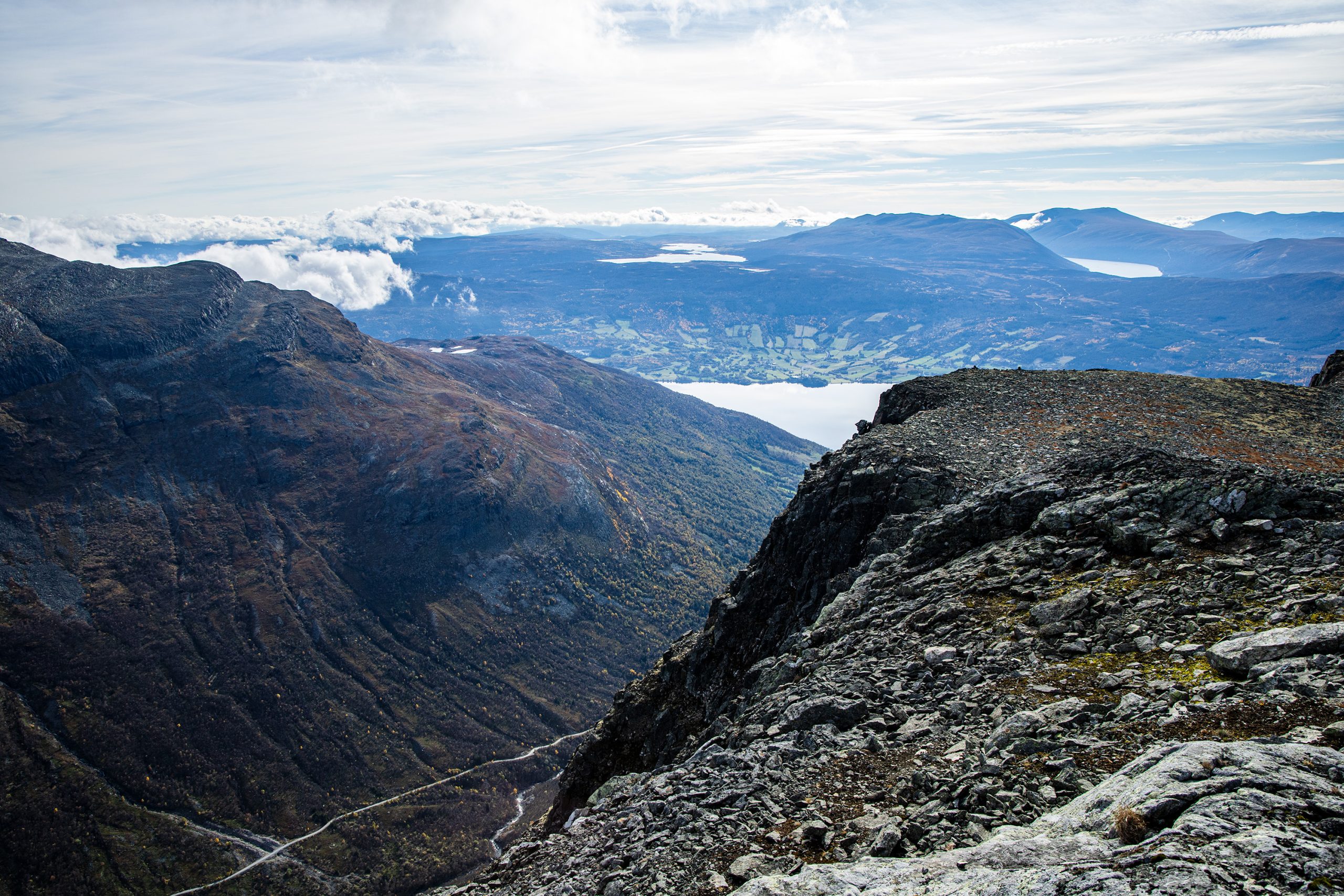
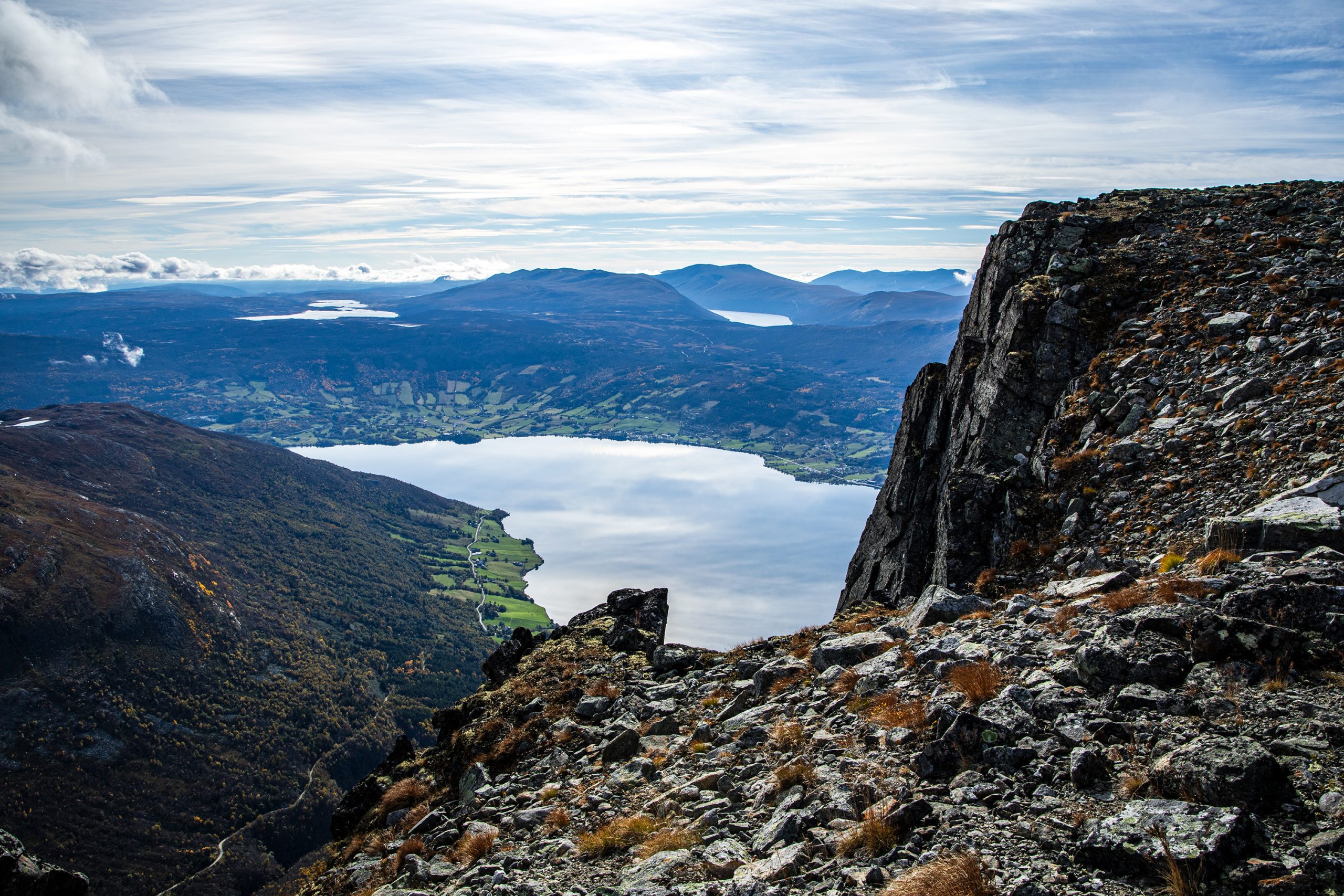
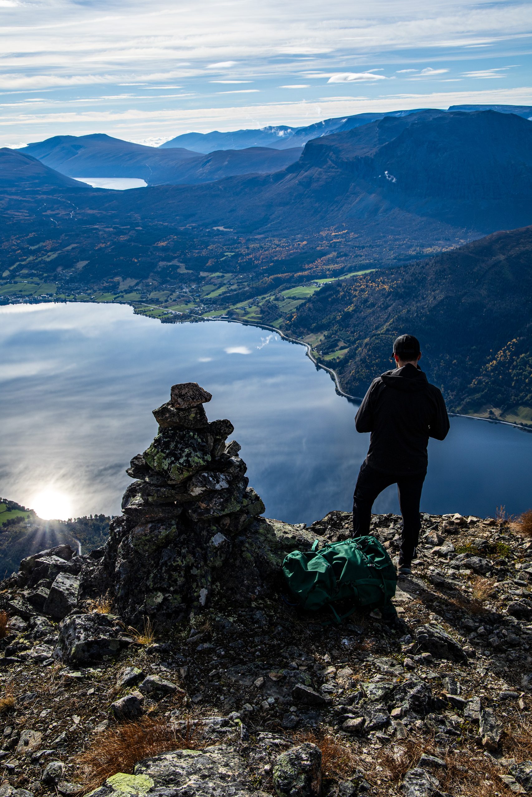
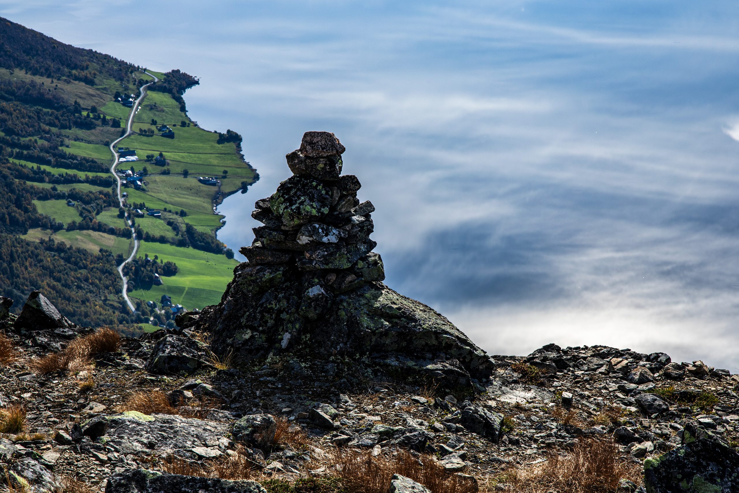
W końcu dotarliśmy na płaskowyż. Tu kierunek marszu wyznaczały nieduże kopczyki kamieni. Teren oświetlało już od jakiegoś czasu słońce, wiele kamieni było sporymi płaskimi bryłami, nie było tu wiec aż tak ślisko jak na zboczu. Parliśmy naprzód aż do samego wierzchołka. Ten okazał się oddalony od krawędzi góry, przez co nie oferował spodziewanych widoków na jezioro Vangsmjøse. Musieliśmy przejść jeszcze kawałek na południe. Zmierzając tam, obserwowałem ostrożnie grunt i wspomnianej przez Hasana szczeliny, ale niczego podejrzanego nie zobaczyłem. Widocznie ów grożący osuwiskiem fragment skały znajdował się niżej lub nieco dalej od szczytu.

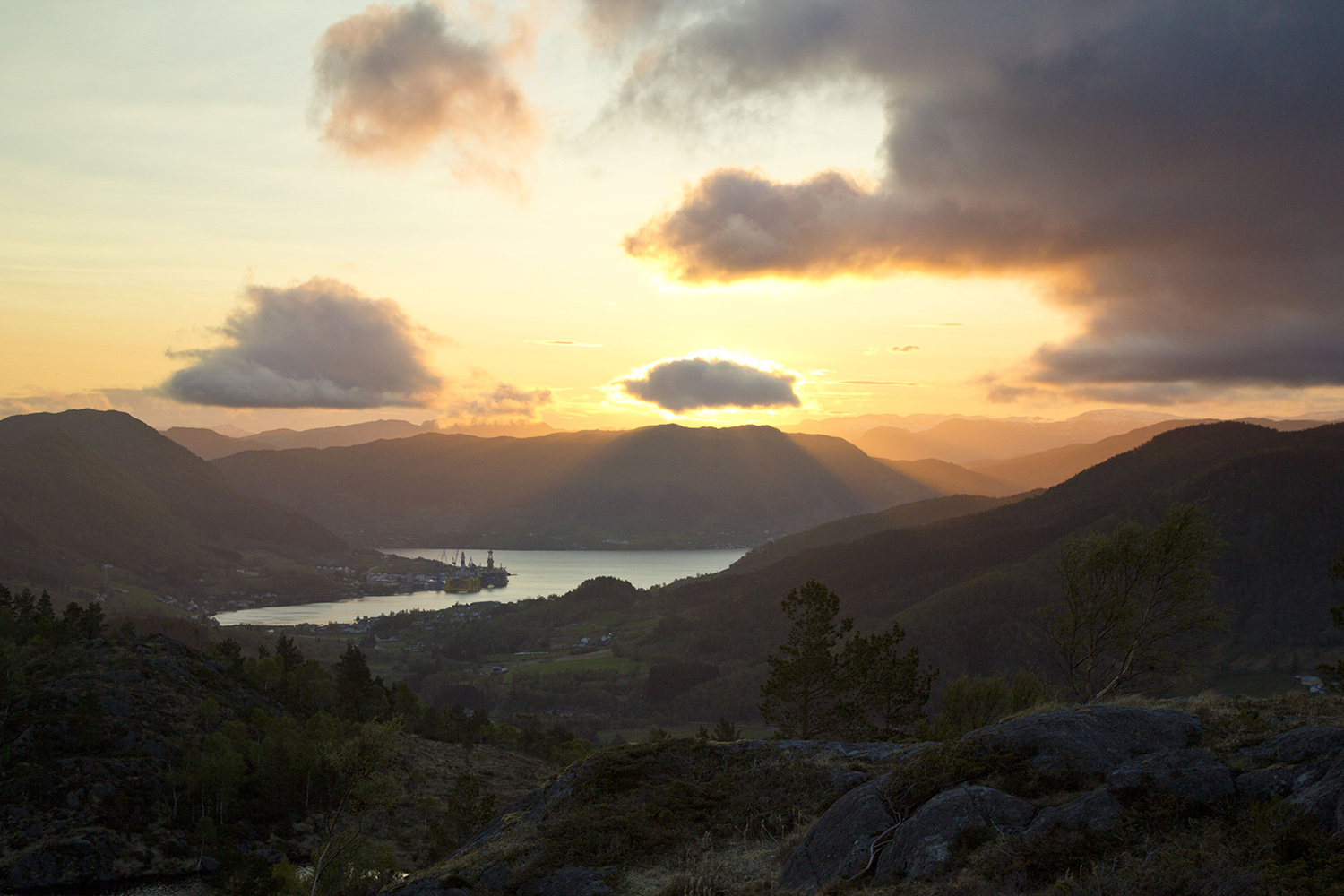
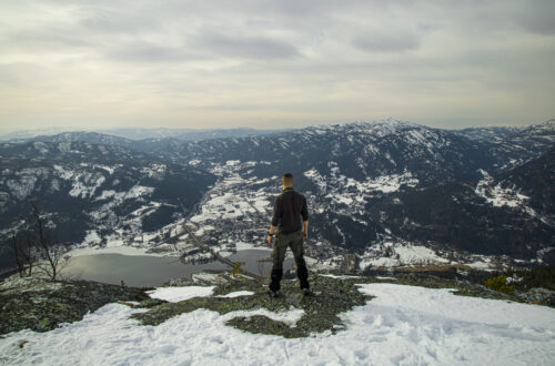
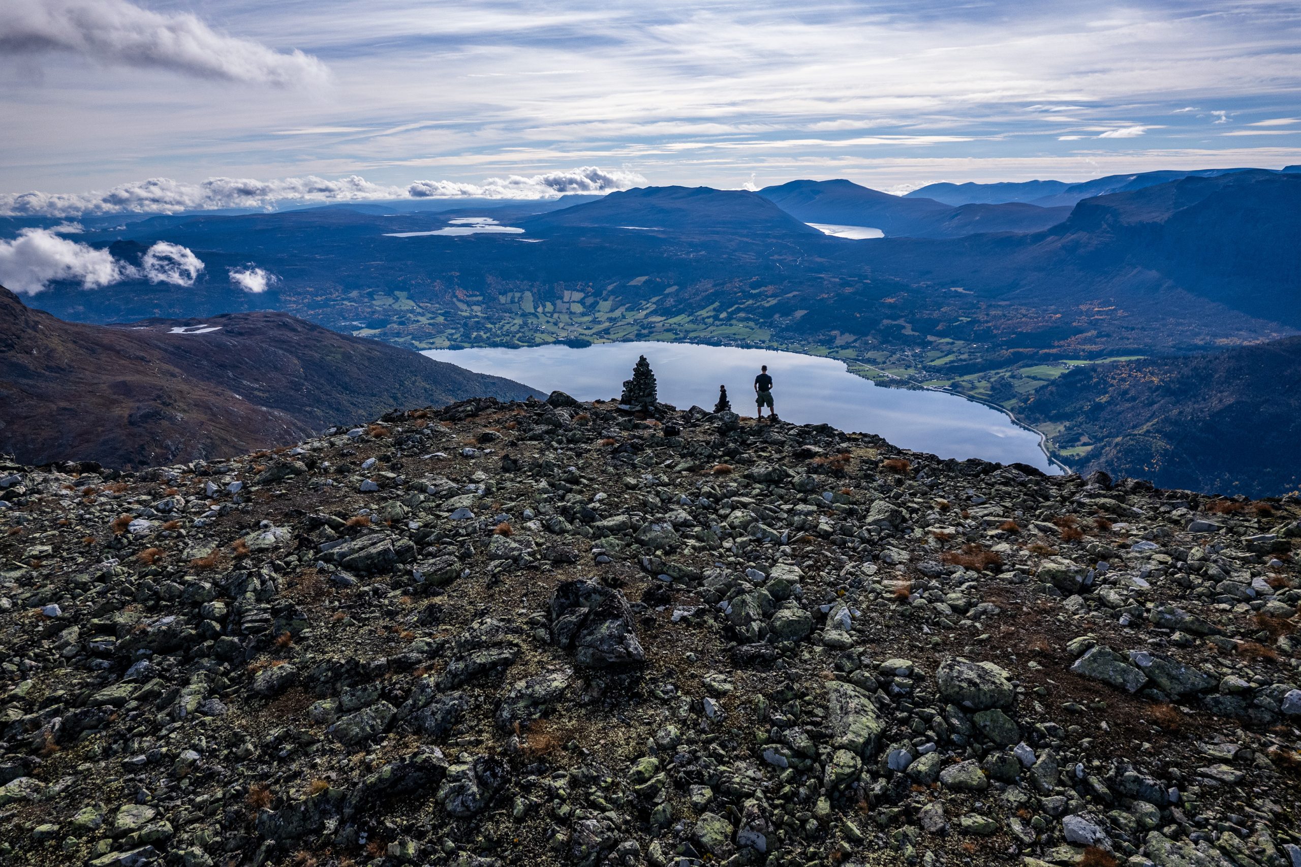
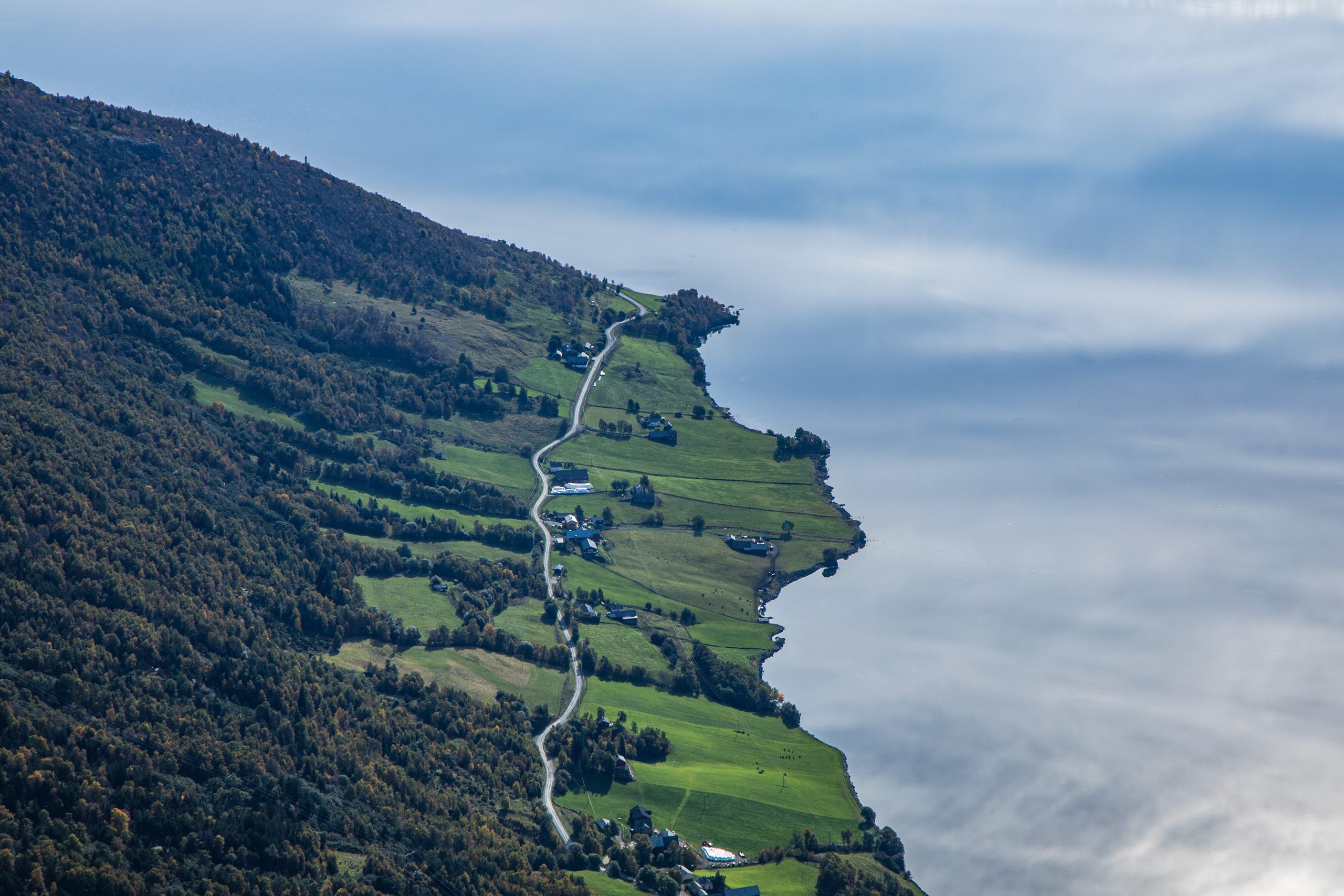
Doszliśmy nad krawędź góry i faktycznie, widoki z tego miejsca to było to, na co czekałem. Vangsmjøse poniżej i cała panorama okolicznych gór w zasięgu wzroku. Mogłem pochwalić się Hasanowi, na których szczytach już byłem. Były tam Bergsfjellet, Grindane i Hugakøllen.
Po krótkiej przerwie postanowiliśmy się zabierać z powrotem. Droga w dół zdawała się jeszcze gorsza niż pod górę. Znów musieliśmy mierzyć się z niestabilnymi kamieniami, śliską powierzchnią, stromizną i znakami na kamieniach, które czasem trudno było dostrzec. Nawet ponownie natrafiliśmy na stado reniferów, ale te oddaliły się pośpiesznie, gdy zaczęliśmy się zbliżać.
Minęliśmy najgorszy odcinek z kamieniami i weszliśmy na „normalną” ścieżkę. Zrobiło się nieco łatwiej, ale ciągła trasa w dół dawała popalić moim kolanom. Gdy więc dotarliśmy w końcu na dno doliny, zmęczeni i obolali, mogłem odetchnąć z ulgą. Zapakowaliśmy się do samochodu i opuściliśmy dolinę Sanddalen. Odwiozłem chłopaków do ich auta i tam się pożegnaliśmy.
Weekend okazał się całkiem udany i pozostało tylko bezpiecznie wrócić do domu.


Skutshorn is a quite large mountain rising above the northern shore of Lake Vangsmjøse, right at the mouth of the Sanddalen valley. When we found ourselves at the old Sparstadstølen farm in the heart of the valley the previous day, the steep slope of the mountain inspired considerable respect. Especially since we intended to climb this way the next day. Hasan also informed me that Skutshorn is one of those Norwegian mountains where a large part of the peak breaks away from the massif and threatens to fall off. The crevasse dividing part of the mountain widens every year and is constantly monitored by geologists. The huge mass could at any moment fall several hundred meters down into the lake, causing a huge wave, the consequences of which are unimaginable. There are ten similar places in Norway, and the Norwegians once made a movie about the course of a potential scenario of such an event (Bølgen from 2015). In 2019, there was a landslide on Mount Mannen in the Romsdalen valley, which resulted in strong tremors recorded in the area from Bergen to Trondheim.
On Sunday morning, after spending the night on the neighboring peak Røgnshovda and returning to the Sparstadstølen farm, we were ready to tackle Skutshorn. The weather improved, the heavy clouds that had obscured the sky at night and at dawn were now just a memory, and the sun’s rays began to creep into the valley.
We had a quick breakfast, swapped our backpacks for lighter ones, and set off. We crossed a wooden bridge over the Leineåne river and a piece of marshy terrain to the foot of the mountain. A narrow path led uphill. At first it wasn’t even that bad, but after a few minutes I had to take off my fleece jacket.
We climbed up and the buildings of Sparstadstølen, where we had left the car, seemed to be getting smaller and smaller. At one point we noticed a few reindeer grazing about 100 meters below. How did they climb that mountain? Well, the approach from the north was probably gentler. It seemed to me that the higher we climbed, the steeper it got. In time, the bearable path was replaced by piles of larger and smaller stones, which made the hike even more difficult. The white letters V marking the trail, painted on gray stones, were barely visible, but somehow we moved forward (or rather upwards). Then another difficulty came. The whole stony, uneven space we were moving on was covered with morning dew. Shoes slipped with every careless step, so we had to be even more vigilant. I had the impression that my companions were far ahead of me and that I was the only one struggling like this, but it turned out that they had similar problems and that they were not so far in front of me.


Finally we reached the plateau. Here the direction of the march was marked by small mounds of stones. The sun had been illuminating the area for some time, many of the stones were large flat blocks, so it was not as slippery here as on the slope. We walked on until we reached the summit. It turned out to be far from the edge of the mountain, which meant it did not offer the expected views of Lake Vangsmjøse. We had to go a bit further south. On our way there, I carefully observed the ground and the crack Hasan had mentioned, but I did not see anything suspicious. Apparently, the fragment of rock threatening a landslide was located lower or a bit further from the peak. We reached the edge of the mountain and indeed, the views from this place were what I had been waiting for. Vangsmjøse below and the entire panorama of the surrounding mountains within sight. I could boast to Hasan about the peaks I had already been to. There were Bergsfjellet, Grindane and Hugakøllen.
After a short break we decided to head back. The way down seemed even worse than the way up. Once again we had to deal with unstable rocks, slippery surfaces, steep slopes and markings on the rocks that were sometimes difficult to see. We even came across a herd of reindeer again, but they quickly ran away as we got closer.
We passed the worst section with rocks and entered the „normal” path. It got a bit easier, but the constant downhill was taking its toll on my knees. So when we finally reached the bottom of the valley, tired and sore, I could breathe a sigh of relief. We packed up the car and left the Sanddalen valley. I drove the guys to their car and said goodbye there.
The weekend turned out to be quite successful and all that was left was to get home safely.