Bitihorn 1607m n.p.m.
Po ukończonej trasie na Knutshøe, miałem do dyspozycji jeszcze kilka godzin do zachodu słońca. A że planowałem spędzić noc pod namiotem w tej okolicy, to z tym nadmiarem czasu trzeba było coś zrobić. Przeczekanie na jednym z parkingów wzdłuż drogi 51 było raczej kiepską opcją z uwagi na ilość podróżnych przewijających się tego dnia w obie strony i zatrzymujących się na każdym możliwym skrawku terenu. Uznałem, że mimo zmęczenia lepiej będzie jak gdzieś jeszcze połażę.
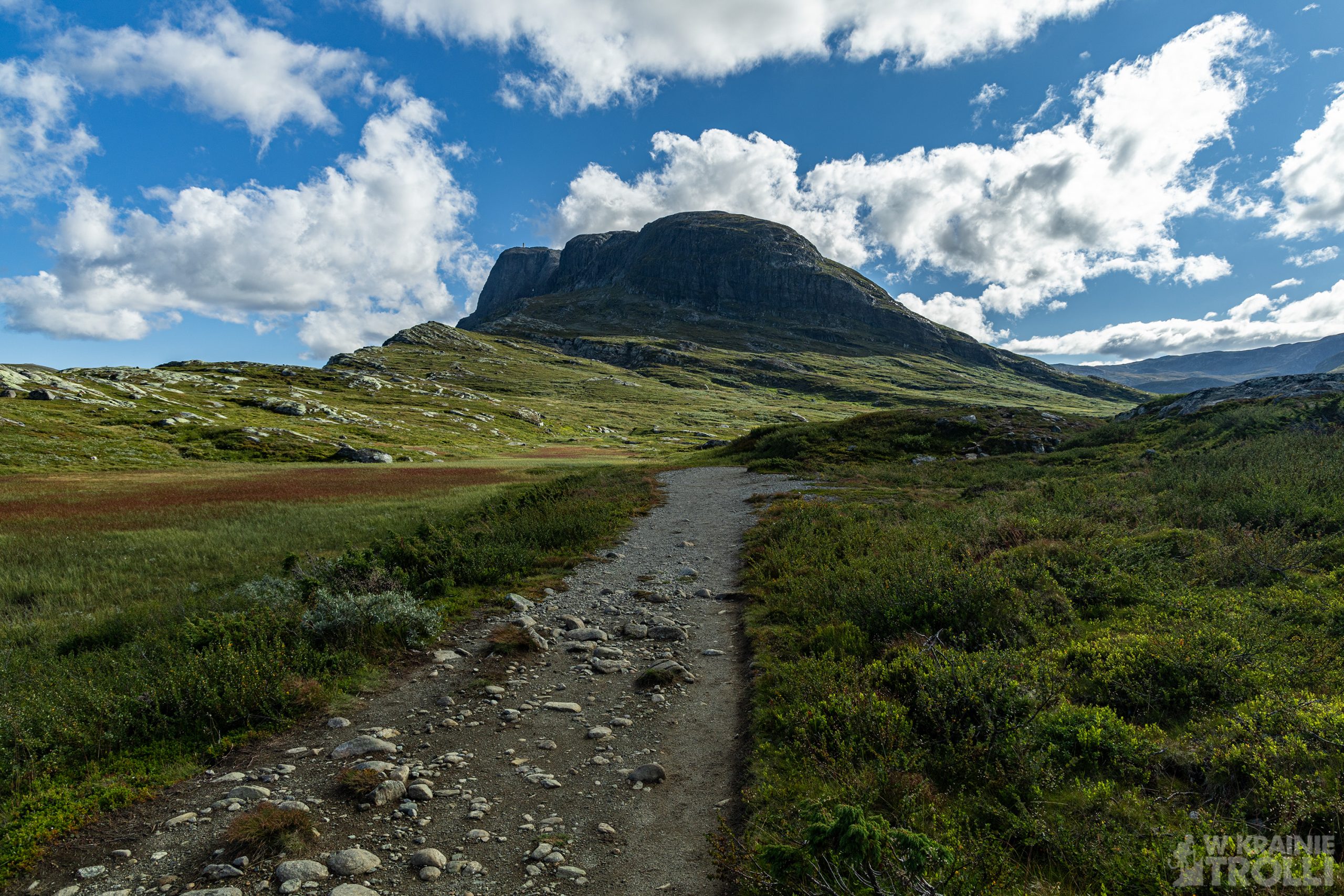
Bitihorn (1607m n.pm.m.) oferował dość krótką trasę, która okazała się dodatkowo bardzo widowiskowa. Co prawda parking przy szlaku okazał się płatny, ale 60kr za dobę nie było jakąś wygórowaną kwotą. Pozostawiłem auto, zabrałem plecak i ruszyłem. Już na samym początku zacząłem mijać wracających z trasy ludzi. Nic dziwnego, druga połowa dnia to czas powrotów z górskich szlaków, a nie czas rozpoczęcia wędrówek. A liczyłem jednak, że spokojnie zdążę wrócić przed zachodem słońca.
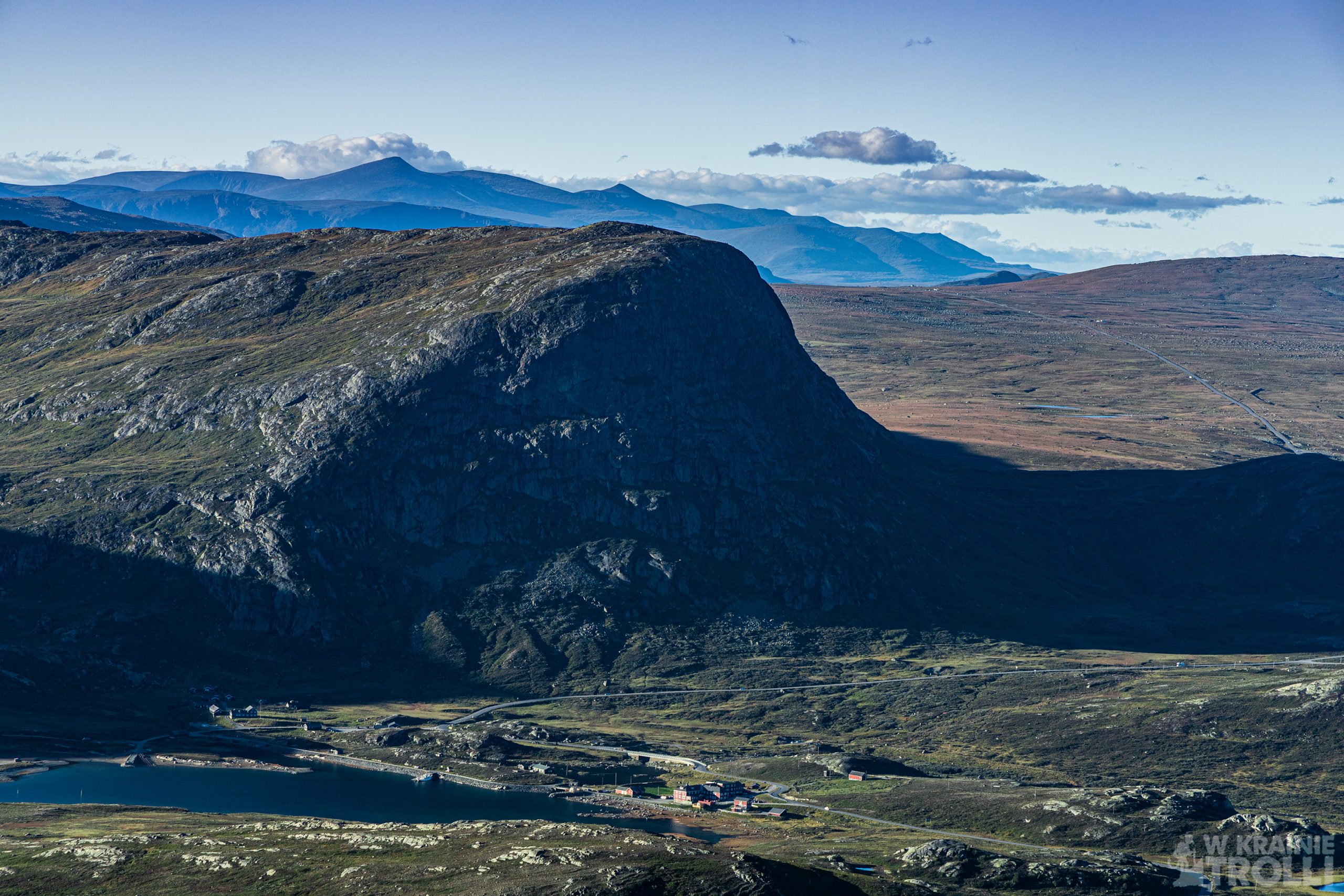
Ścieżka na Bitihorn znajduje się pod opieką DNT, jest więc świetnie oznaczona i wydeptana. A ilość ludzi, których minąłem świadczy również o tym, jak bardzo popularna jest to trasa. Znajduje się zresztą tuż przy głównej drodze, niedaleko popularnego hotelu Bygdin Høyfjellshotell i nie jest jakoś specjalnie wymagająca, wobec czego trudno się dziwić, że takie tłumy się na nią wybierają.
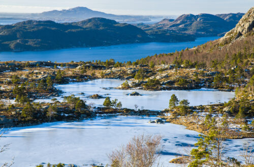
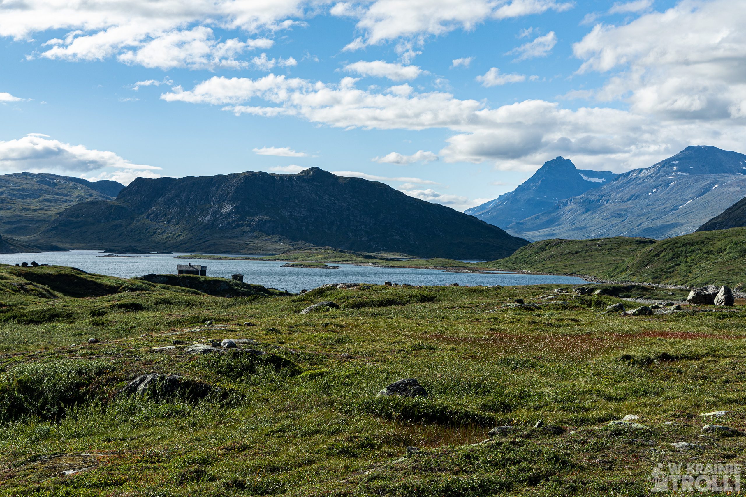
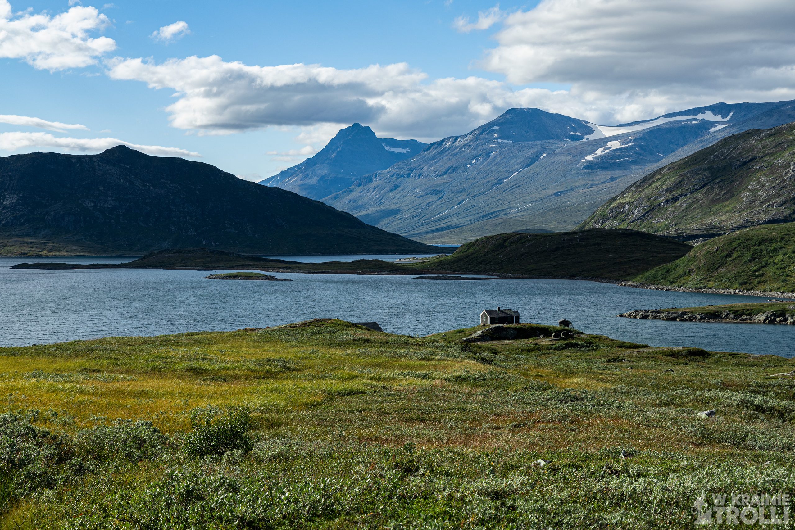
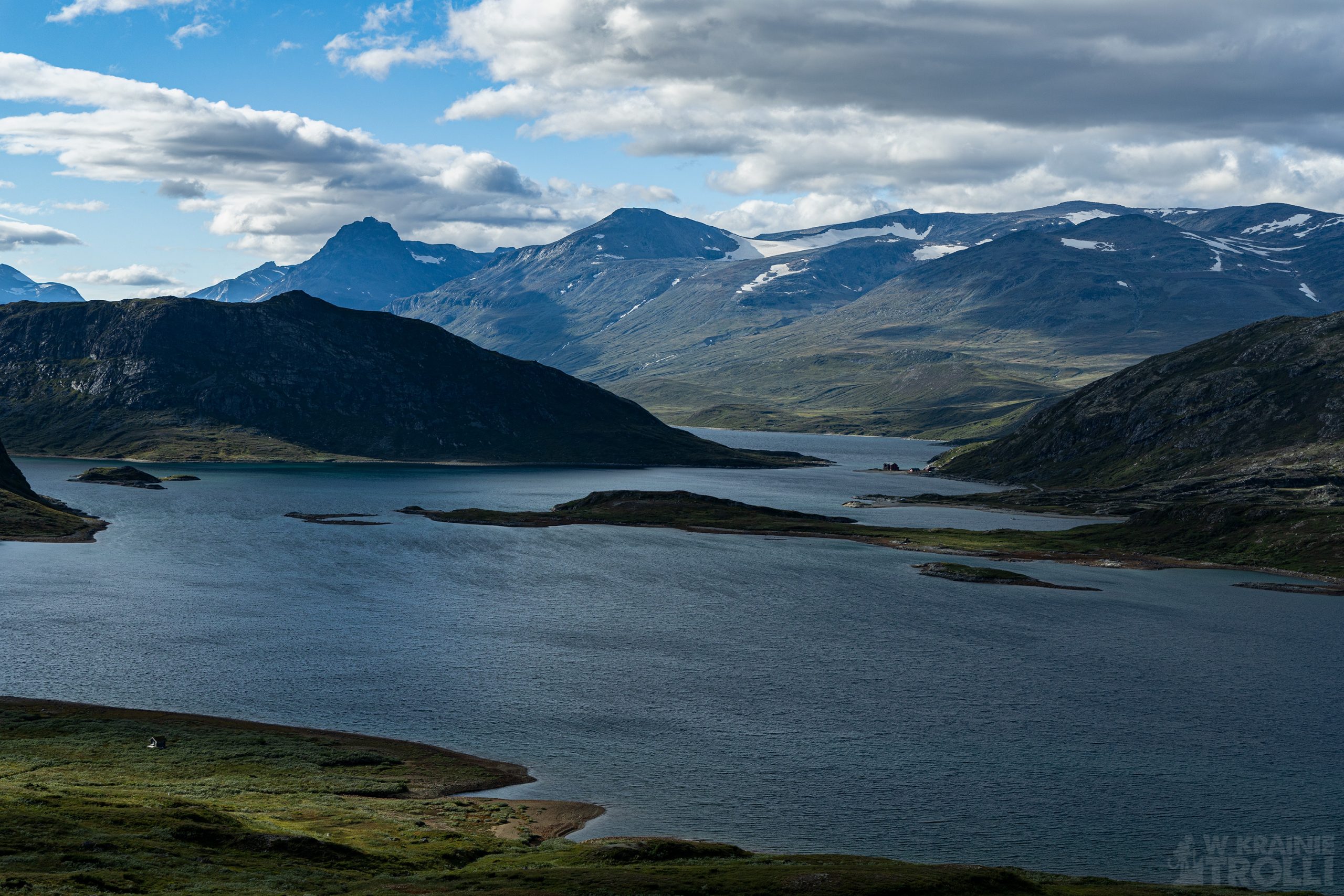
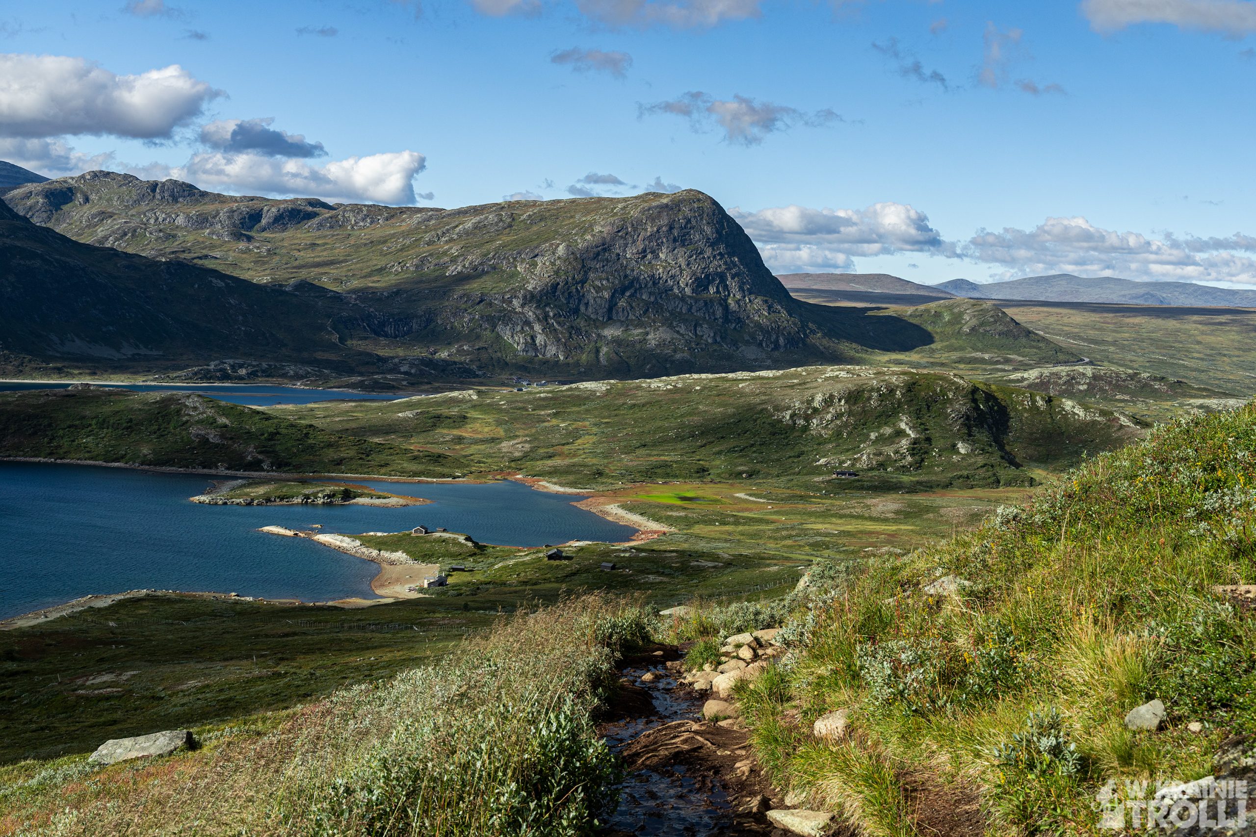
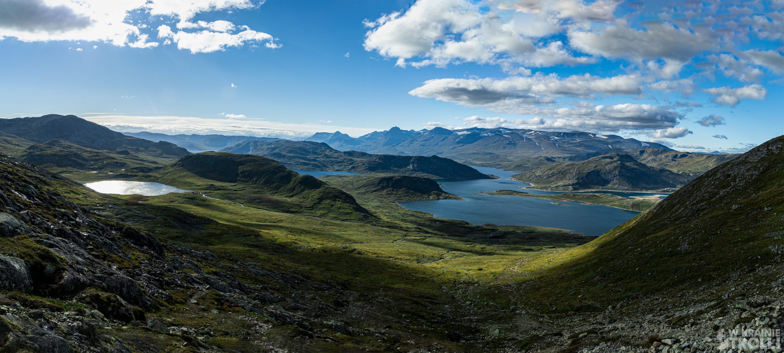
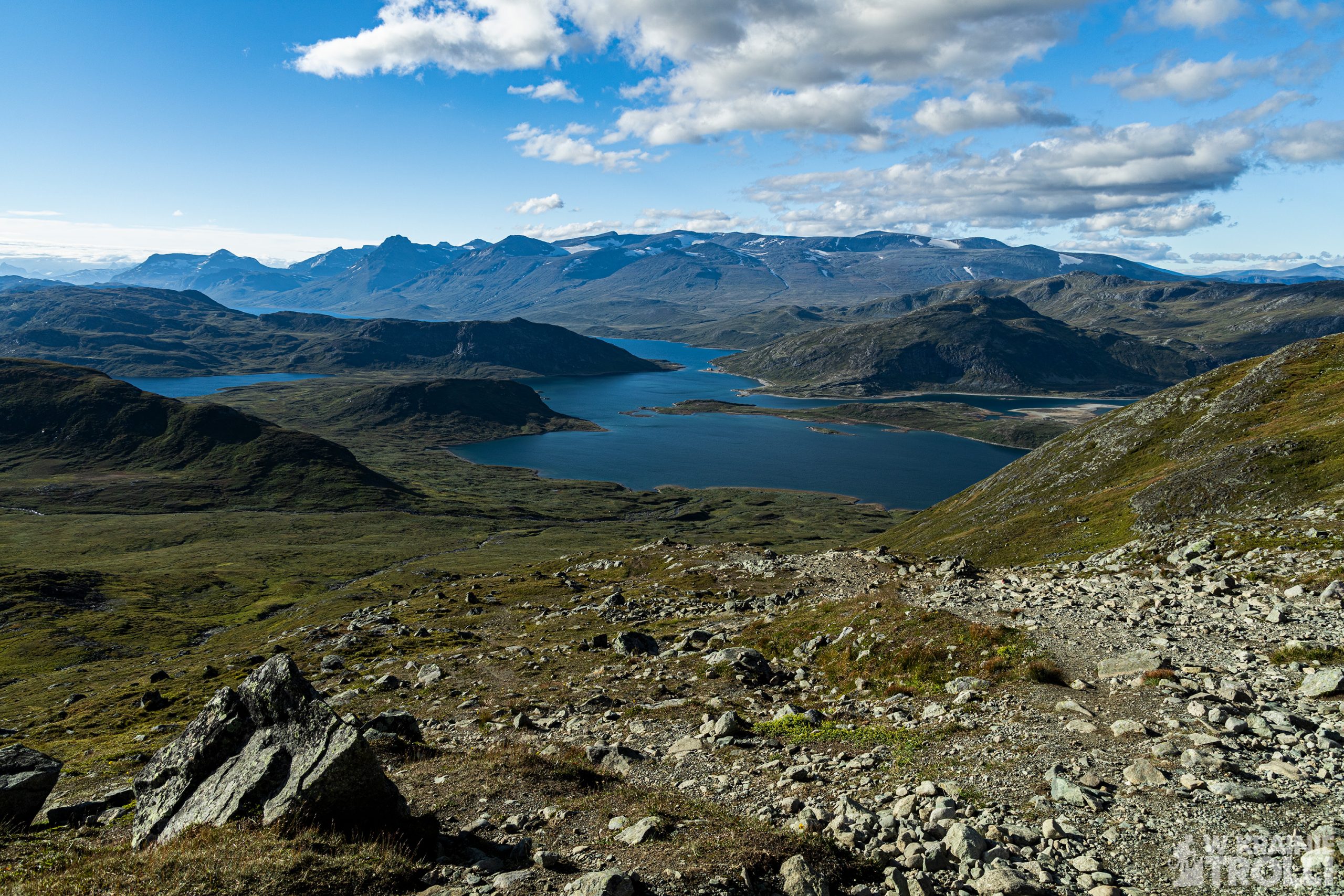
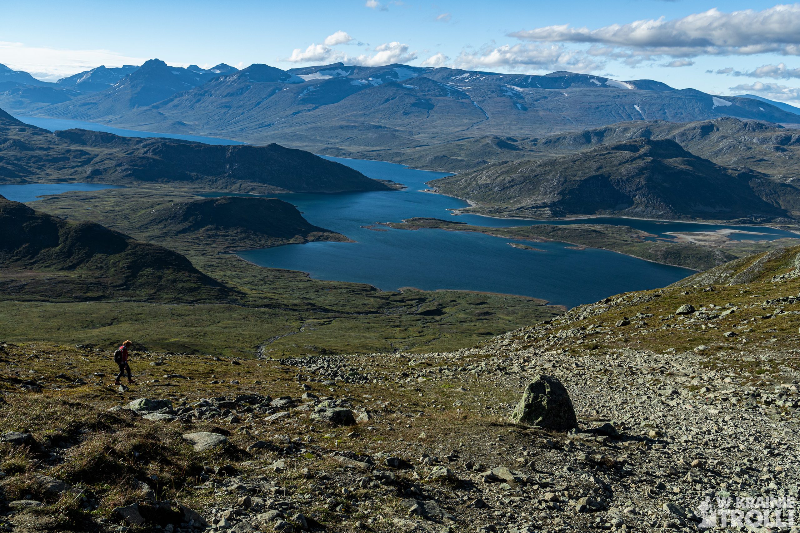
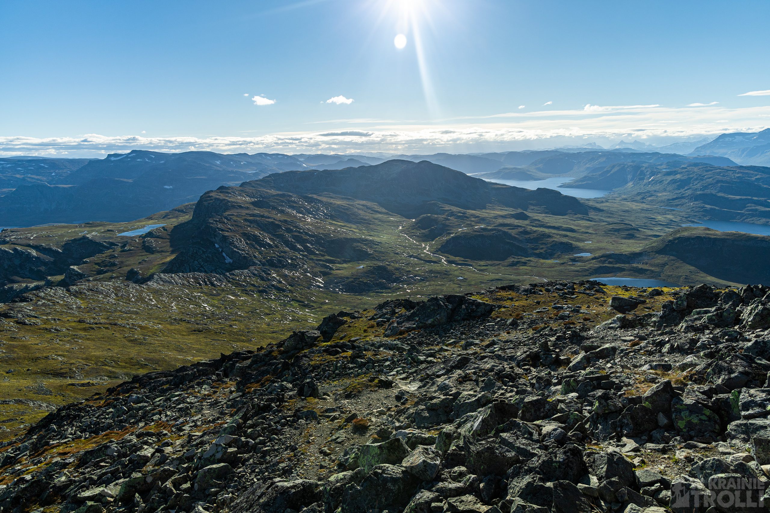
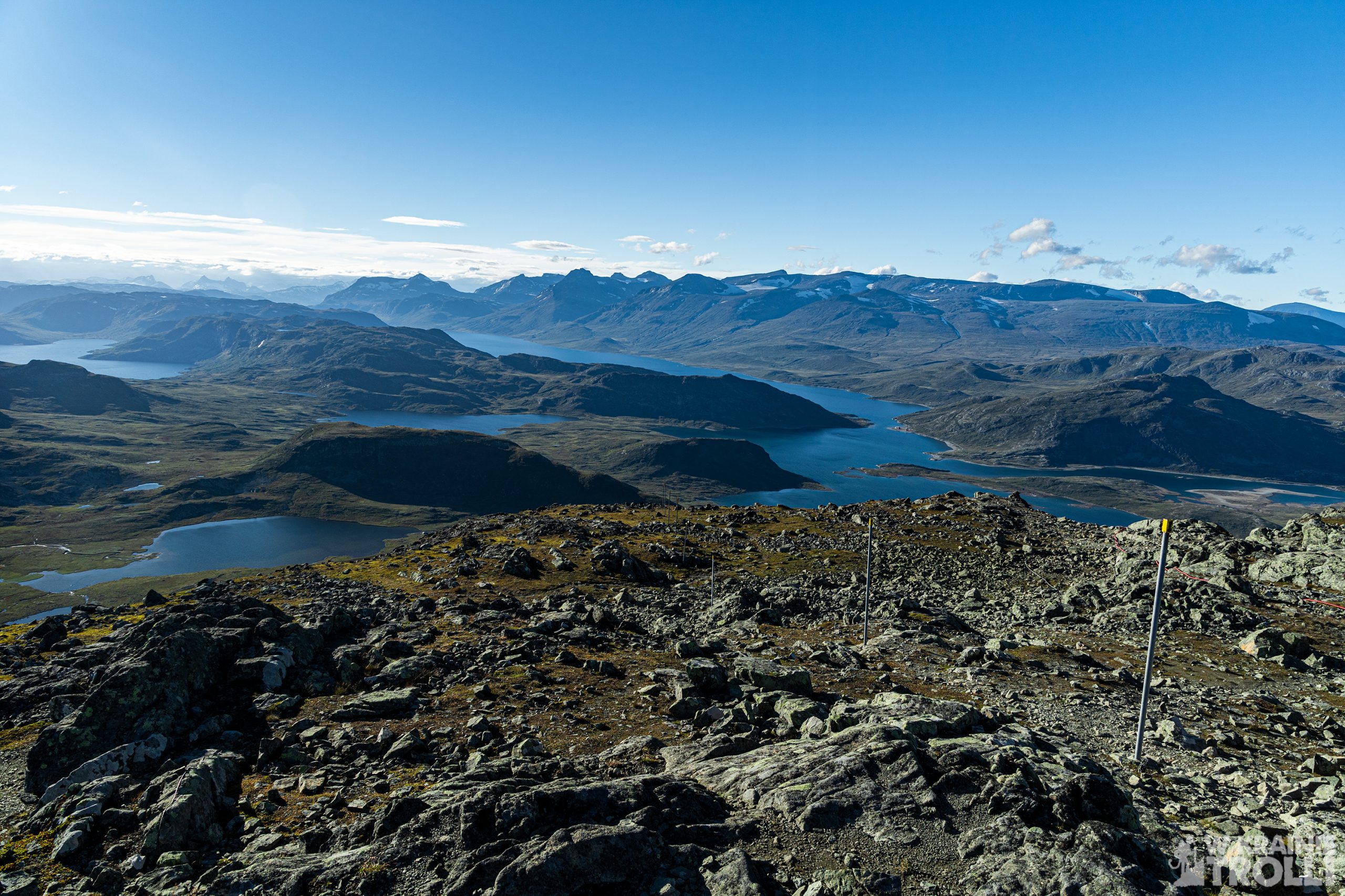
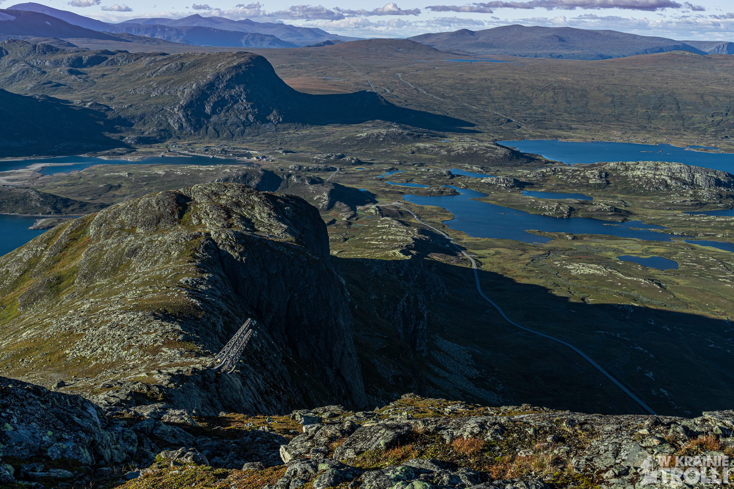
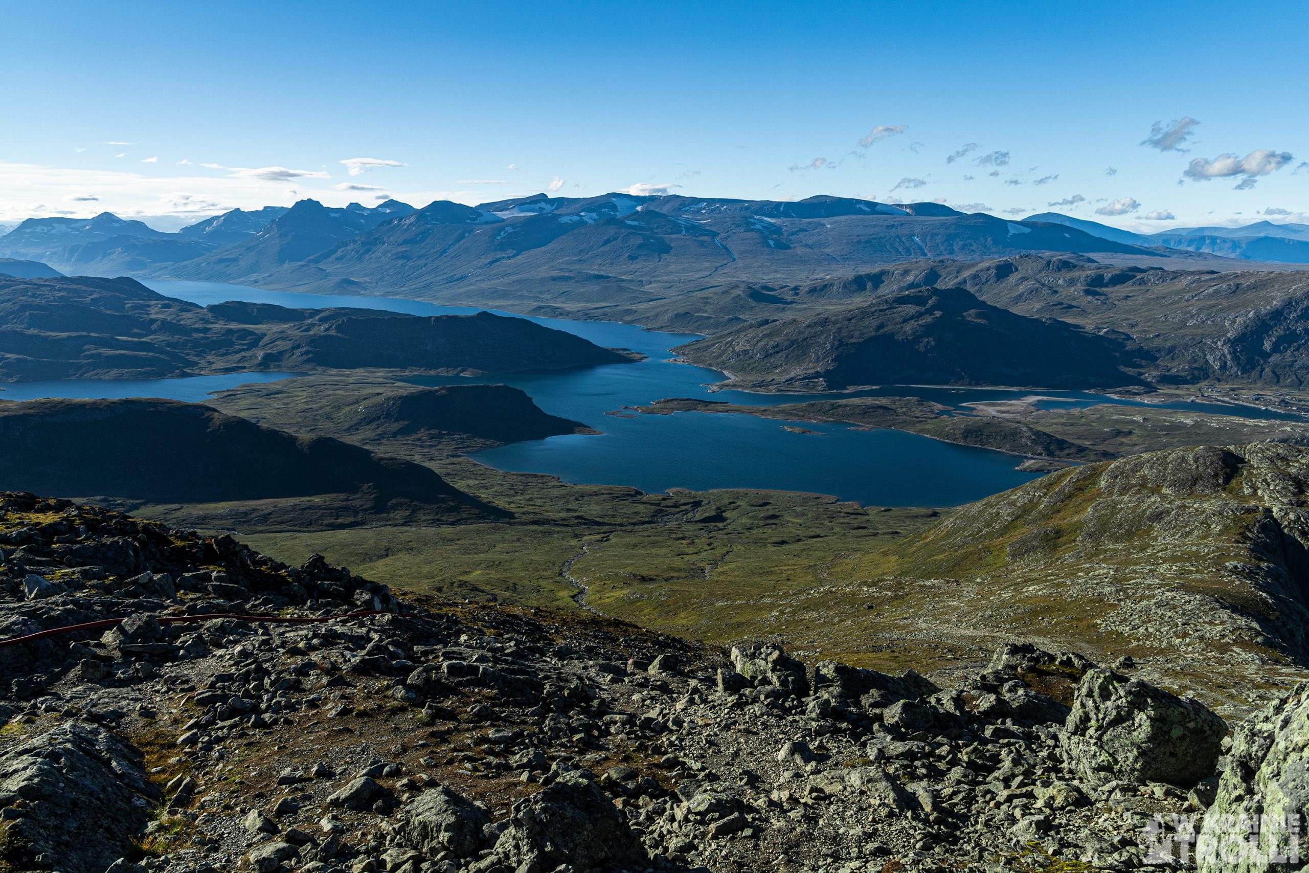
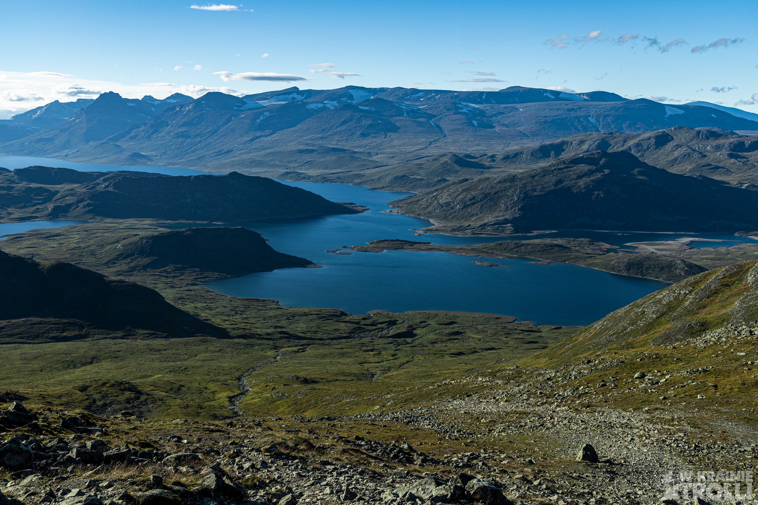
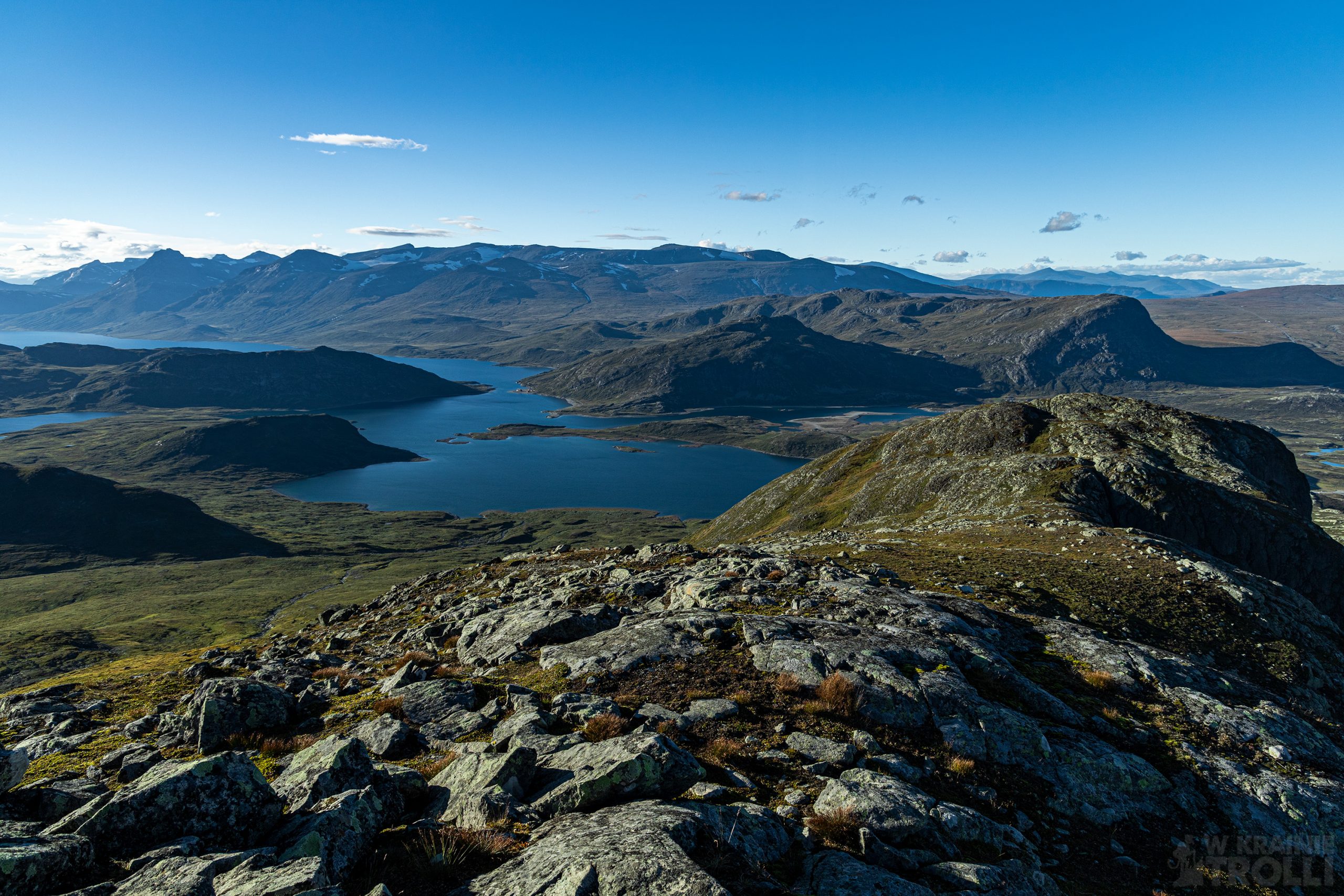
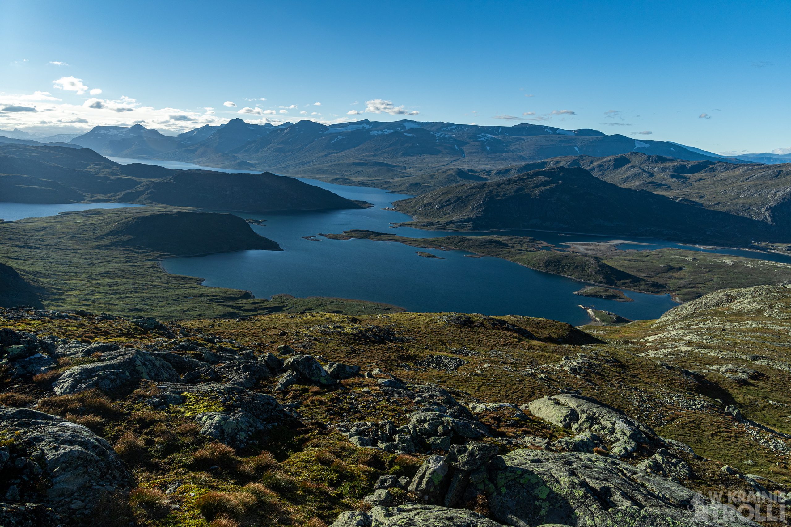
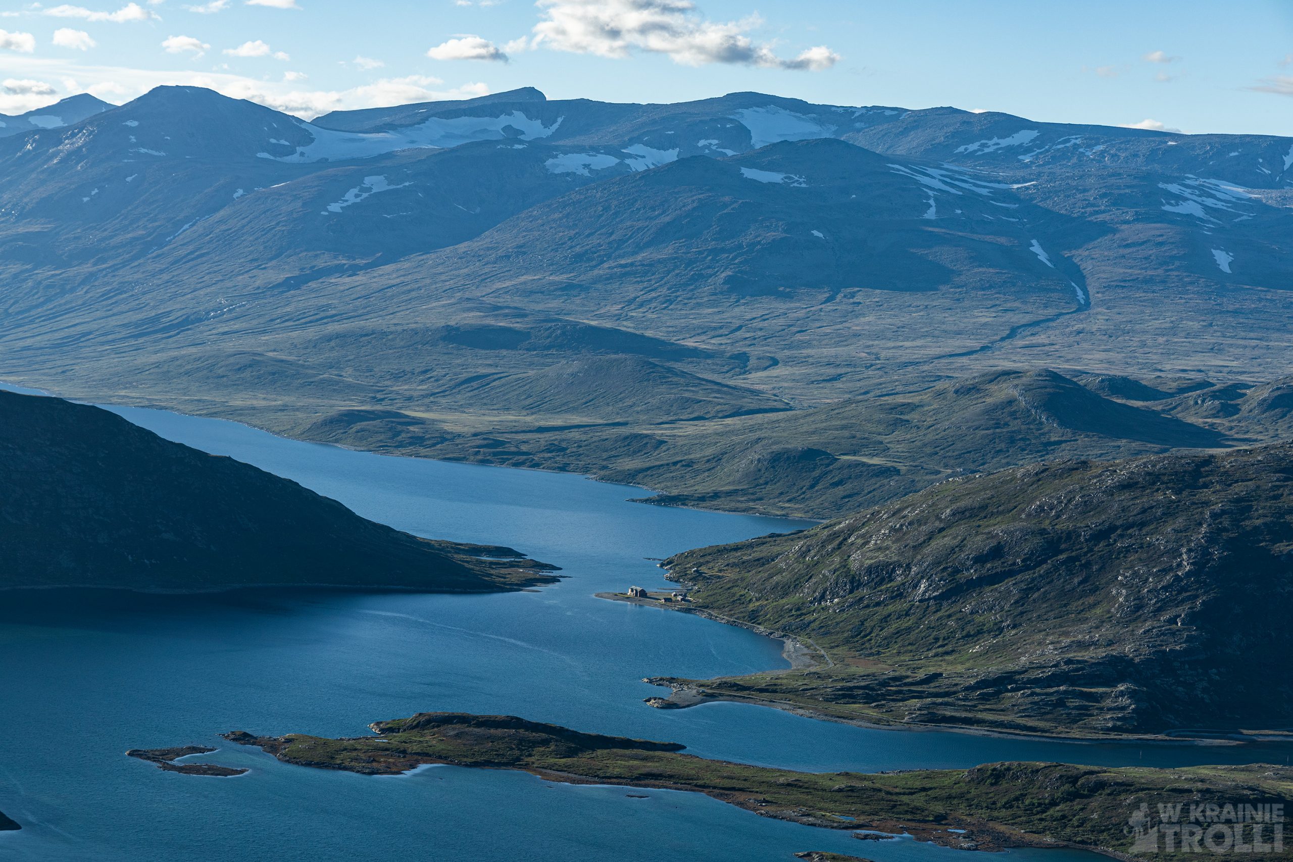
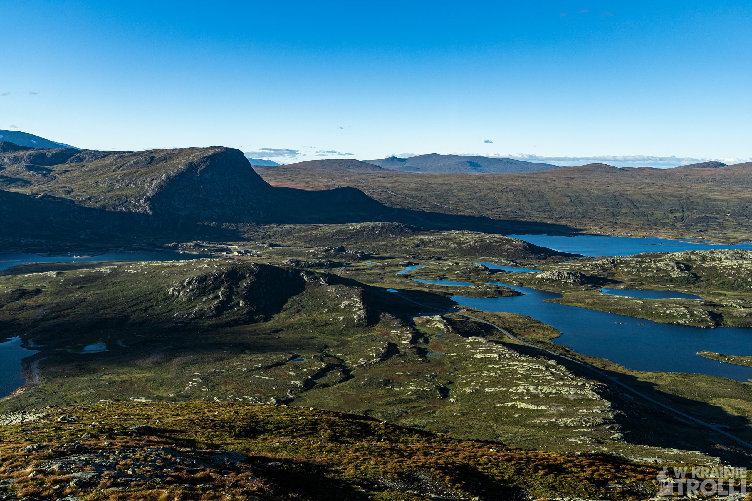
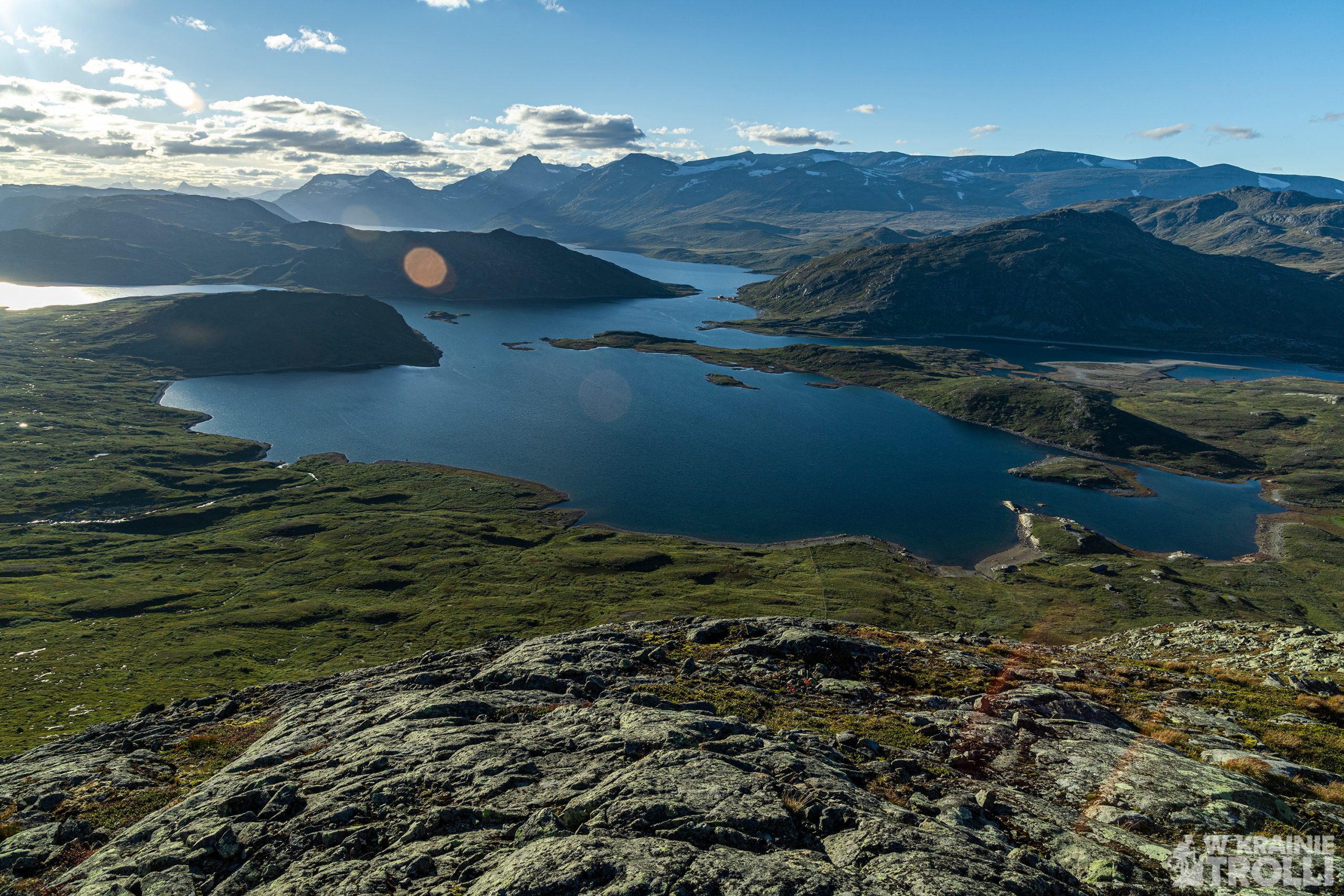
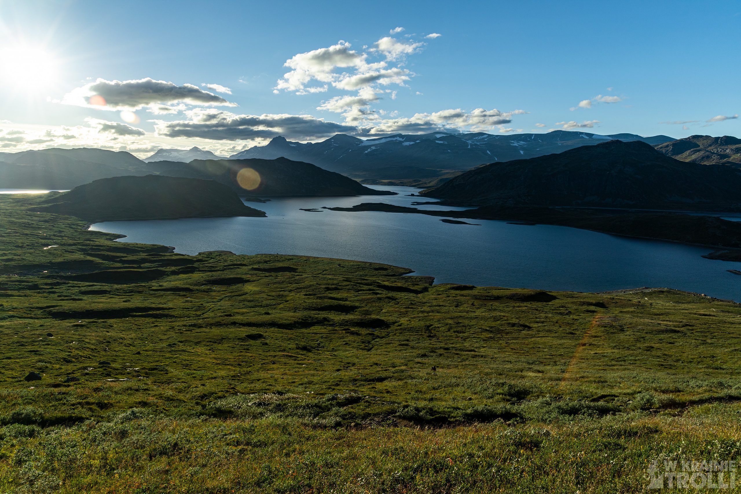
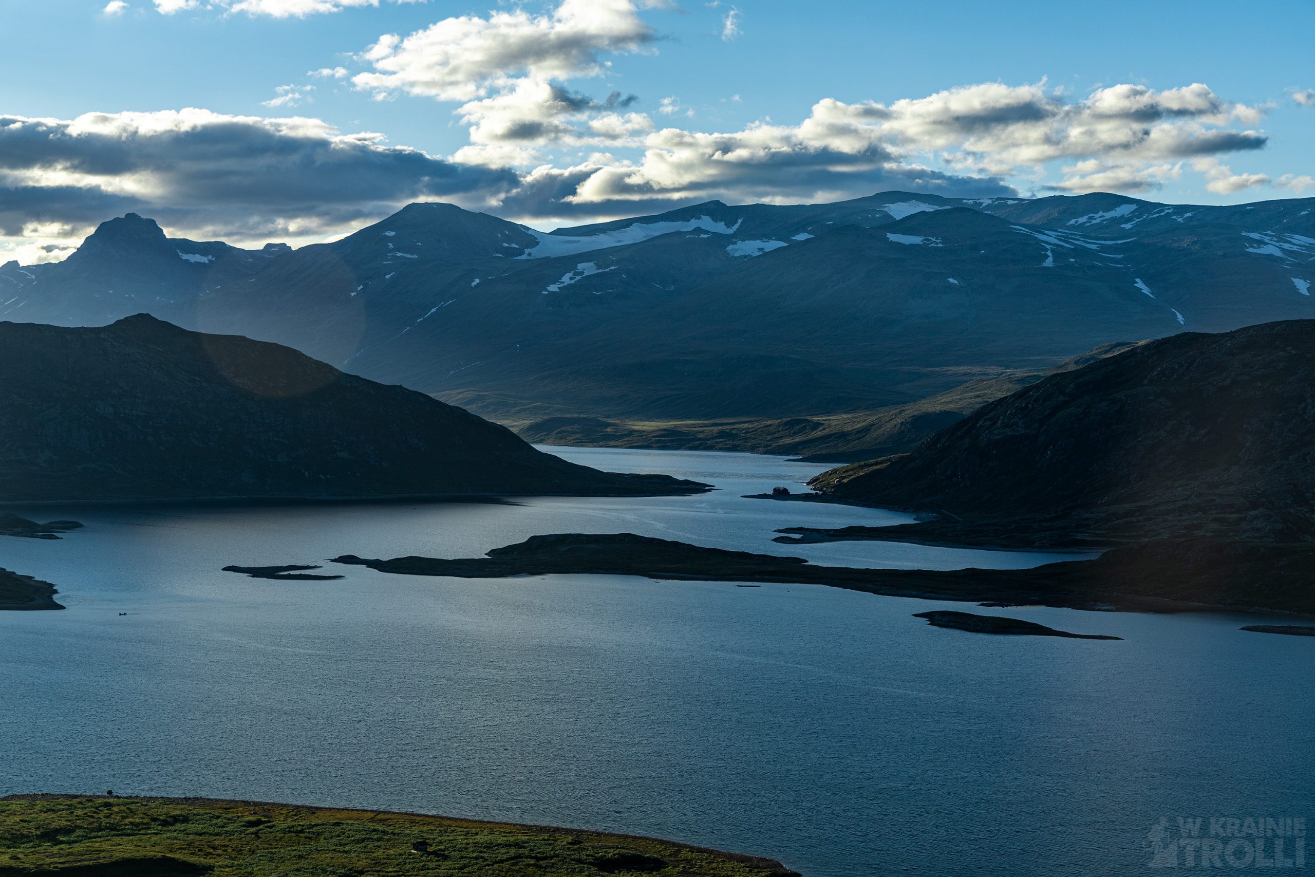
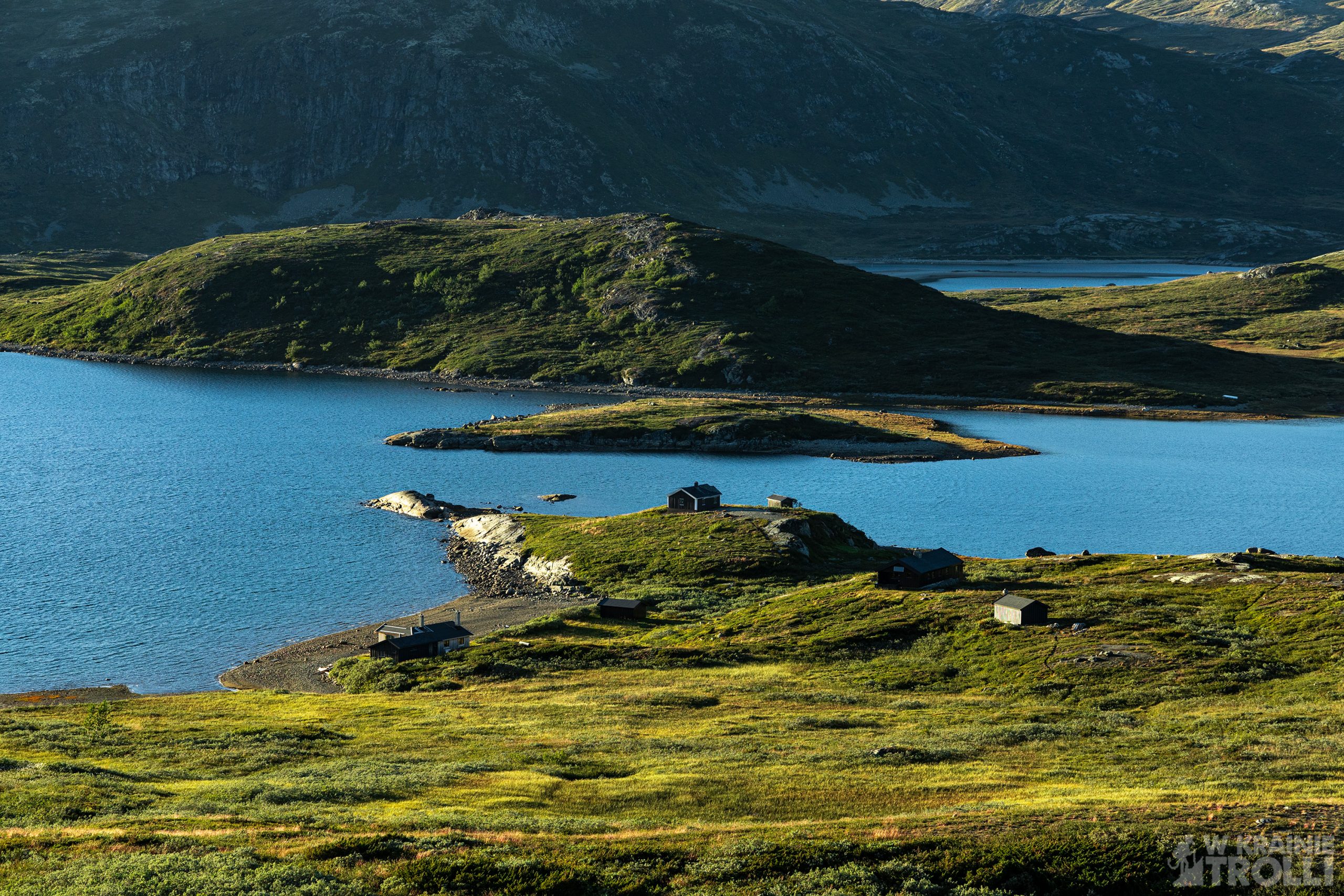
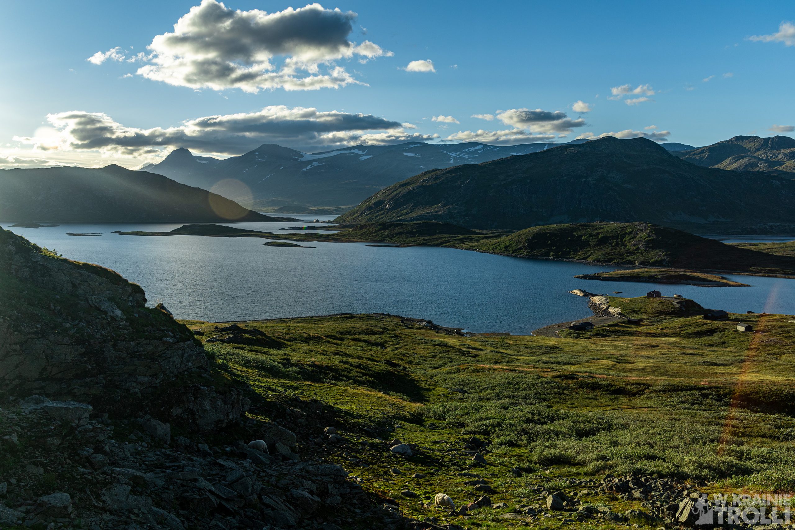
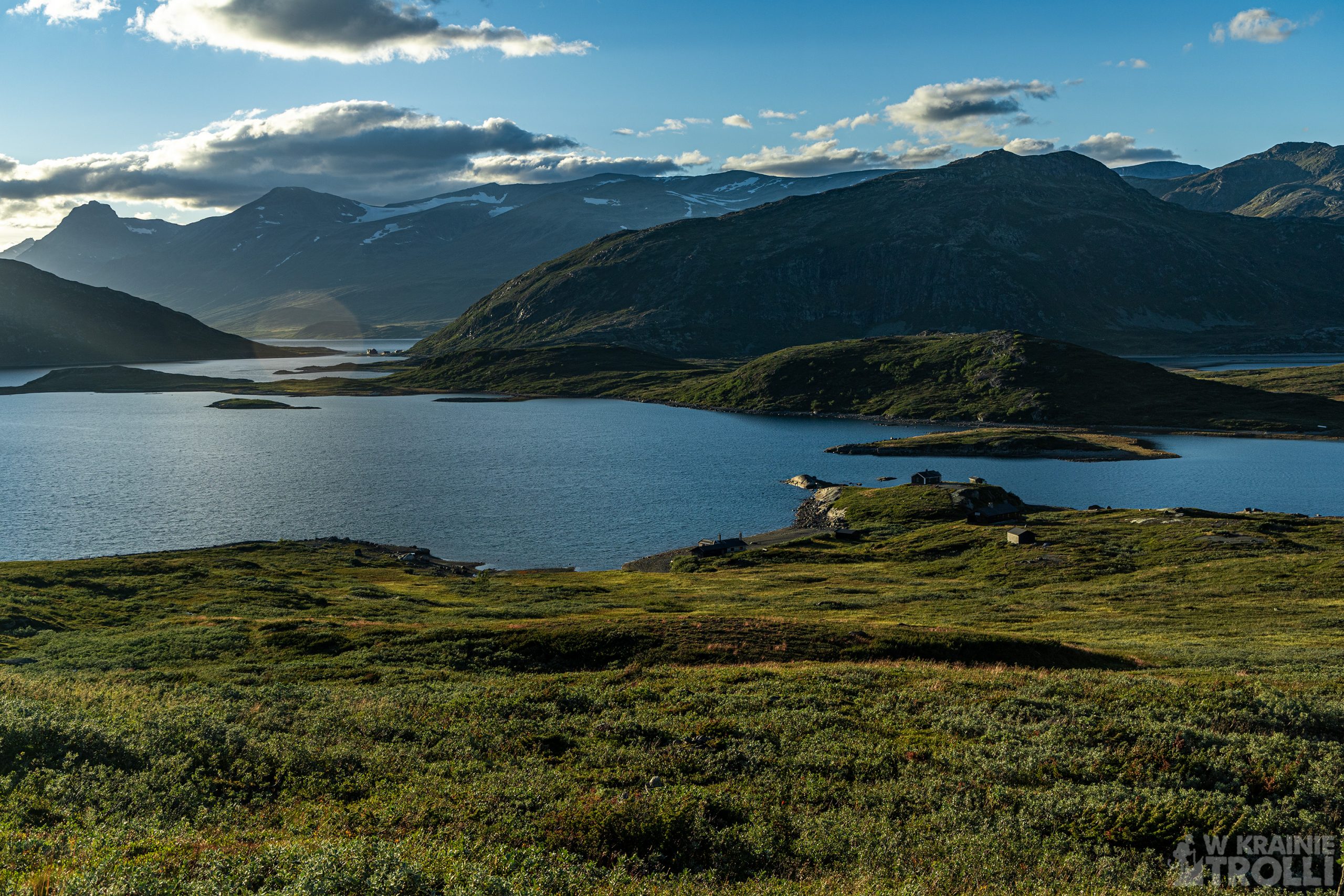
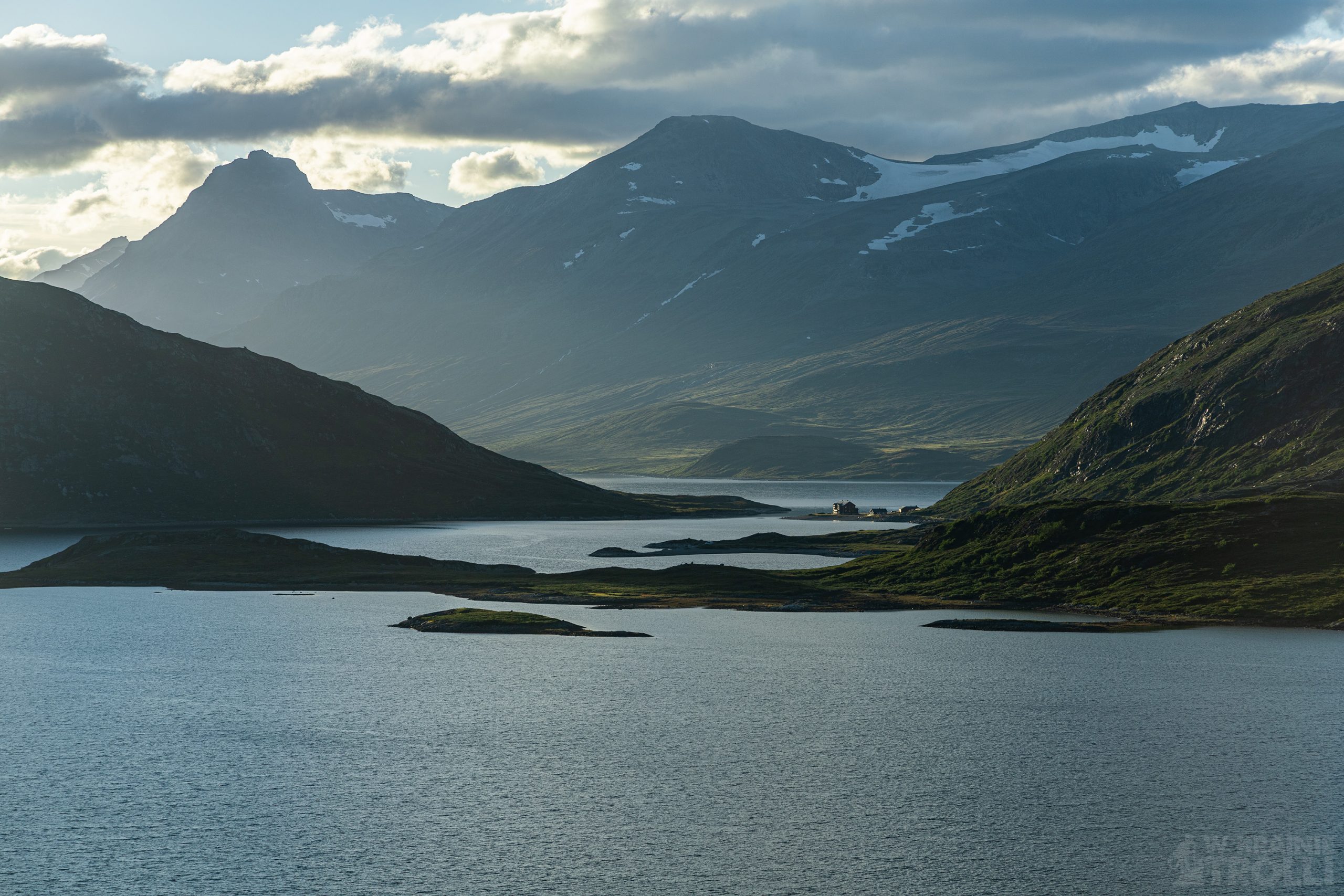
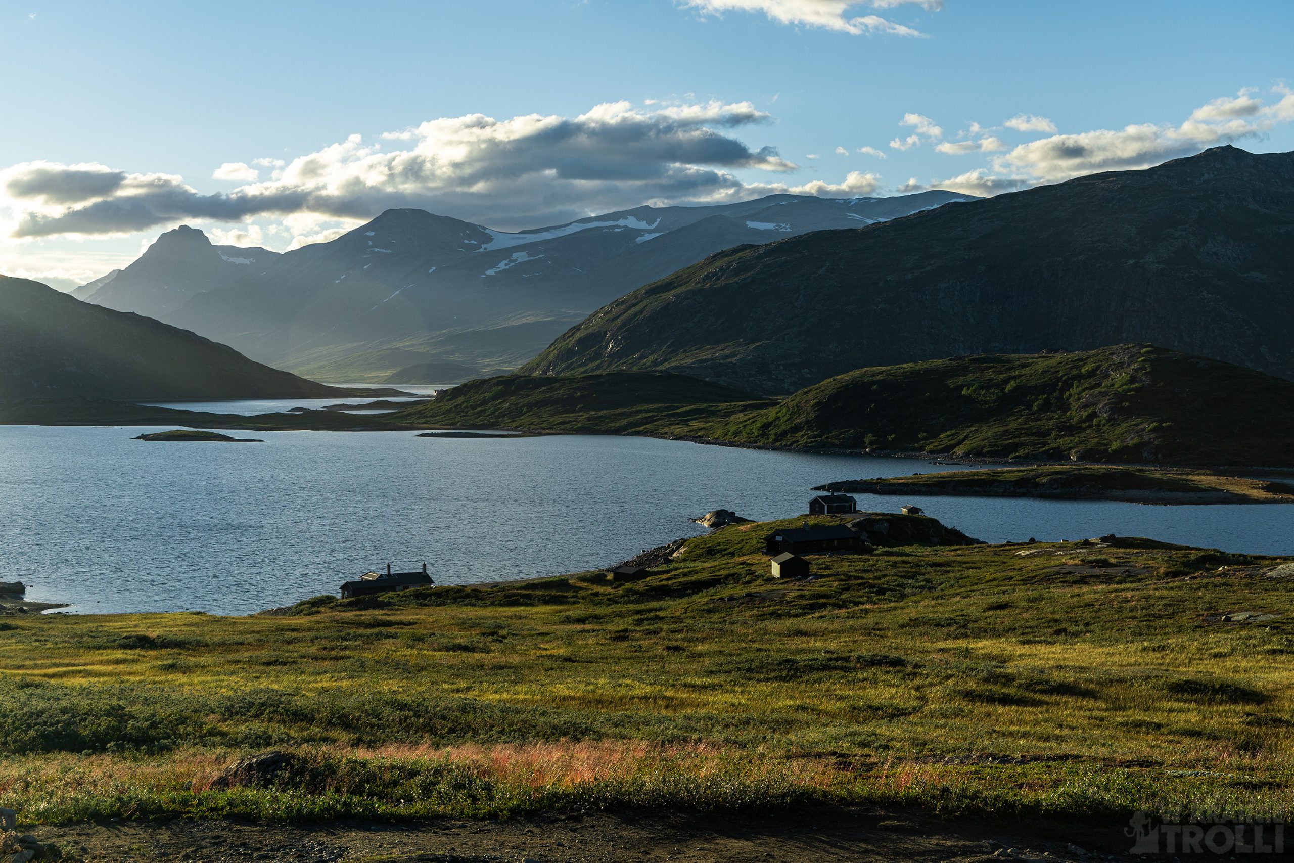
W pewnym momencie znajduje się rozwidlenie szlaków. Jeden prowadzi na zachód w kierunku schroniska Yksendalsbu, drugi bezpośrednio na szczyt Bitihorn. Trasa na wierzchołek od tego miejsca robi się bardziej stroma, a im wyżej się idzie tym więcej po drodze kamieni. A w przerwach na złapanie oddechu można zachwycać się widokami. Jeziora Raudfjorden oraz Kjelda, połączone na północy przesmykiem z Jeziorem Bygdin i otaczające zewsząd szczyty robią piorunujące wrażenie. A im wyżej, tym widok lepszy.
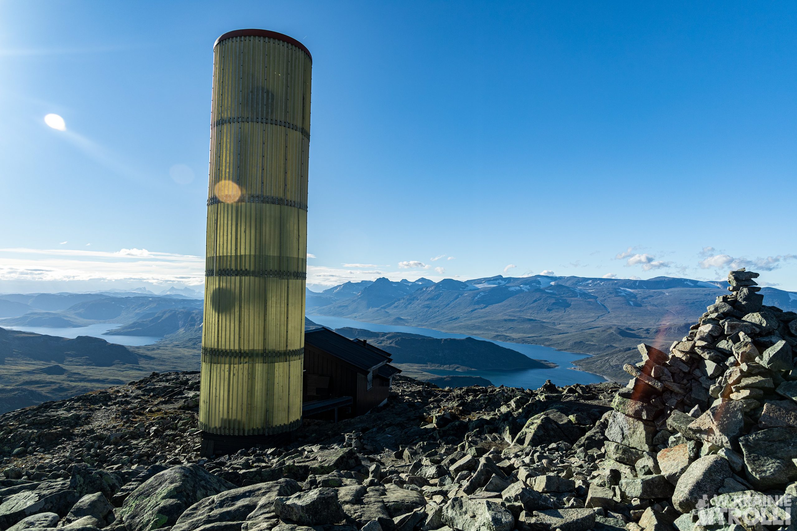
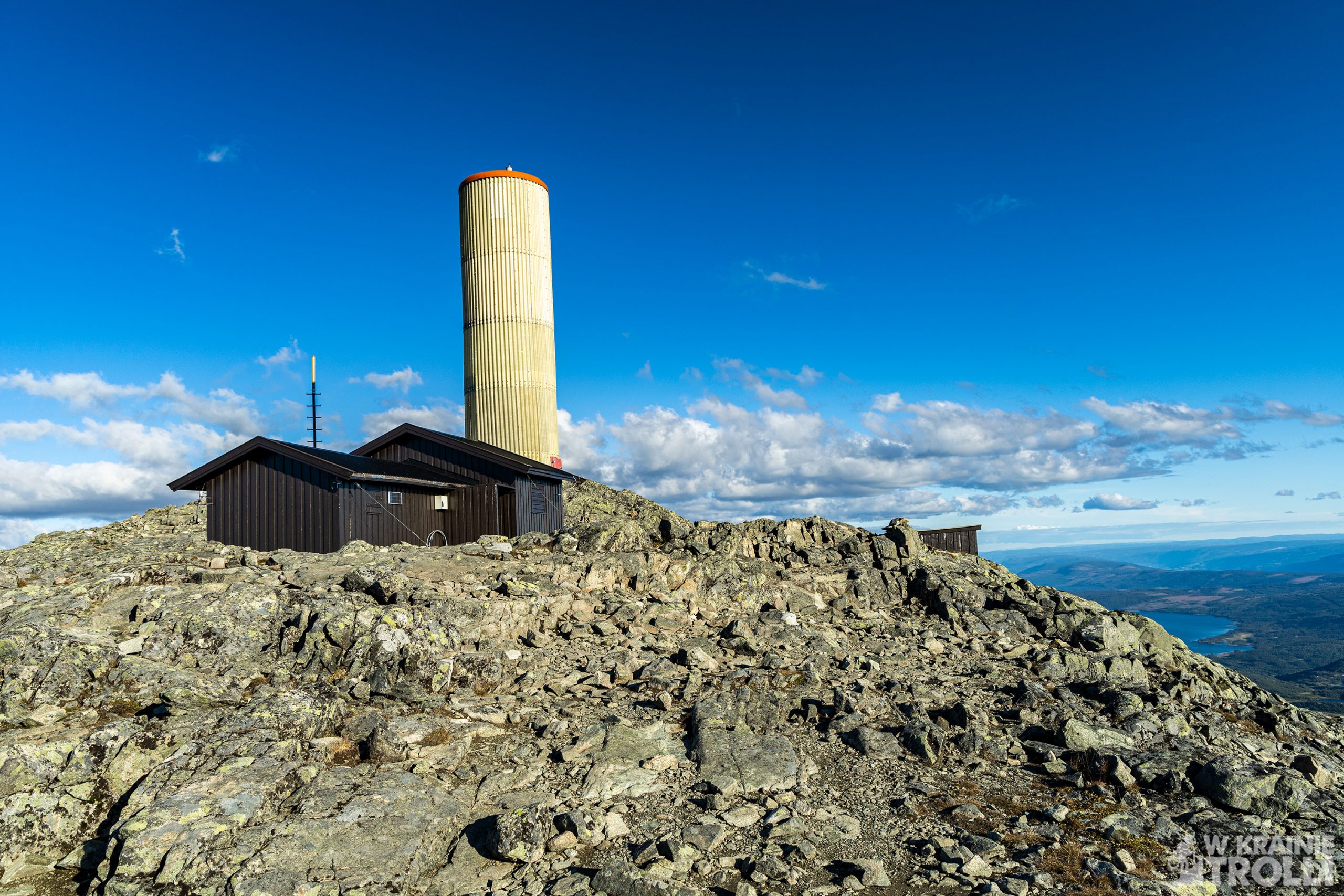
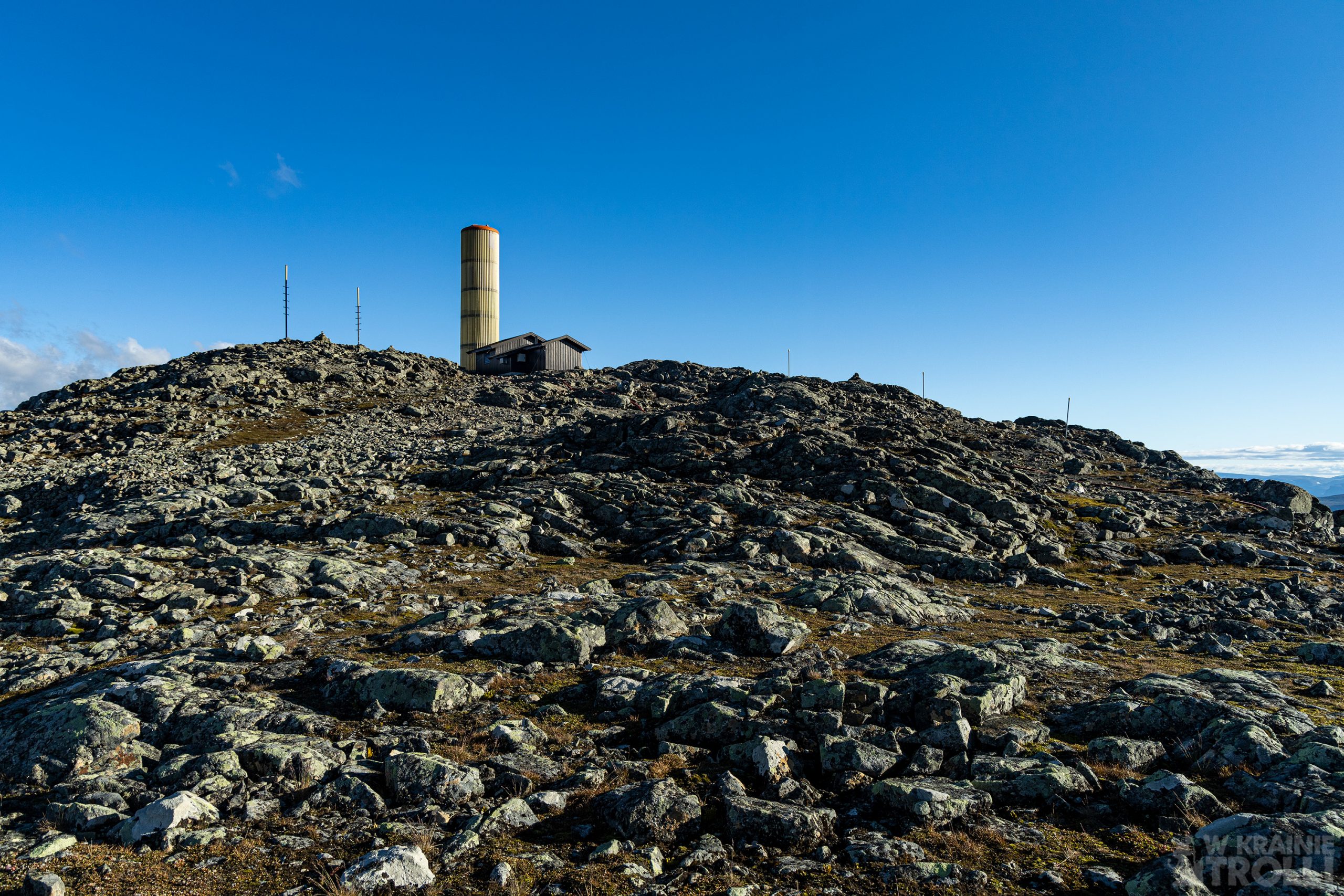
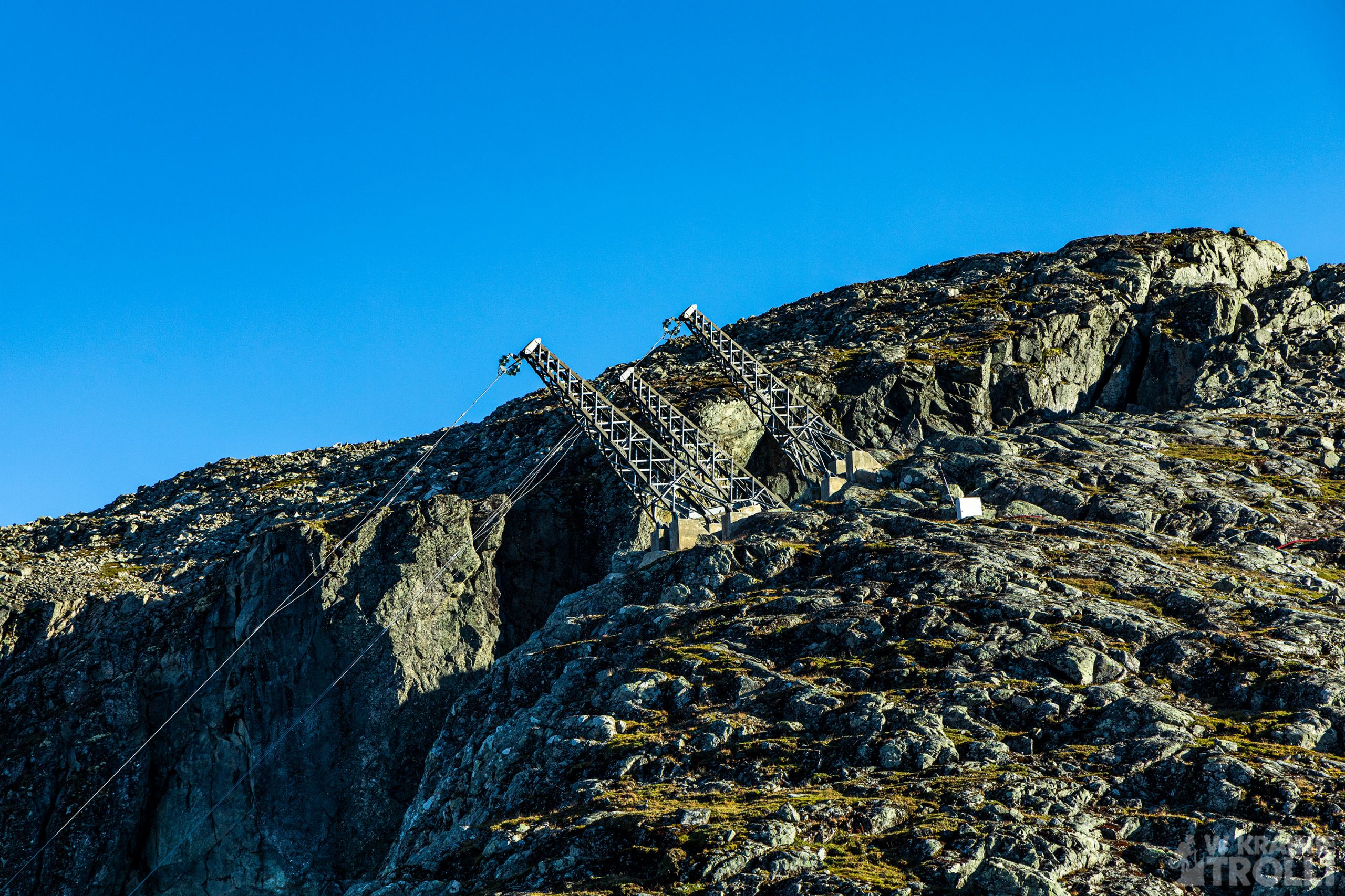
Szczyt Bitihorn to już jedno wielkie skupisko kamieni i wielka telekomunikacyjna antena. Jest też skromna chatka, zapewne służąca obsłudze instalacji.
Wikipedia podaje kilka ciekawych informacji na temat tej góry. Jej nazwa składa się z dwóch słów: ‘’bite’’ czyli ‘’gryźć’’ i ‘’horn’’ czyli ‘’róg’’. Całość oznacza więc ugryzioną górę lub ugryziony róg. W roku 1811 odnotowano pierwsze wejście na szczyt Bitihorn, a dokonał tego botanik Christen Smith, prowadzący badania w górach Jotunheimen. Ze swoimi 1607 metrami wysokości, Bitihorn bezsprzecznie góruje nad okolicznymi szczytami, przez co uznawany jest jako swego rodzaju symbol branży turystycznej, zwłaszcza w pobliskim kurorcie Beitostølen, położonym zaledwie parę kilometrów dalej na południe.
Podczas II wojny światowej stroma wschodnia ściana była wykorzystywana przez niemieckie wojska alpejskie do szkolenia. Na południowym zboczu można znaleźć małe jednoosobowe schrony z otworami na działa. Niektóre z nich są prawdopodobnie zbudowane później jako repliki, ale niektóre z nich pochodzą z lat 1941-1942.
Na górę prowadzi jeszcze jeden szlak od południowej strony. Jest on jednak bardzo stromy i zaleca się, aby korzystać z niego wyłącznie w obecności kogoś, kto dobrze zna trasę.
Zgodnie z założeniami wróciłem na parking jeszcze przed zachodem słońca. Miałem więc czas na znalezienie odpowiedniego miejsca na rozbicie namiotu.


After finishing the Knutshøe tour, I had a few more hours until sunset. And since I was planning to spend the night in a tent in this area, I had to do something about this excess time. Waiting in one of the parking lots along the road 51 was a rather poor option due to the amount of passengers passing both ways that day and stopping at every possible piece of land. I decided that despite the tiredness, it would be better if I go somewhere else.
Bitihorn (1607m above sea level) offered a fairly short route, which also turned out to be very spectacular. The parking lot by the trail turned out to be paid, but 60kr per day, seems not an exorbitant amount. I left the car, took my backpack and set off. At the very beginning I started to pass people coming back from the tour. No wonder, the second half of the day is the time to come back from the mountain trails and not the time to start hiking. But I hoped that I would be able to come back before sunset.
The path to Bitihorn is under the care of DNT, so it is well marked and well-trodden. And the amount of people I passed also shows how popular this tour is. It is located right on the main road, not far from the popular Bygdin Høyfjellshotell hotel, and it is not particularly demanding, so it is hardly surprising that such crowds are going there.
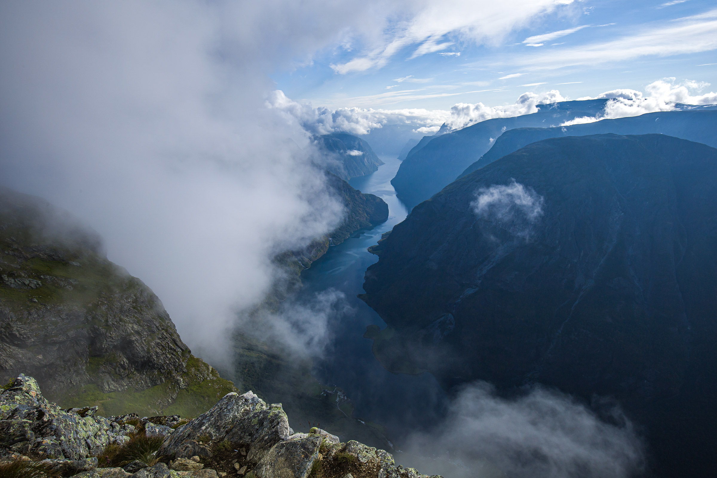
At some point there is a crossing the trails. One leads west towards the Yksendalsbu hut, the other one goes directly to the Bitihorn peak. The trail to the summit from here gets steeper, and the higher you go, there are more stones along the way. And during breaks to catch your breath you can admire the views. Lakes Raudfjorden and Kjelda, connected in the north by an isthmus with Lake Bygdin and the peaks surrounding from everywhere make an electrifying impression. And the higher the view, the better.
The summit of Bitihorn is already one large cluster of stones and a spot of big telecommunications antenna. There is also a modest hut, probably used for serving the antenna installation.


Wikipedia gives some interesting information about this mountain. Its name consists of two words: ” bite’’ and ‘’horn’’. The whole therefore means a bitten mountain or a bitten horn. In 1811, the first ascent to the Bitihorn peak was recorded, by the botanist Christen Smith, who conducted research in the Jotunheimen mountains. With its 1,607 meters high, Bitihorn rises over the surrounding peaks, making it a symbol of the tourism industry, especially in the nearby tourist resort of Beitostølen, just a few kilometers to the south.
During World War II, the steep eastern side was used by the German Alpine troops for training. On the southern slope you can find small single-person shelters with openings for cannons. Some of them are built later as replicas, but some are from 1941-1942.
There is one more trail leading to the top from the south side. However, it is very steep and it is recommended that you only use it in the presence of someone who knows the route well.
As planned, I returned to the parking lot before sunset. So I had time to find a suitable place to pitch a tent.