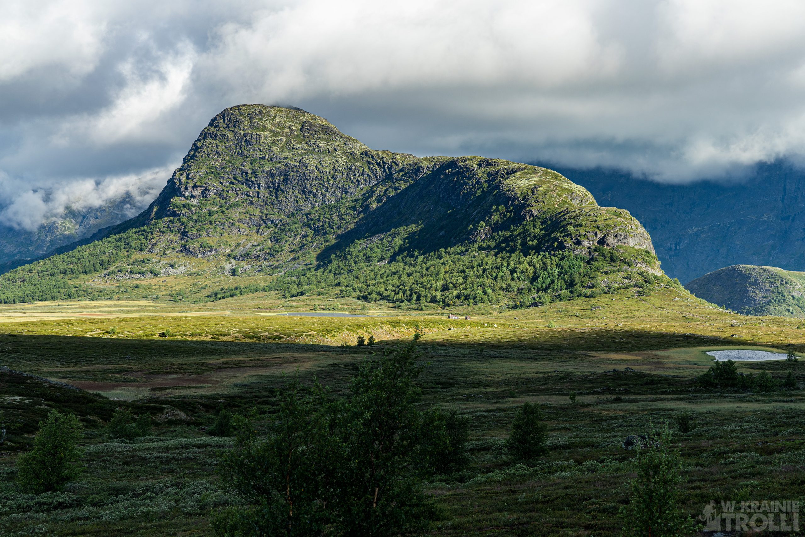
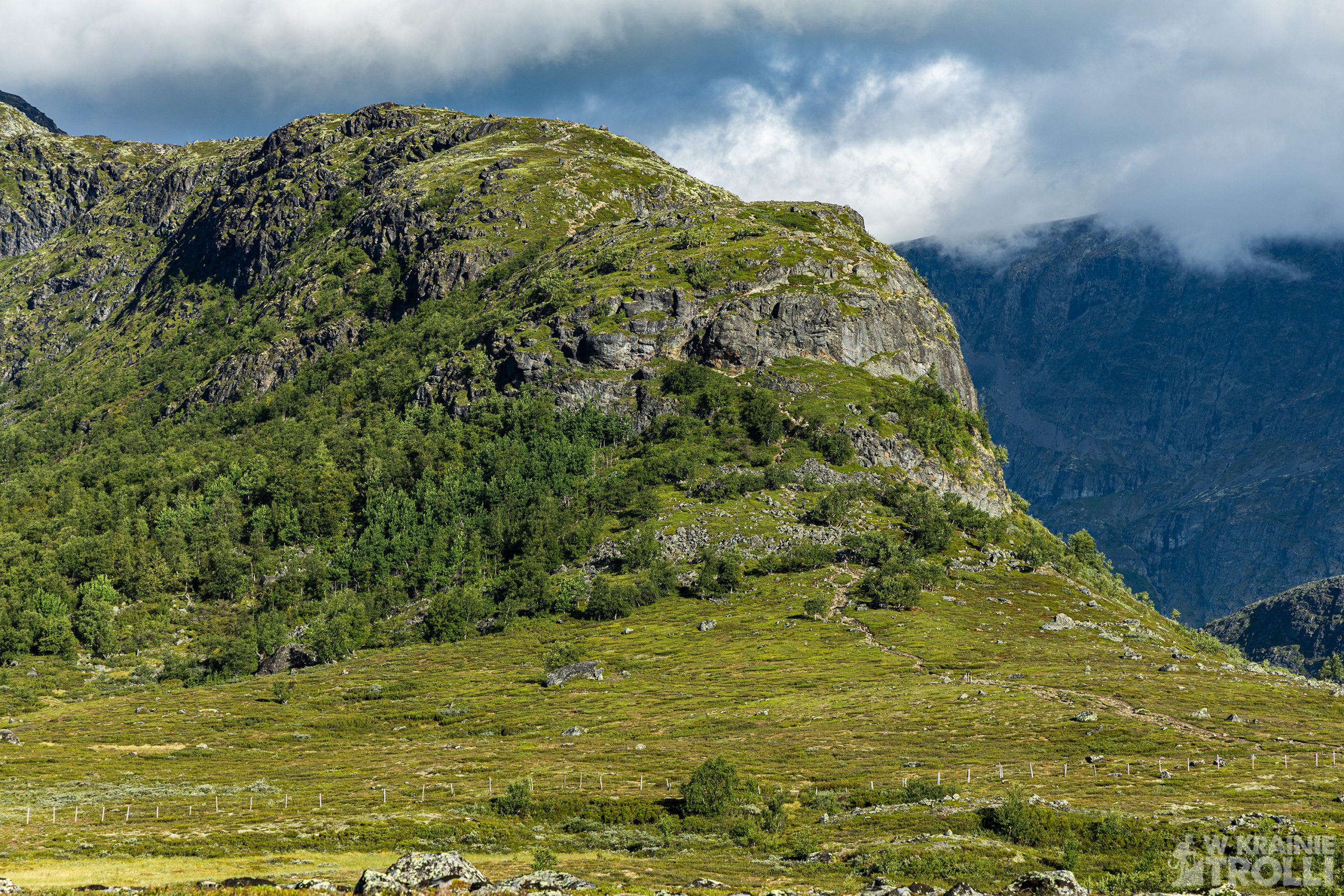
Knutshøe 1517 m n.p.m.
Pamiętacie zeszłoroczną wyprawę na Besseggen w górach Jotunheimen? Jednym z najbardziej niesamowitych widoków podczas tego marszu była samotna góra po drugiej stronie jeziora Gjende. Nosi ona nazwę Knutshøe, i obiecałem sobie, że któregoś dnia się na nią wybiorę. Cóż, ten dzień właśnie nadszedł.
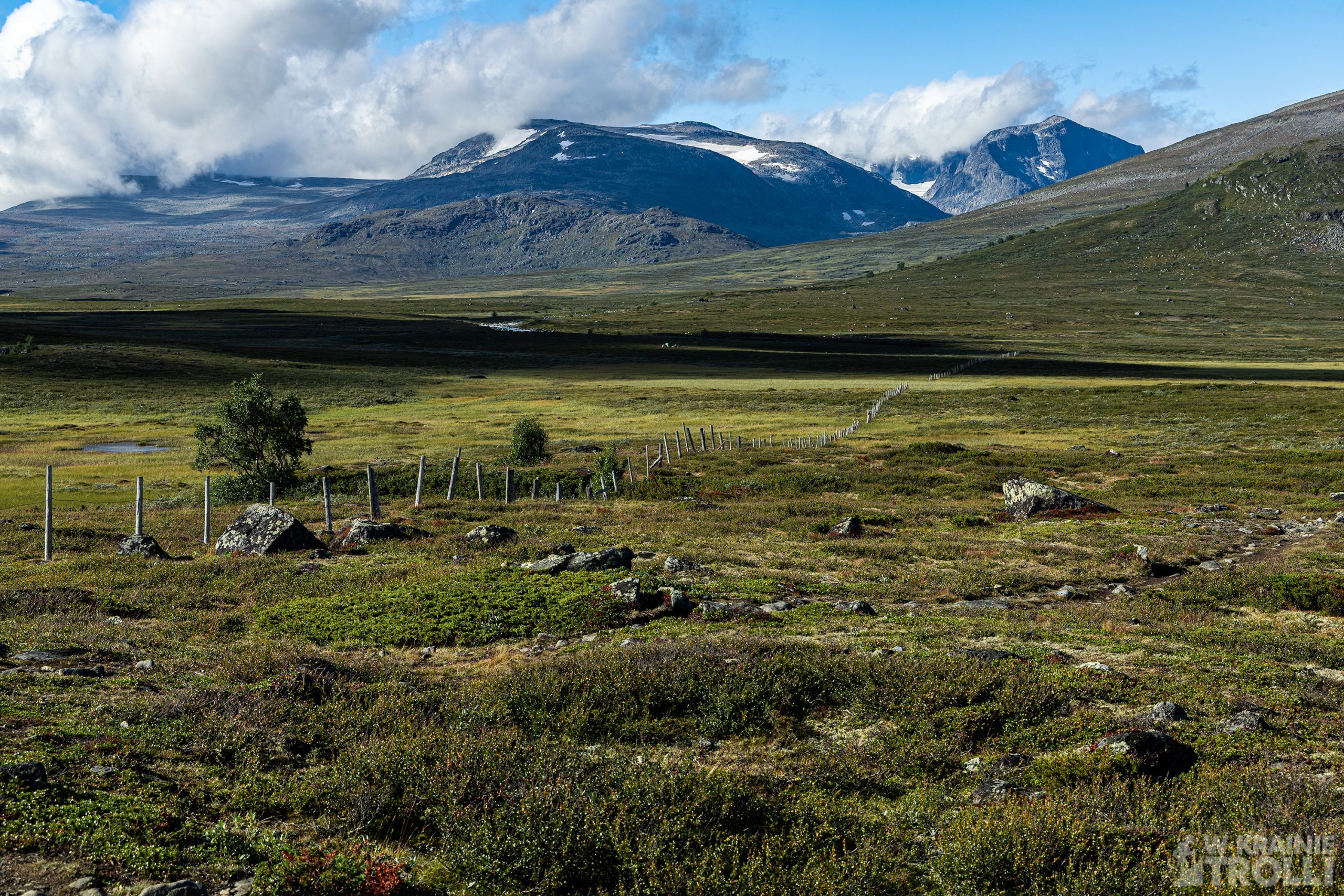
Szczyt liczy 1517 m n.p.m. i w zasadzie prowadzą na niego tylko dwie drogi: od południowego wschodu i od północnego zachodu. Zbocza na innych kierunkach są zbyt strome by poprowadzić na nich jakieś inne szlaki. Można więc wejść na szczyt z jednej strony, zejść z drugiej i wrócić do punktu wyjścia doliną, wzdłuż rzeki. Takie też były moje założenia na tę wyprawę. Cała trasa liczy ponad 12 km i, o czym osobiście się przekonałem, jest niesamowicie widowiskowa.
Do Jotunheimen dojechałem około ósmej rano. Zapowiadał się przyjemny dzień, choć gdy wysiadłem z samochodu uderzył we mnie zimny wiatr. Zmieniłem buty, założyłem bluzę i kurtkę, porobiłem kilka zdjęć z niewielkiej zatoczki przy głównej drodze, gdzie postanowiłem zostawić auto i wyruszyłem na szlak. Już na początku zgubiłem właściwą ścieżkę i musiałem przejść kawałek po podmokłym terenie by znów na nią trafić. Dalej było już lepiej. Trasa nie jest może jakoś specjalnie oznaczona, ale ścieżka wyraźnie wydeptana, świadczyła o popularności tej trasy. Zresztą, wkrótce się o tym przekonałem, bowiem zobaczyłem zmierzające w stronę Knutshøe co rusz nowe grupki wędrowców. W większości startowali oni z kolejnej zatoczki przy tej samej drodze, gdzie pozostawiłem swoje auto. Kilak godzin później, gdy już wracałem samochodów było tam już tyle, że ci, którzy nie znaleźli sobie miejsca parkowali na poboczu, z połową auta na samej drodze. Zgroza.
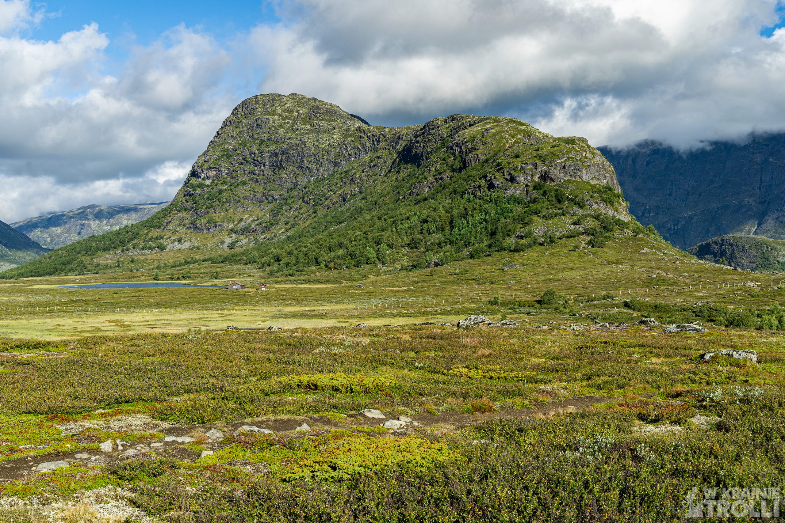
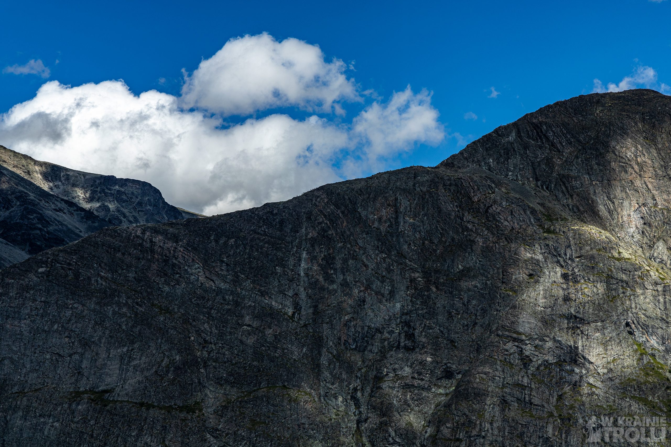
Dotarłem do podnóża góry. Szlak w tym miejscu się rozwidlał. Jedna ścieżka prowadziła w górę, druga kierowała się w stronę doliny Leirungsdalen. Tą drugą miałem wracać jakiś czas później. Skierowałem się na zbocze i rozpocząłem wspinaczkę. Wejście na grań nie było trudne, może poza jednym wyjątkiem. Gdzieś po drodze natrafiłem na miejsce, gdzie trzeba użyć wszystkich czterech kończyn, aby pokonać jakieś trzy do pięciu metrów. Potem było już łatwiej.
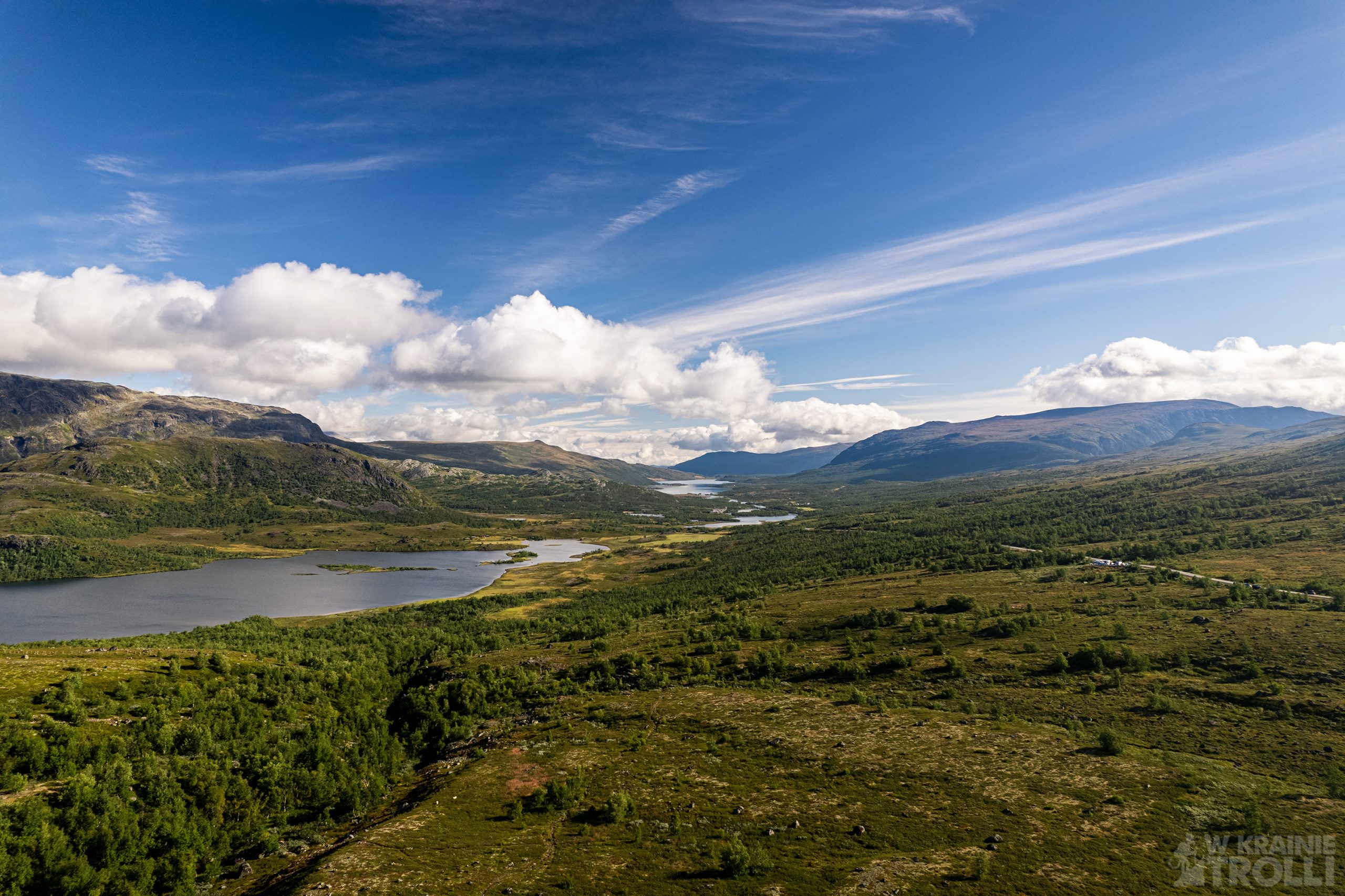
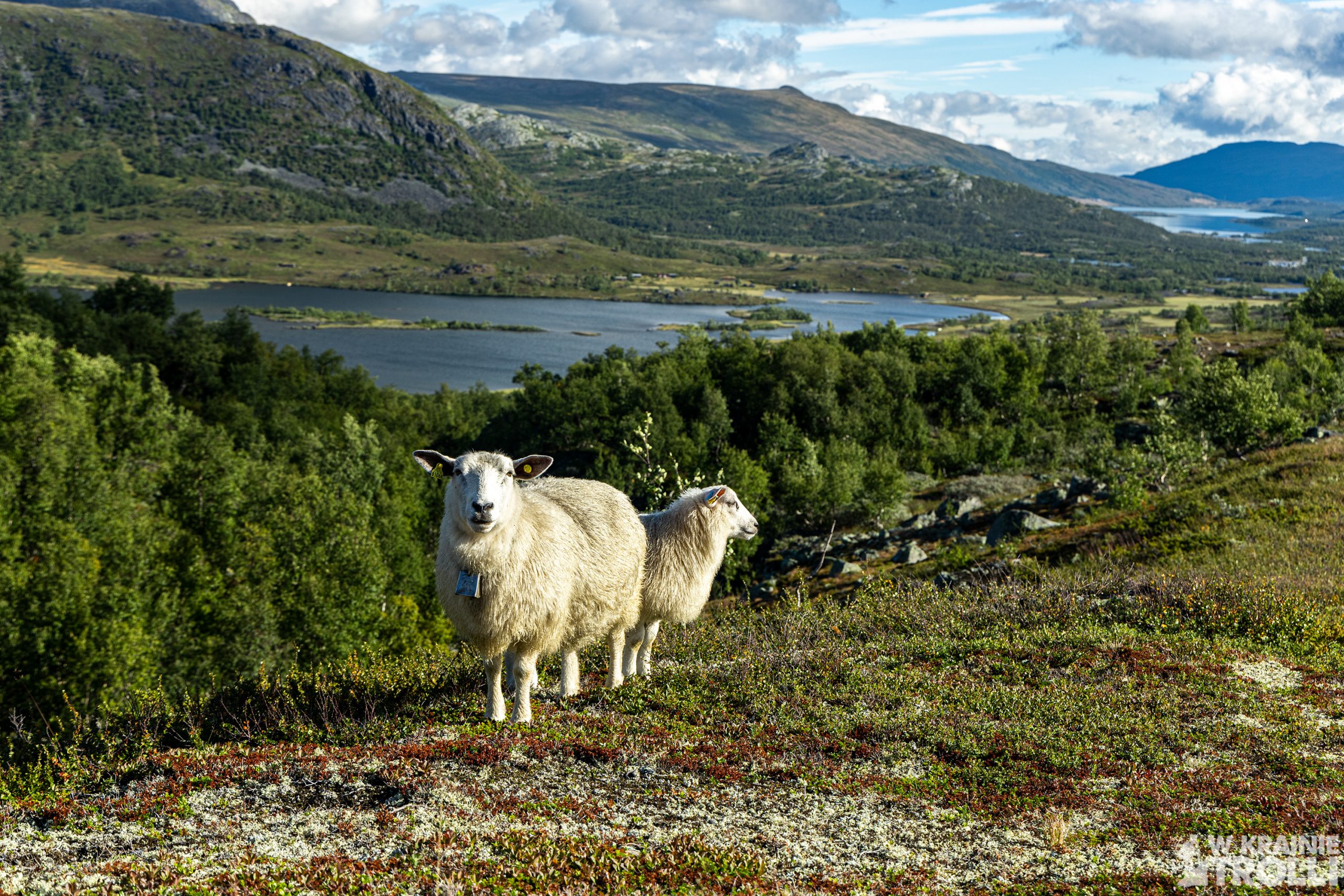
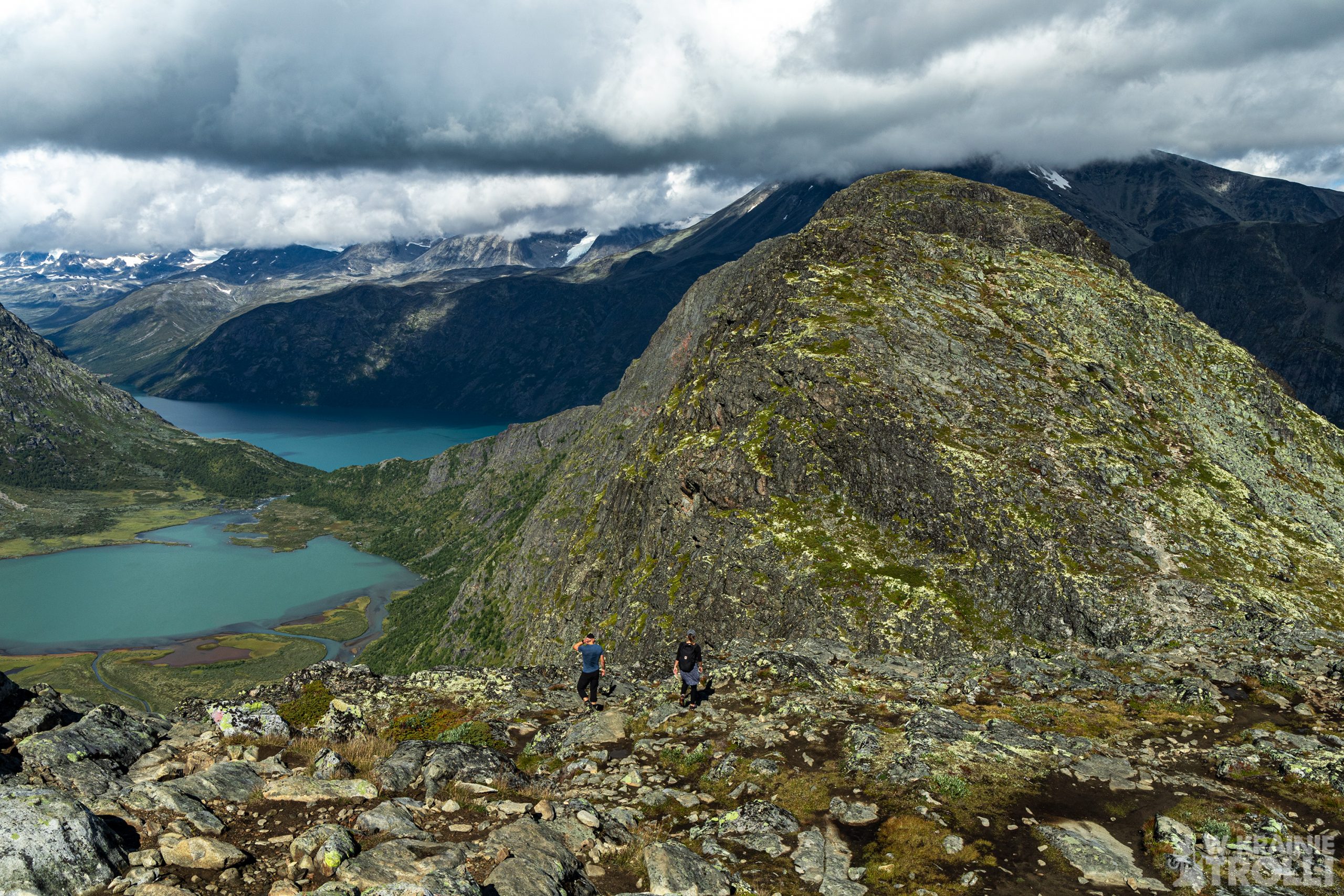
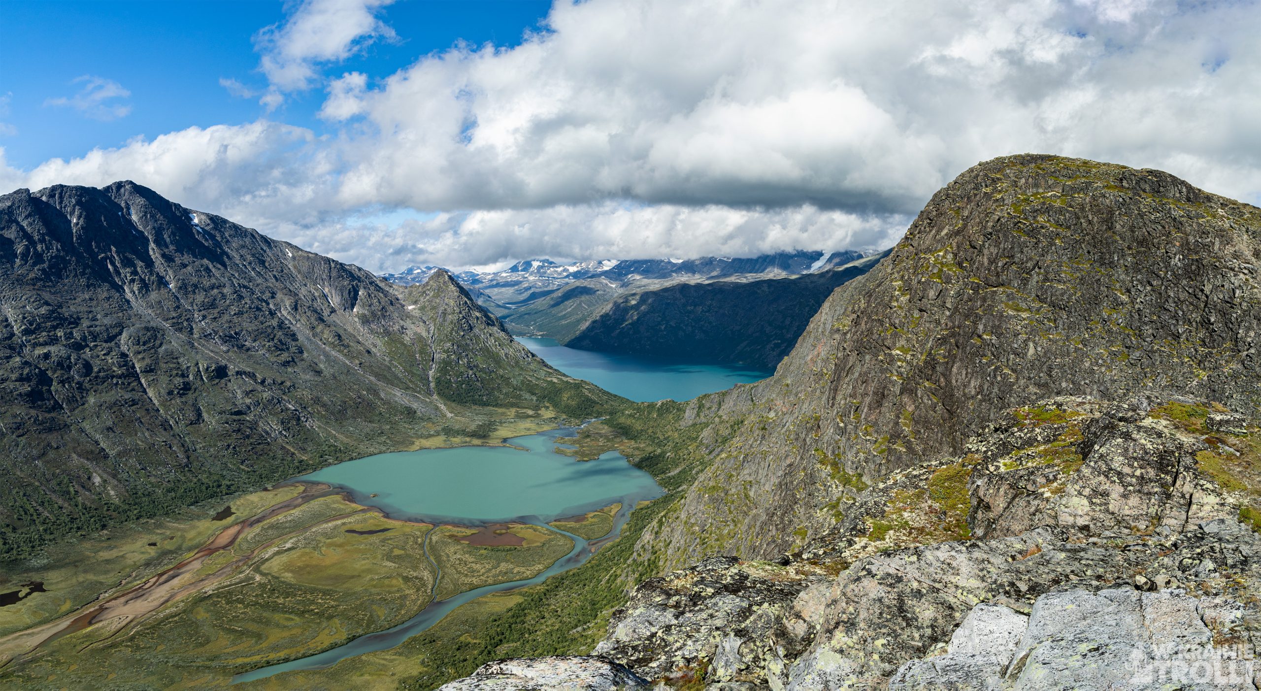
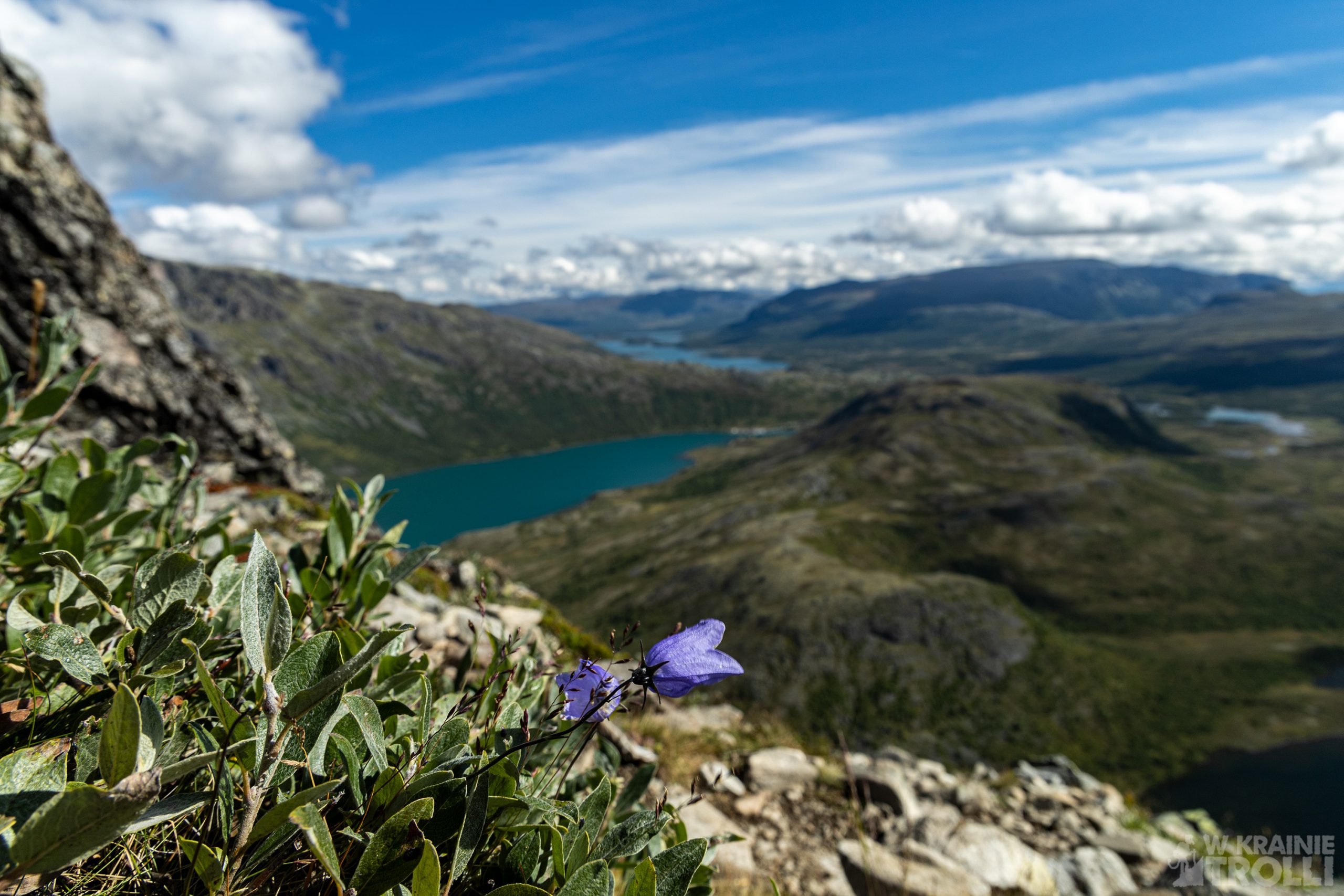
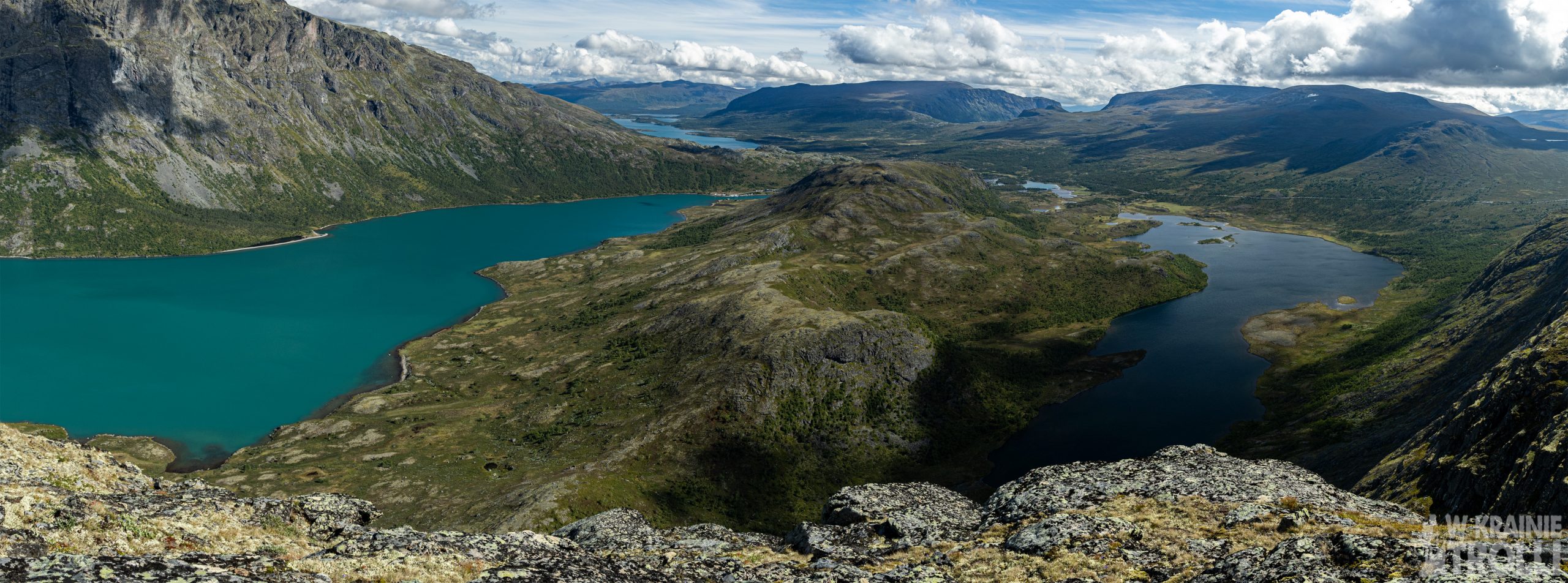
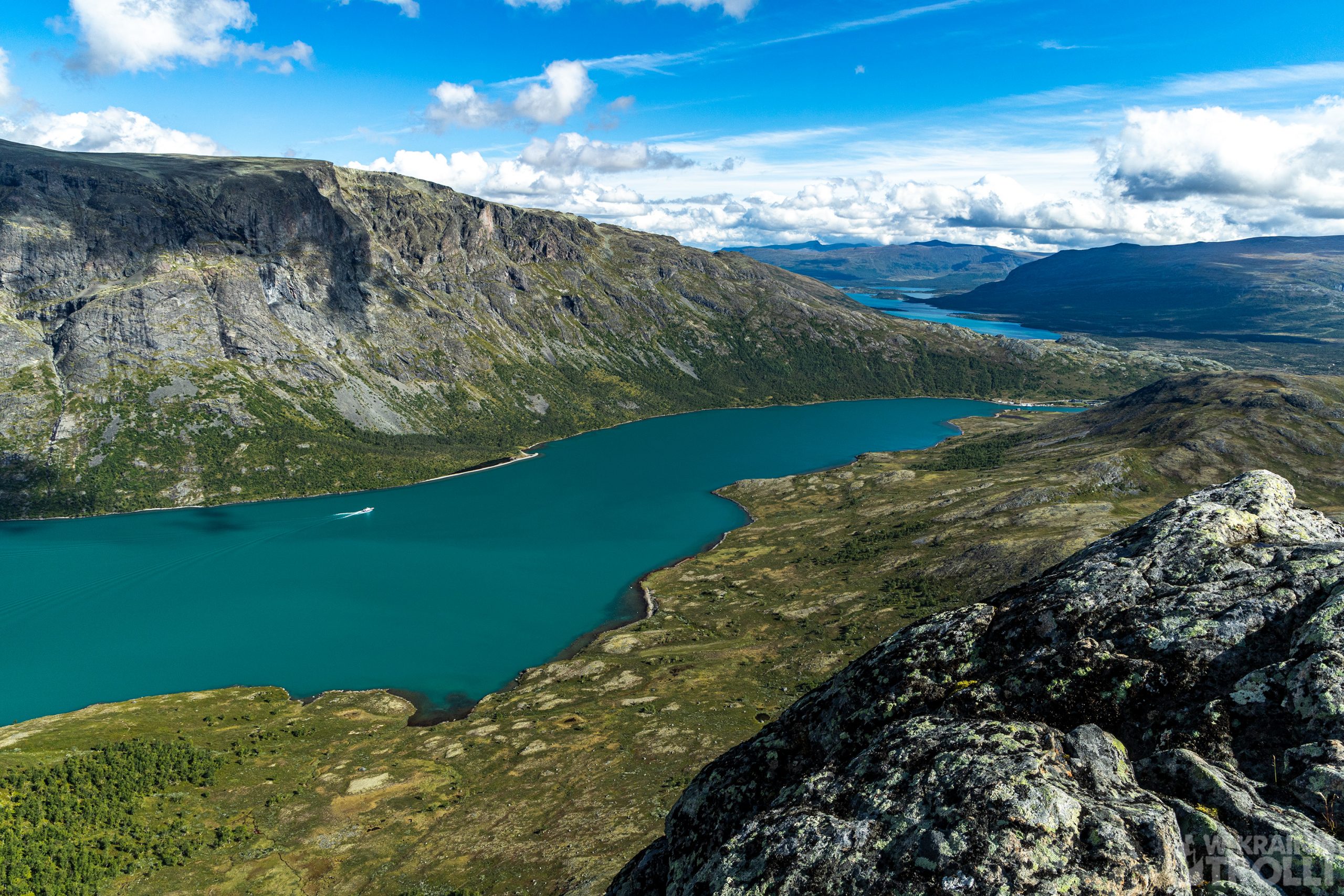
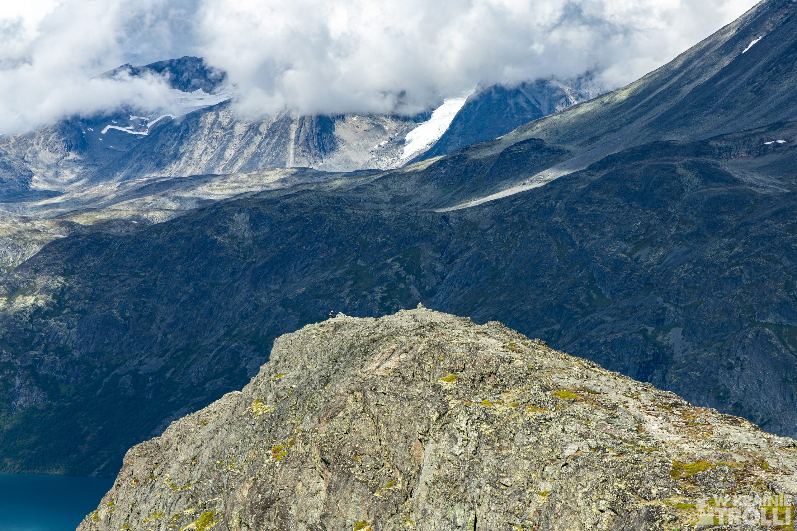
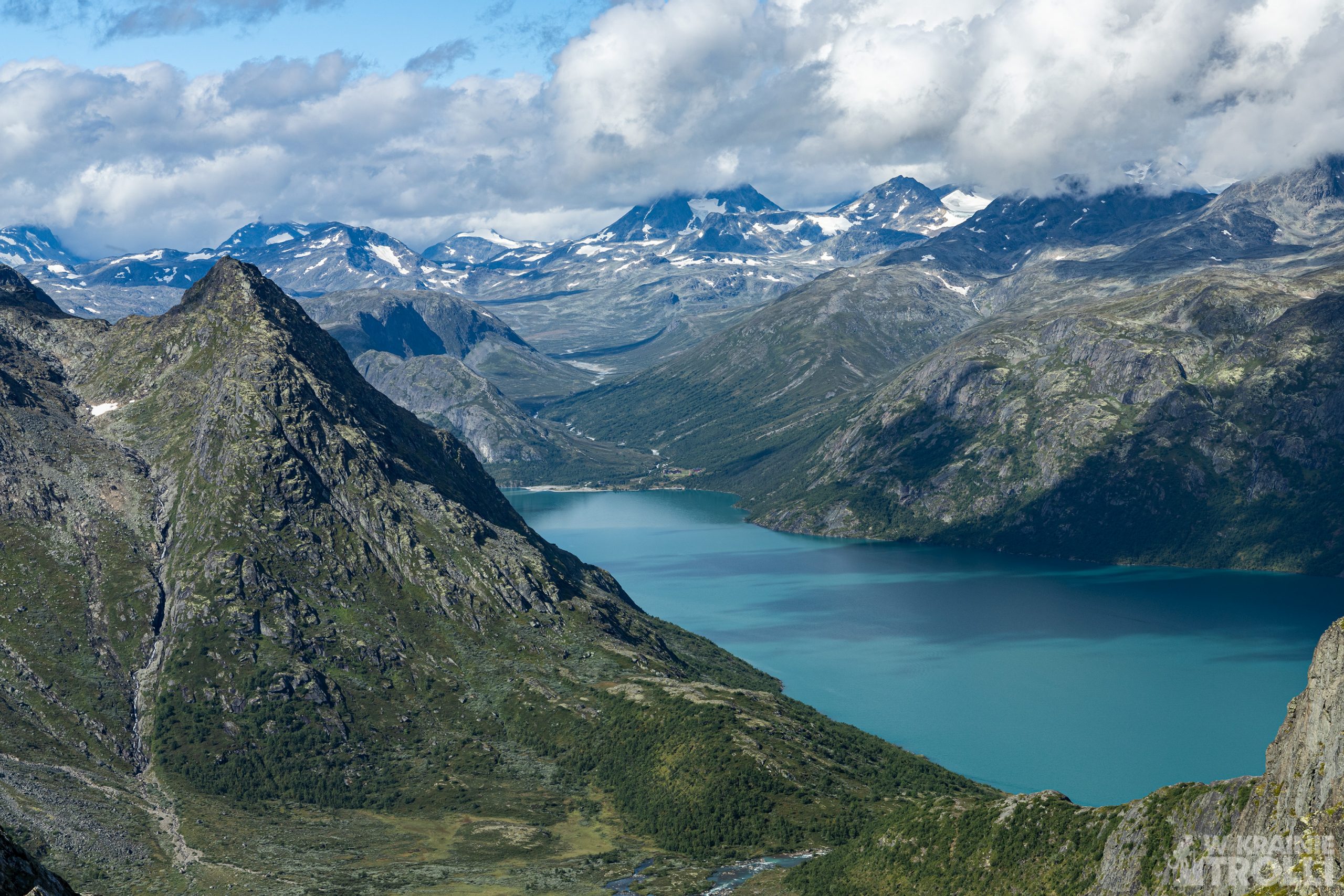
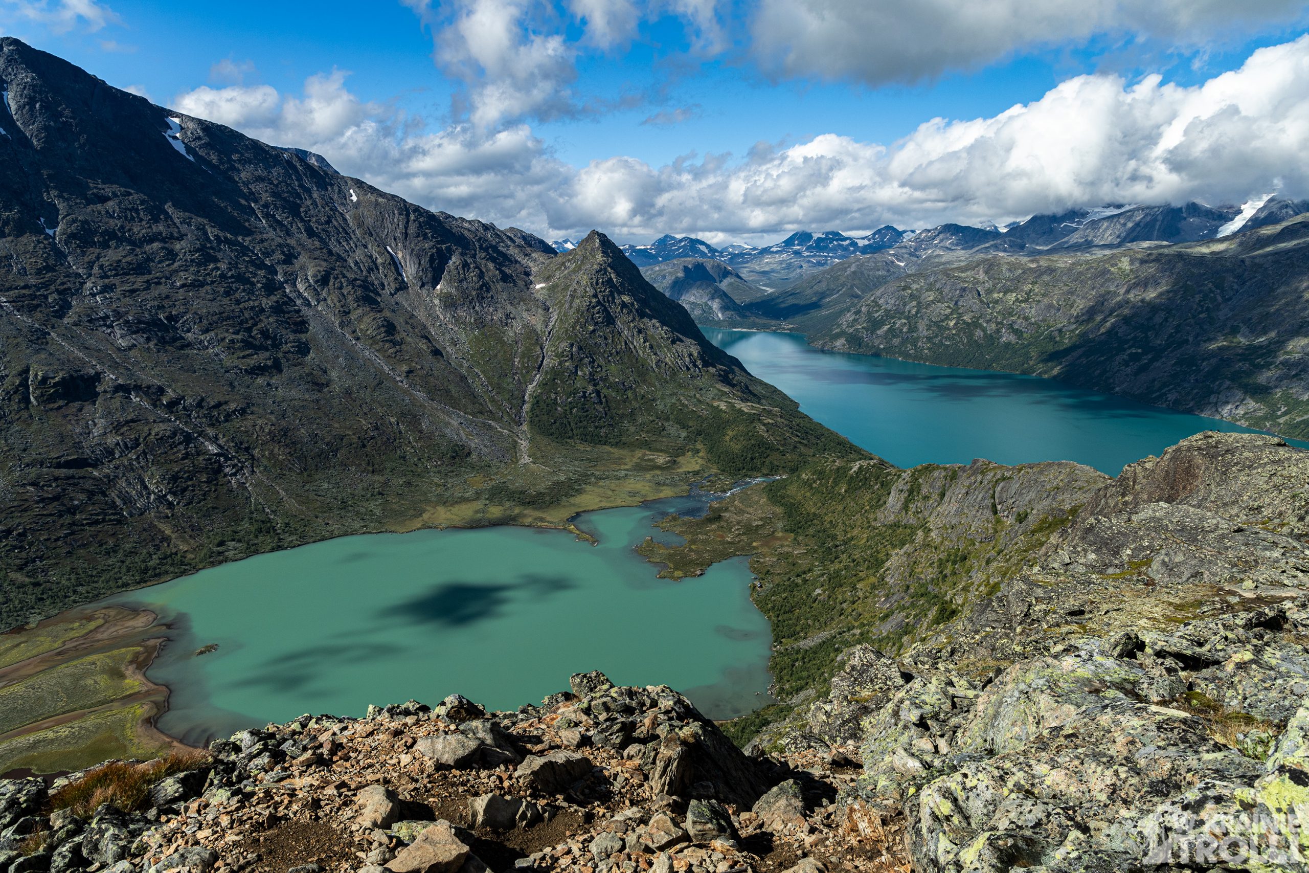
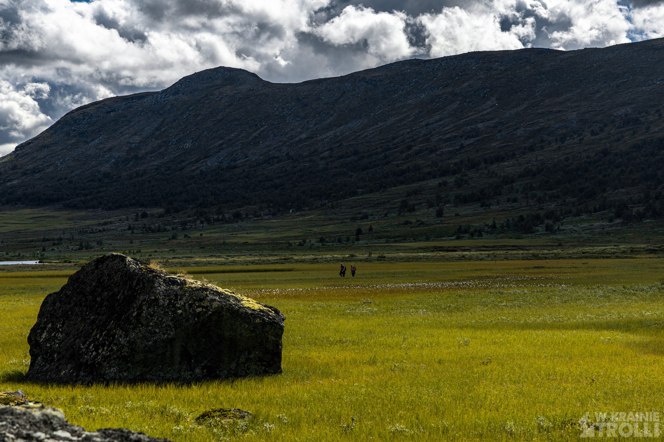
Widoki z trasy zapierają dech. Knutshøe ma to do siebie, że właściwie na każdym etapie można zachwycać się scenerią. Pobliski Besseggen jest bardziej popularny, ale szczerze mówiąc tylko przez połowę trasy towarzyszą nam świetne krajobrazy. Część wędrówki pokonuje się po kamienistej pustyni bez żadnych interesujących widoków. Za to tutaj, niemal przez cały czas nie mogłem wyjść z zachwytu.
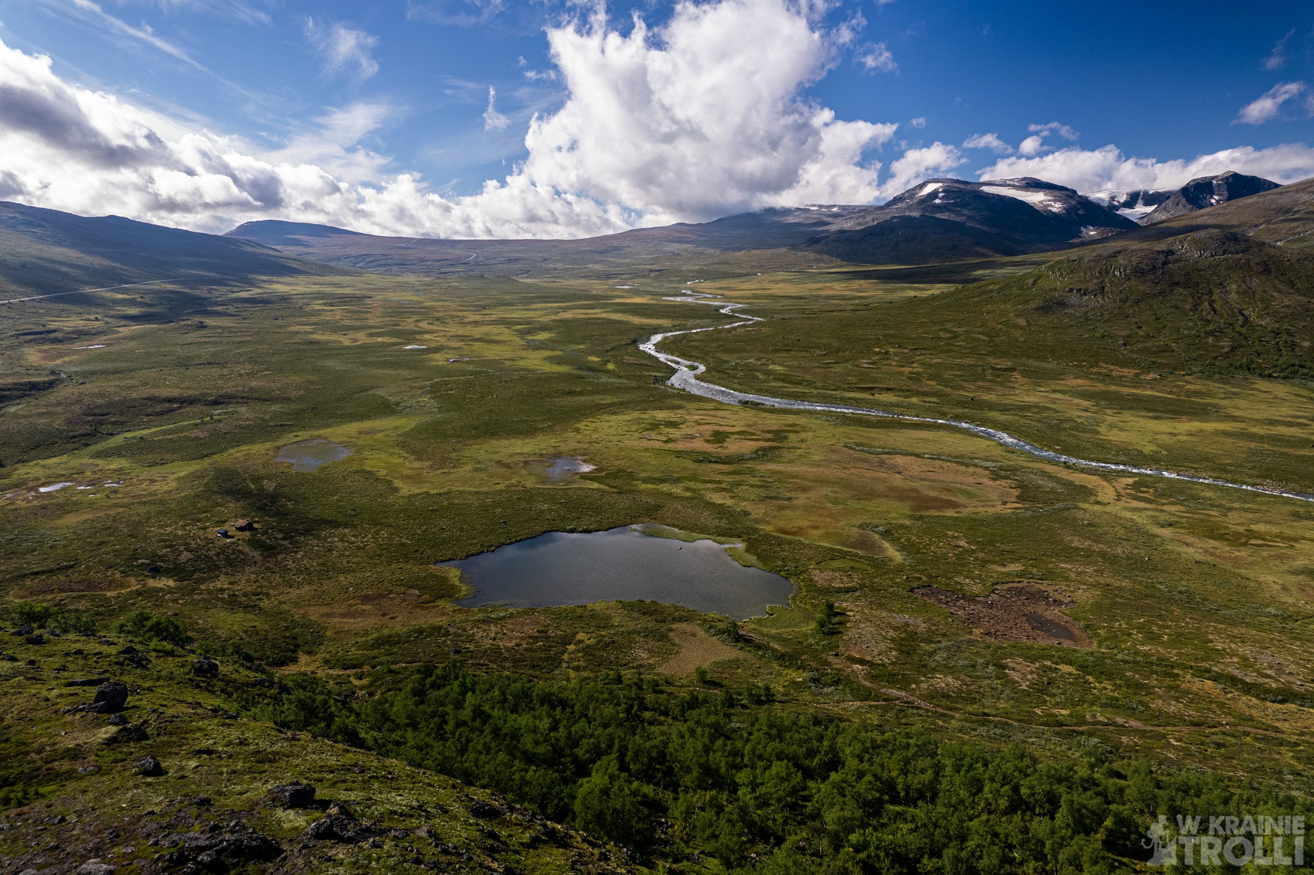
Parę dni wcześniej usiłowałem zorientować się, czy będę mógł polatać na trasie dronem. Przepisy zabraniają takich ekstrawagancji na terenie parków narodowych, a w Jotunheimen znajduje się właśnie jeden z norweskich parków narodowych. Jednak przeglądając w necie mapy odkryłem, że granica parku rozpoczyna się dopiero gdzieś tak w połowie drogi na szczyt Knutshøe. Miałem więc okazję nieco polatać i nakręcić parę ujęć nim dotarłem tabliczki z informacją ‘’Nasjonalpark’’ i z zakazem używania dronów.
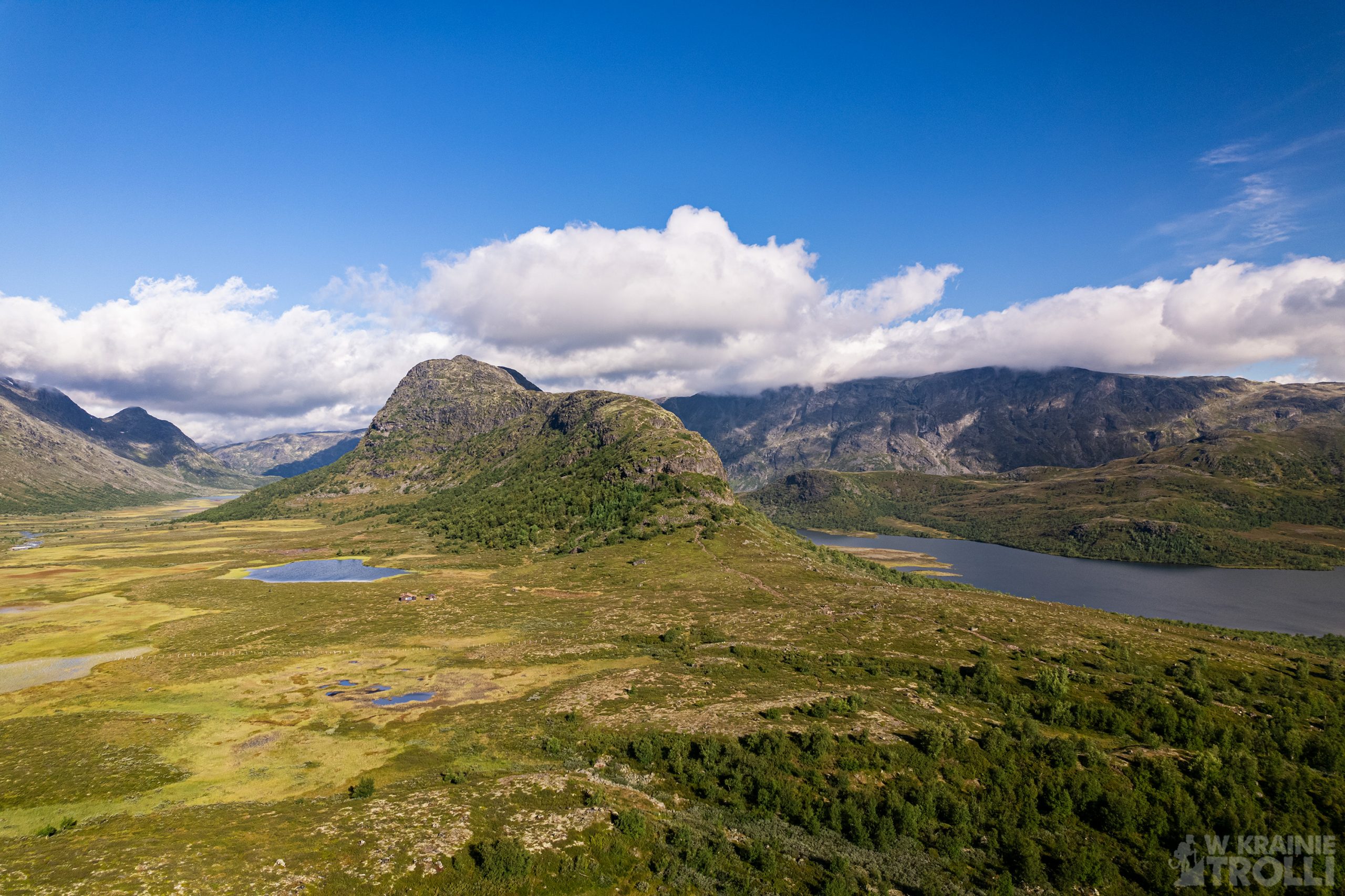


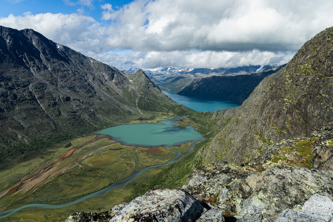
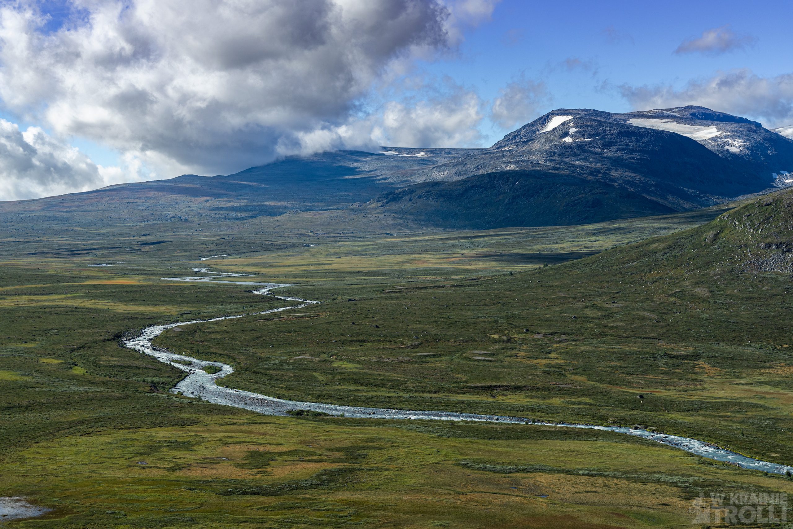
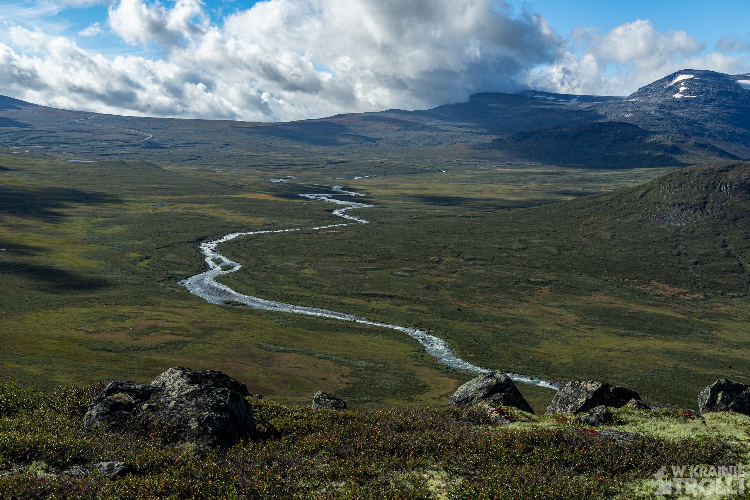
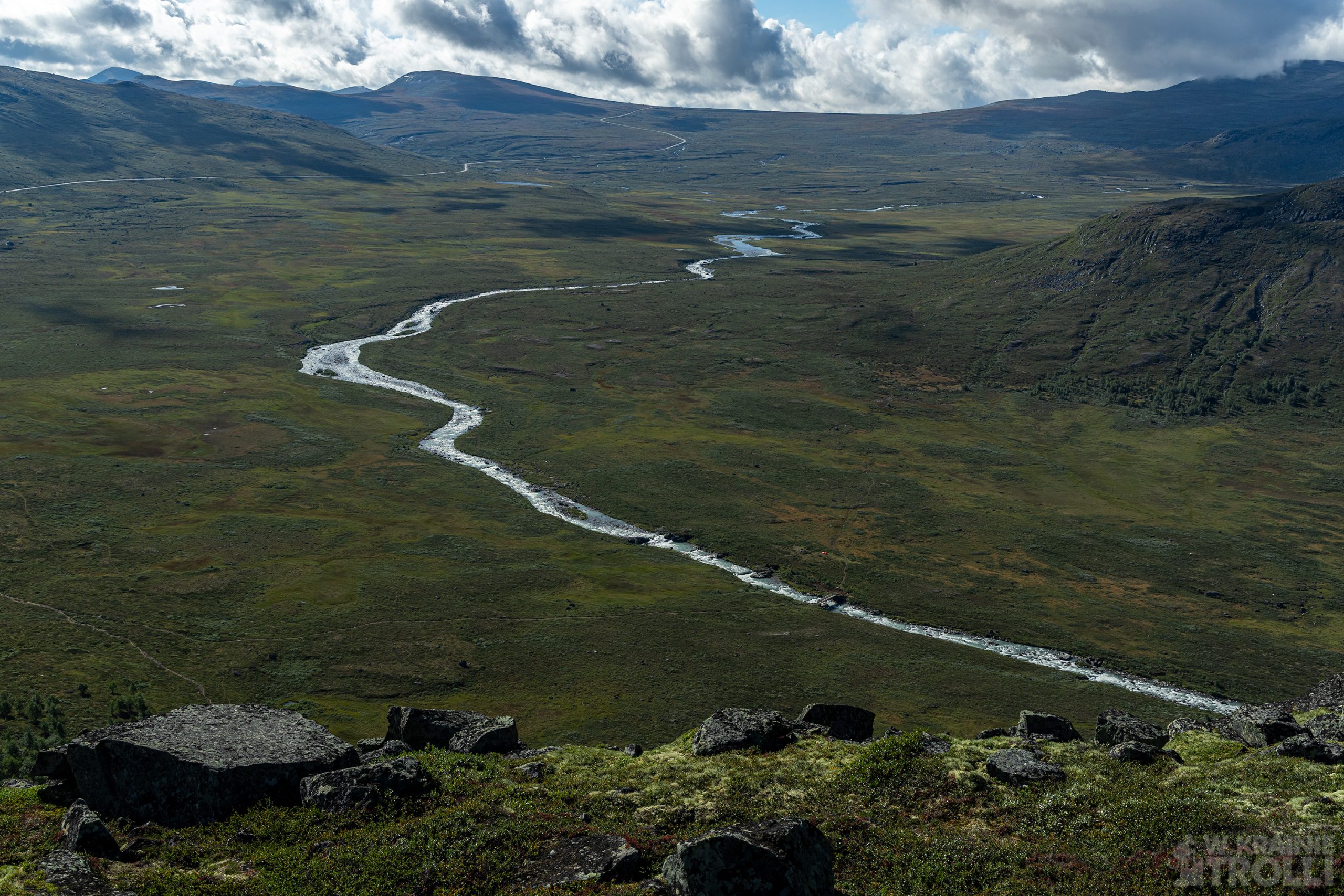
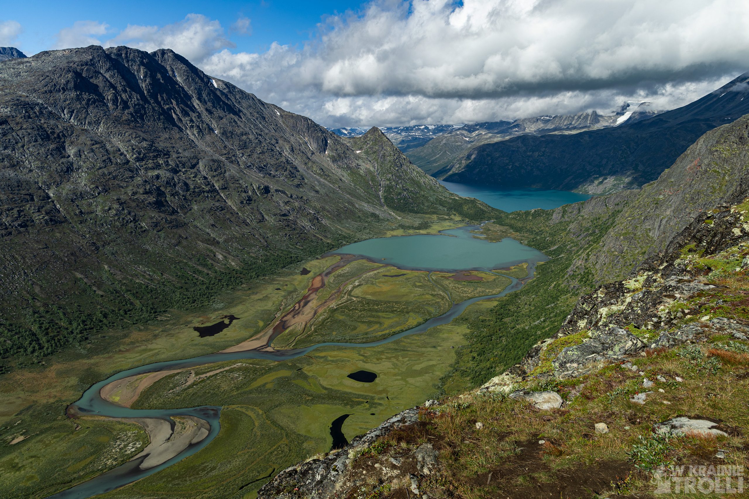
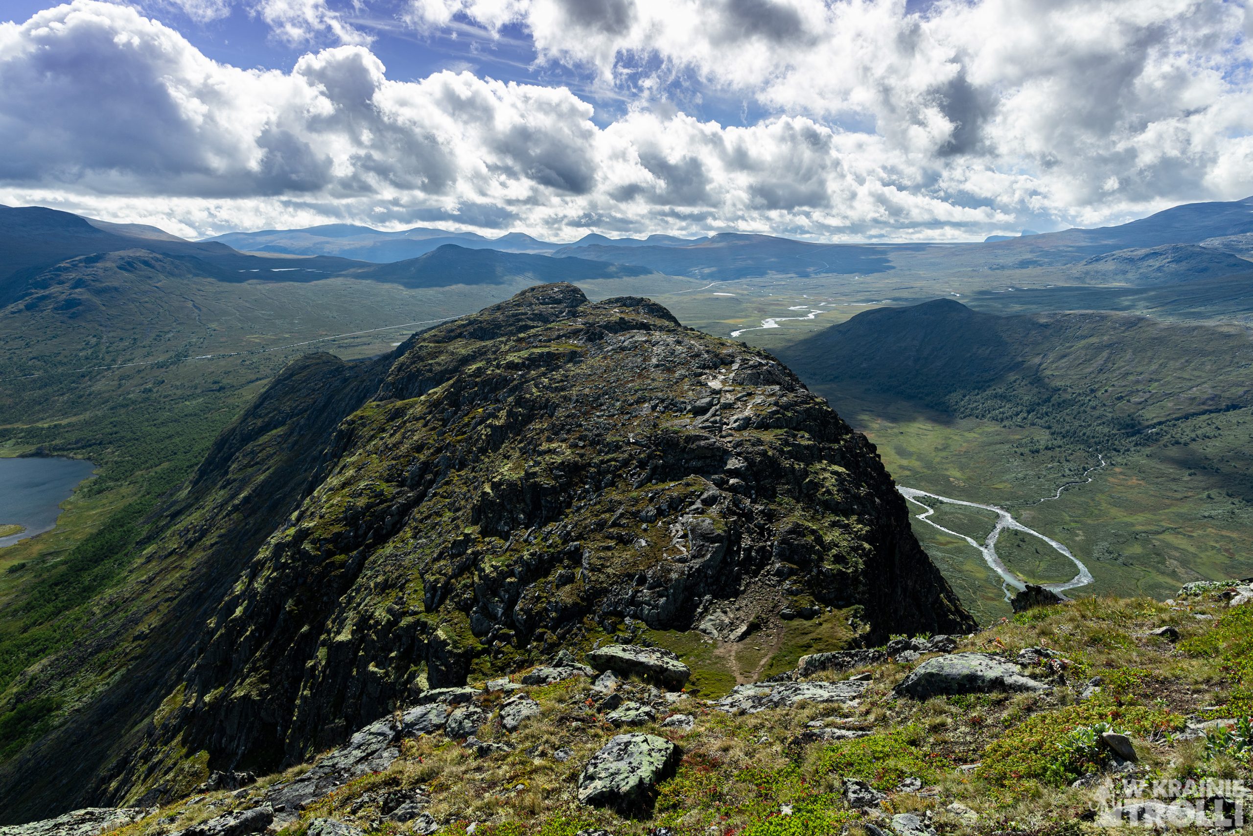
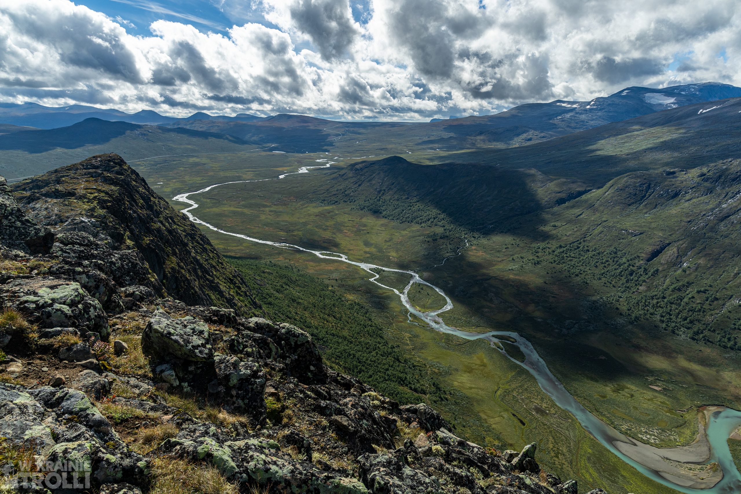
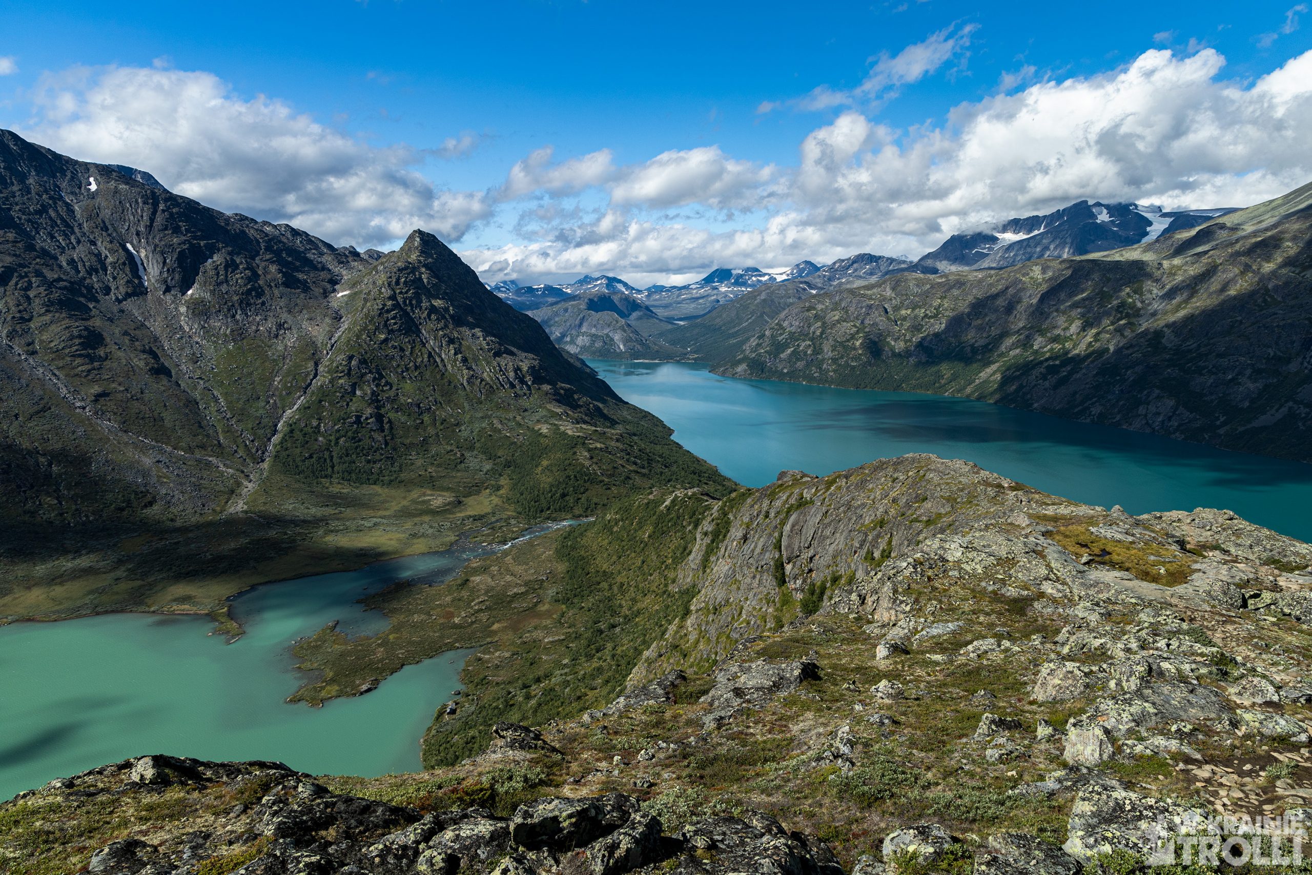
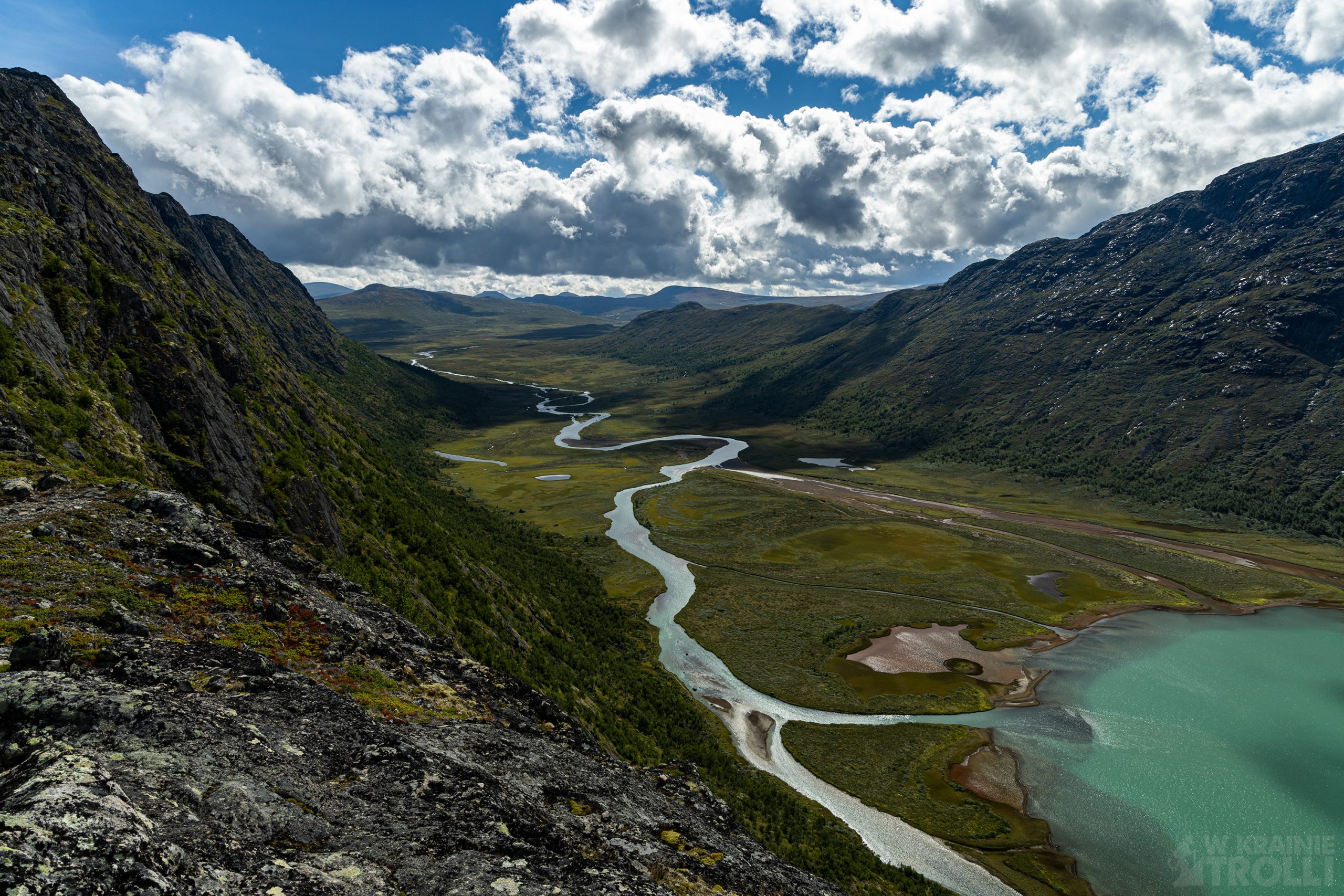
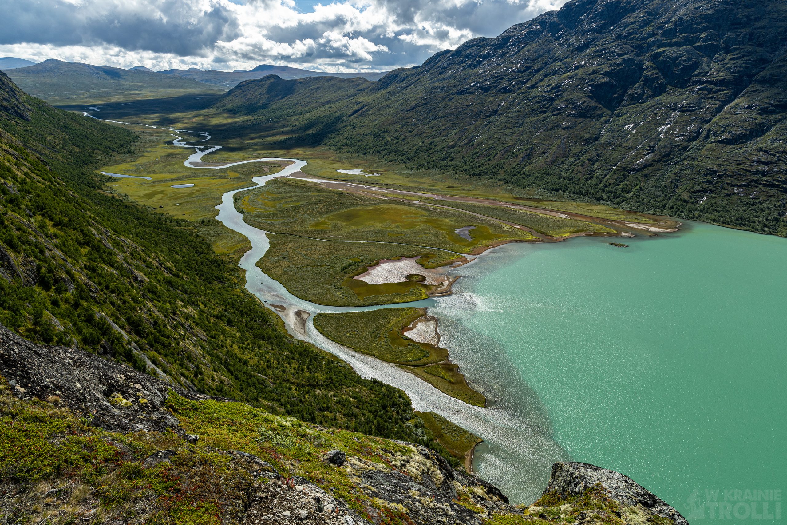
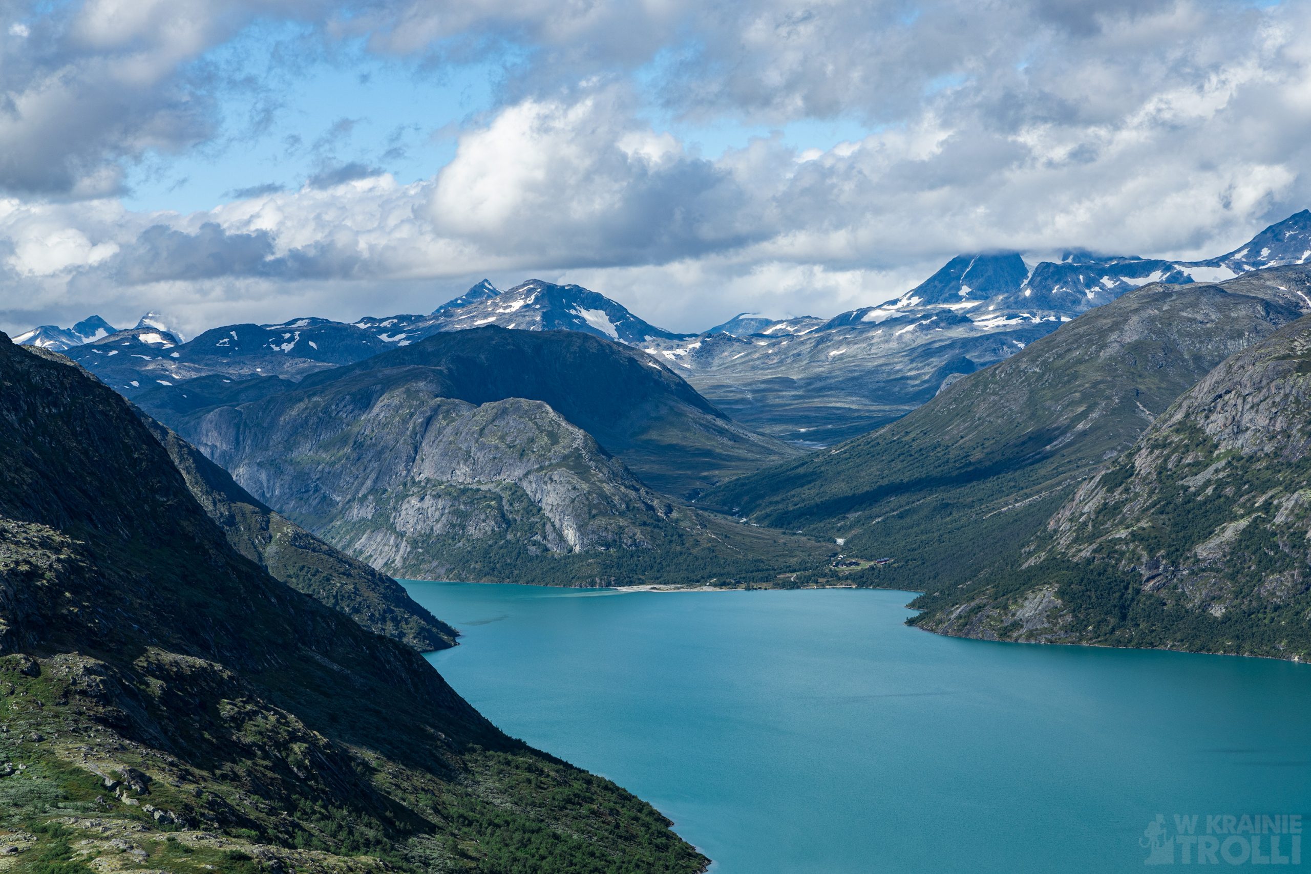
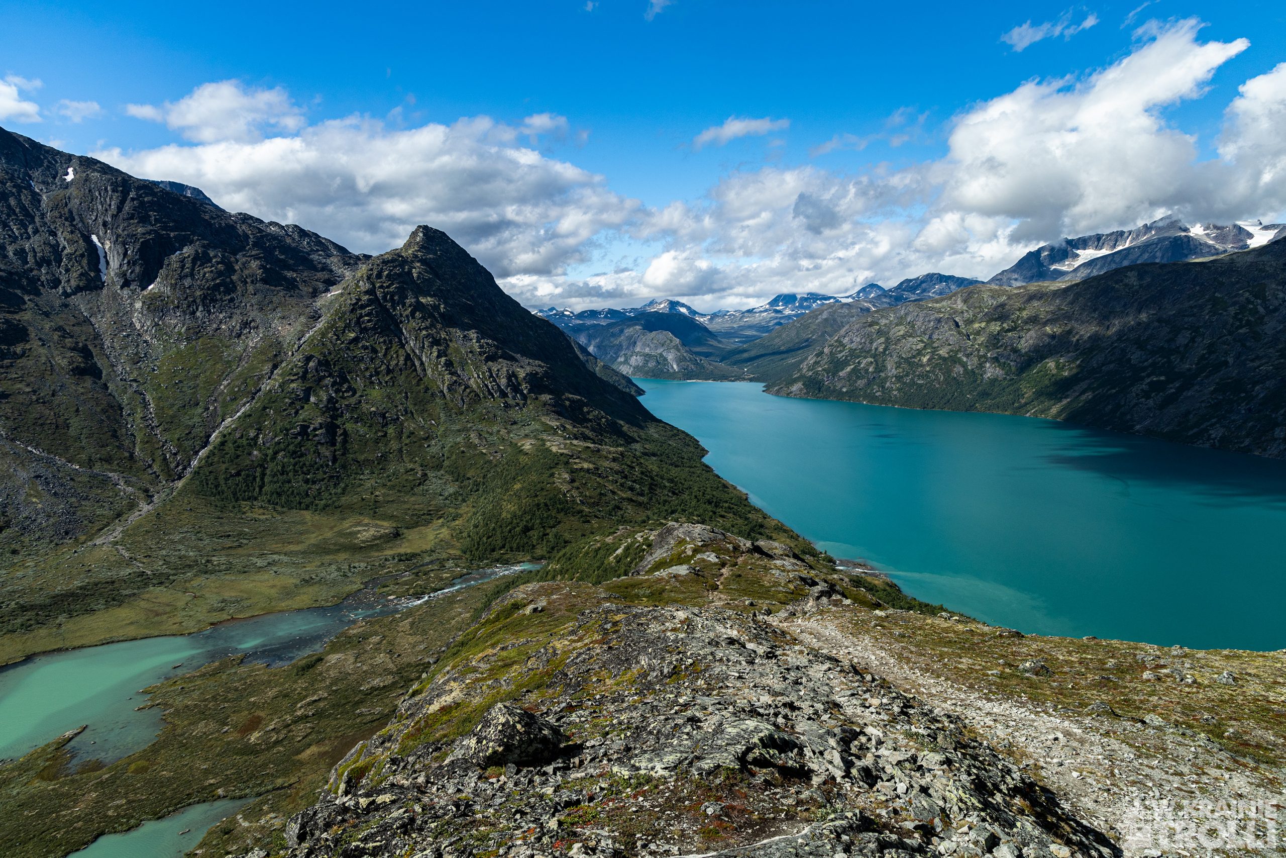
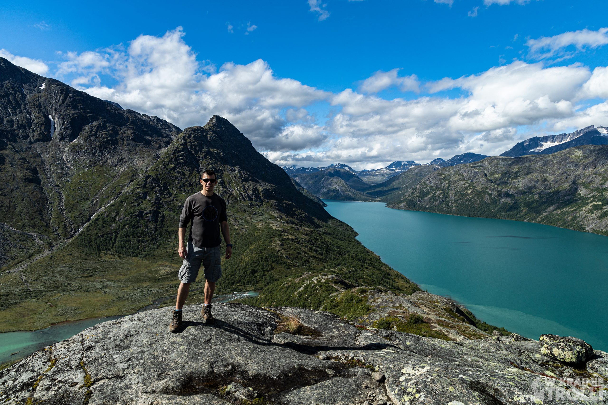
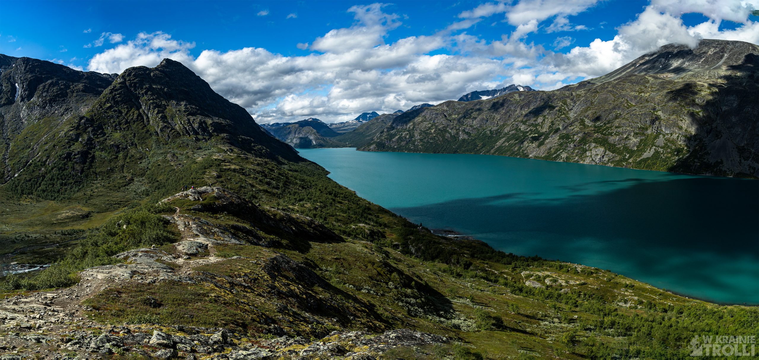
Na tym etapie trasy można dojrzeć już turkusowy kolor wód jeziora Gjende na północy i wznoszącą się grań Besseggen. Od południa był jednak zdecydowanie lepszy widok na dolinę Leirungsdalen i wijącą się jej dnem rzekę Leirungsåe. Rzeka ta rozdziela się na trzy nurty tuż pod wierzchołkiem Knutshøe i zasila niewielkie jeziorko Øvre Leirungen, a następnie widowiskowymi kaskadami spływa do jeziora Gjende. Widok z góry na ten spektakl robi niesamowite wrażenie.
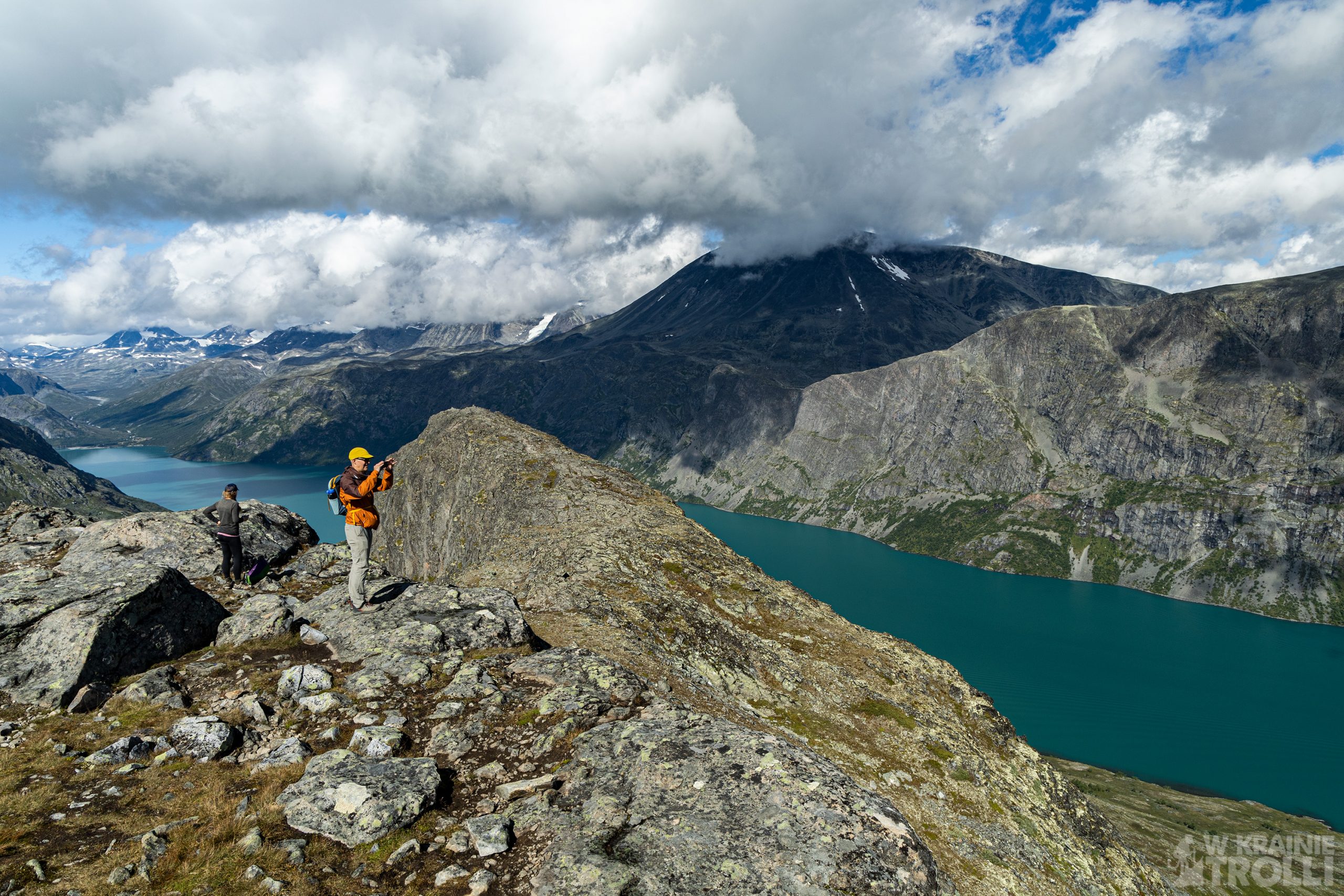
Tuż pod szczytem znajduje się ostatnie strome podejście. Podobnie jak na początku trasy, i tutaj znajduje się wyeksponowany odcinek, gdzie musiałem posiłkować się rękoma. Chwilę później byłem na miejscu. Nie będę się rozpisywał na temat widoków, bo te na całej trasie są niesamowite. Porobiłem kilka zdjęć i zacząłem schodzić po północnej (a właściwie północno-zachodniej) grani. Zejście nie jest skomplikowane, należy jednak uważać, bo na mokrych kamieniach łatwo się poślizgnąć.
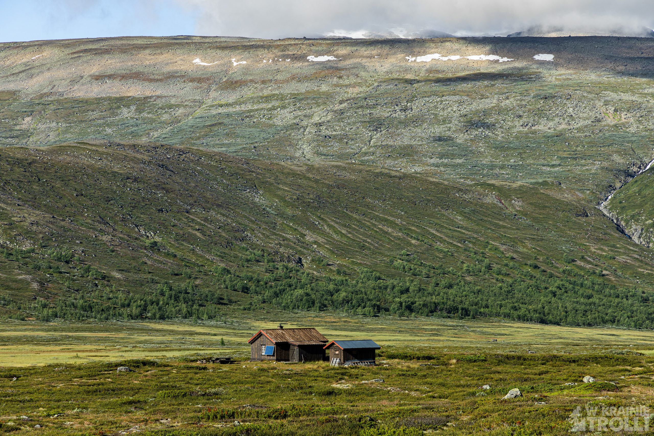
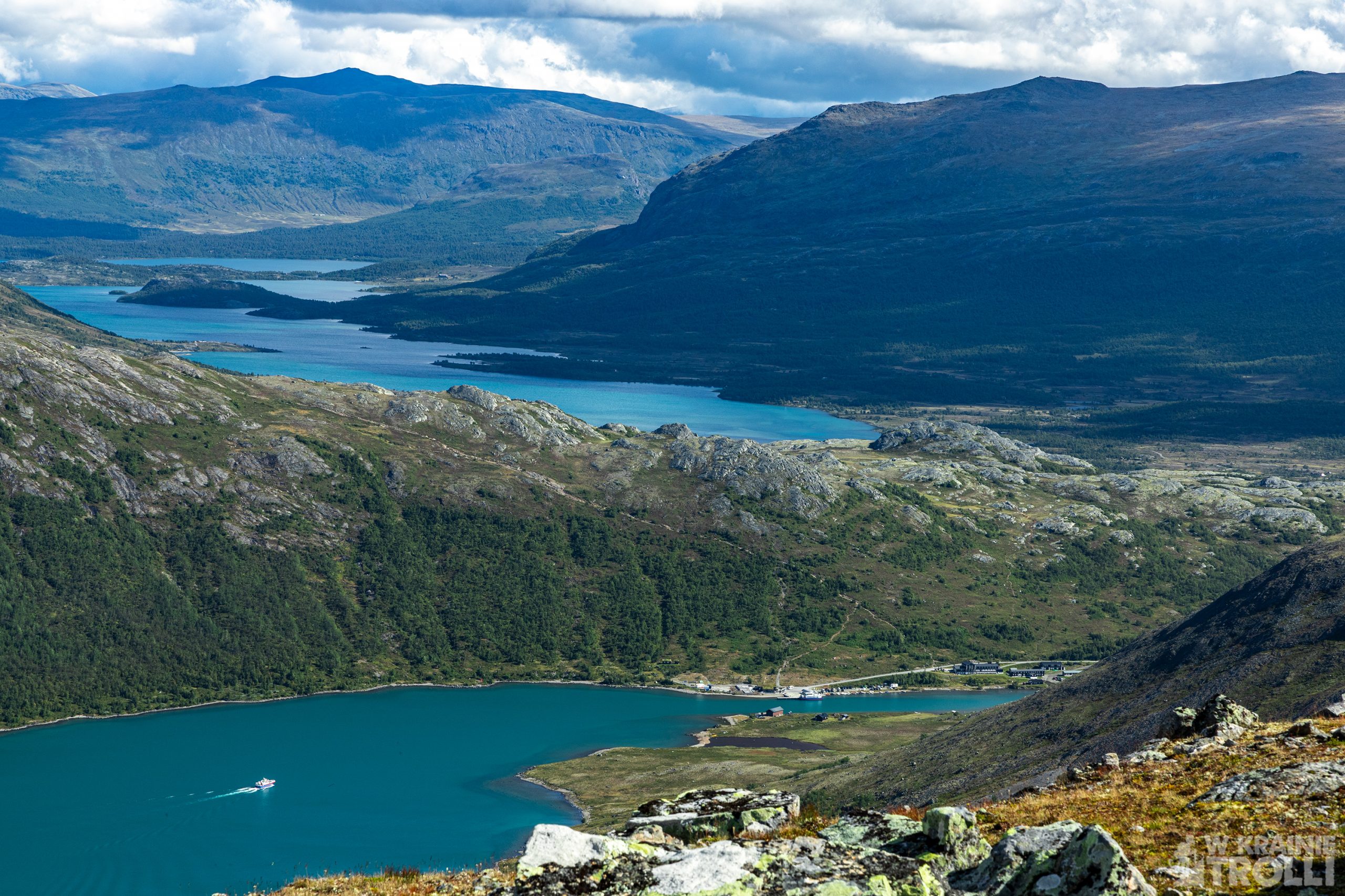
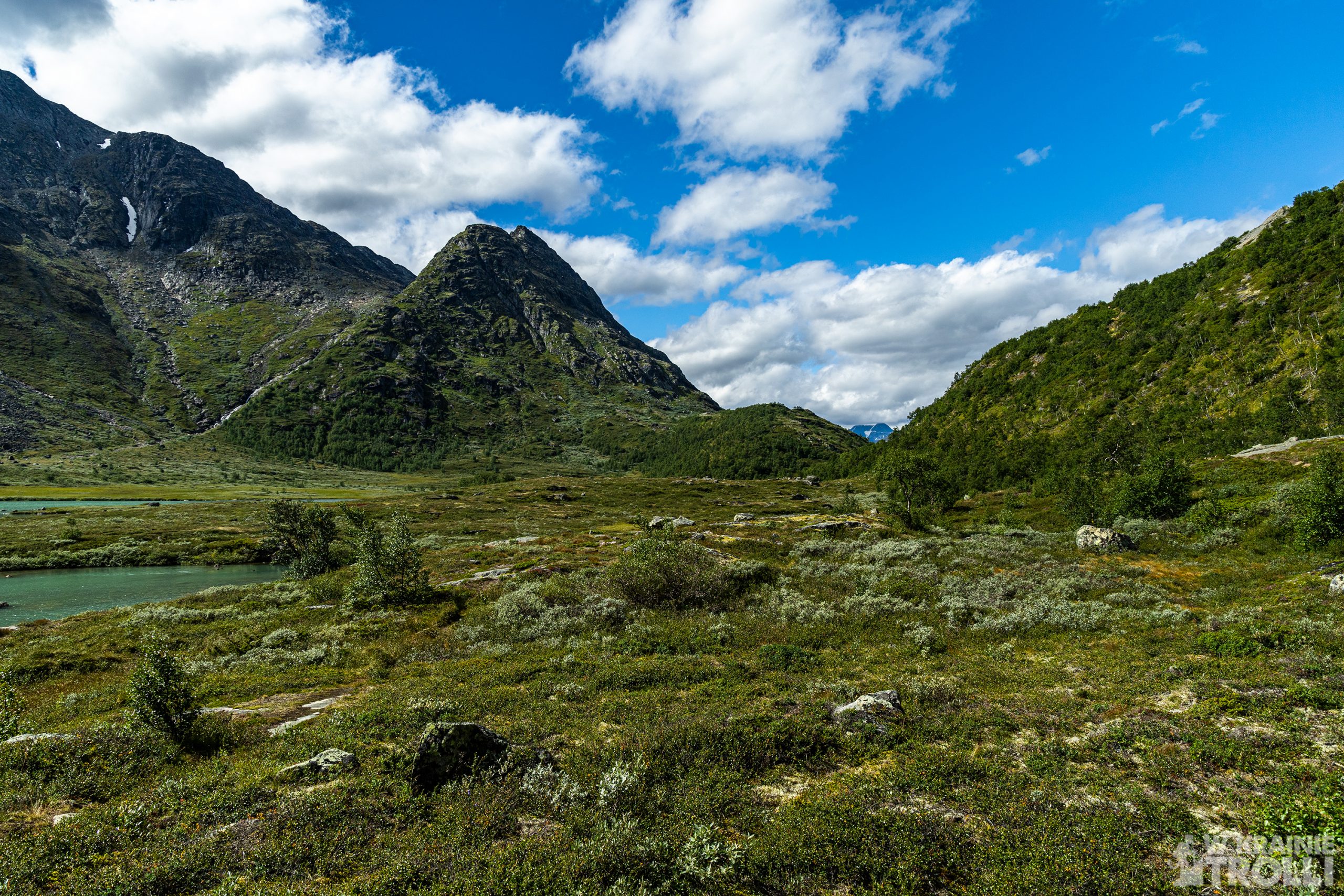
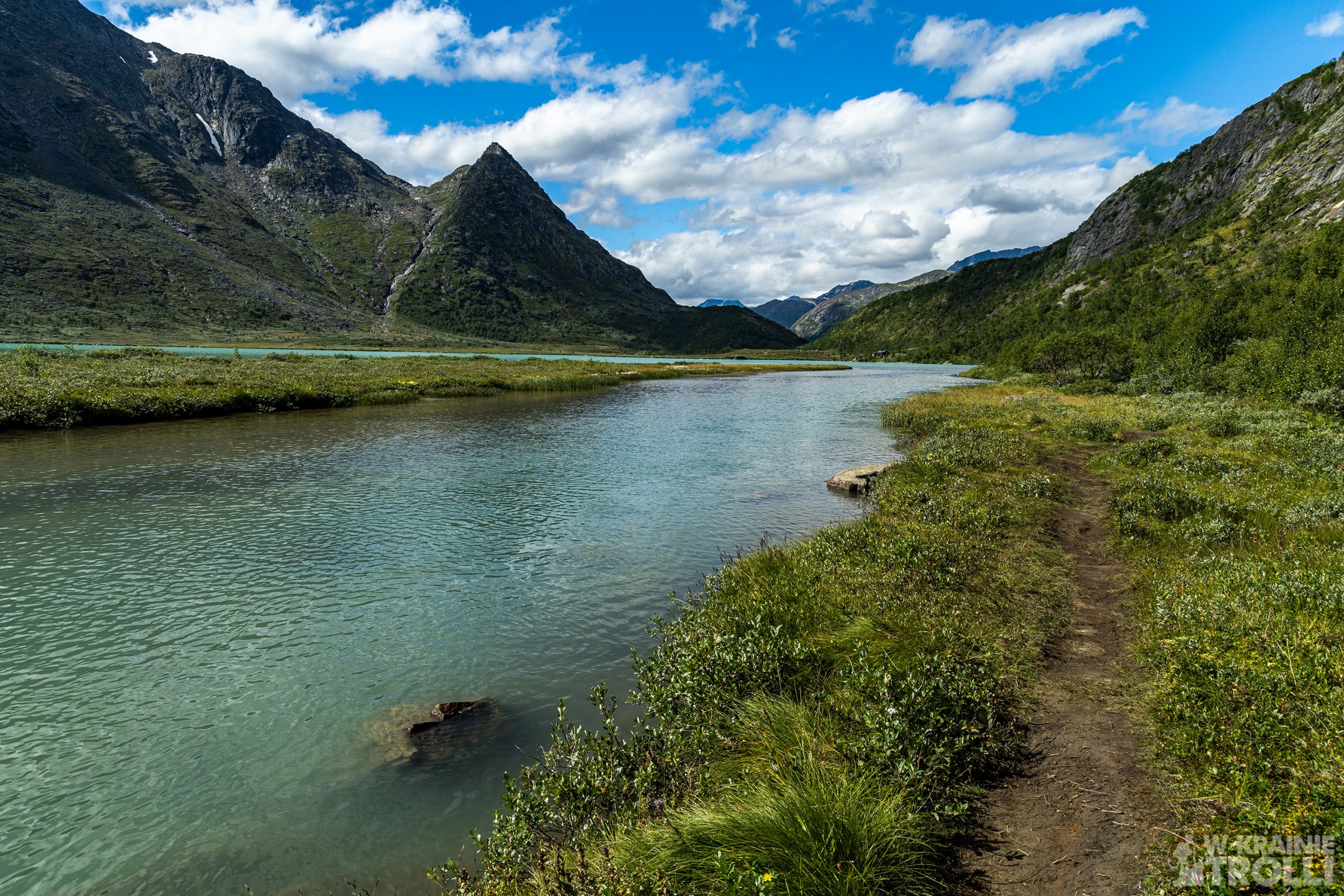
Dotarłem do linii drzew, a wkrótce potem do samego dna doliny. Dalej wędrowałem wzdłuż rzeki Leirungsåe, aż do momentu gdy ta zawija na południe. Minąłem rozwidlenie szlaków, które mijałem parę godzin wcześniej i udałem się do pozostawionego w zatoczce samochodu. Byłem zmęczony ale zadowolony z marszu. Zastanawiałem się co zrobić z drugą połową dnia. Chciałem spędzić gdzieś w okolicy noc pod namiotem i z rana może wejść jeszcze na jakąś górkę zanim wrócę do domu. Teraz miałem przed sobą jeszcze sporo czasu do zachodu słońca i rozważałem różne dostępne opcje. Ale o tym co było dalej, napiszę w kolejnym wpisie.


Do you remember last year’s trip to Besseggen in the Jotunheimen mountains? One of the most amazing views on that day was a lonely mountain on the other side of Gjende Lake. It’s called Knutshøe, and I promised myself that one day I would go there. Well, that day has just come.
The summit is 1517 m above sea level. and there are basically only two roads to it: from the southeast and from the northwest. Slopes in other directions are too steep to lead there any other trails. So, you can go up to the top on one side, go down on the other and come back to the starting point through the valley, along the river. This was also my assumption for this trip. The entire route is over 12 km long and, as I have found out for myself, it is incredibly spectacular.
I arrived in Jotunheimen around eight in the morning. It was going to be a pleasant day, although it was quite cold on the beginning. I changed my shoes, put on a sweatshirt and jacket, took a few photos from a small bay by the main road, where I decided to leave the car and set off on the trail. The route is not marked in any special way, but the path is clearly well-trodden. Soon I noticed few groups of hikers heading towards Knutshøe. Most of them started from the next bay on the same road where I had left my car. A few hours later, when I on my way back, there was so many cars that it was hardly to count them.
I got to the foot of the mountain. The trail splited at this point. One path went up, the other headed towards the Leirungsdalen valley. I headed up the slope and started climbing. It wasn’t difficult to climb the ridge, with maybe one exception. Somewhere along the way, I came across a place where all four limbs must be used to go up about three to five meters. Afterwaeds it was much easier.
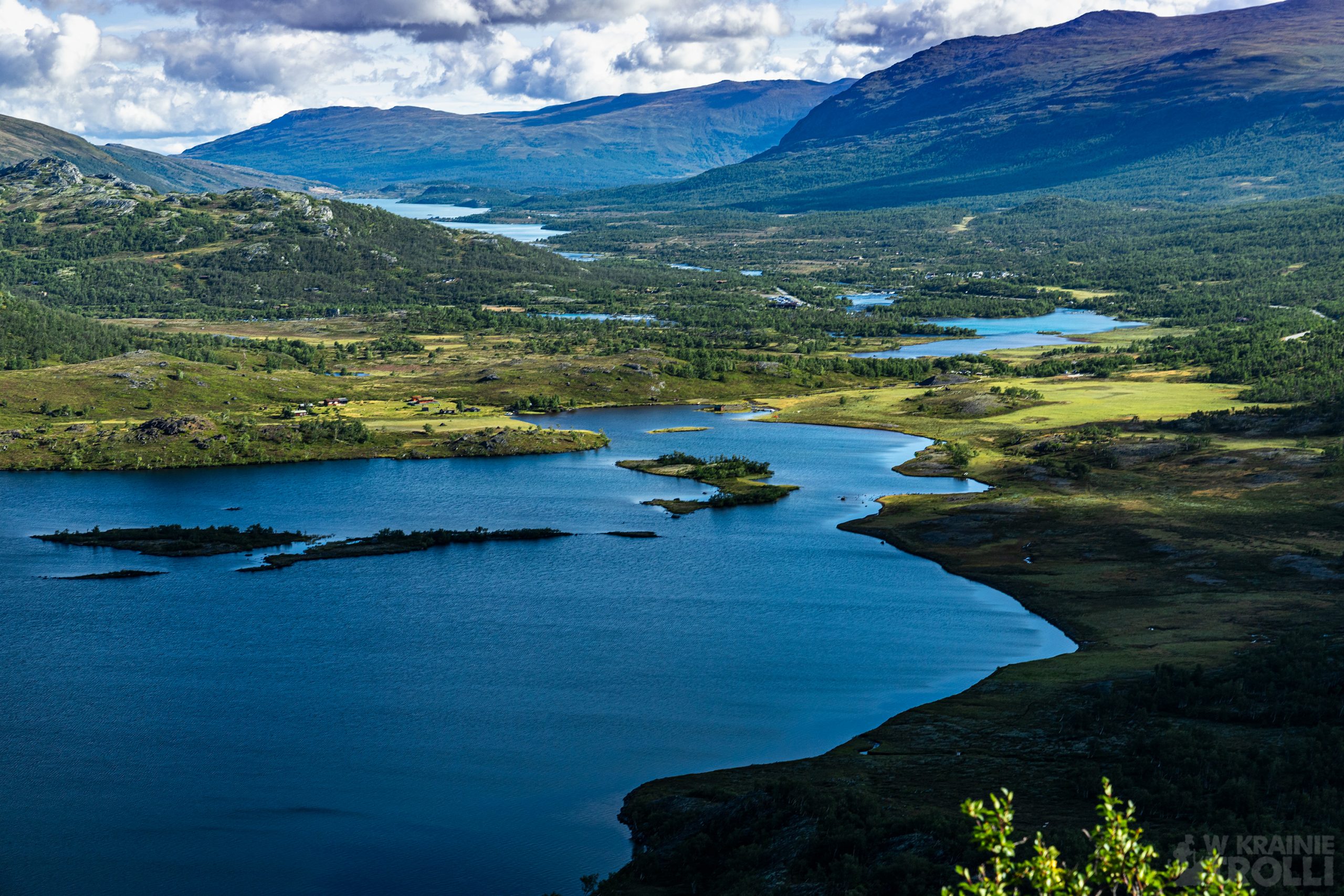
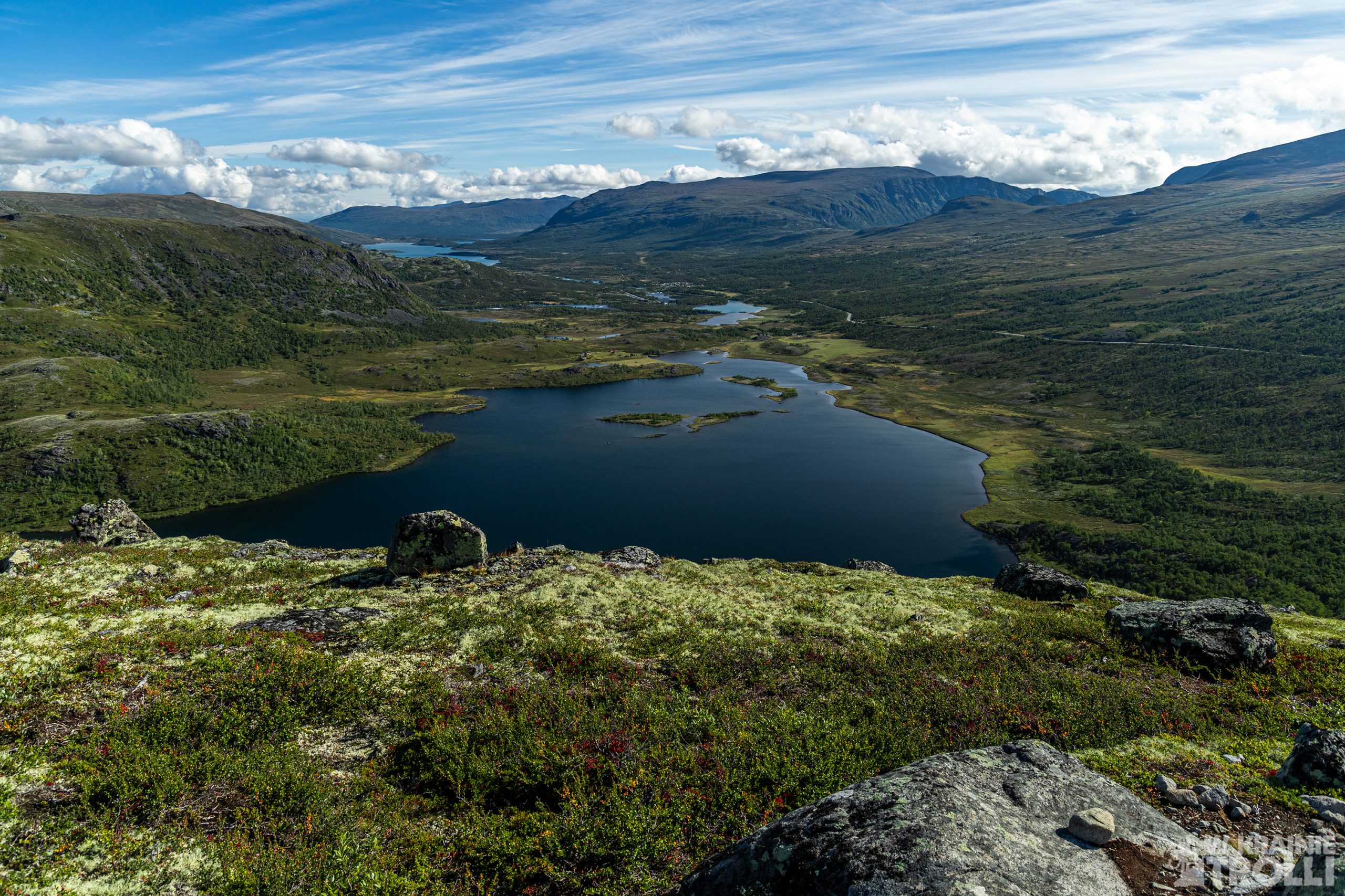
The views from the route are breathtaking. Knutshøe’s characteristic is that you can admire the scenery at almost every stage. The nearby Besseggen is more popular, but honestly, only half of the route is accompanied by great scenery. Part of the hike is a rocky desert without any interesting views. But here, almost all the time I could not get over my delight.

A few days earlier, I was trying to figure out if I would be able to fly a drone on the route. Regulations prohibit such extravagance in national parks, and Jotunheimen is home to one of Norway’s national parks. However, while browsing the maps on the Internet, I discovered that the border of the park starts somewhere halfway to the Knutshøe peak. So, I had the opportunity to fly around a bit and shoot a few shots before I reached the restricted area.
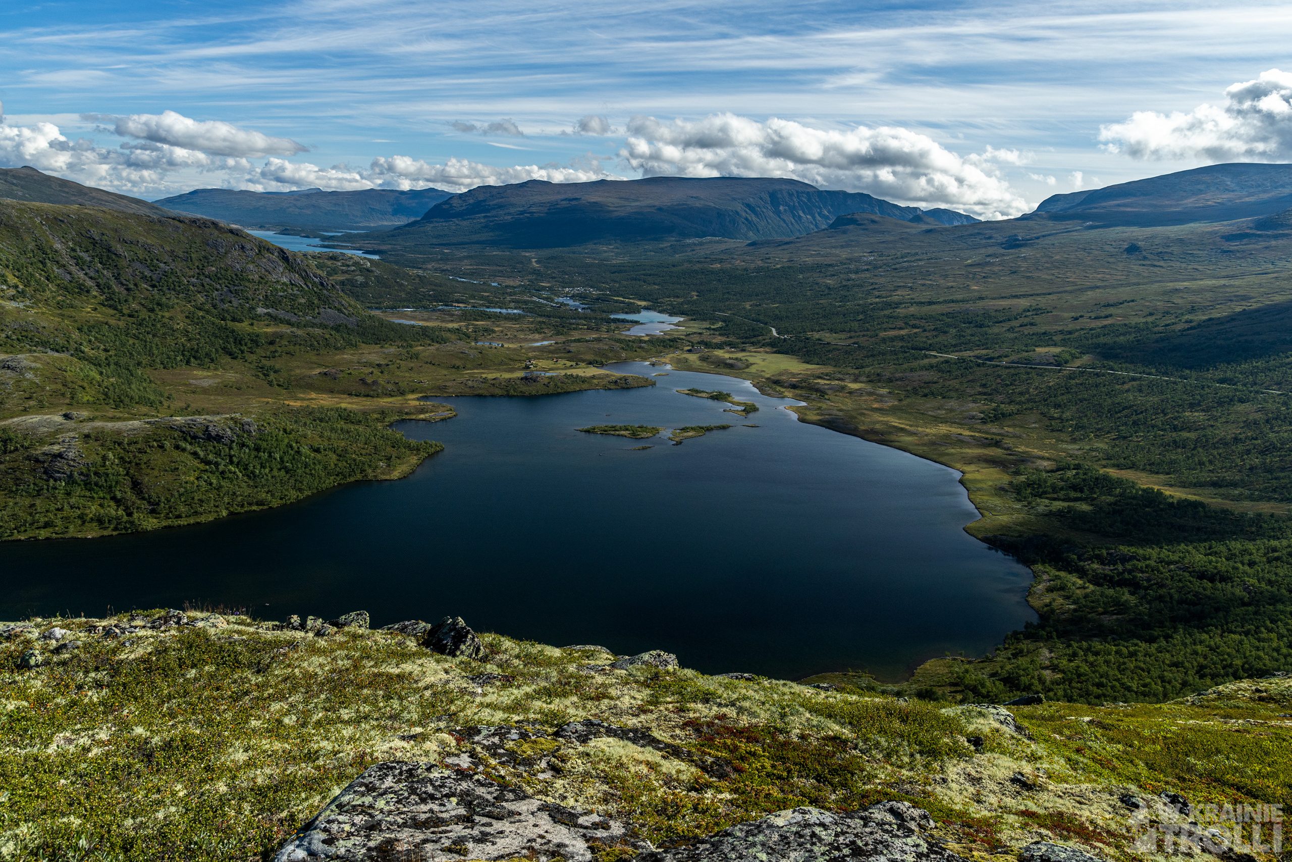
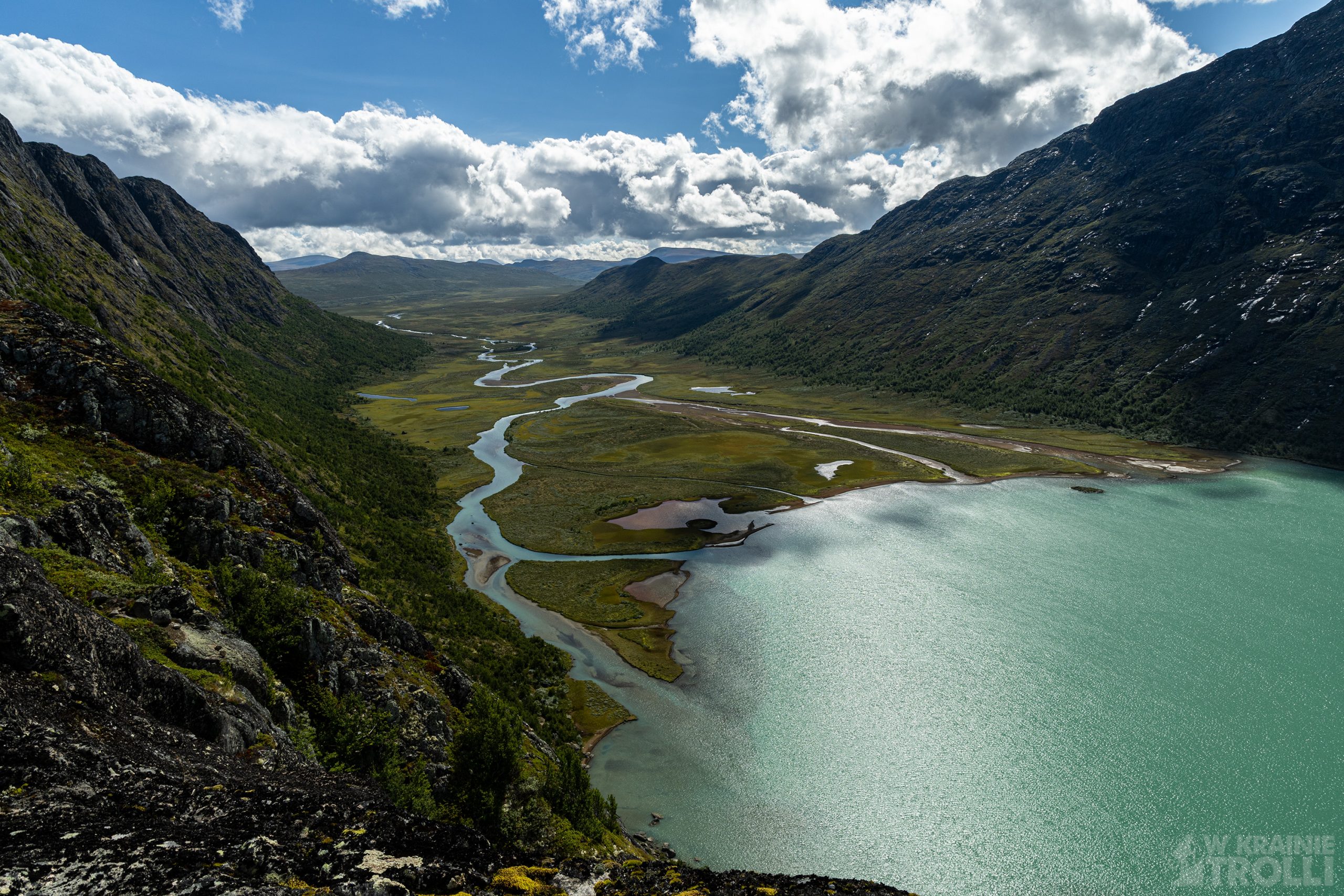
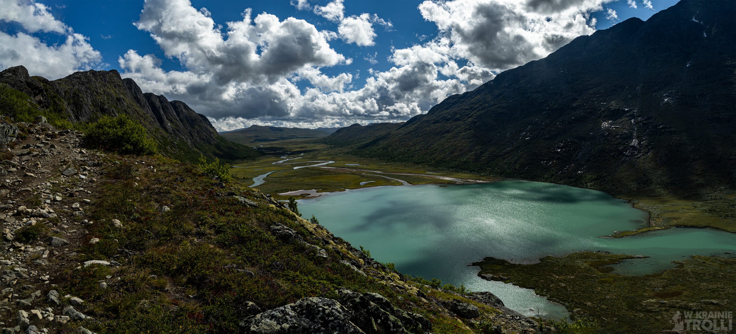
At this stage of the route, you can already see the turquoise color of the waters of Gjende Lake on the north and the rising Besseggen Ridge. From the south, however, there was a much better view of the Leirungsdalen valley and the Leirungsåe river meandering at its bottom. This river splits into three currents just below the peak of Knutshøe and feeds the small lake Øvre Leirungen, before it flows in spectacular cascades to Gjende Lake. The view from above on this spectacle is amazing.
Just below the summit is the last steep climb. Just like at the beginning of the route, here is an exposed section, where I had to use my hands to go up. A moment later I was there. I will not elaborate on the views, because those on the entire route are amazing. I took a few photos and started descending the north (actually north-west) ridge. The descent is not complicated, but you should be careful, because it is easy to slip on wet rocks.
I reached the tree line and shortly thereafter I stand at bottom of the valley. I continued walking along the Leirungsåe River until it turned south. I passed the crossing of the trails I had passed a few hours earlier and made my way to the car left in the bay. I was tired but happy with the walk. I was wondering what to do with the second half of the day. I wanted to spend the night in a tent somewhere in the area and in the morning, I could make some short hike before return home. Now I had a long time until sunset and I was considering the various options available. But I will write about what happened next in the next post.