Fugleleiken
Na terenie Østfold znajduje się aż 22 tzw. utsiktstårn czyli wież widokowych. Położone w środku lasu pełnią tez funkcje pożarowe, obserwacyjne, ale nie wiem czy w czasie największego zagrożenia pożarowego, czyli podczas suszy, latem na wieżach przydzielona jest jakaś straż leśna, tudzież pożarna. Musiałbym się wybrać na jedną z nich podczas letnich miesięcy, a nie zimą, jak do tej pory. Latem jednak dużo bardziej nęci mnie inny kierunek podróży, więc raczej nikłe szanse są na rozwikłanie tej zagadki. Chociaż kto wie, nigdy nie mów nigdy 🙂
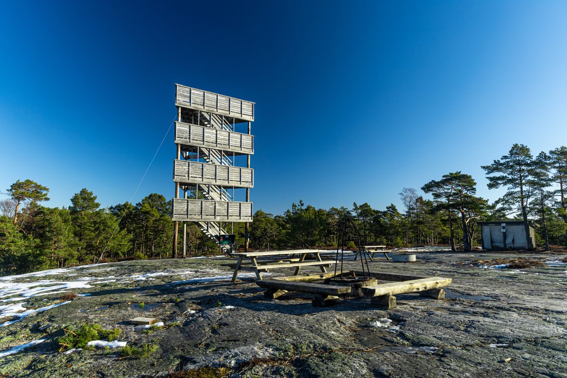
Fugleleiken to jedna z wież na obrzeżach Moss (a właściwie przyległego Råde). Podobno przy dobrej pogodzie ze szczytu można dojrzeć nawet Gaustatoppen. Cóż, slogan reklamowy równie dobry jak ten, mówiący, że ze szczytu Gaustatoppen rozpościera się widok na 1/6 całej Norwegii.
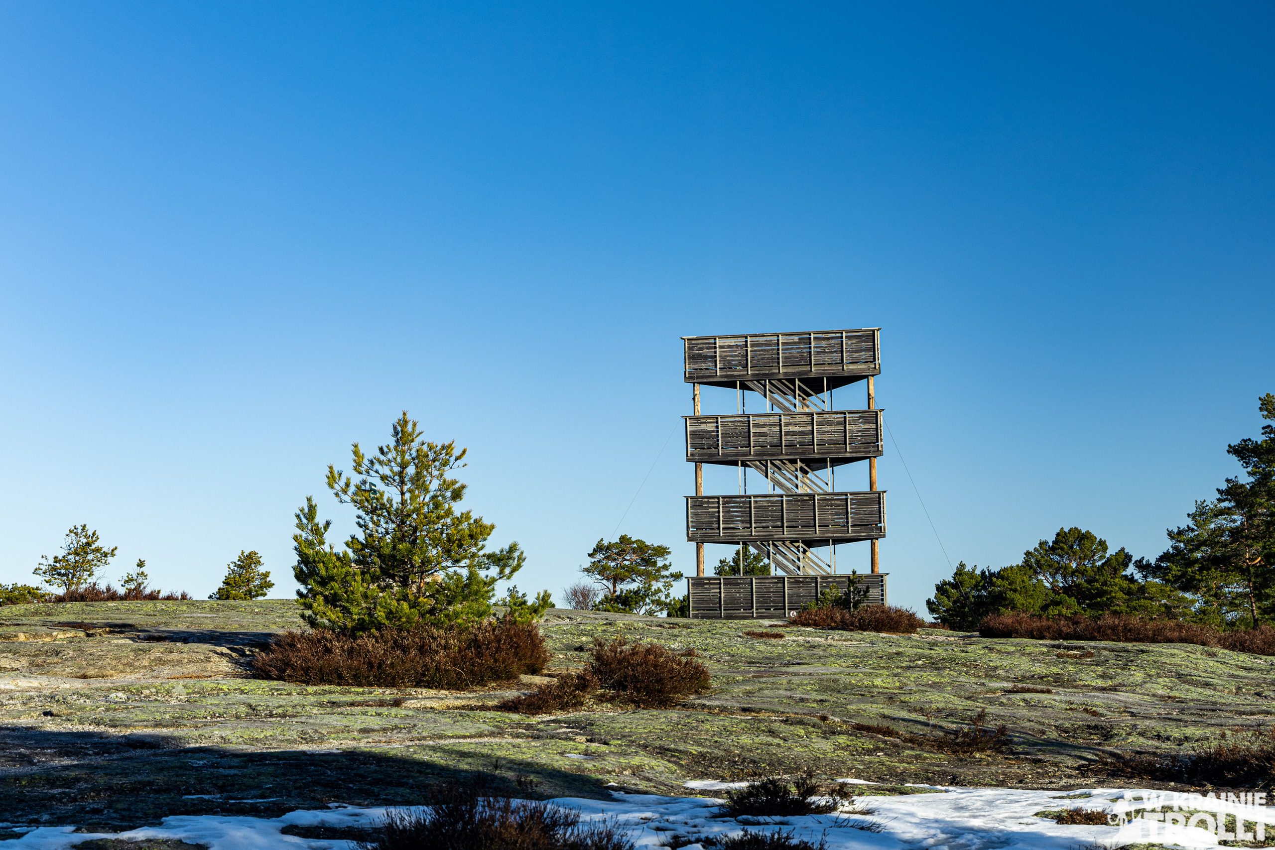
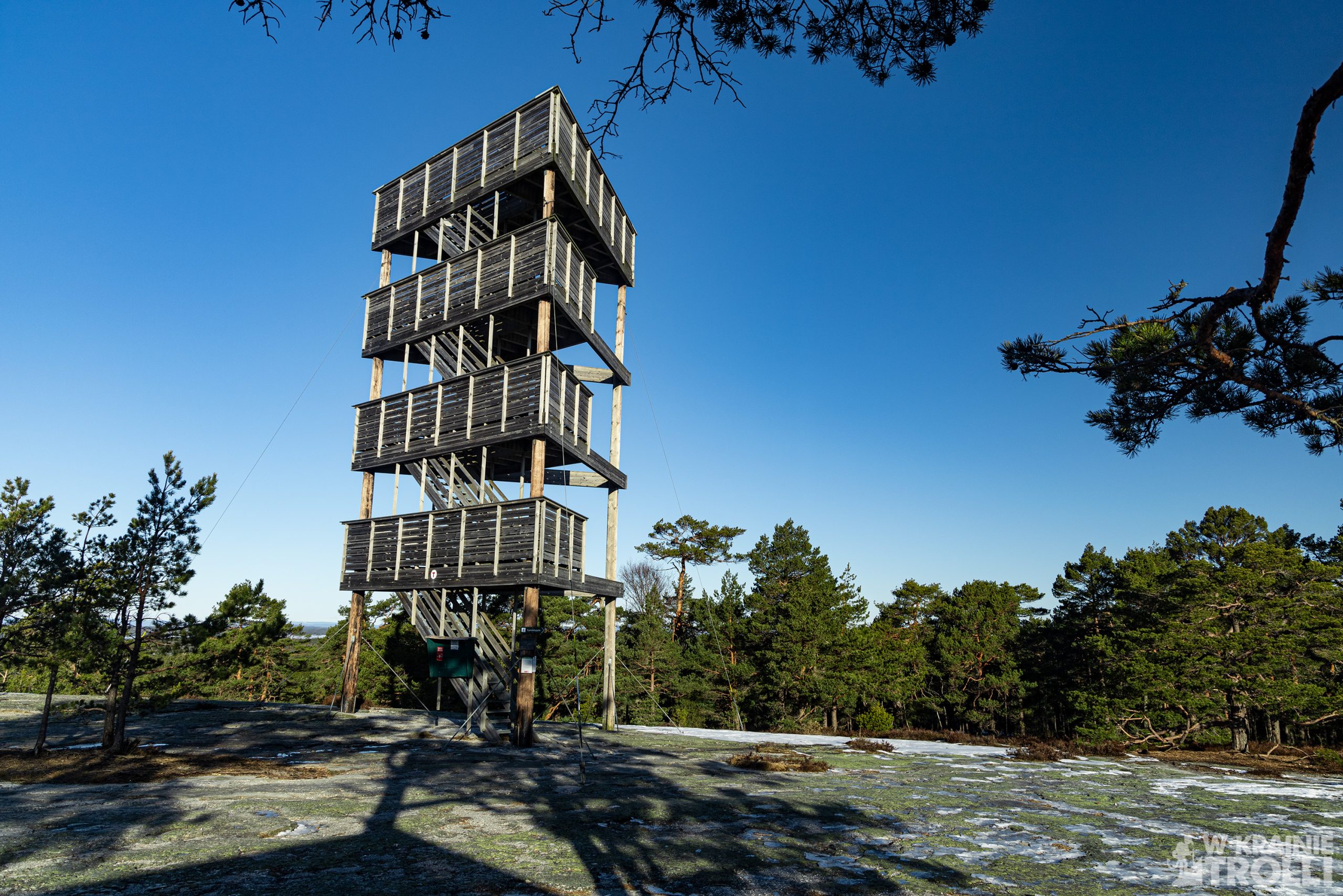
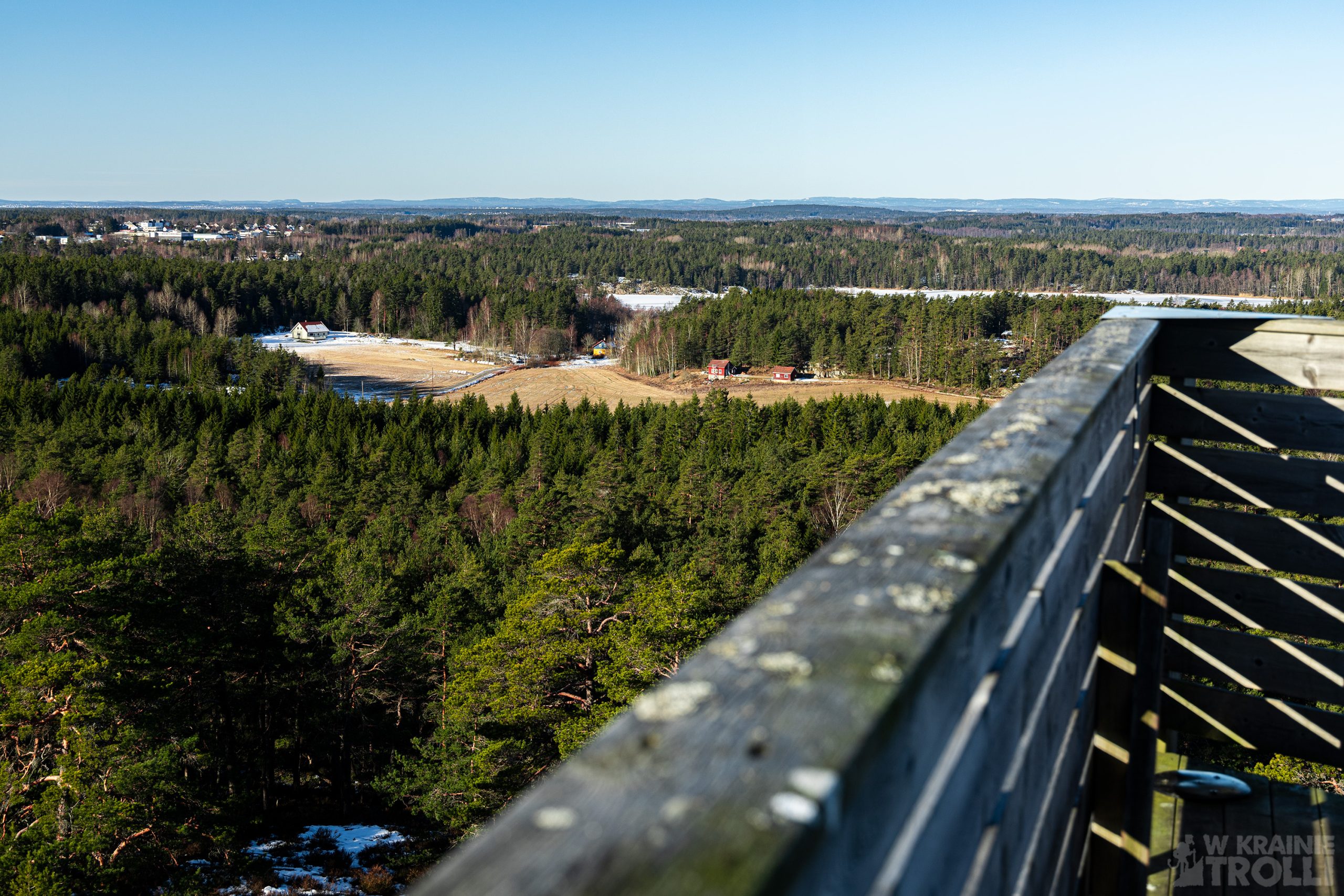
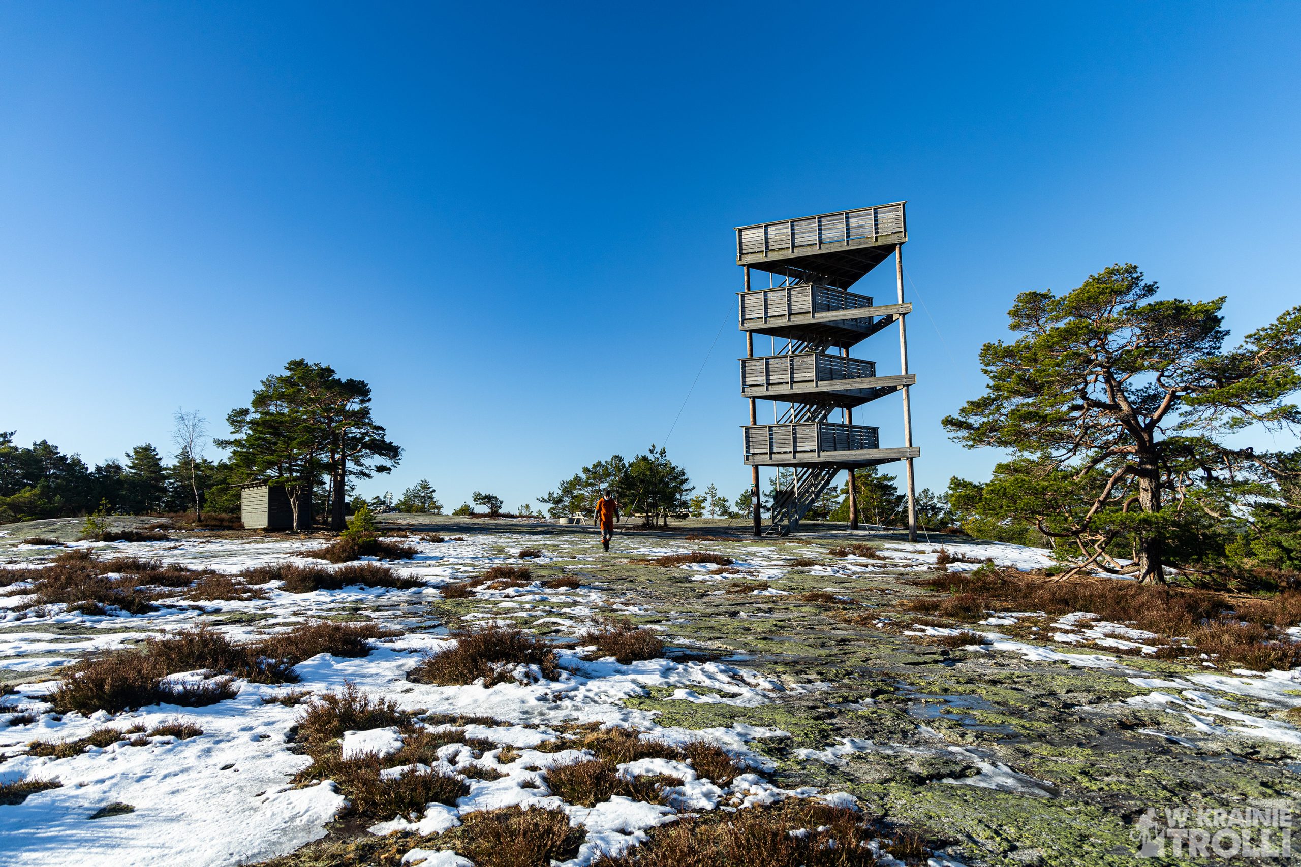
W każdym razie Fugleleiken, znajduje się w czołówce wież widokowych, jeśli chodzi o te, które do tej pory odwiedziłem (cała lista obejmuje więc jakieś 4, może 5 pozycji). Co mnie tak urzekło? Łatwy dojazd, krótki dystans do przebycia od parkingu, ciekawa, trójkątna konstrukcja i widok. W przeciwieństwie do pozostałych wież, na których byłem, ta znajduje się niedaleko wspomnianego Råde, ze szczytu widać więc pojedyncze zabudowania wraz z charakterystyczną wieżą kościoła, a nie tylko las dookoła. Poza tym u podstawy wieży znajdziemy ławeczki i miejsce na dwa ogniska a także zapas drewna, z którego można skorzystać podczas biwaku (za jedyne 40kr od worka).
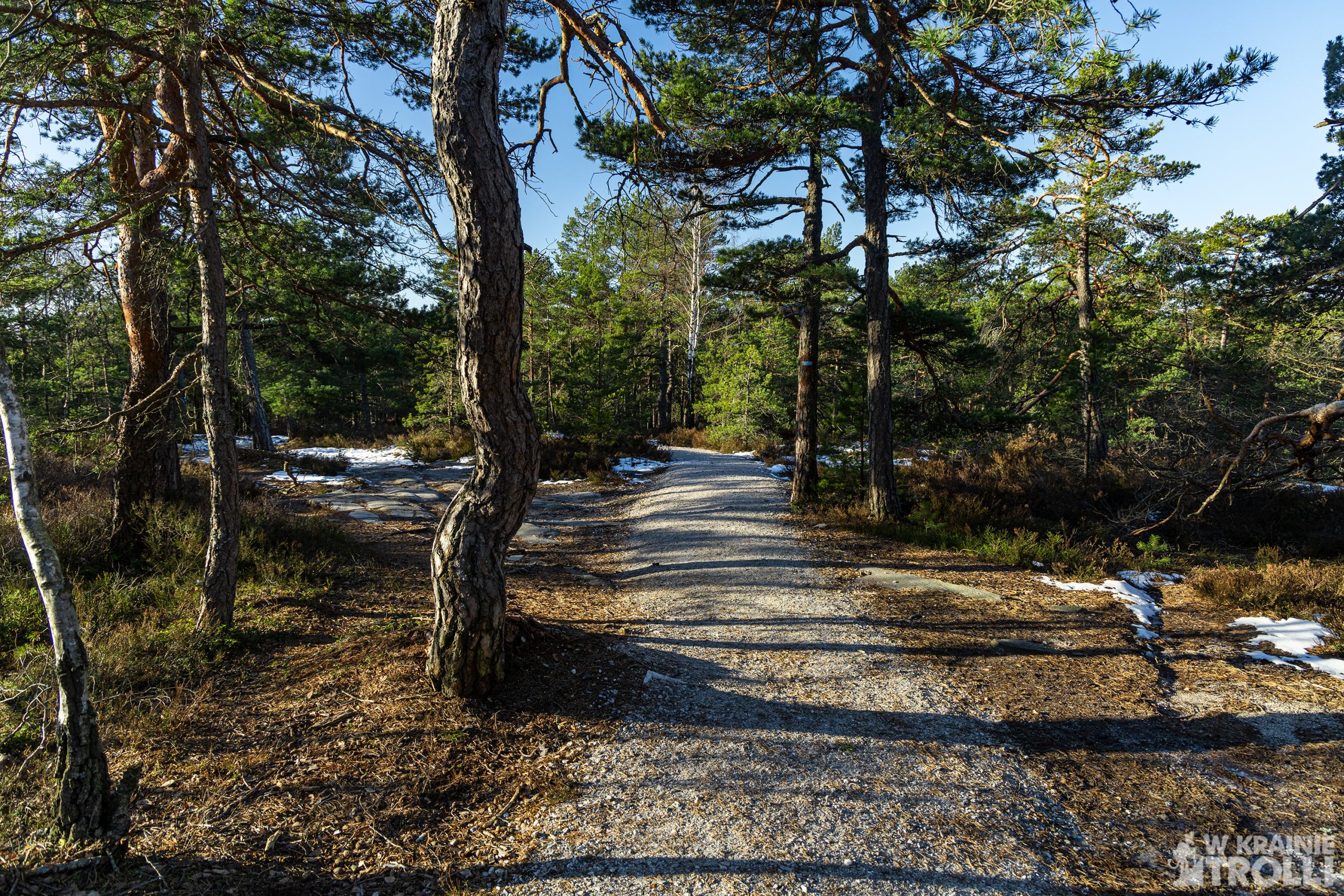
Dojazd na parking nie jest skomplikowany. Tym bardziej jak korzysta się z map google. Wystarczy wpisać w wyszukiwarkę ‘’fugleleiken turparkering’’, a dalej aplikacja poprowadzi nas na miejsce. Ja zjechałem z autostrady E6 tuż za miejscowością Karlshus, wróciłem kawałek w przeciwnym kierunku boczną, równoległą drogą, a potem odbiłem na północ, przejeżdżając wąskim mostem nad autostradą i po przejechaniu może 200 metrów byłem na miejscu. Na starcie wita nas spora tablica informacyjna z mapą, paroma zdjęciami i informacjami o terenie, na który wkraczamy. Okazuje się, że sporo się tu działo w przeszłości. Potem czeka nas spokojny spacerek przez las. Trasa jest zadbana i nie sposób się zgubić. Po około 20 minutach docieramy na miejsce.
Obejrzałem sobie wieżę ze wszystkich stron, porobiłem zdjęcia i mogłem już wracać do auta ale postanowiłem kontynuować wędrówkę i iść jeszcze dalej na północ. I chyba nie był to najlepszy pomysł, jako że ostatnio dokuczają mi trochę plecy, a dźwiganie plecaka ze sprzętem wcale nie pomaga pozbyć się bólu. Poza tym ścieżka przez las pozbawiona była jakichkolwiek ciekawych widoków i choć dystans nie był duży, dłużyło mi się niemiłosiernie. Doszedłem do momentu, w którym ścieżka skręca ostro na południowy zachód, a potem po jakimś czasie dochodzi do żwirowanej drogi. Tą ostatnią doszedłem z powrotem na parking mając świadomość, że nic bym nie stracił pomijając ten ostatni etap marszu.


In Østfold there are 22 so-called utsiktstårn or lookout towers. Located in the middle of the forest, they also perform fire and observation functions, but I do not know if during the greatest fire risk, i.e. during drought in summer, some forest guards or fire brigades are assigned to the towers. I would have to go to one of them during the summer months and not in the winter, as so far. In the summer, however, I am much more attracted to a different direction of travel, so the chances of solving this mystery are rather slim. But who knows, never say never as they say.
Fugleleiken is one of the towers on the outskirts of Moss (actually adjacent Råde). Apparently, in good weather, you can even see Gaustatoppen from the top. Well, an advertising slogan as good as the one saying that from the top of Gaustatoppen there is a view of 1/6 of all Norway.
Anyway, Fugleleiken is at the forefront of the lookout towers I’ve visited so far (the whole list includes about 4, maybe 5 positions). What charmed me so much? Easy access, short distance from the parking lot, interesting triangular structure and view. Unlike the other towers I’ve been to, this one is located near the aforementioned Råde, so from the top you can see single buildings with a characteristic church tower, not just the forest around. In addition, at the base of the tower you will find a bench and a place for two bonfires as well as a supply of wood that can be used during camping (for only 40kr per bag).
Access to the parking lot is not complicated. Especially when using google maps. Just type in the search engine „fugleleiken turparkering” and the application will guide you to the place. I left the E6 highway just outside the town of Karlshus, returned a bit in the opposite direction along a side, parallel road, and then turned north, crossing a narrow bridge over the highway, and after driving maybe 200 meters I was there. At the start, I was greeted by a large information board with a map, some photos and information about the area I was entering. Turns out a lot has happened here in the past. Afterwards, I had a leisurely walk through the forest. The route is well-kept and it is impossible to get lost. After about 20 minutes I reached the place.
I looked at the tower from all sides, I took pictures and I could go back to the car, but I decided to continue my journey and go even further north. And it probably wasn’t the best idea, as my back has been bothering me a bit lately, and carrying a backpack with equipment doesn’t help at all to get rid of the pain. In addition, the path through the forest was devoid of any interesting views, and although the distance was not long, I couldn’t take any pleasure from that walk. I came to a point where the path turns sharply southwest, and then after a while it comes to a gravel road. This way I came back to the parking lot, knowing that I would not lose anything by omitting this last stage of the march.


Zobacz również
Aurora borealis w Bodø

Snøvegen, Aurlandsvangen, Flåm, Undredal & Gudvangen
