Snøvegen, Aurlandsvangen, Flåm, Undredal & Gudvangen
Są takie miejsca, do których chętnie powracamy i które urzekają nas z każdą kolejną wizytą. Czasem zdarz mi się wracać w te same miejsca i odkrywać je na nowo. Niedawno pisałem o dwóch szlakach w górach Haukeli, wodospadzie Rjukandefossen w Hemsedalen czy fragmentach Drogi Królewskiej w okolicach Borgund wraz z kościołem klepkowym z XII w. Będąc w tym ostatnim rejonie, wybrałem się także na objazdówkę po nieco dalszej okolicy. Trasa obejmowała przejazd Snøvegen (Drogą śnieżną) oraz zahaczenie okolicznych miejscowości: Aurlandsvangen, Flåm, Undredal oraz Gudvangen. To zapis tamtej wrześniowej wycieczki.
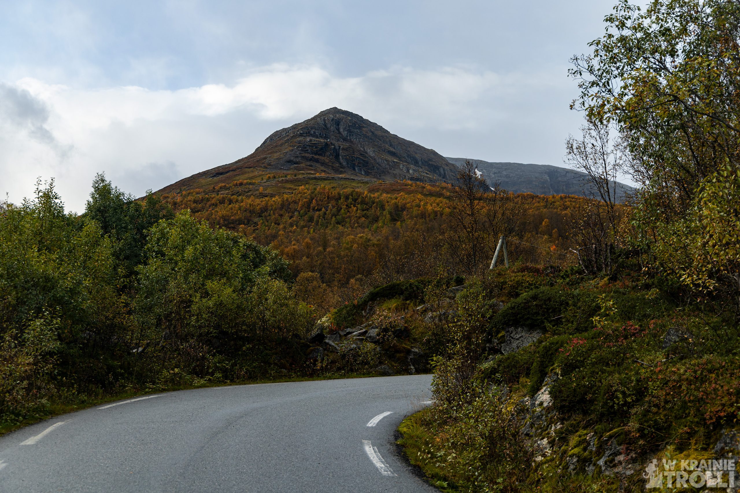
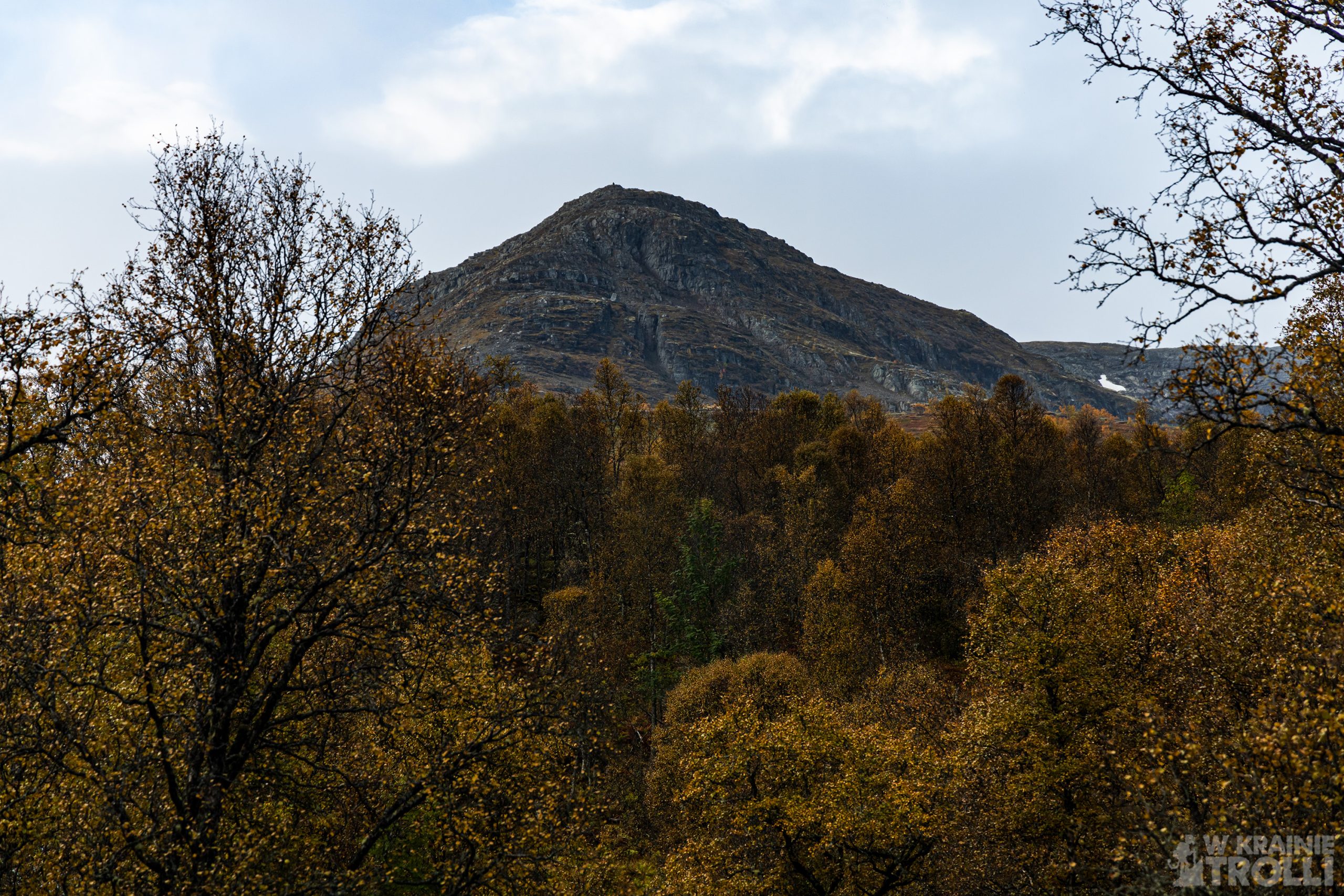
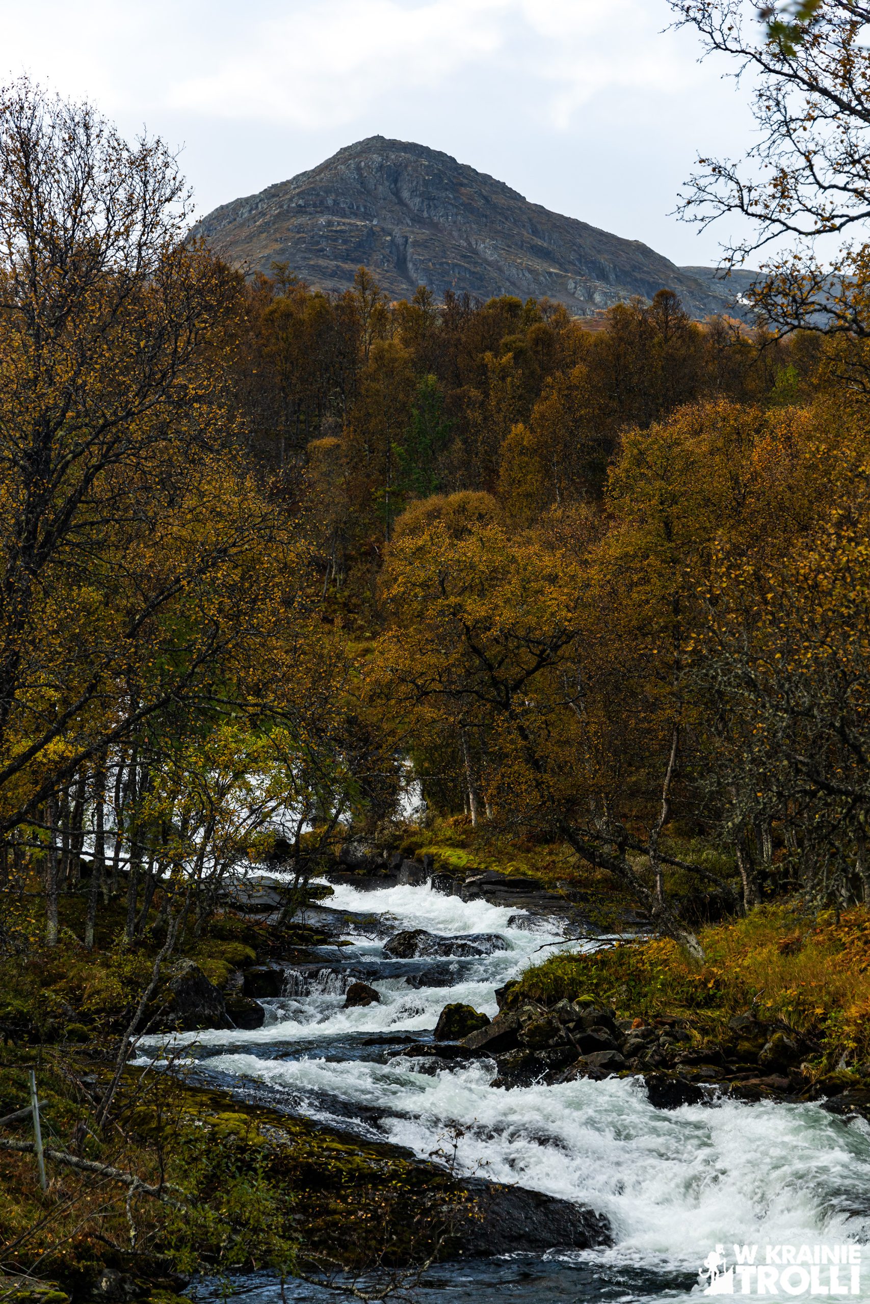
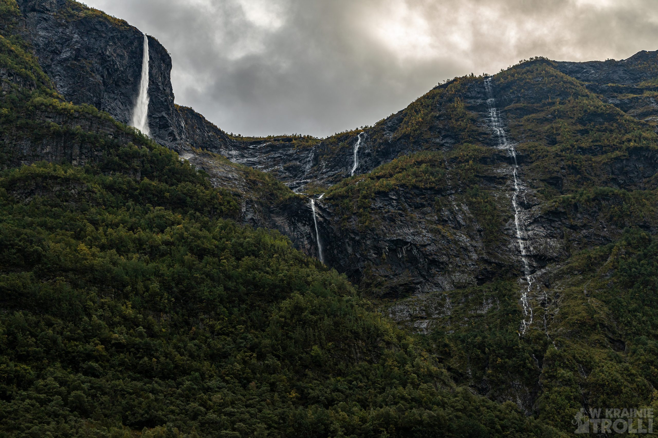
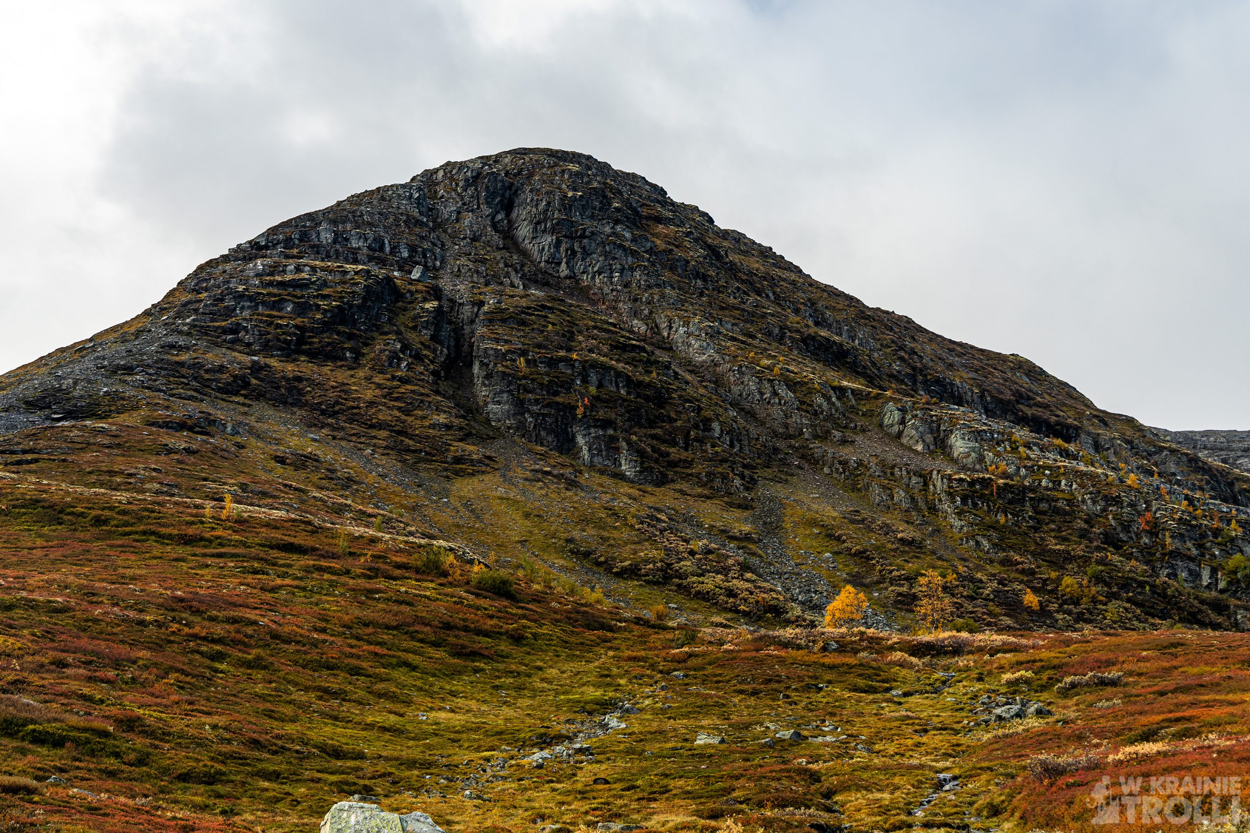
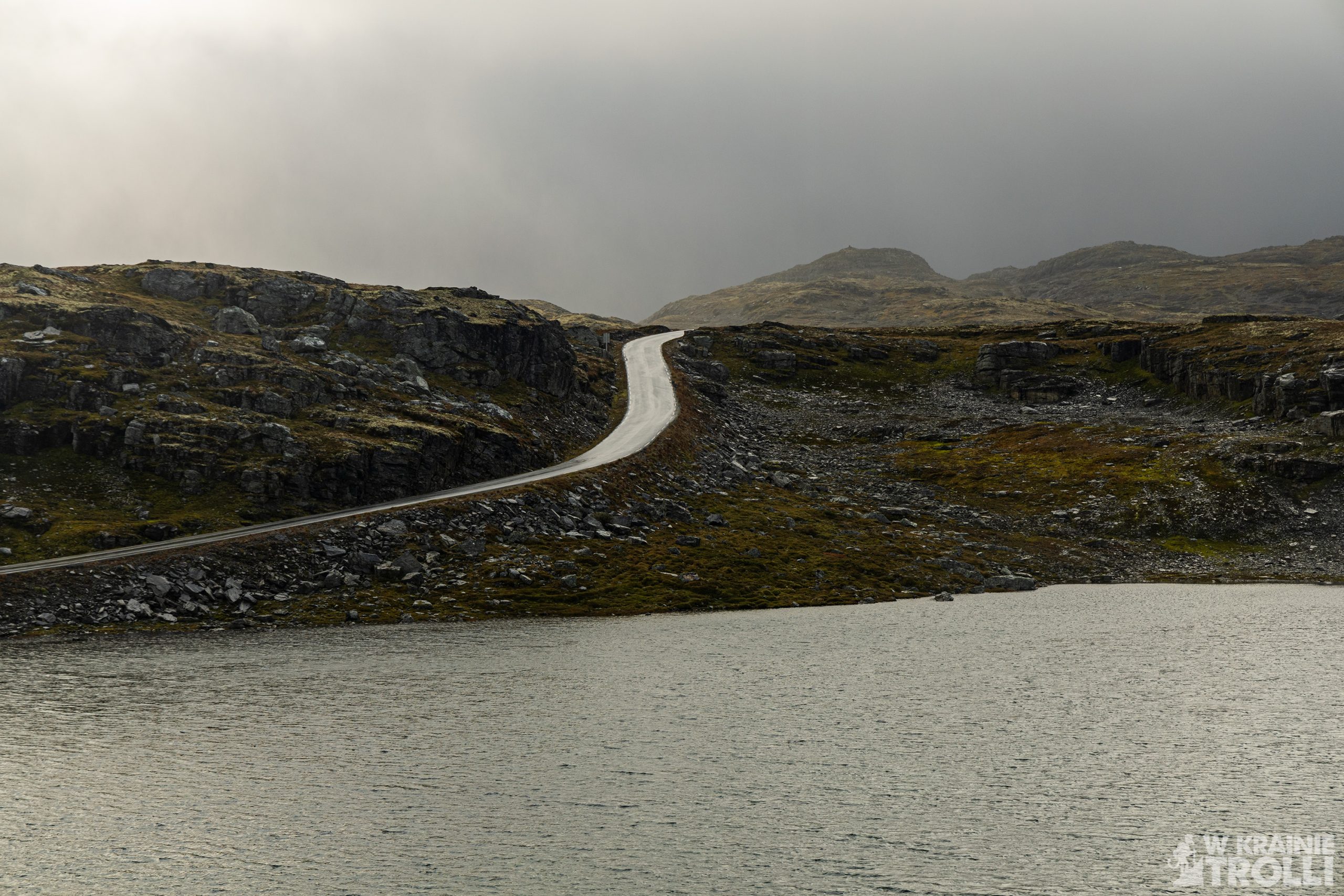
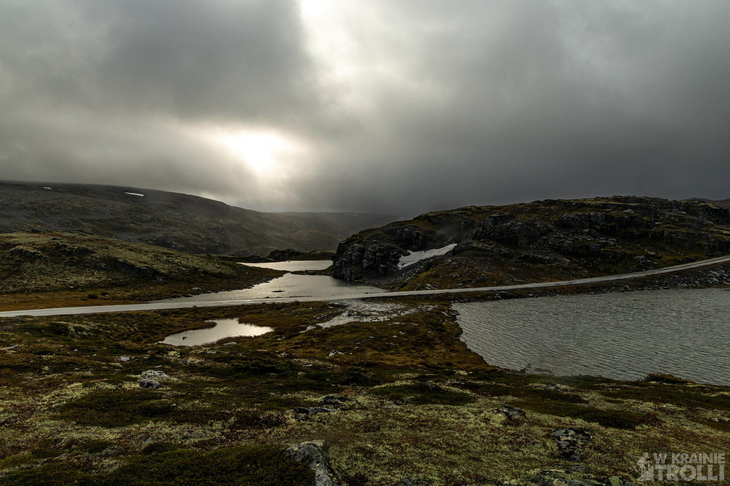
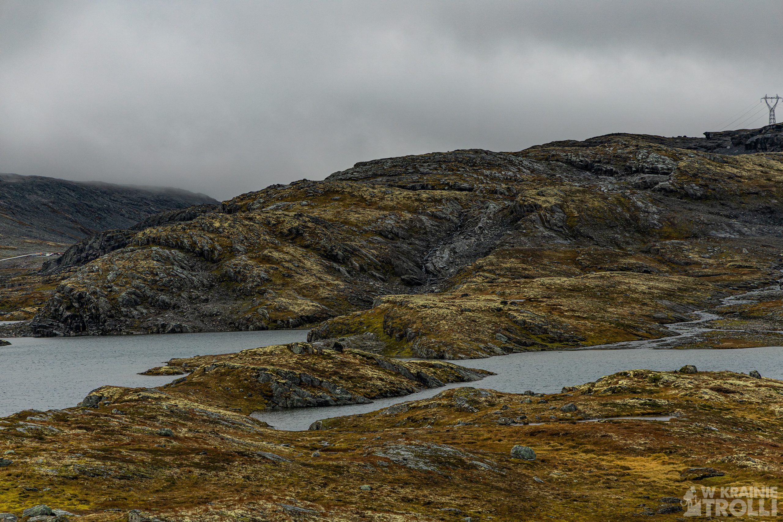
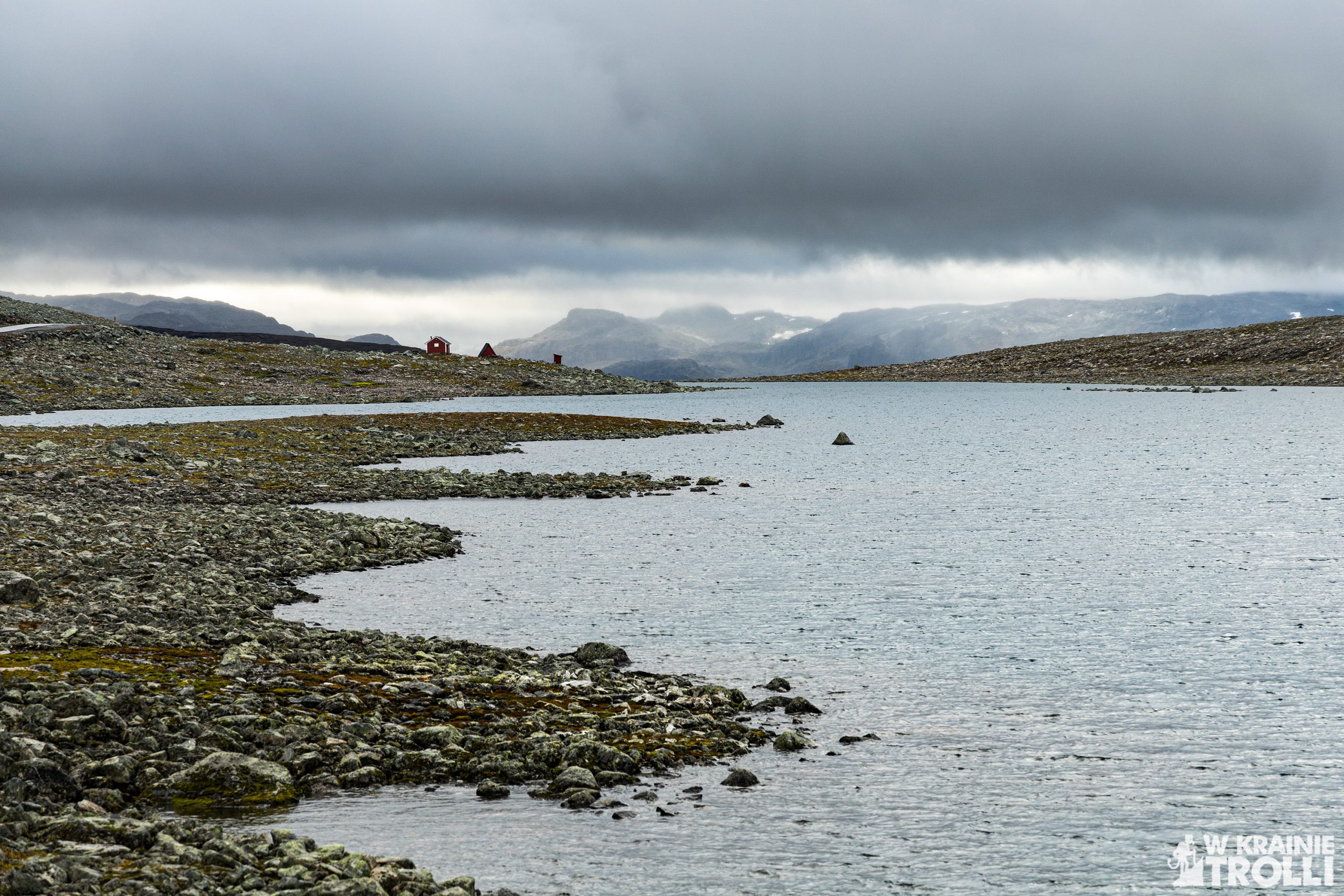
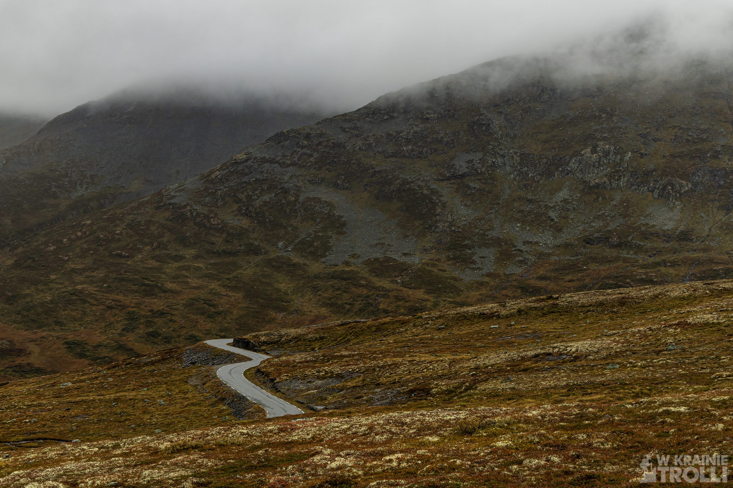
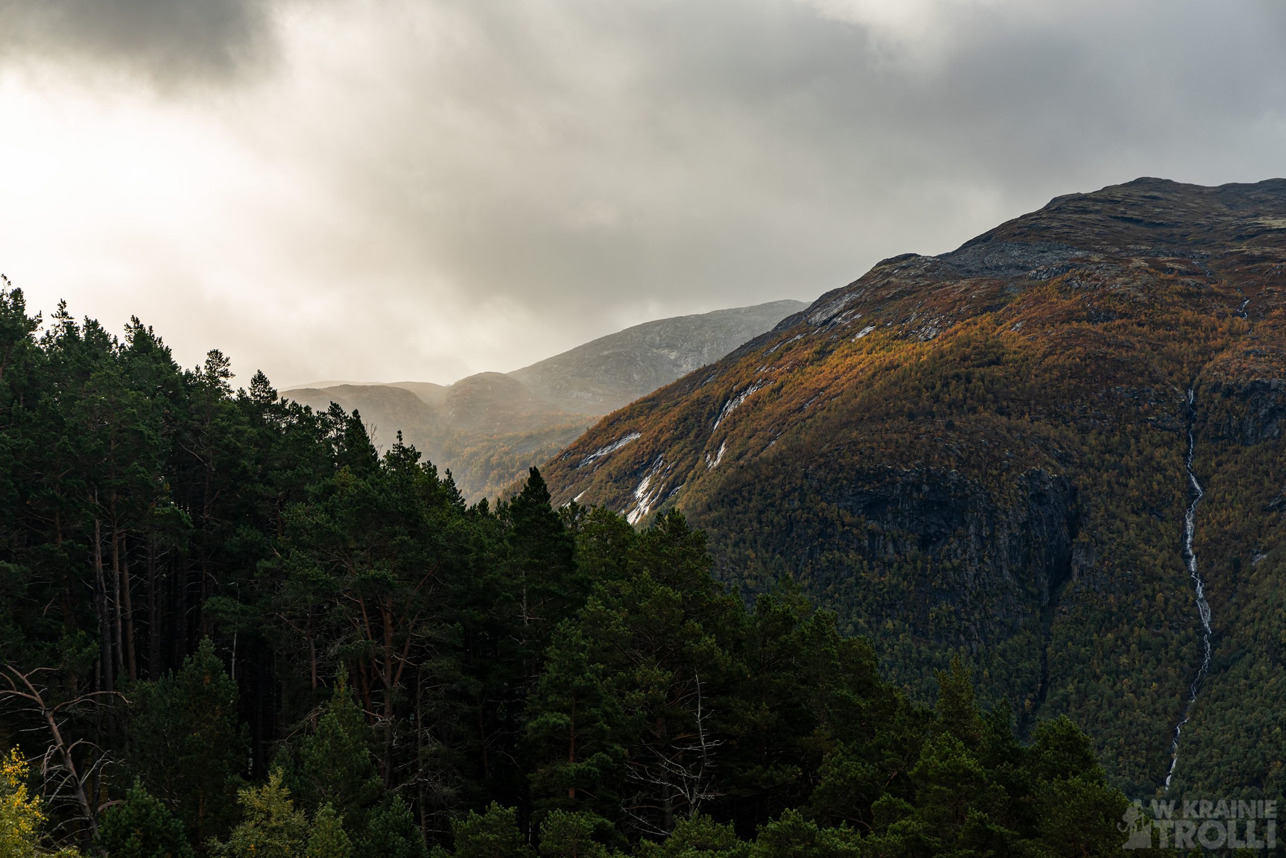
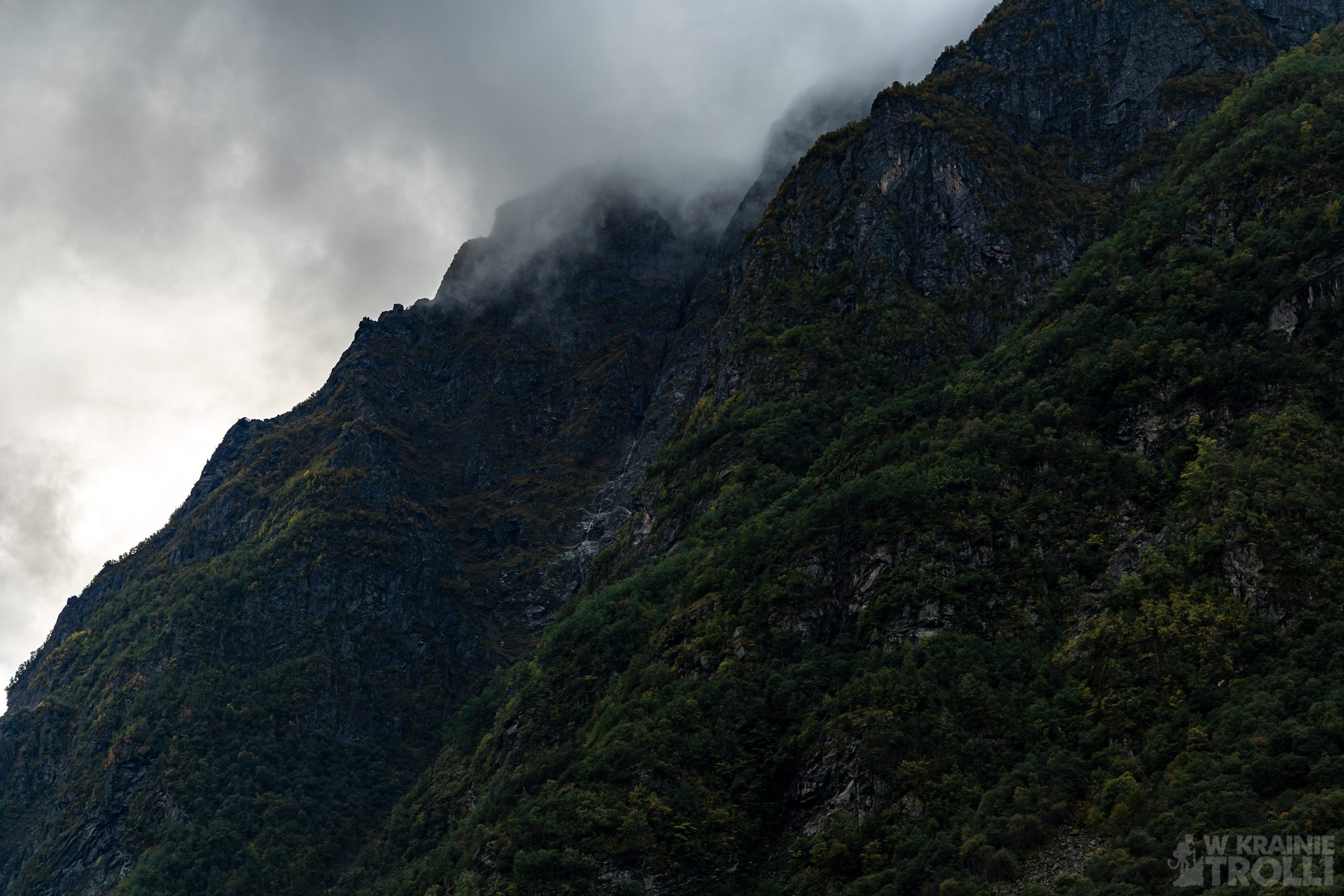
Droga śnieżna to trasa łącząca Lærdalsøyri z Aurlandsvangen. Liczy ona 48,6 km i biegnie w górskim, surowym terenie. Bywa, że nawet w środku lata na poboczu drogi zalegają grube warstwy śniegu, stąd też wzięła się potoczna nazwa tego odcinka. Droga ta jest zamykana w okresie zimowym, a ruch pomiędzy obiema miejscowościami (jak też między wschodnią a zachodnią Norwegią) przekierowywany jest do czynnego przez cały rok tunelu Lærdalstunellen na drodze E16. Jest to swoją drogą najdłuższy tunel drogowy na świecie, liczy bowiem aż 24 km. W środku przewidziano aż trzy nieduże zatoczki, dla tych, którym monotonna droga w ciemnościach (tunel jest oczywiście podświetlany) przymyka ze znużenia powieki.
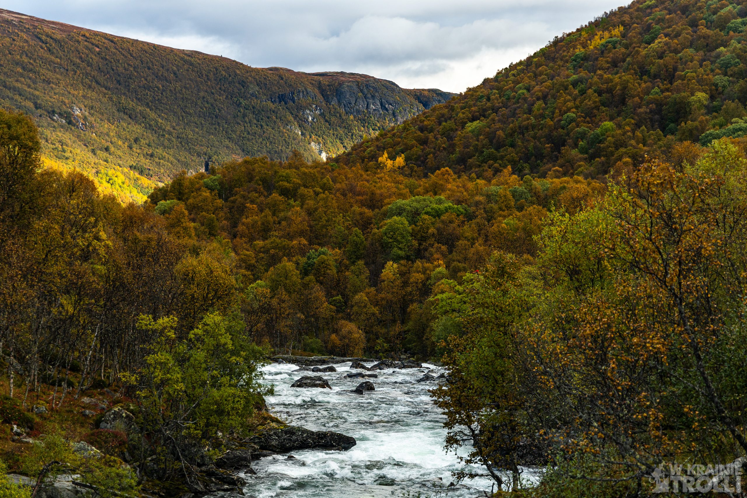
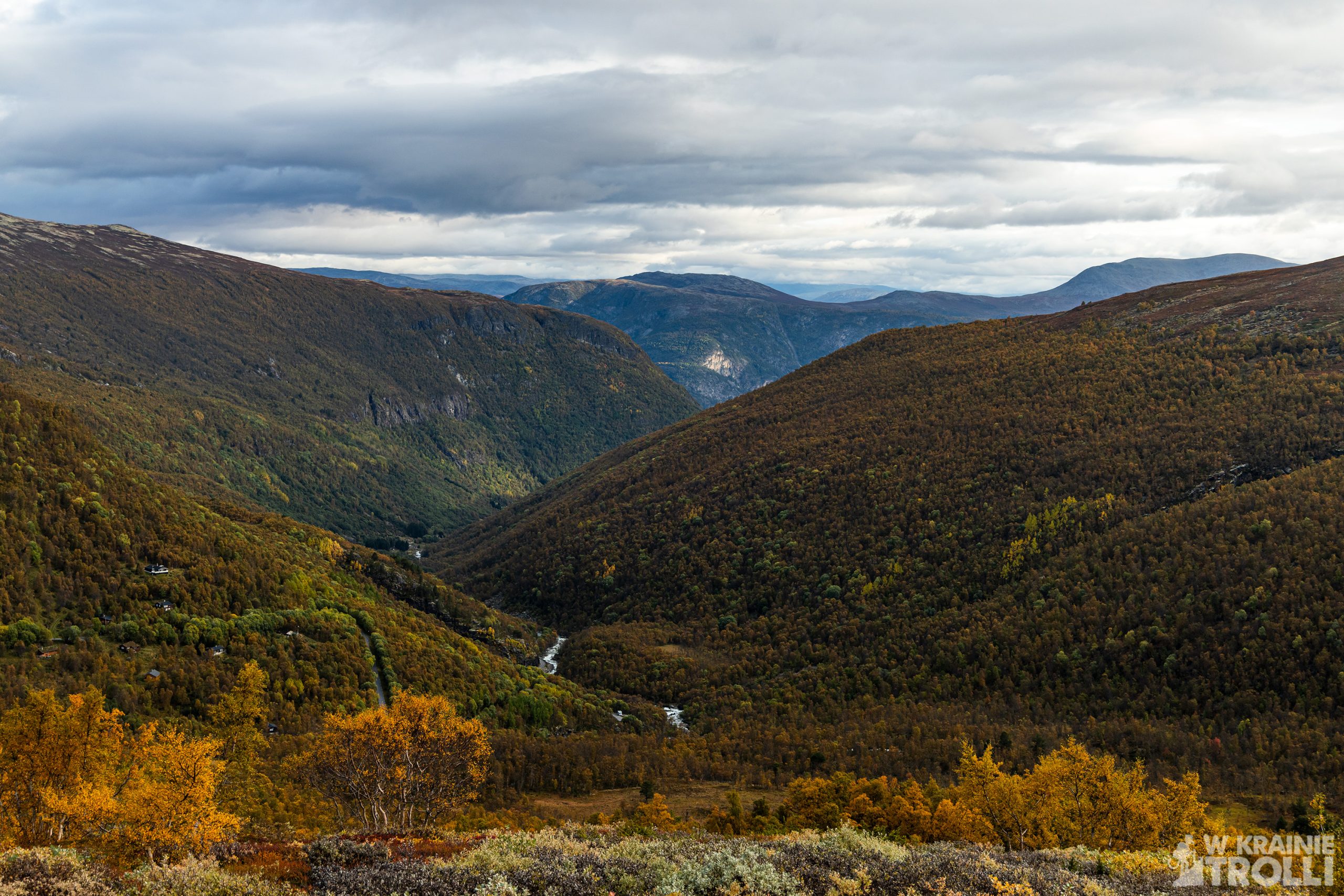
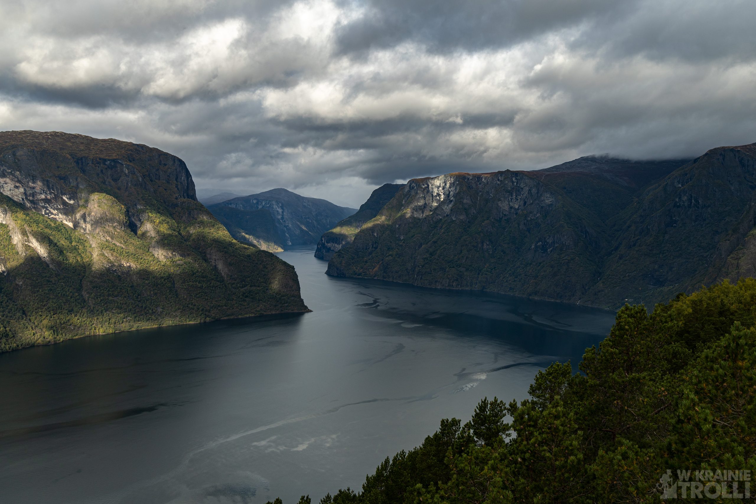
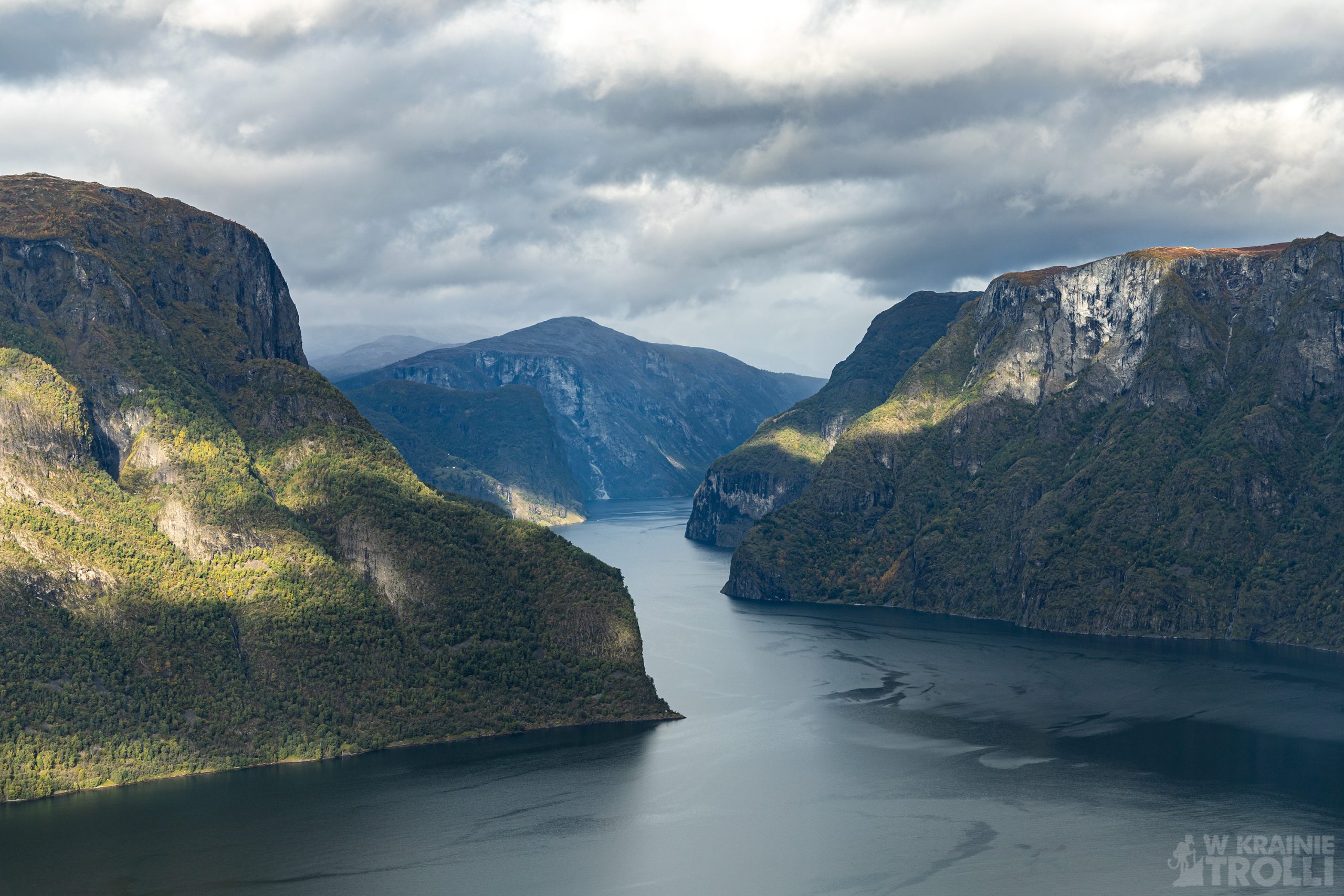
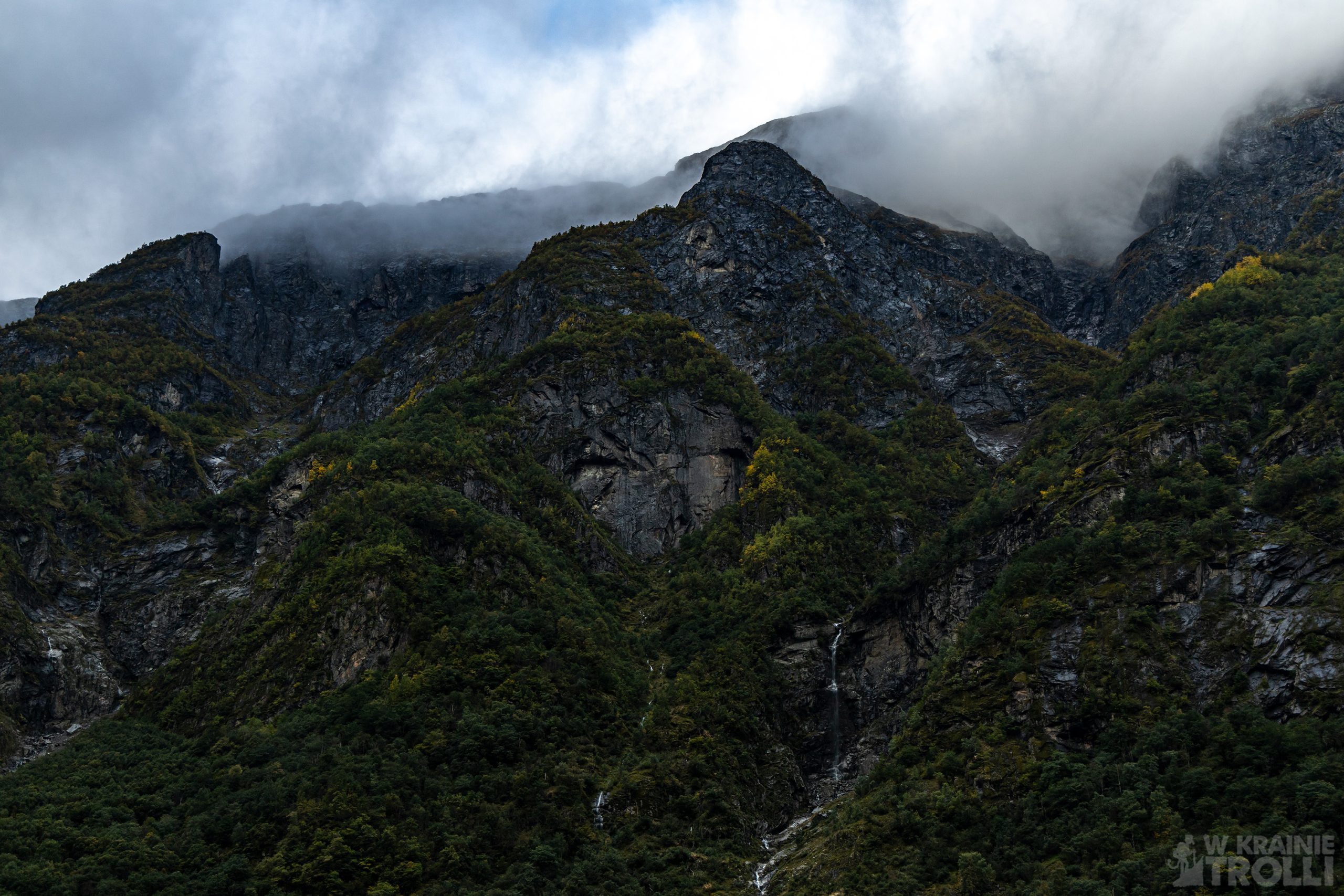
Snøvegen jest jedną z kilkunastu (dokładnie 18) dróg szczególnie podkreślających walory krajoznawcze Norwegii. Tzw. Nasjonal Turistveg, lub z angielska Scenic Route powinno wzbudzać czujność każdego żądnego wrażeń przyjezdnego, przemierzającego kraj fiordów. To trasy niezwykle malownicze, przebiegające często przez przepiękne, dziewicze tereny. Tak też mamy i tutaj. Właściwie jedynymi oznakami bytności człowieka są asfaltowa droga oraz linia energetyczna. Na trasie znajduje się kilka miejsc postojowych, przy których warto przystanąć. Są to, licząc od strony Lærdalsøyri: Sluppen, Vedahaugane, Flotane i Stegastein.

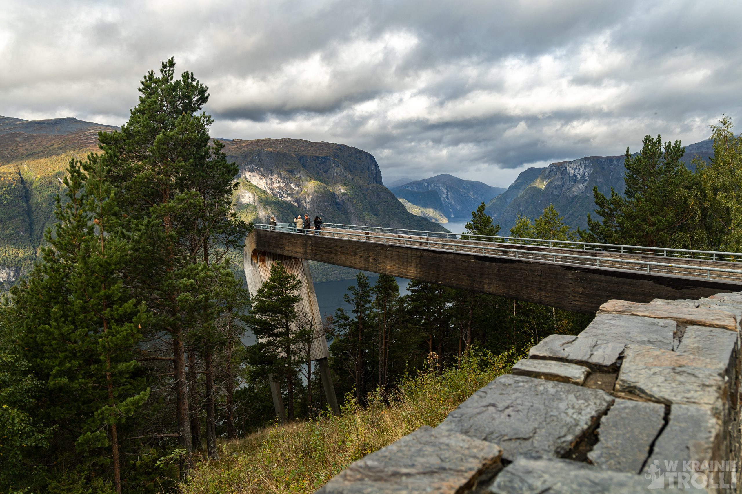
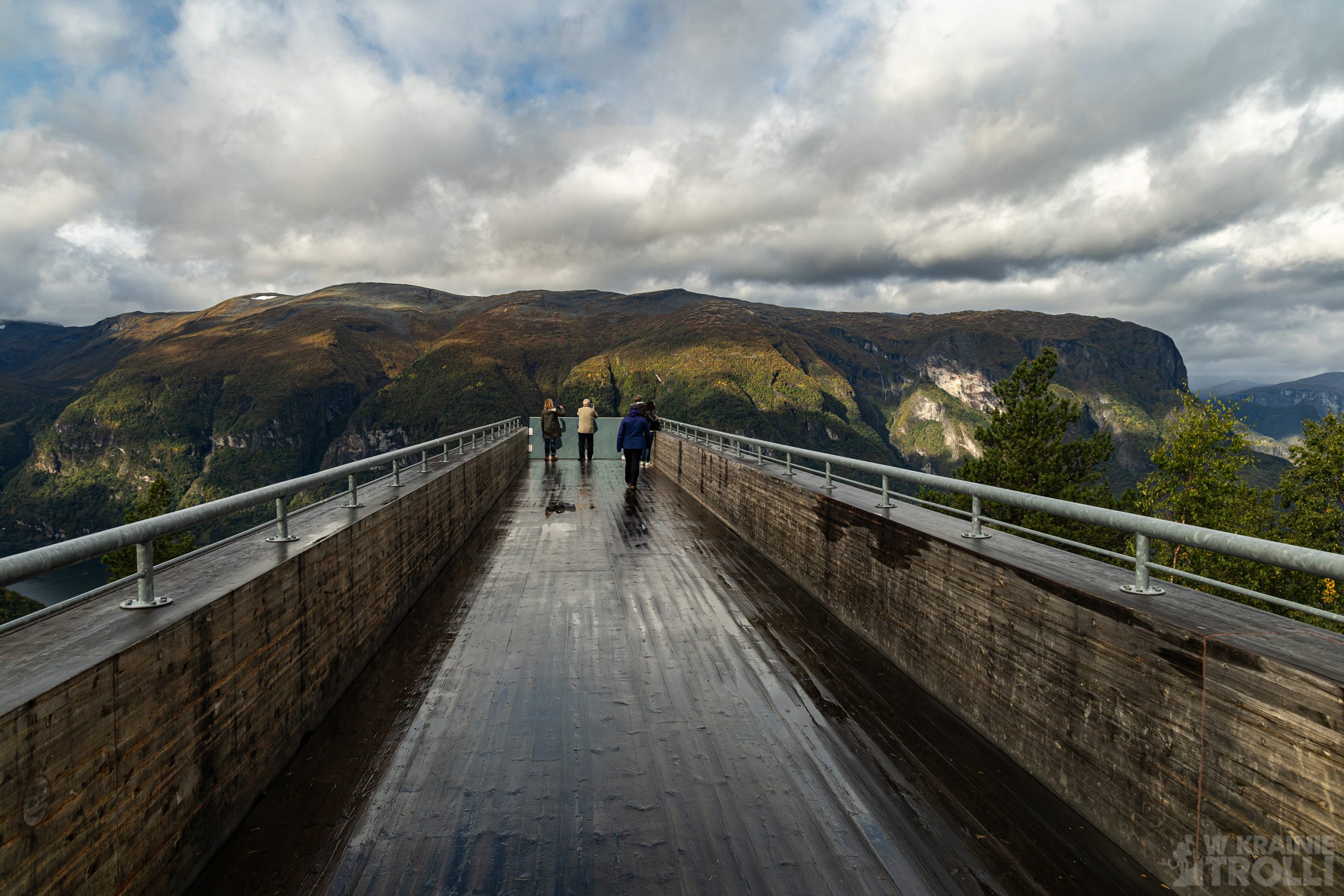
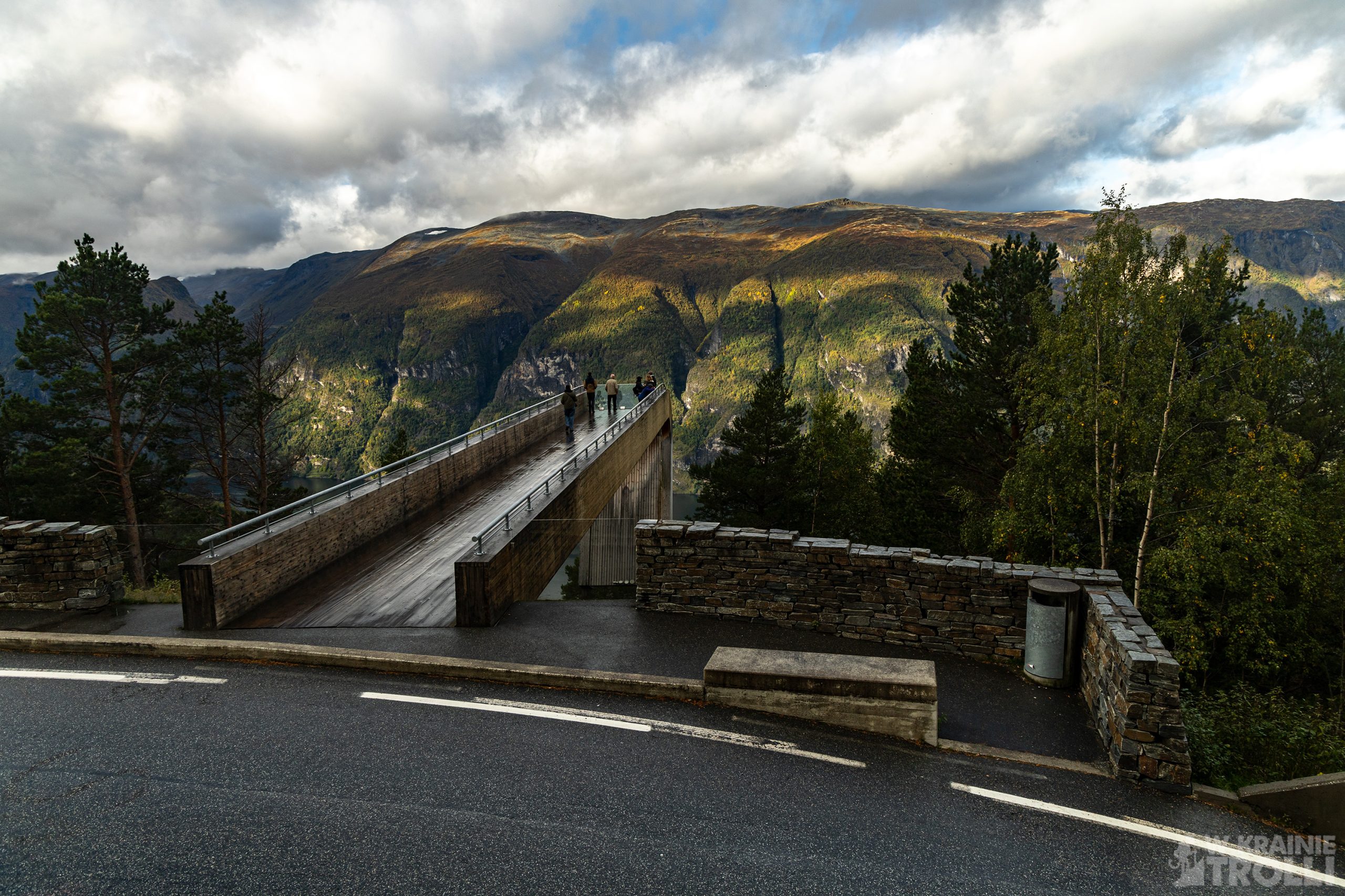
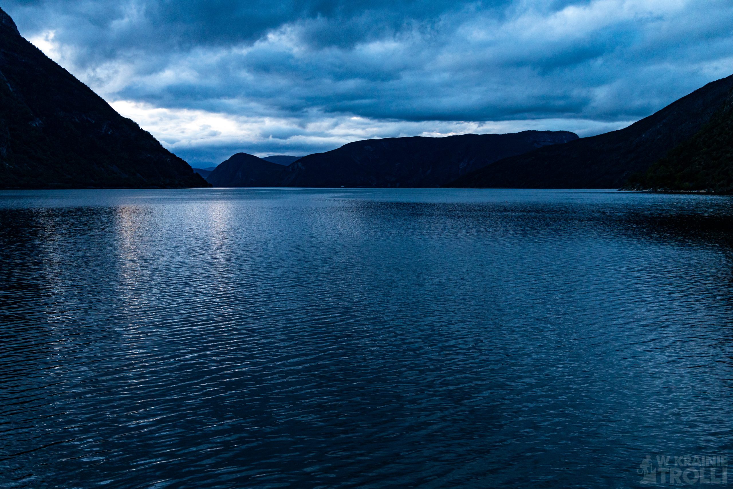
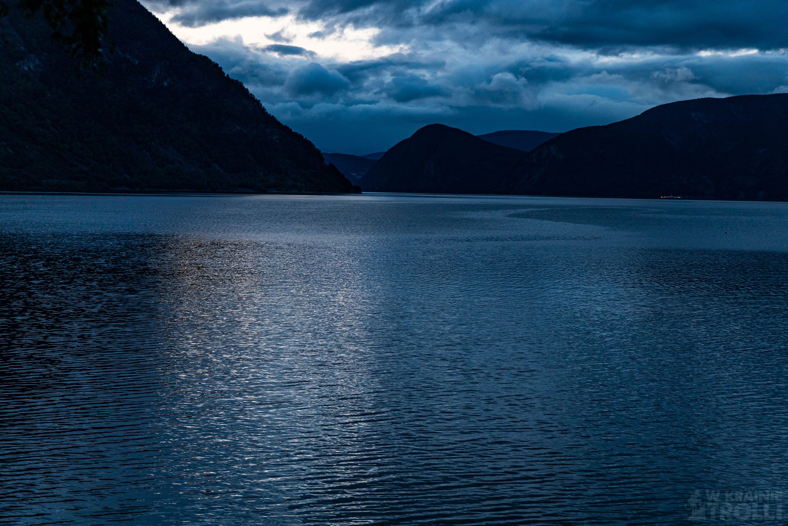
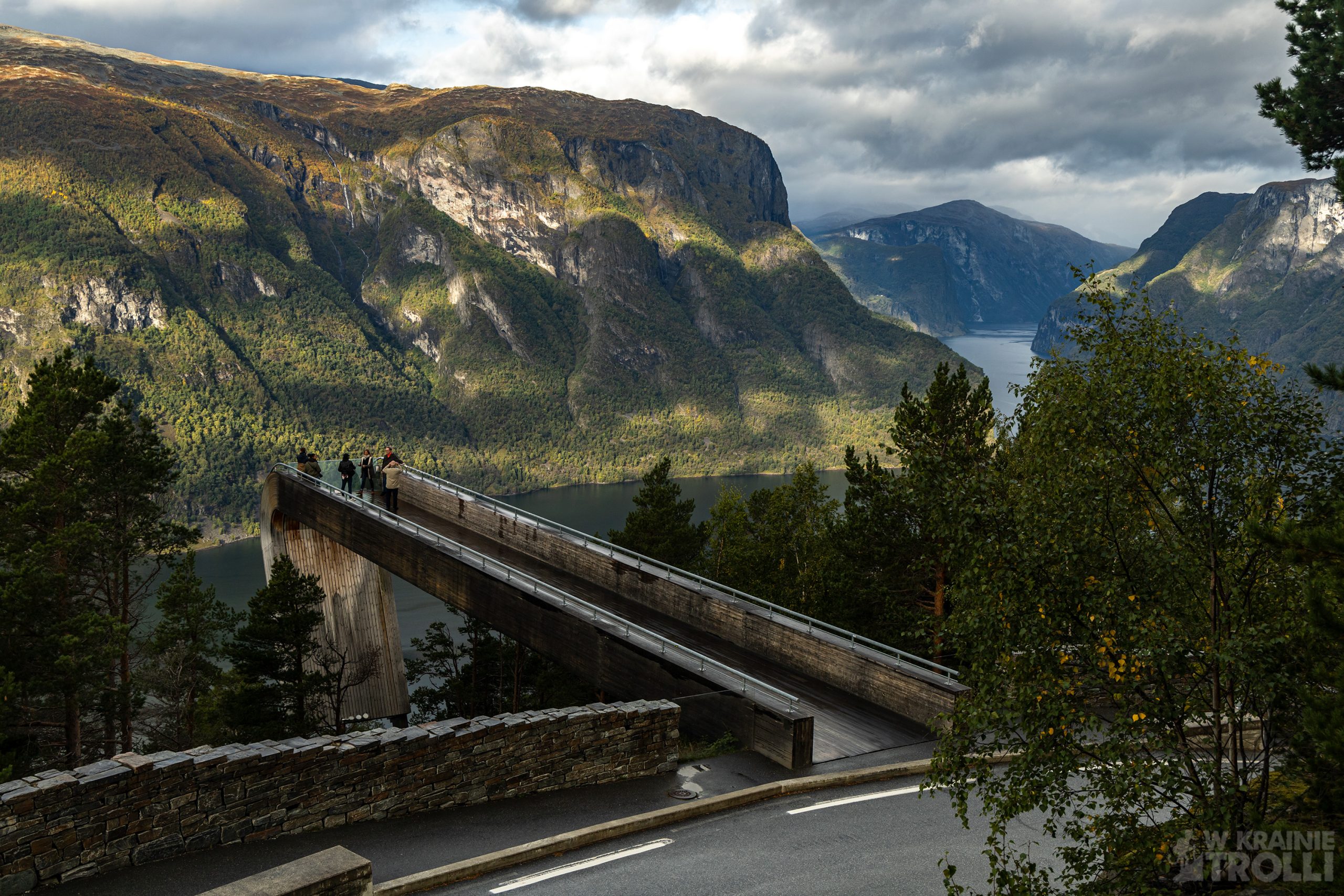
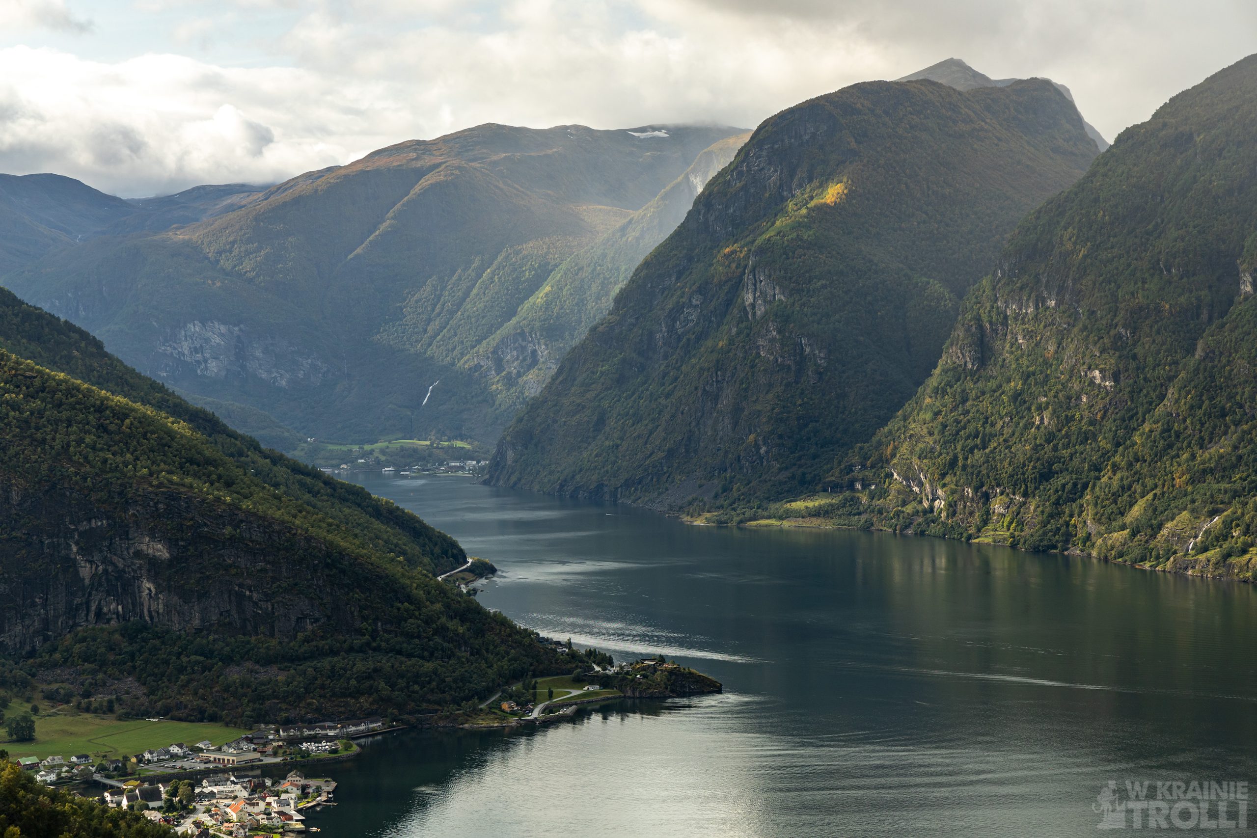
Ten ostatni, to kolejny punkt, który odwiedzałem już w przeszłości i obowiązkowy punkt programu każdej wycieczki w tym rejonie. Drewniana platforma widokowa wysunięta 30 metrów ze zbocza góry, z charakterystycznym panoramicznym widokiem na Aurlandsfjord robi na mnie wrażenie za każdym razem i prawdopodobnie nigdy nie będę miał dosyć powrotów w to miejsce. Zwykle parking przy platformie jest zapchany do granic możliwości. Nawet tym razem, w drugiej połowie września, przy wietrznej pogodzie i przewijających się przez cały dzień przelotnych deszczach był tu dość spory ruch. Ci, których przyszpiliła potrzeba mogą skorzystać z toalet przy parkingu i nawet podczas rutynowych fizjologicznych czynności mogą oni podziwiać widoki, przez szklana ścianę. Sama panorama fiordu i okolicznych gór z tego miejsca, jakieś 650 m nad poziomem morza, to uczta dla oczu, bez względu na pogodę.
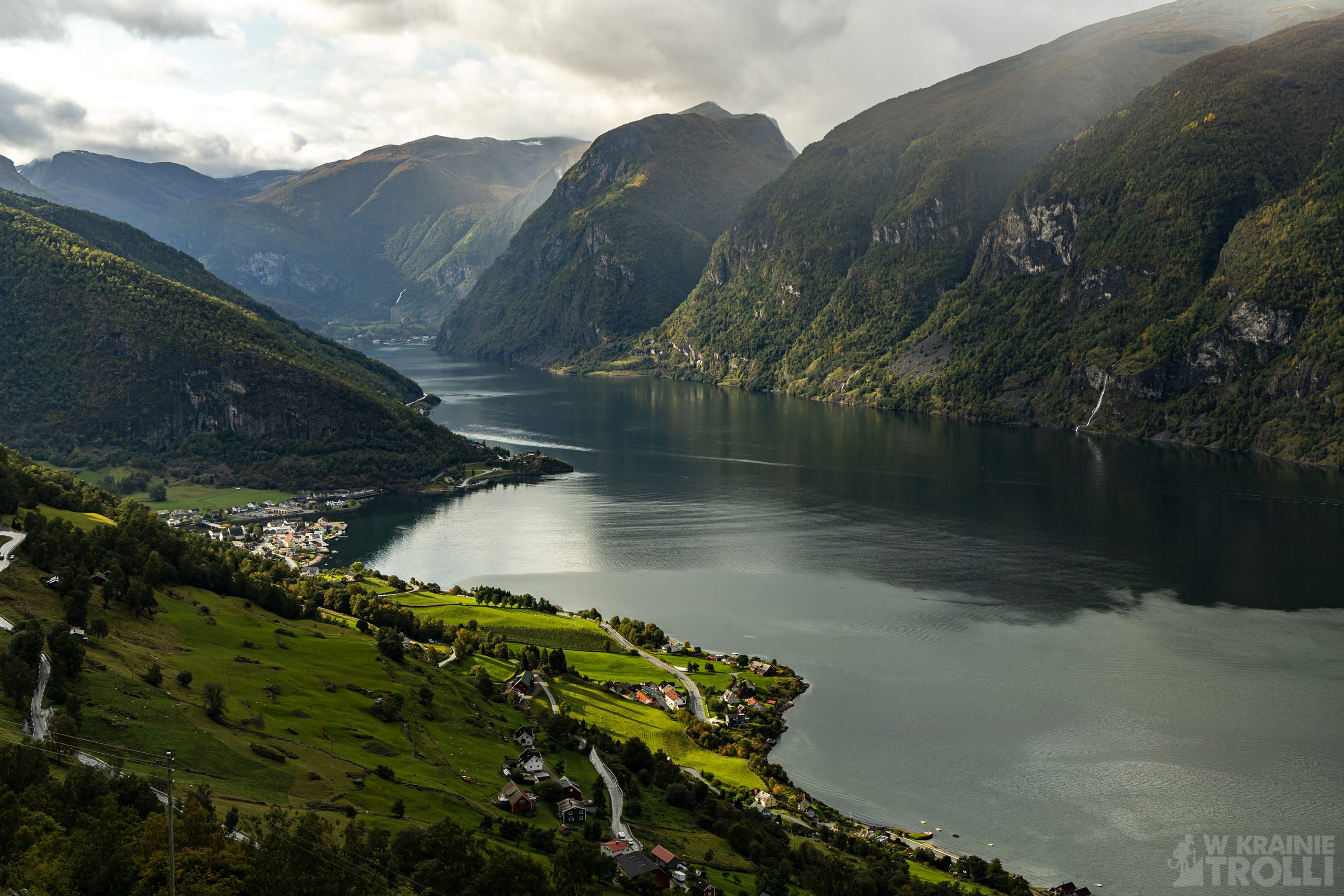
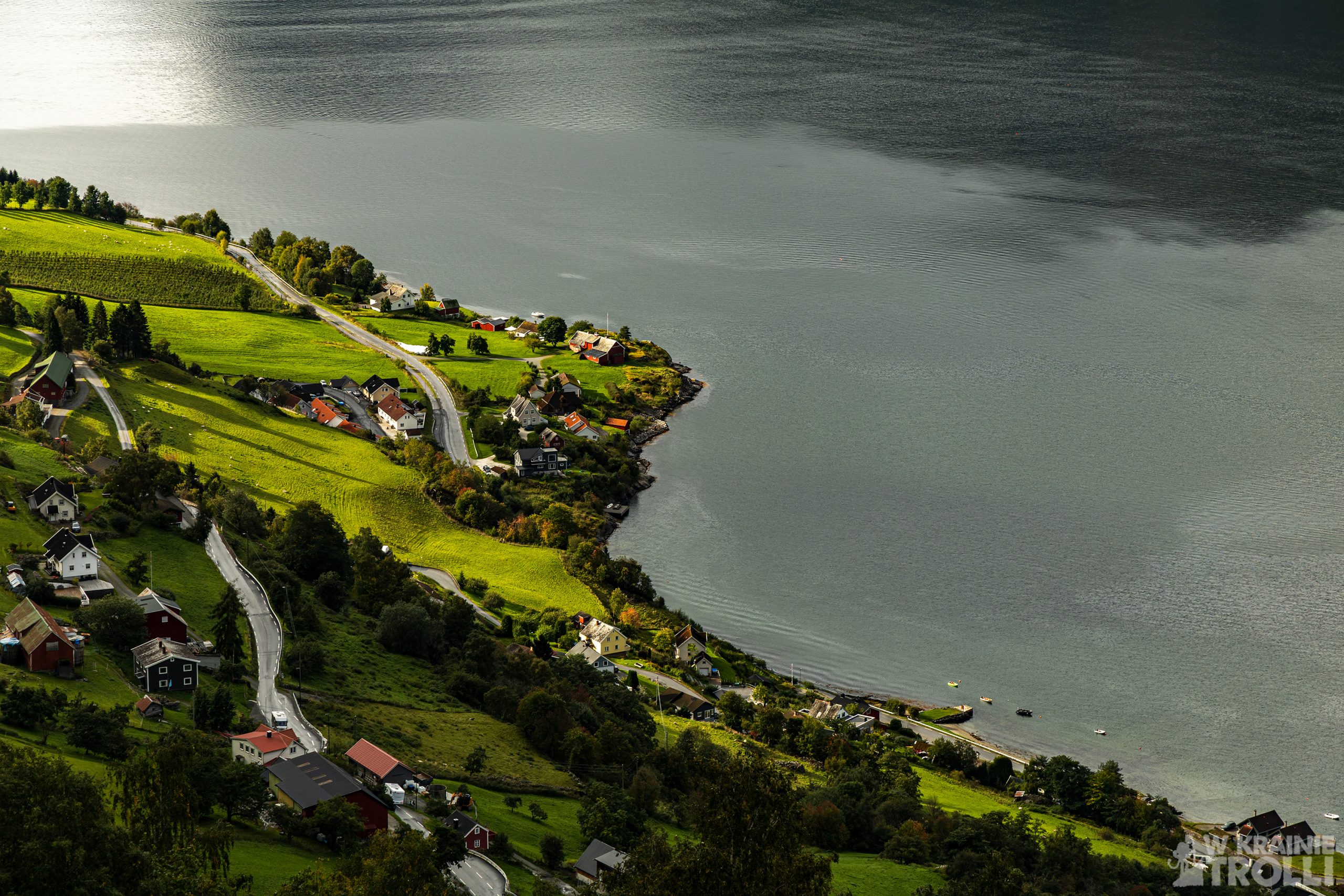
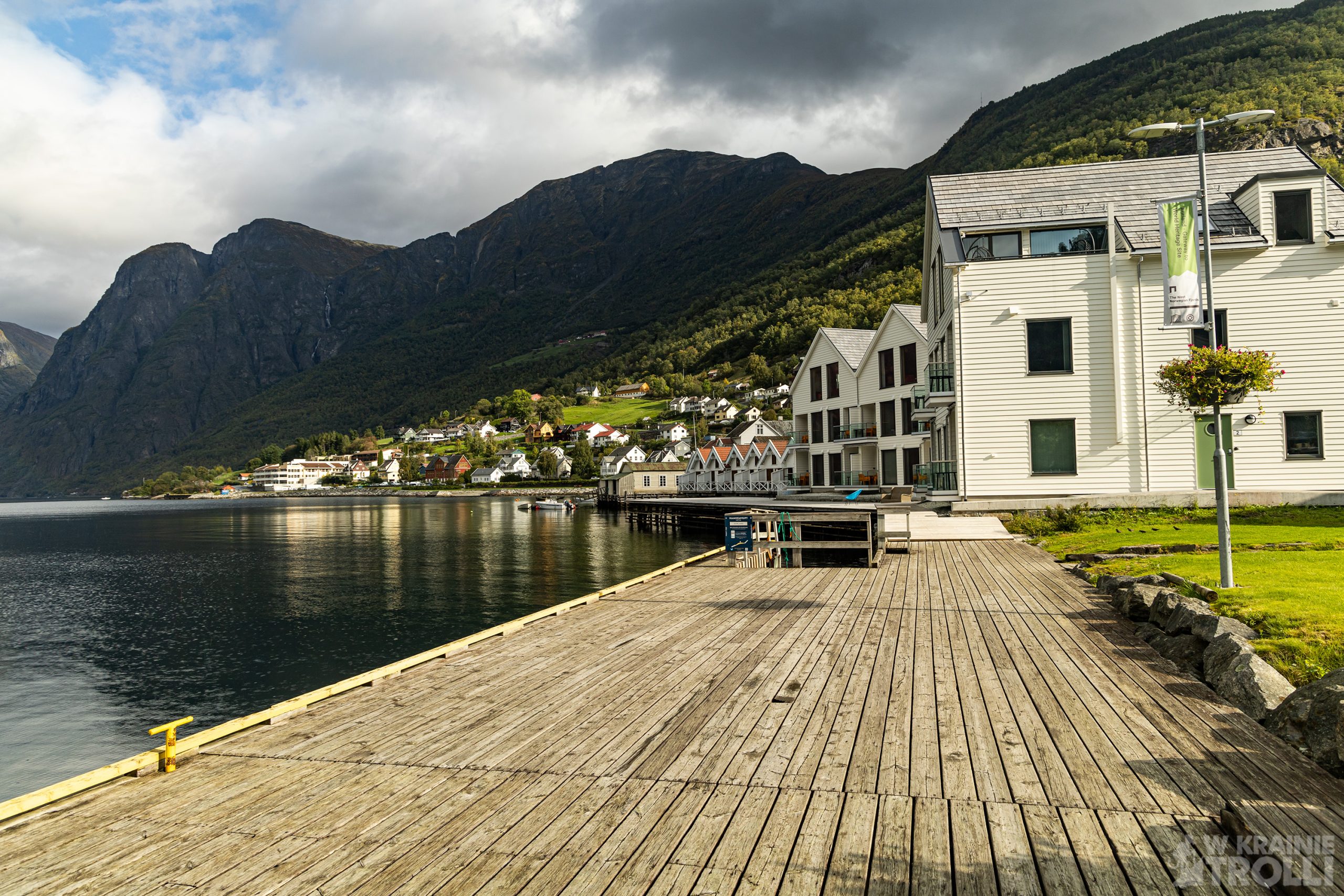
Dalsza trasa wiodła serpentynami w dół aż do miasteczka Aurlandsvangen. W samym centrum kolejny postój i obowiązkowa wizyta na nabrzeżu. Oprócz tego nie ma chyba zbyt wiele do zobaczenia Albo ja jeszcze nie odkryłem czegoś wartego uwagi. Chyba w przyszłości będę musiał zrobić sobie dłuższy spacer by przekonać się, czy miasteczko ma coś więcej do zaoferowania niż tylko platformę widokową nad fiordem.
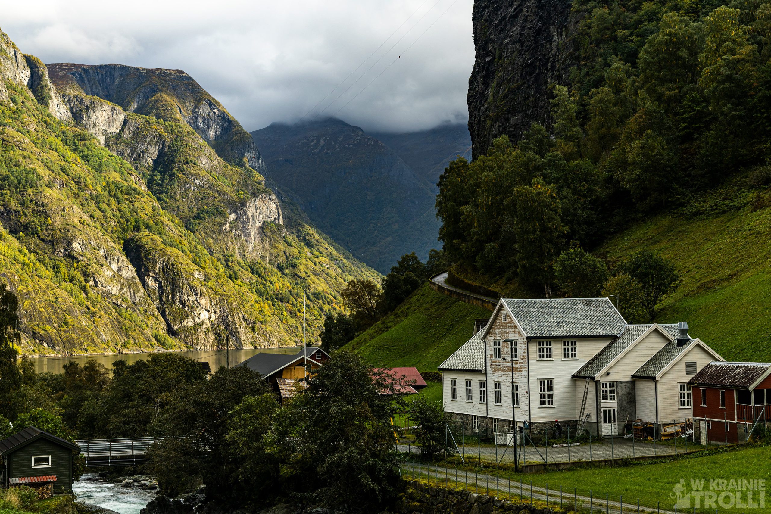
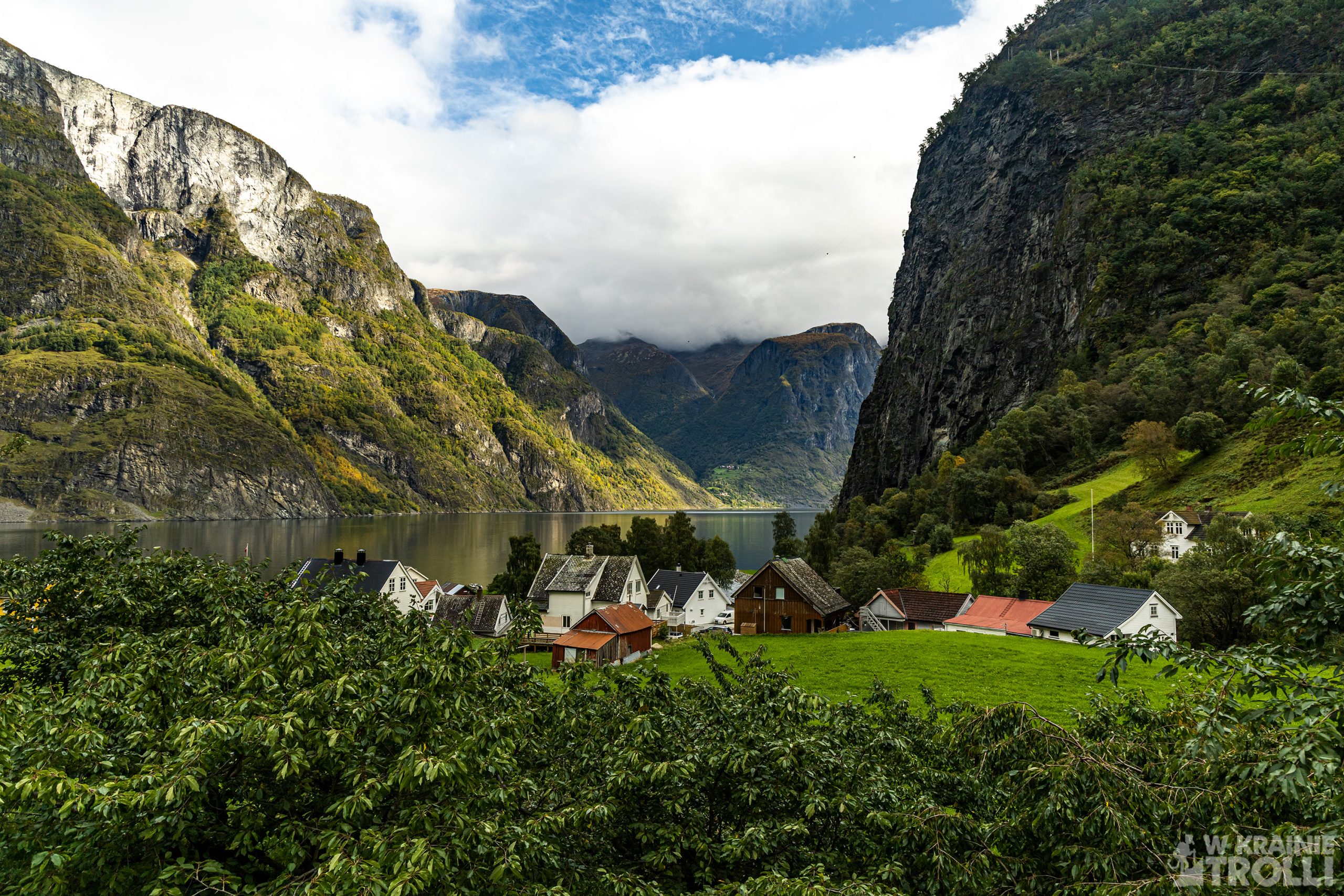
Kolejny postój wypadł w Undredal, miasteczku znanym z wyrobów brązowego koziego sera (geitost) oraz z lokalizacji jednego ze średniowiecznych kościołów słupowych (stavkirke). Podaje się, że populacja osady liczy 100 osób i … 500 kóz. Sera nie było mi dane spróbować, choć podobno ten przysmak wyrabiany jest w tradycyjny sposób. Kościół natomiast nie przypomina tych spotykanych w Bogrund, Urnes czy Heddal. Ma raczej bryłę zbliżoną do typowo norweskich drewnianych świątyń. To co urzeka w Undredal to wąskie uliczki wiodące pomiędzy uroczymi kolorowymi domkami oraz nabrzeże i widok jaki rozciąga się z drewnianego pomostu. Po prostu bajka.
Wikipedia podaje, że aż do roku 1988 nie prowadziła do Undredal żadna droga dojazdowa, a jedyna komunikacja z osadą była prowadzona drogą morską. Ciekawe, zważywszy że miejsce to znane jest ze swoich tradycji w wyrabianiu sera od dziesiątków lat (a może i dłużej).
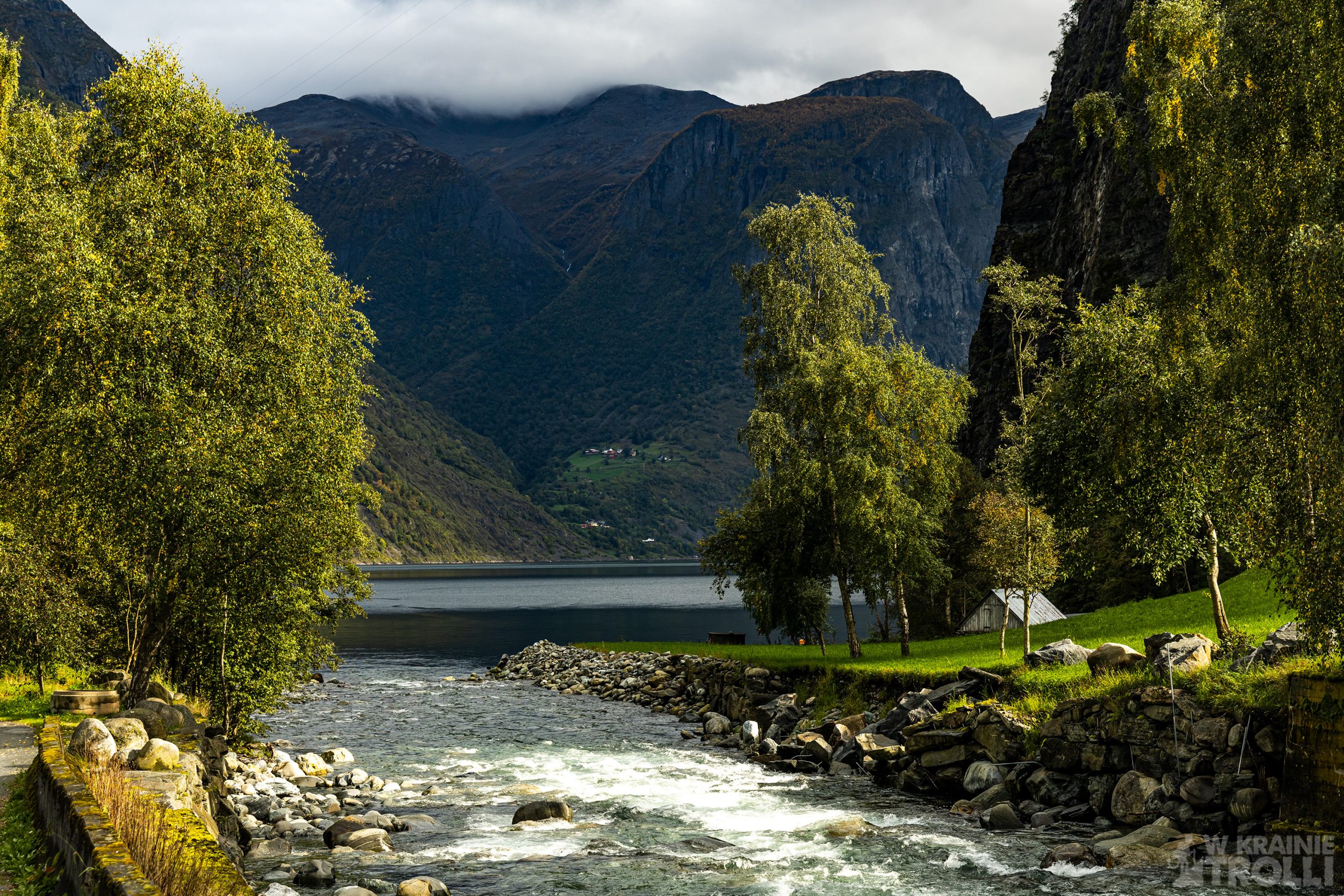
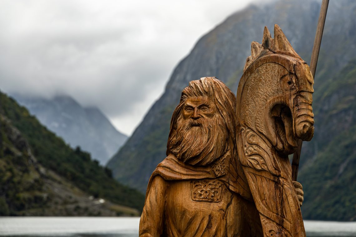
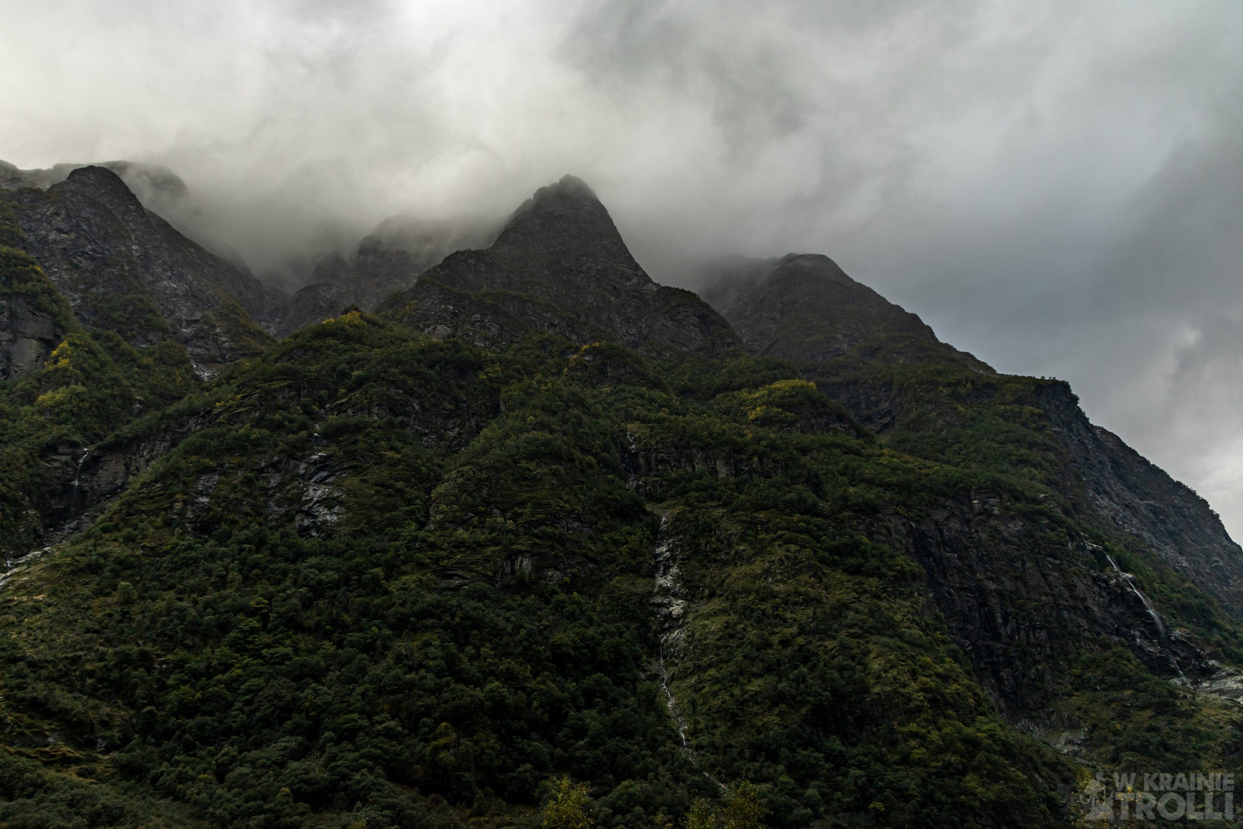
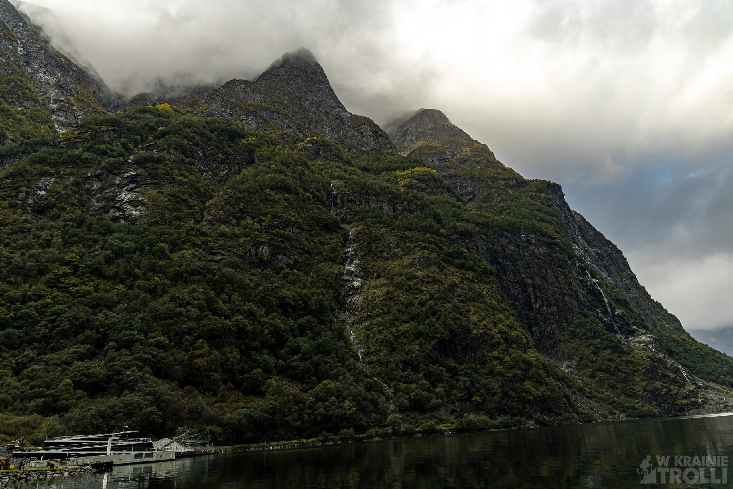
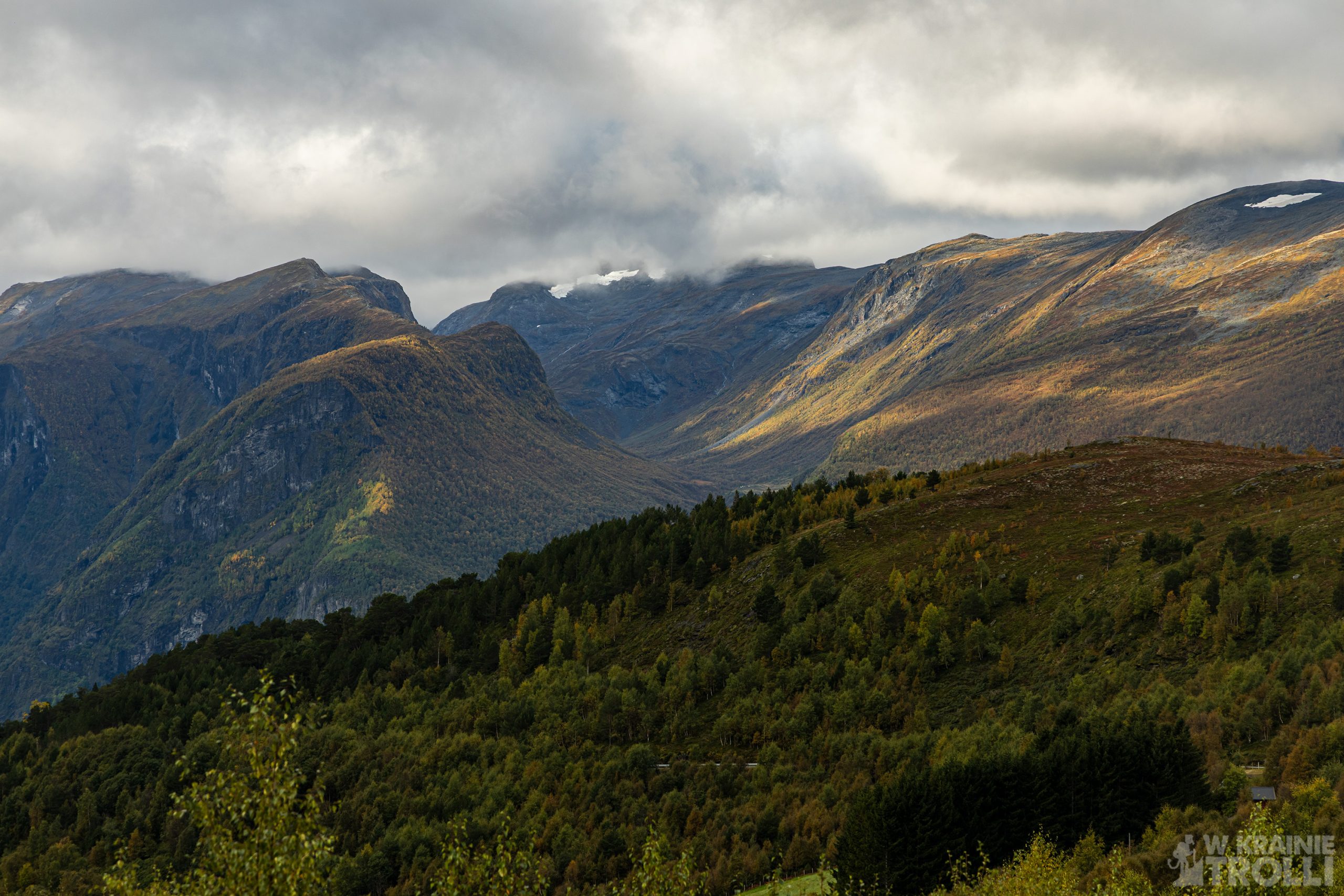
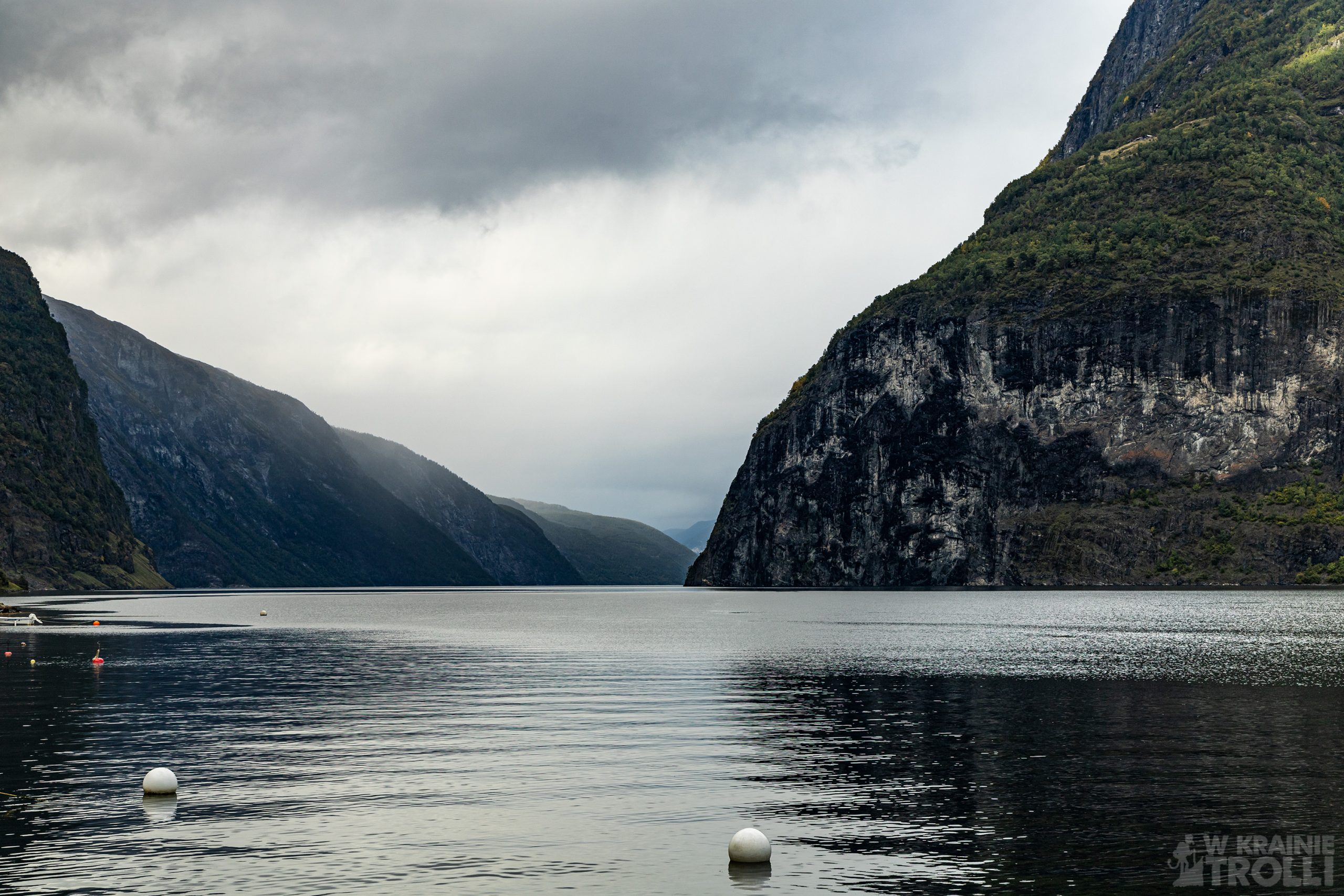
Gudvengen to niewielka wioska na samym końcu Nærøyfjordu. To popularna wśród turystów miejscówka może poszczycić się położonym nad fiordem hotelem, kilkoma kempingami w okolicy, wioską wikingów czy wypożyczalnią kajaków. Pomiędzy Gudvengen a Flåm kilka razy dziennie kursują napędzane elektrycznymi silnikami łodzie turystyczne. W rejonie Gudvengen znajduje się także kilka ciekawych szlaków turystycznych, z czego na szczególną uwagę zasługują te prowadzące na Bakkanosi i Breiskrednosi (innych nie miałem okazji jak dotąd poznać), skąd podziwiać można jeden z najpiękniejszych fiordów w całej Norwegii, Nærøyfjord. Fiord wraz przyległą okolicą jest od 2005 roku wpisany na listę dziedzictwa kulturowego UNESCO.


Ostatni etap wycieczki to Flåm, kolejne turystyczne miasteczko, miejsce skąd odchodzi słynna na całą Norwegię linia kolejowa Flåmbana, biegnąca do Myrdal, oraz z szeregiem połączeń wodnych. Do Flåm często zawijają potężne liniowce pasażerskie, a z zakotwiczonych na fiordzie statków pasażerowie dowożeni są na ląd mniejszymi łódkami. Latem miejsce to tętni życiem, a nabrzeże, stanowiące centrum turystyczne przeżywa prawdziwe oblężenie przyjezdnych. W tym punkcie wycieczka dobiegła właściwie końca. Pozostał powrót, tym razem krótszą trasą, przez Lærdalstunellen. Żeby jeszcze bardziej urozmaicić sobie dzień, postanowiłem obejrzeć zachód słońca nad fiordem tuż za Lærdalsøyri. Niestety zdaje się, że miejsce nie do końca nadaje się na tego typu atrakcje, jako że poza słabą, bladą poświatą niewiele było widać. Przeszkodziły po części chmury, a głównie chyba przesłaniające słońce masywne góry. Mimo wszystko należy uznać ten dzień za udany i pełen wrażeń. Nawet pomimo faktu, że wszystkie odwiedzone miejsca widziałem po raz któryś z kolei. Ale jak już wspomniałem, takich widoków nigdy za wiele 😊
There are places to which we eagerly return and which captivate us with each subsequent visit. Recently I wrote about two trails in the Haukeli Mountains, the Rjukandefossen waterfall in Hemsedalen and parts of the King’s Road near Borgund with the stave church from the 12th century. While in the latter area, I also went on a tour around a slightly further area. The route included driving along the Snøvegen (Snow Road) and visiting the surrounding towns: Aurlandsvangen, Flåm, Undredal and Gudvangen. This is a record of that September trip.
The snow road is a route connecting Lærdalsøyri with Aurlandsvangen. It is 48.6 km long and runs in mountainous, raw terrain. It happens that even in the middle of summer there are thick layers of snow on the roadside, hence the common name of this section. This road is closed in winter and traffic between both towns (as well as between eastern and western Norway) is redirected to the Lærdalstunellen tunnel on the E16 road, which is open all year round. It is, by the way, the longest road tunnel in the world, measuring as much as 24 km. There are three small bays inside, for those who are tired of the monotonous road in the dark (the tunnel is illuminated, of course).
Snøvegen is one of several (18 to be exact) routes that particularly highlight the scenic values of Norway. The so-called Nasjonal Turistveg, or Scenic Route in English, should arouse the attention of every adventurous visitor traveling through the country of fjords. These are extremely picturesque routes, often running through beautiful, untouched areas. That’s what we have here too. In fact, the only signs of human presence are an asphalt road and a power line. There are several parking spaces along the route that are worth stopping at. These are, counting from Lærdalsøyri: Sluppen, Vedahaugane, Flotane and Stegastein.
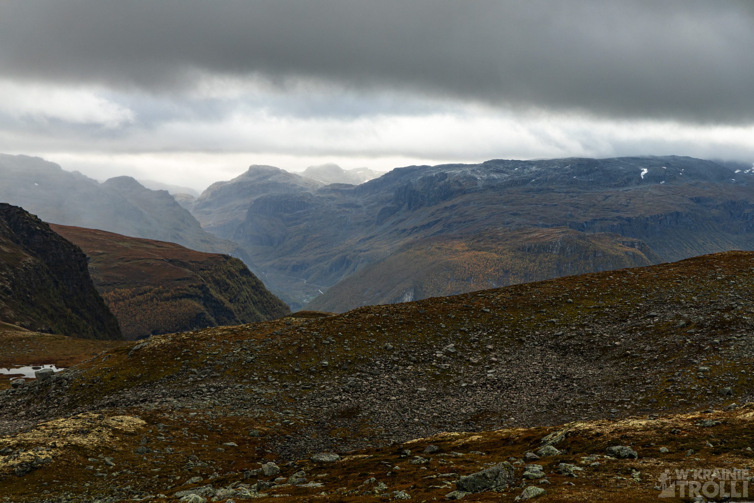
The latter is another point that I have visited in the past and a must-see on every trip to this area. The wooden viewing platform protruding 30 meters from the mountainside, with a characteristic panoramic view of the Aurlandsfjord, impresses me every time and I will probably never tire of returning to this place. Usually the parking lot at the platform is packed to capacity. Even this time, in the second half of September, with windy weather and light showers throughout the day, there was quite a lot of traffic here. Those who need to use the may admire the views through the glass wall inside. The panorama of the fjord and the surrounding mountains from this place, about 650 m above sea level, is a feast for the eyes, regardless of the weather.
The further route led down serpentines to the town of Aurlandsvangen. In the very center, another stop and a mandatory visit to the quay. Apart from that, there doesn’t seem to be much to see. Or maybe I haven’t discovered anything worth seeing yet. I guess in the future I will have to take a longer walk to see if the town has something more to offer than just a viewing platform over the fjord.
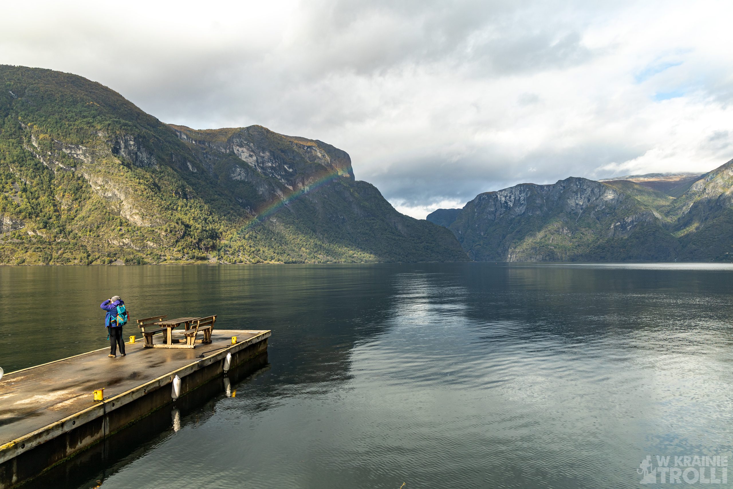
The next stop was in Undredal, a village known for its brown goat cheese (geitost) and the location of one of the medieval stave churches (stavekirke). They say that the population of the settlement is 100 people and … 500 goats. I haven’t had a chance to try the cheese, although apparently this delicacy is made in a traditional way. The church, however, is not the type of buildings found in Bogrund, Urnes or Heddal. Rather, its shape is similar to the other wooden temples typically found in Norwegian villages. What is captivating in Undredal are the narrow streets leading between charming colorful houses, the quay and the view from the wooden pier. Just like from fairy tale.
Wikipedia says that until 1988, there was no access road to Undredal, and the only communication with the settlement was by sea. Interesting, considering that this place has been known for its cheese-making traditions for decades (or maybe even longer).
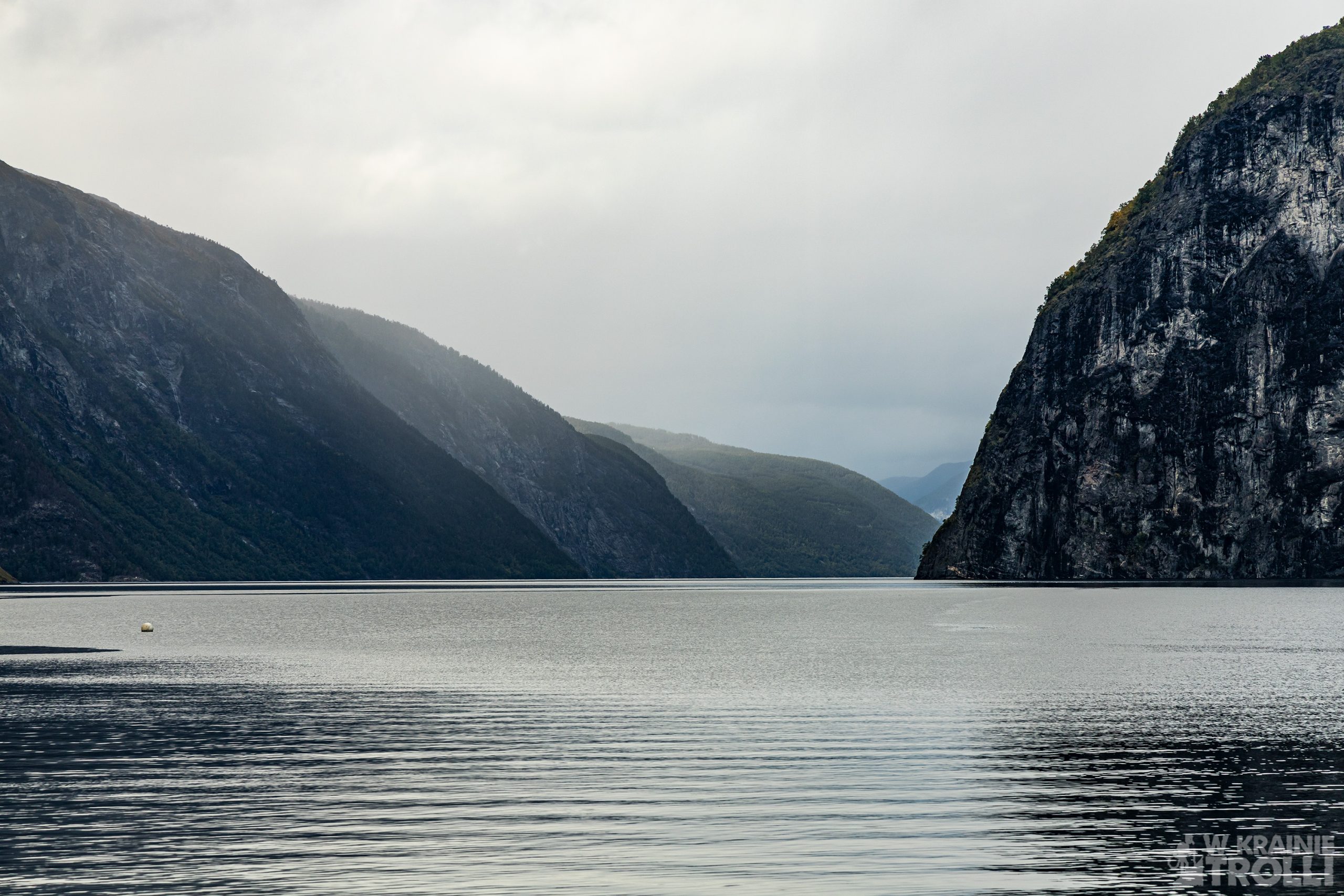

Gudvengen is a small village at the very end of the Nærøyfjord. This popular tourist spot offers a hotel located on the fjord shore, several campsites in the area, a viking village and kayak rentals. Electric tourist boats run between Gudvengen and Flåm several times a day. There are also few interesting hiking trails in the area, of which the ones leading to Bakkanosi and Breiskrednosi (I haven’t had the opportunity to explore the others so far) deserve special attention, from where you can admire one of the most beautiful fjords in all of Norway, Nærøyfjord. The fjord and the surrounding area have been included on the UNESCO cultural heritage list since 2005.

The last stage of the trip is Flåm, another tourist town, the place where the Flåmbana railway line, famous throughout Norway, runs to Myrdal and has a number of water connections. Huge passenger liners often show up at Flåm, and passengers are transported to land by smaller boats from the ships anchored in the fjord. In the summer, this place is teeming with life, and the pier, which is a tourist center, is really crowded with visitors.
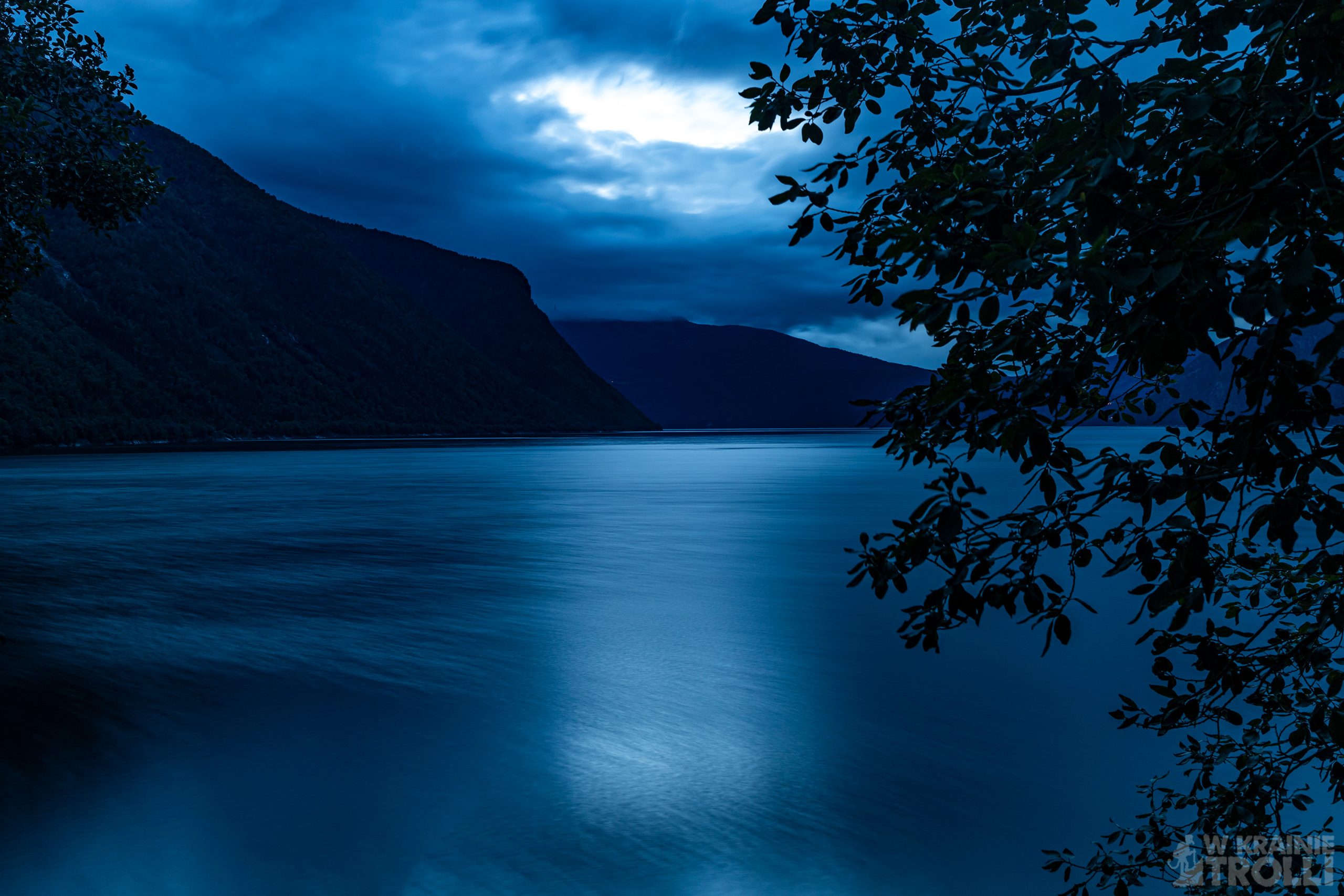
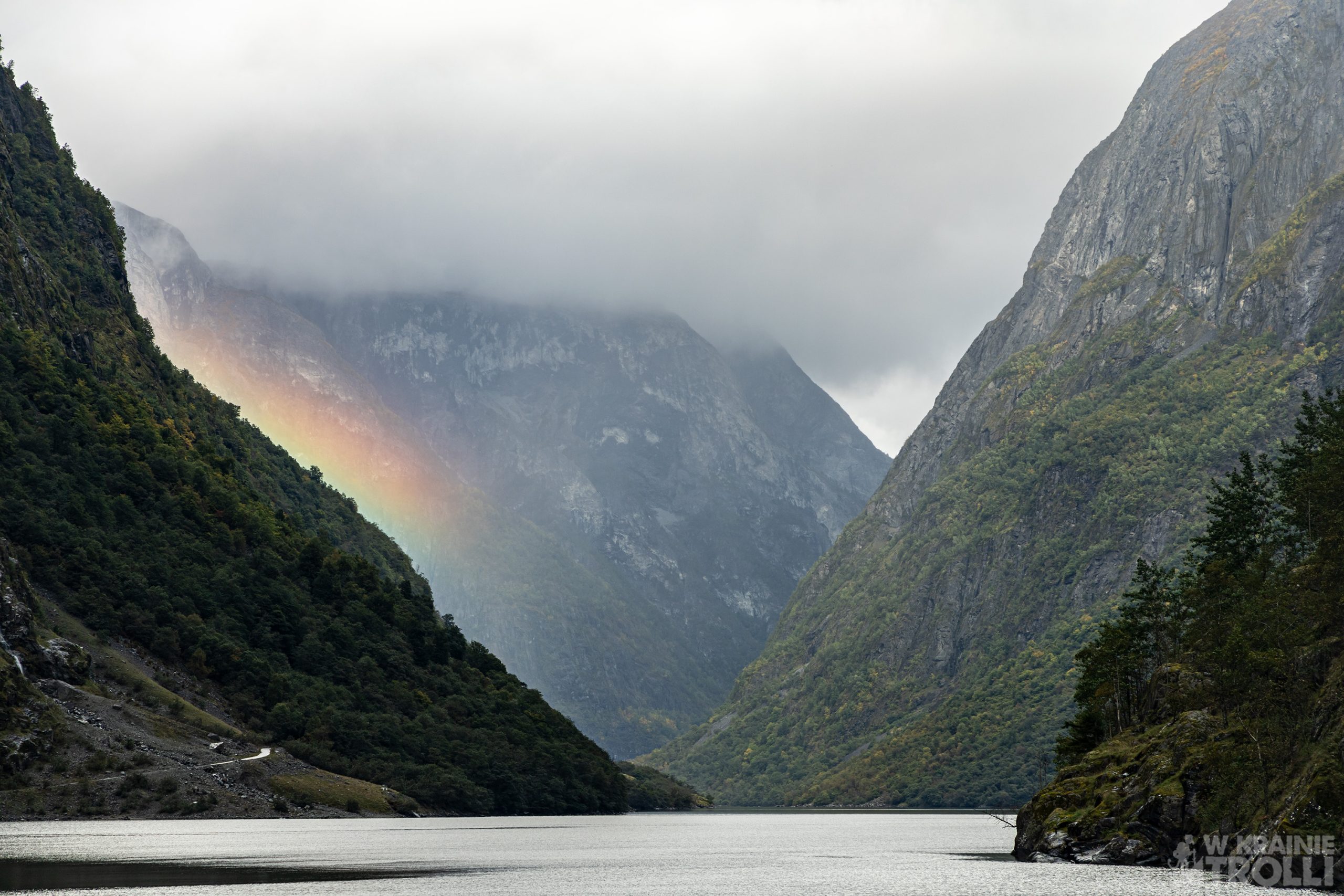
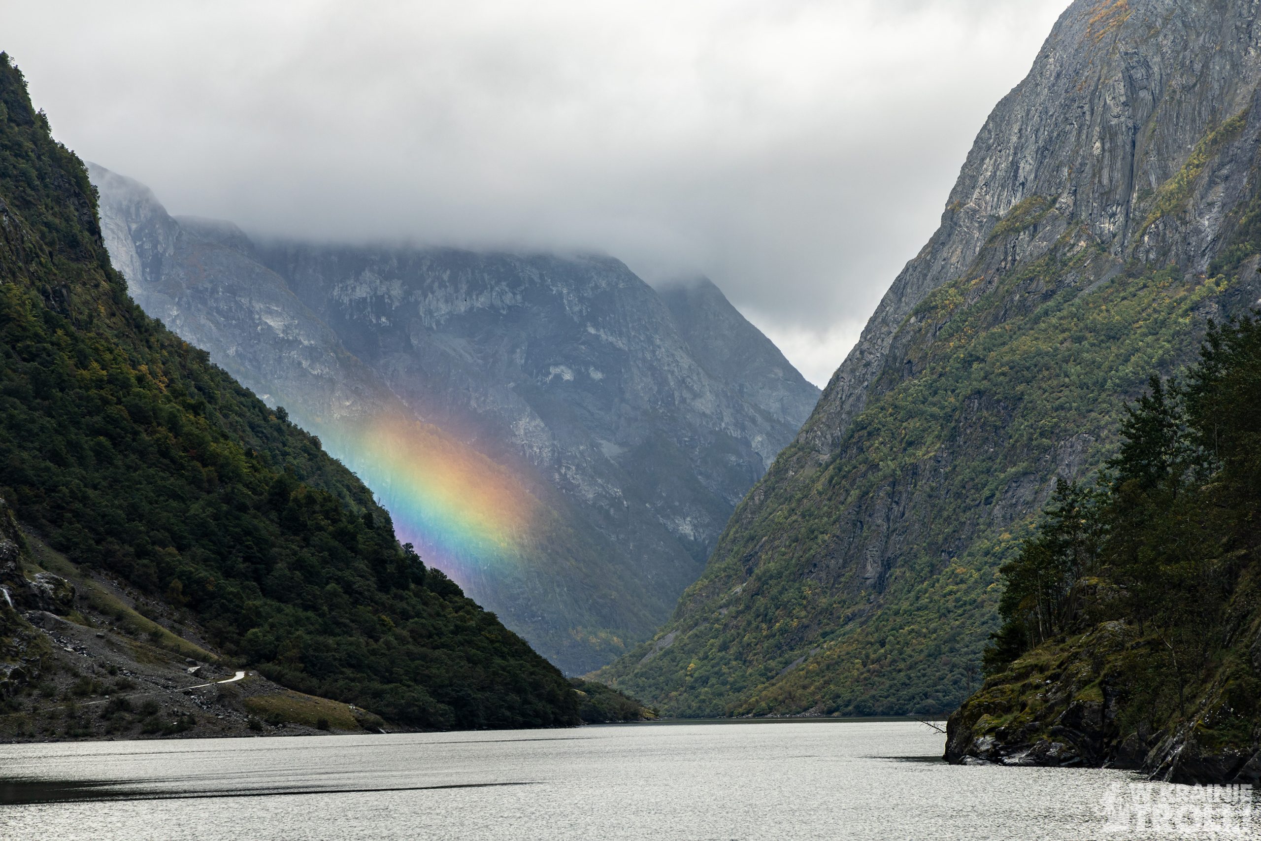
At this point the trip was basically over. The only thing left to do was to return, this time via a shorter route, through Lærdalstunellen. To make my day even more interesting, I decided to watch the sunset over the fjord just outside Lærdalsøyri. Unfortunately, it seems that the place is not quite suitable for this type of attractions, as there was little visible apart from the faint, pale glow. This was partly hindered by clouds, and mainly by massive mountains blocking the view of sun. Despite everything, this day should be considered successful and full of positive feelings. Even despite the fact that I have seen all of these the places already in the past. But as I mentioned, you can never have enough views like this😊


Jeden komentarz
Lidia Ogrodowczyk
Przepięknie, tylko wikingów brak.