Hellandsnuten
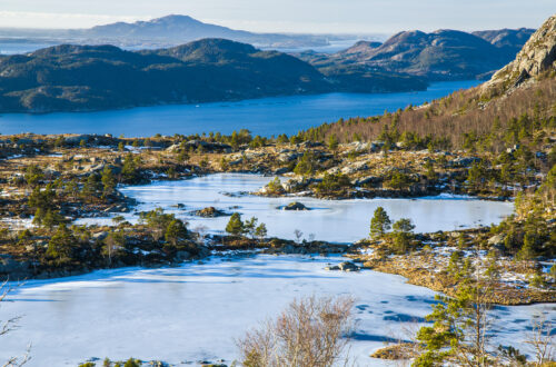
Szczyt Hellandsnuten (747m n.p.m.) znajduje się tuż przy miejscowości Sand w rejonie Suldal. Na górę prowadzi przyzwoicie poprowadzony szlak liczący jakieś 3,5 km, ale trasa na górę jest sklasyfikowana jako wymagająca lub bardzo wymagająca. Mając w zanadrzu wolny dzień, postanowiłem sprawdzić co ze szczytu widać, a będąc już na miejscu, podreptać dodatkowo na sąsiednią górkę, Månastølsnuten (806m n.p.m.).
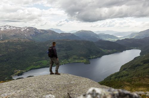
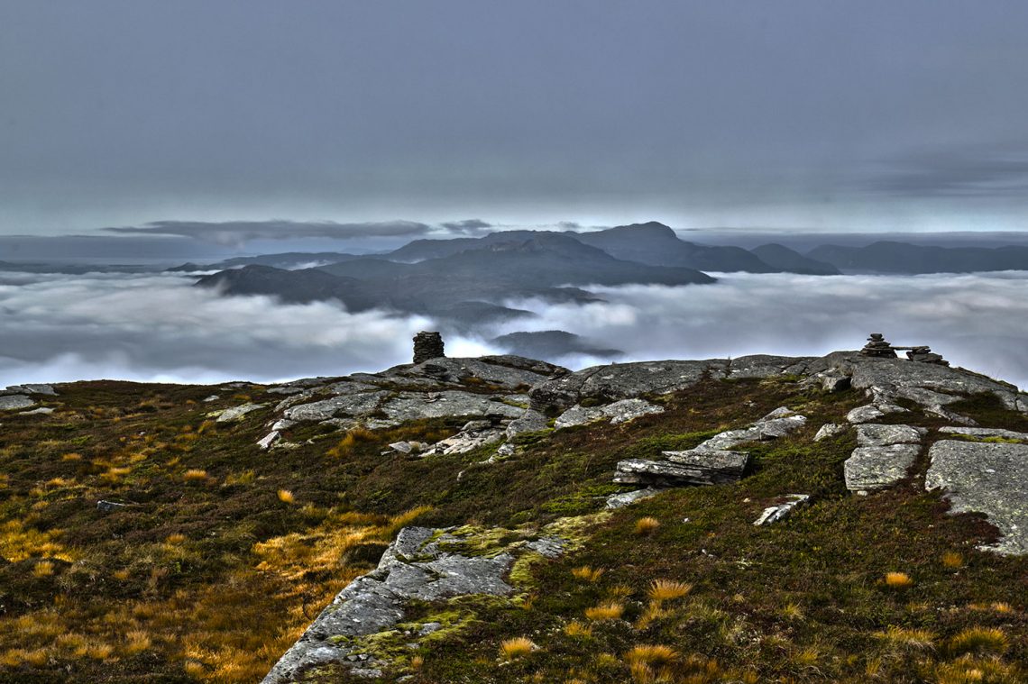
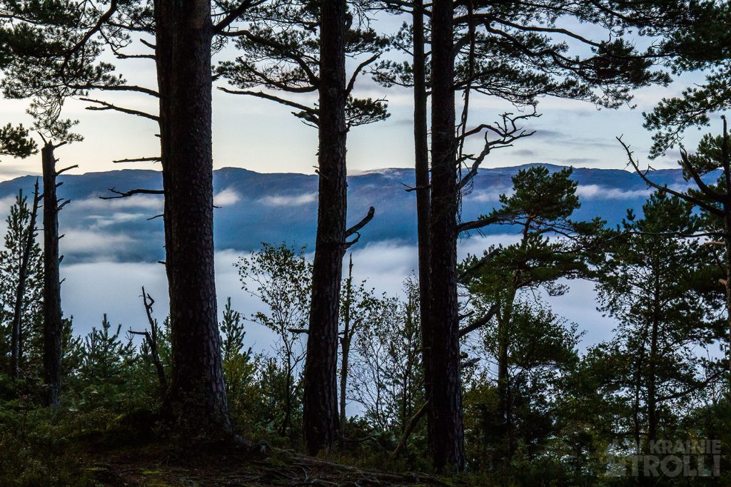
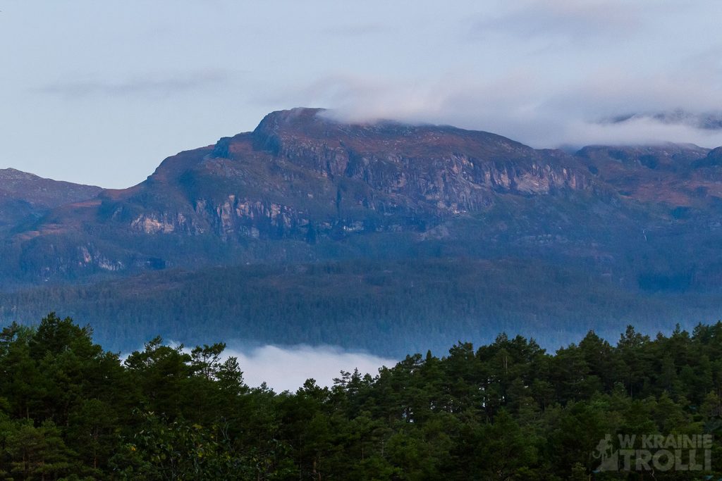
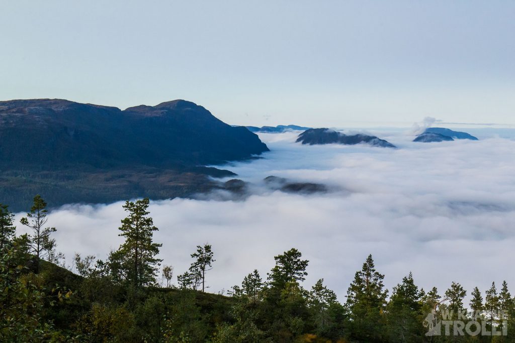
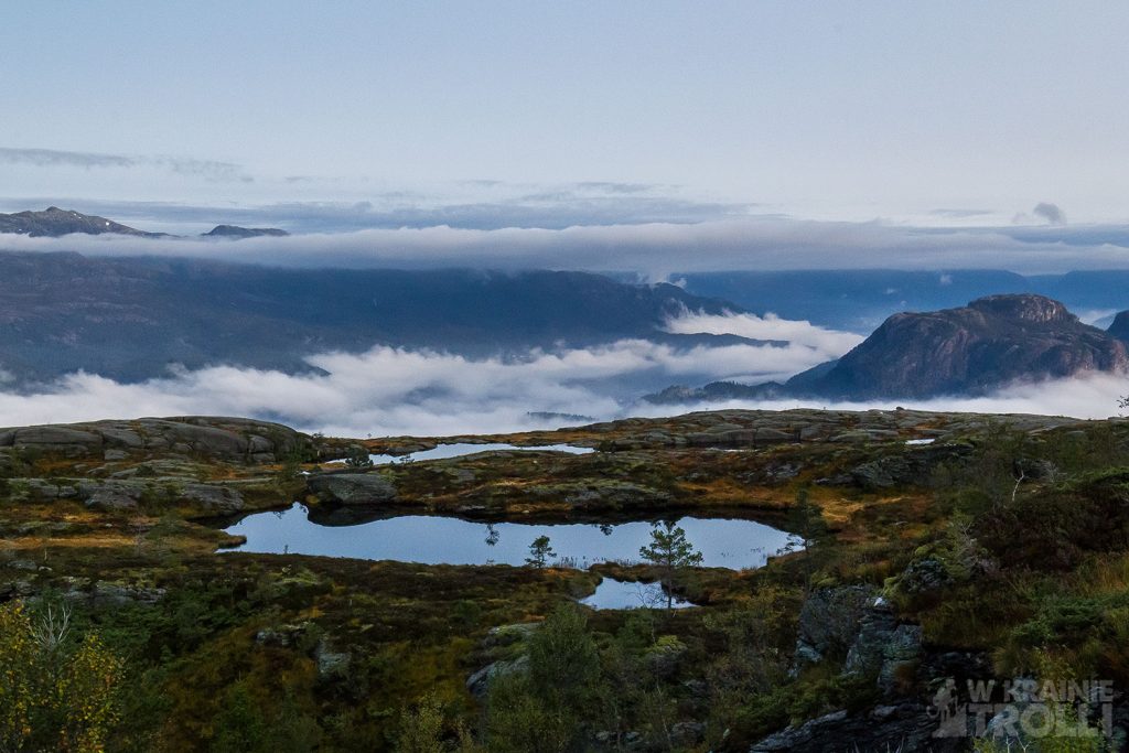
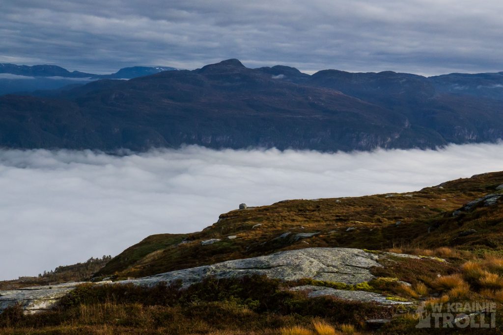
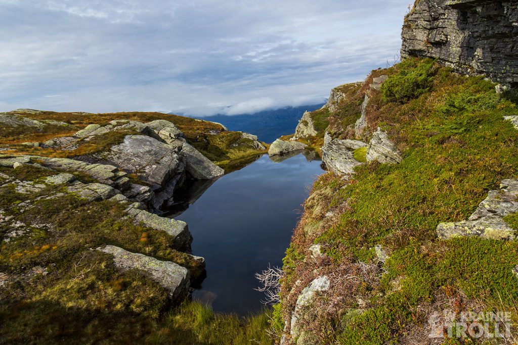
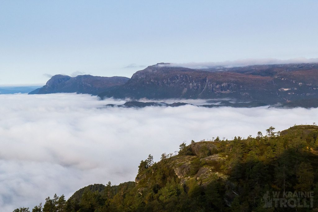
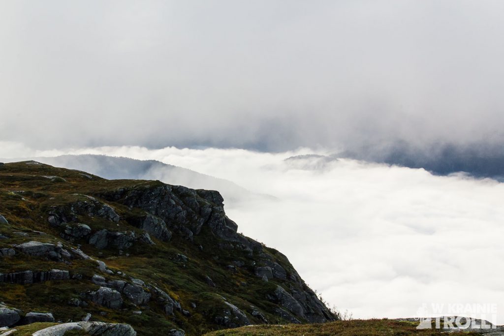
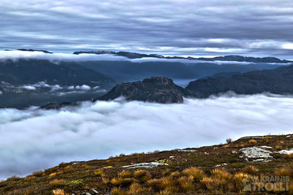
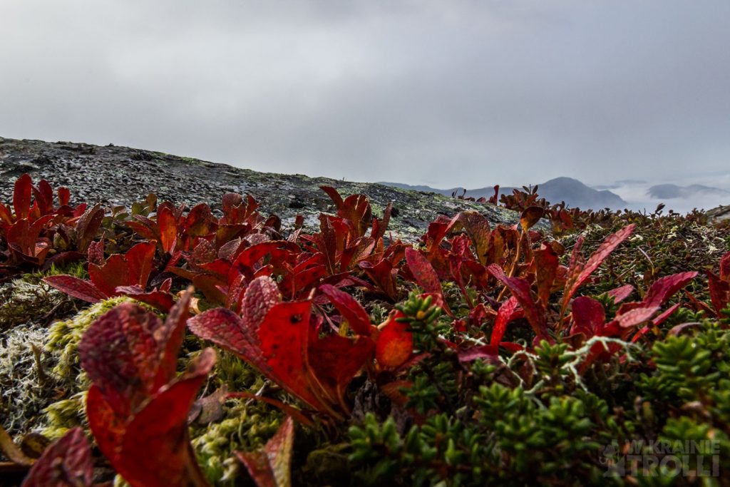
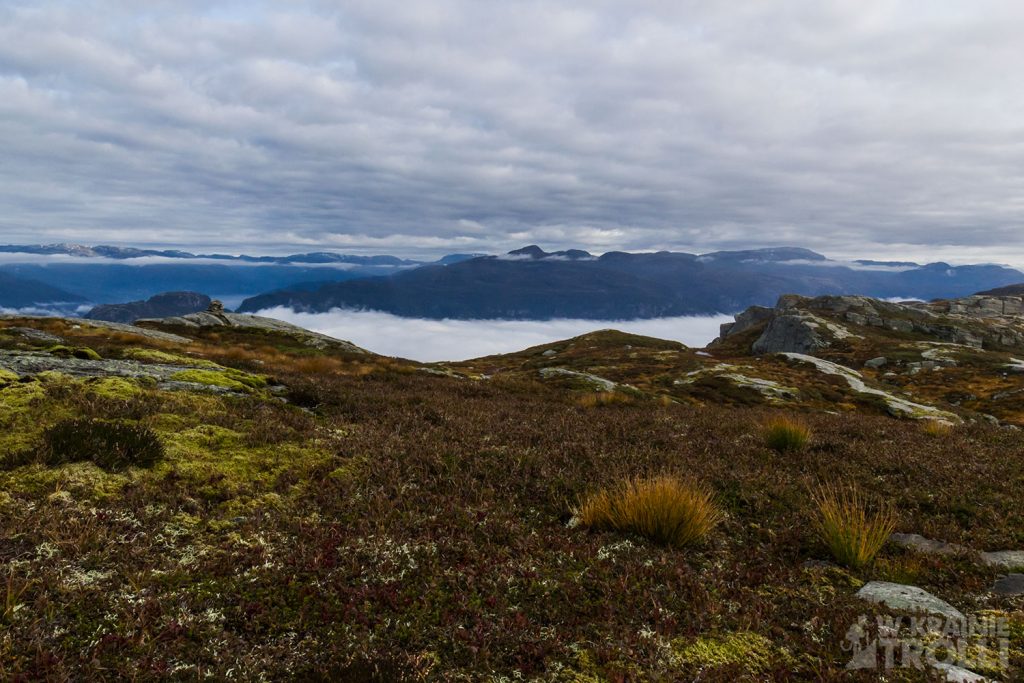
Wyruszyłem z samego rana. Na zewnątrz było jeszcze ciemno, jednak gdy zjawiłem się na niedużym parkingu koło przedszkola Joagarden w Eide (osiedle w Sand), było już widno i śmiało mogłem ruszać na szlak. Ścieżka biegła przez las. I właściwie na tym mógłbym zakończyć opis trasy, bo drzewa skończyły się właściwie tuż pod samym szczytem. Nie na darmo szlak opisano jako trudny. Szło mi się ciężko, mozolnie, i tylko w paru miejscach, w prześwicie między drzewami, mogłem pocieszyć się jakimś widokiem. Gdy jednak wyszedłem ponad linię drzew, moim oczom ukazał się widok, który rekompensował wszystkie moje trudy. Nisko zawieszone chmury przelewały się jak morze poniżej, przesłaniając wody fiordu i niższe partie gór. Wybierając się na tę wędrówkę spodziewałem się ujrzeć wspaniały widok na skrzyżowaniu trzech fiordów: Saudafjordu, Sandsfjordu i Hyldsfjordu. W oddali zapewne mógłbym dojrzeć i czwarty, Vindafjord i całe spektrum okolicznych gór. Zamiast tego otrzymałem równie imponujący spektakl przepływających z wiatrem chmur poniżej.
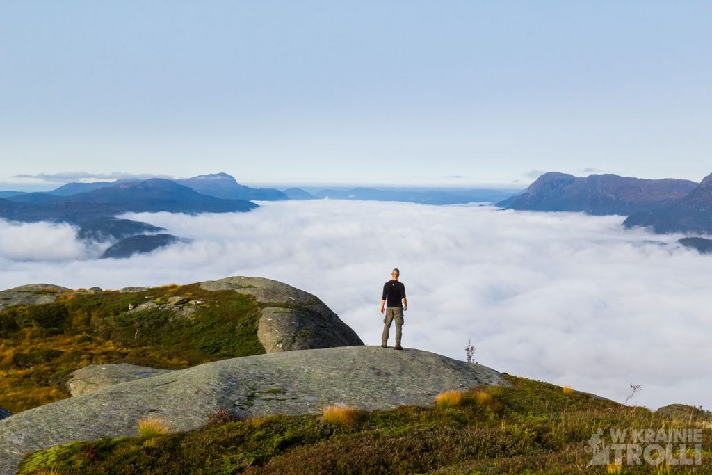
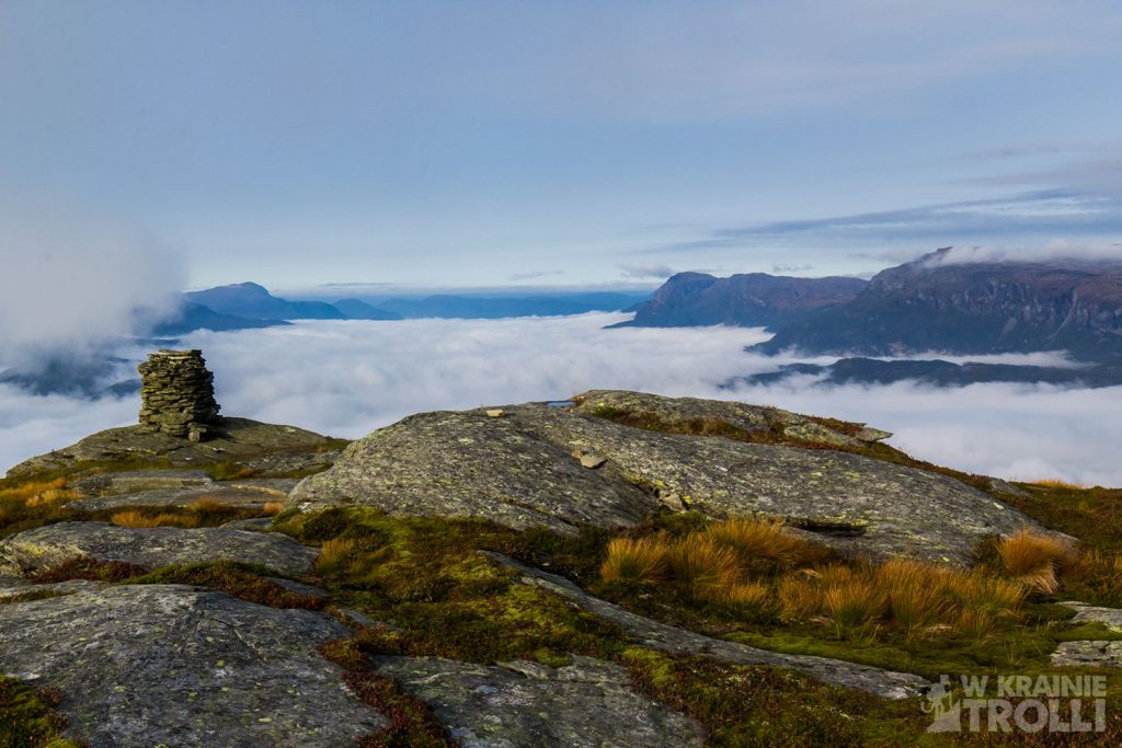
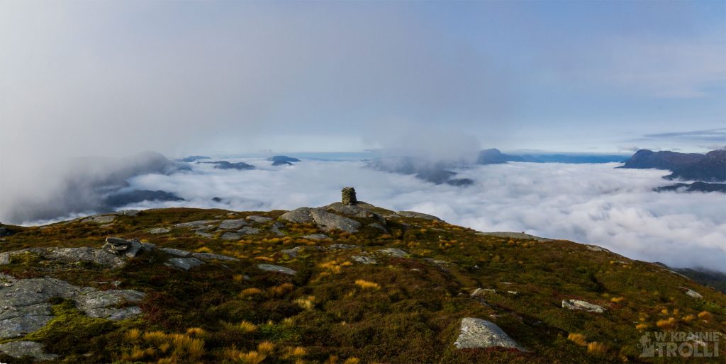
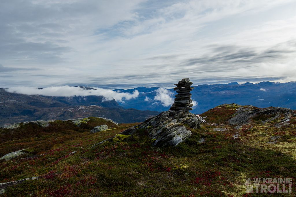
Kilka (lub kilkanaście) minut zabrało mi pokonanie ostatniego odcinka dzielącego mnie od wierzchołka. Tradycyjnie wpisałem się do zeszytu umieszczonego w skrzynce przy kamiennej konstrukcji i zabrałem się za robienie zdjęć. Wędrówka pod górę zmęczyła mnie na tyle, że zastanawiałem się czy nie odpuścić sobie marszu na kolejny szczyt. Tym bardziej, że wg mapy nie istniała żadna oficjalna trasa prowadząca w tamtym kierunku. W dodatku idąc na Månastølsnuten oddalałbym się od punktu startowego, więc w perspektywie powrót do auta byłby dość długi.
Już wcześniej zdecydowałem, że będę schodził inną trasą, nieco dłuższą ale mniej stromą. To od niej powinienem odbić, kierując się na Månastølsnuten. Teraz, mając tę górkę w zasięgu wzroku uznałem, że w zasadzie nie wydaje się ona zbyt daleko i mógłbym jednak się na nią wybrać. Tak też zrobiłem. Jeszcze będąc na szlaku, zorientowałem się, że droga w dół nie będzie łatwa. Zabłocona ścieżka i przedzieranie się przez mokre zarośla były przedsmakiem tego, co czeka mnie gdy tylko zejdę ze szlaku. Ale że rzadko porzucam raz powziętą decyzję, uparcie maszerowałem naprzód. Oszacowałem w którym miejscu najlepiej zejść ze ścieżki i jak poprowadzić dalszą marszrutę.
Było mokro, a brak ścieżki sprawiał, że parę razy musiałem zmieniać kierunek marszu, gdy okazywało się, że góra, którą brałem za Månastølsnuten, wcale nią nie jest. Pomocą w określaniu prawidłowego kierunku okazała się apka ut.no z aktywnym śledzeniem mojego położenia na mapie. Nie ma to jak nowoczesna technologia.

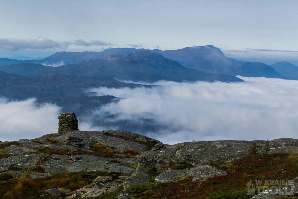
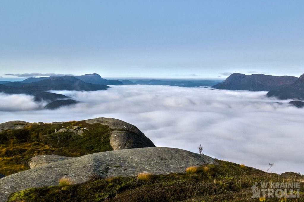
W końcu dotarłem na miejsce. Jak już parokrotnie się przekonywałem, tak i teraz musiałem przyznać, że brak oznaczonego szlaku prowadzącego na zdawałoby się atrakcyjną górę nie jest przypadkowy. Ze szczytu Månastølsnuten nie ujrzałem nic ponadto, co widziałem wcześniej z Hellandsnuten. Widok z poprzedniego szczytu wydawał się nawet ciekawszy. Chmurzyska poniżej wciąż się utrzymywały, choć były już jakby rzadsze. Spędziłem chwilę dokumentując tę wiekopomną chwilę i ruszyłem z powrotem.
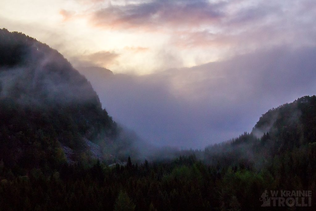
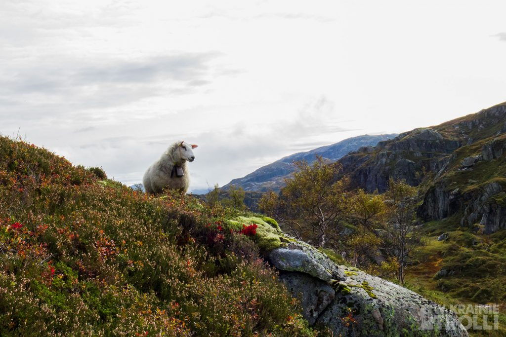
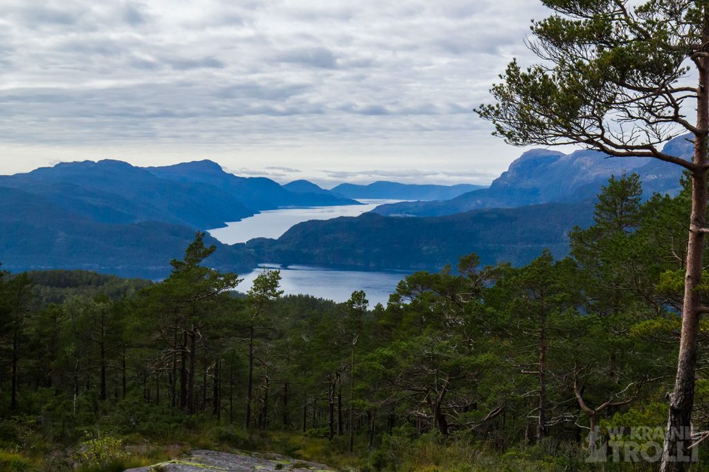
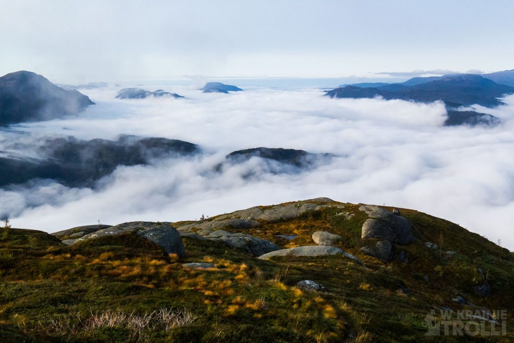
Zanim dotarłem do ścieżki, natknąłem się na grupkę owiec, które uciekły spłoszone moim widokiem. Potem znów zabłądziłem ze dwa razy nim odnalazłem szlak, a gdy już udało mi się do niego dojść, reszta drogi wydawała się prosta. Ale oczywiście nie była, bo zmęczenie dawało już o sobie znać, i wkrótce otrzymałem wyraźne sygnały od moich kolan, że i im już się dłuży wędrówka i zaczynają zgłaszać swoje pretensje. Plusem był fakt, że chmury już się rozstępowały i w rzadkich chwilach pomiędzy drzewami dostrzegałem wody fiordów daleko przede mną.
Jakoś udało mi się dotrzeć z powrotem do miejsca, gdzie zostawiłem samochód. Z ulgą usadowiłem się na fotelu i ruszyłem w drogę powrotną do domu.

The Hellandsnuten mountain (747m above sea level) is located next to the town of Sand in the Suldal region. A decent marked trail is about 3.5 km long but the route to the top is classified as demanding or very demanding. Having a free day, I decided to check what could I see from the summit, and while already there, I would additionally walk to the neighboring peak, Månastølsnuten (806m above sea level).
I left home early in the morning. It was still dark outside, but when I ended in a small parking lot near the Joagarden kindergarten in Eide (housing estate in Sand), it was already light and I could go straight on the trail. The path runs through the forest. And actually, this is where I could finish the route description, because the trees ended just below the top. It is not for nothing that the trail is described as difficult. The walk was hard, arduous, and only in a few places, in the gap between the trees, I was granted by some nice views. However, when I stepped above the tree line, I saw a sight that compensated all my hardships. Low-slung clouds poured over like the sea below, obscuring the waters of the fjord and the lower parts of the mountains. Going on this hike, I was expecting to see a great view at the intersection of three fjords: Saudafjord, Sandsfjord and Hyldsfjord. In the distance, I could probably see the fourth, Vindafjord and the whole spectrum of the surrounding mountains. Instead, I got an equally impressive spectacle of the clouds below.

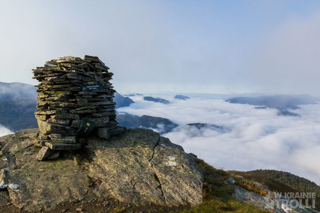
It took me a few (or a dozen) minutes to make the last stretch between me and the top. Traditionally, I recorded my name in a notebook placed in a box next to the stone structure and started taking photos. The hike uphill tired me so much that I wondered if I should not give up the walk to the next peak. According to the map there was no official route leading in that direction. In addition, going to Månastølsnuten, I would be far from the starting point, so returning to the car would be quite long.
I had already decided beforehand that I would go down by a different route, a bit longer but less steep. It is from that trail I should leave, heading for Månastølsnuten. Now, with this mount in sight, I decided that it does not really seem too far away and I could go on it. So I did it. While still on the trail, I realized that the way down will not be easy. The muddy path and wading through the wet brush were a foretaste of what awaits me as soon as I leave the trail. But as I seldom abandon a once-made decision, I kept walking stubbornly. I estimated the best places to leave the path and how to continue the route.
It was wet, and the lack of a path meant that I had to change the direction of the march several times, when it turned out that the mountain I took for Månastølsnuten was not one at all. The ut.no app with active tracking of my location on the map turned out to be helpful in determining the correct direction. There is nothing like modern technology.
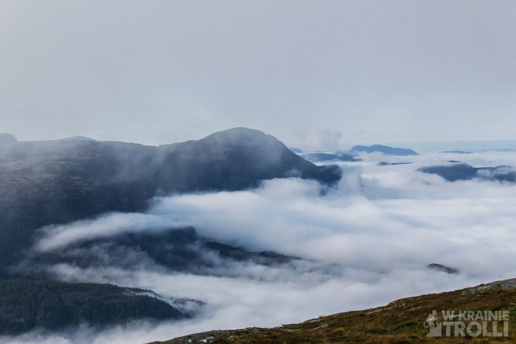
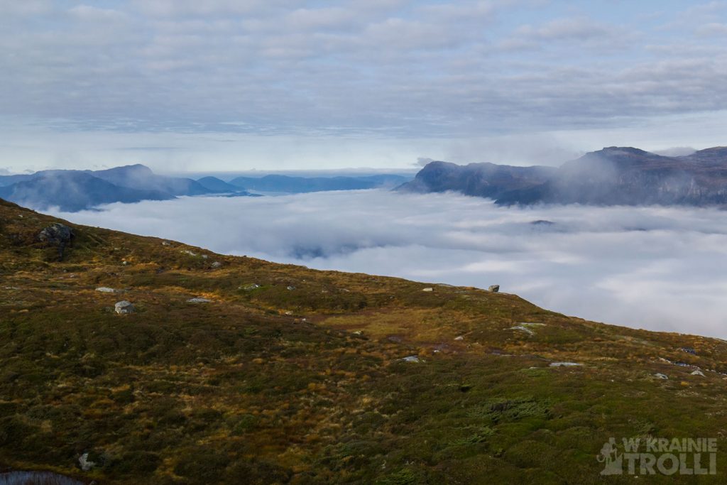
I finally got there. As I have already found out several times before, I had to admit now that the lack of a marked trail leading to a seemingly attractive mountain is not accidental. From the top of Månastølsnuten, I didn’t see anything else than what I had seen from Hellandsnuten. The view from the previous peak seemed even more interesting. The clouds below still be there, although they were less frequent. I spent a moment documenting this memorable moment and headed back.
Before I reached the path, I stumbled upon a group of sheep that had run away scared at my sight. Then I got lost, twice before finding the right trail, and once I managed to get to it, the rest of the way seemed easy. But of course it was not, because the fatigue was already making itself felt, and soon I received clear signals from my knees that they were already on a long journey and they were starting to express their grievances. The good thing was the fact that the clouds were already parting and in rare moments between the trees I saw the waters of the fjords far ahead of me.
Somehow I managed to get back to place where I left my car. I was relieved to sit behind the steering wheel and set off on my way home.