Romtveitnuten & Reinsgravnuten
Wejście na Store Nup w ostatnich dniach było związane z podróżą drogą E134, przebiegającą przez góry Haukeli. Kilkugodzinny postój i przerwa na góry okazały się tylko dodatkiem, a nie celem tamtej podróży. Jak widać całkiem udanym dodatkiem. I jako, że zbliżała się moja ponowna podróż tą trasą, wymyśliłem, że fajnie będzie powtórzyć historię, ale tym razem z jakąś inną górką, najlepiej mniej wymagającą. Chwyciłem za mapę i wkrótce miałem określony kolejny cel. Nazywał się Reinsgravnuten (1109m n.p.m.) i znajdował się zaledwie kilkanaście kilometrów na północ od miejscowości Edland, nad jeziorem Songavatnet.
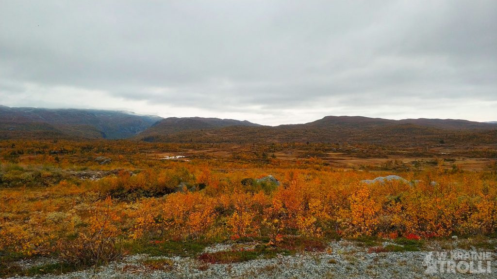
Żeby nie tracić całego dnia na podróż, wyruszyłem z samego rana i około siódmej byłem już w Haukeli. Znalezienie drogi na interesującą mnie górkę zabrało trochę czasu a na miejscu okazało się, że przy jeziorze Songavatnet trwają prace budowlane przy stawianiu ogromnej zapory i ostatni odcinek drogi został zamknięty. Okolica upstrzona była jednak domkami wypoczynkowymi i pomyślałem, że właściciele tych domków muszą przecież jakoś dojeżdżać na swoje włości. Dostrzegłem numer kontaktowy przy zagradzającym wjazd szlabanie i zadzwoniłem. Głos po drugiej stronie linii poinformował mnie, że niedługo się zjawi i otworzy mi przejazd. Czekałem jakieś dwadzieścia minut i już miałem się zbierać z powrotem ale w końcu przyjechał człowiek, który otworzył kłódkę przy szlabanie, pozwolił mi przejechać na drugą stronę i polecił dalej jechać za nim. W takiej asyście dojechałem aż do końca drogi, co było o wiele za daleko od miejsca, skąd chciałem zacząć wędrówkę. Potem jednak spostrzegłem, że i z tego miejsca mogę wspiąć się na interesującą mnie górkę a dodatkowo pokusić się i o sąsiedni szczyt Romtveitnuten (1218m n.p.m.).
Budowlaniec obsługujący szlaban zamknął kłódkę na przejeździe i z tej strony, pozostawiając mnie na tym odludziu i zniknął. Znalazłem obszerny parking do pozostawienia auta i niemal od razu dostrzegłem ścieżkę biegnącą w górę, w stronę Romtveitnuten. Mapa w komórce podpowiadała, że szlak nie prowadzi bezpośrednio na szczyt, tylko wiedzie dalej w głąb dzikich górskich ostępów. Podejście nie sprawiało wrażenia stromego, więc zdecydowałem się najpierw pójść w tę stronę, a pierwotny plan wejścia na Reinsgravnuten pozostawiłem sobie na deser.
Szedłem wydeptaną ścieżką tak daleko jak tylko mogłem. Szybko teren przeistoczył się w zdradliwe bagnisko, porzuciłem więc szlak i lawirując pomiędzy porośniętym wrzosami zboczu, zalegającymi wokół kamlotami i rosnącymi sporadycznie brzózkami, zacząłem piąć się w górę.
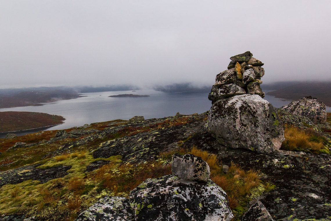
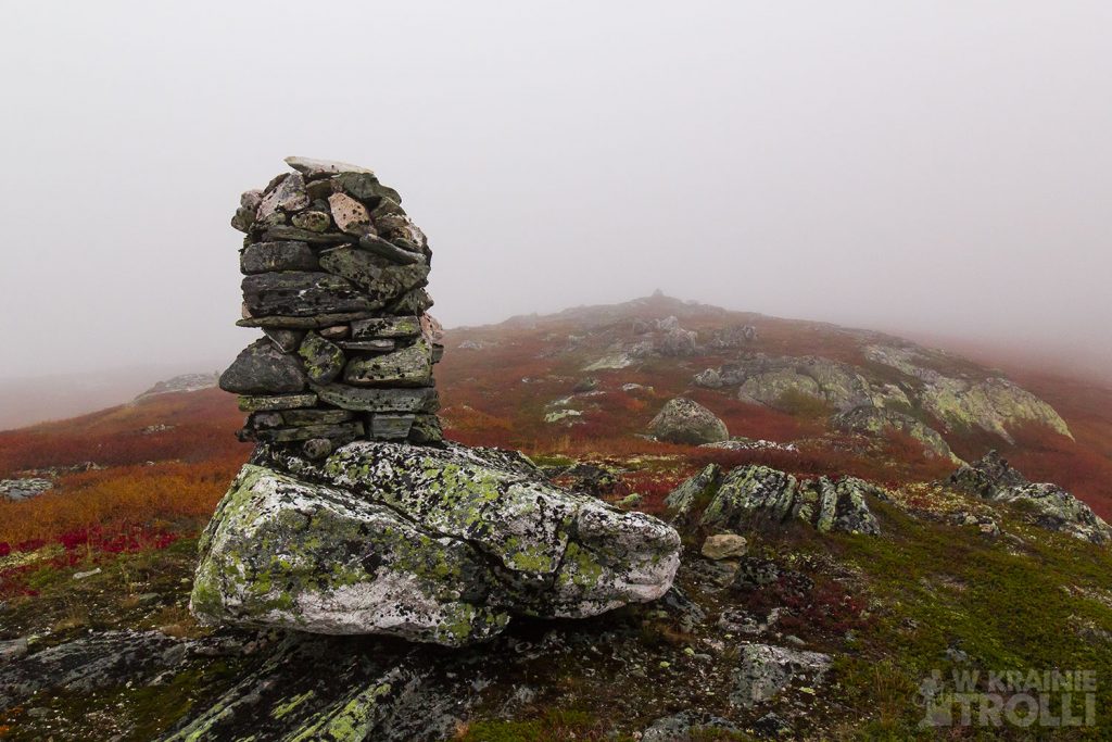
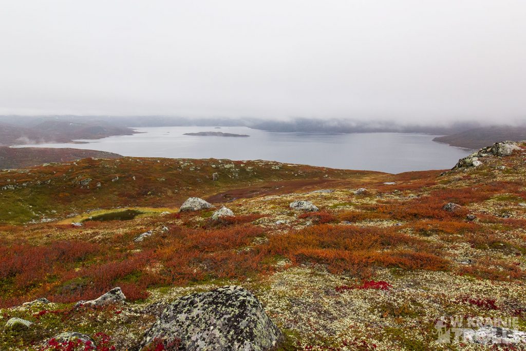
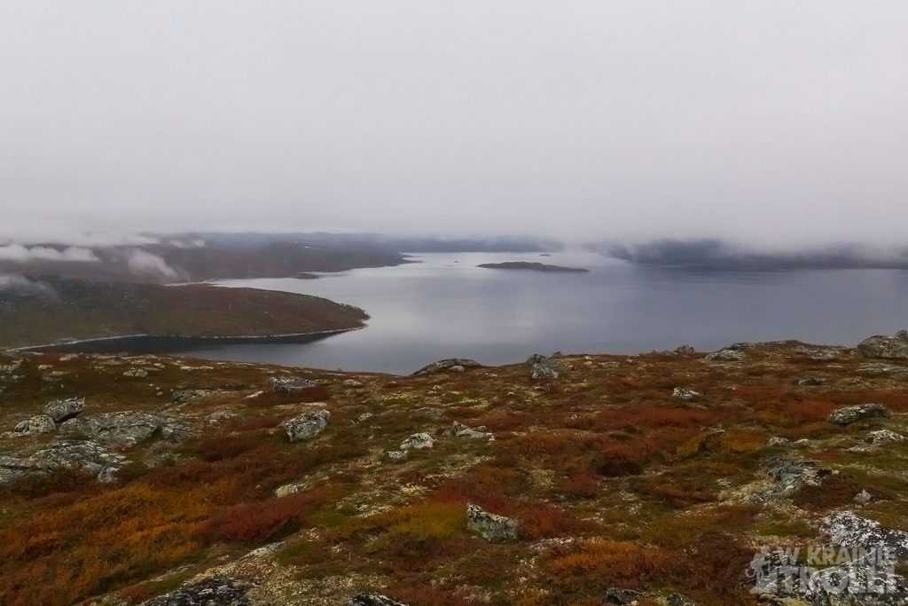
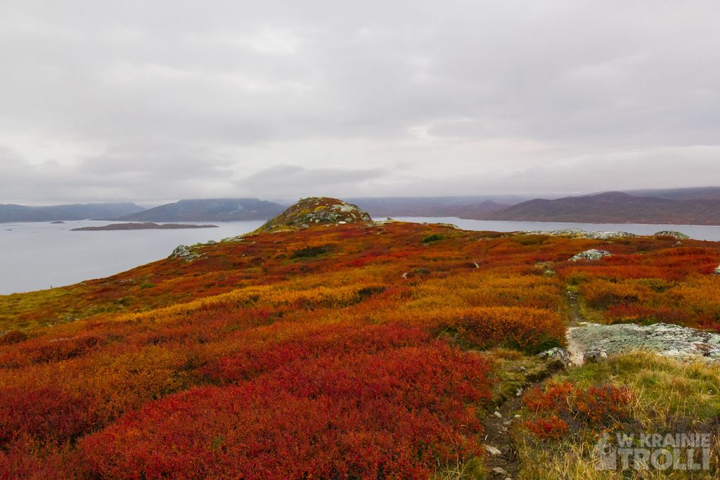
Widok na jezioro mógłby prezentować się znacznie lepiej, gdyby na niebie świeciło słońce. Jak na złość, trafiłem na pochmurny dzień, mimo że prognozy mówiły jedynie o częściowym zachmurzeniu. Zanim dotarłem na szczyt, pogoda spłatała mi kolejnego figla, przynosząc mi z wiatrem nisko zawieszone chmury. Wkrótce otoczyła mnie mgła i o jakichkolwiek widokach mogłem jedynie pomarzyć. Tylko dzięki mapie w komórce wiedziałem gdzie jestem i zdołałem dojść na wierzchołek. Niedługo potem chmury zaczęły się rozwiewać i znów dostrzegłem jezioro i jakieś widoki wokół. Dotarłem na kolejny wierzchołek i postanowiłem wracać.
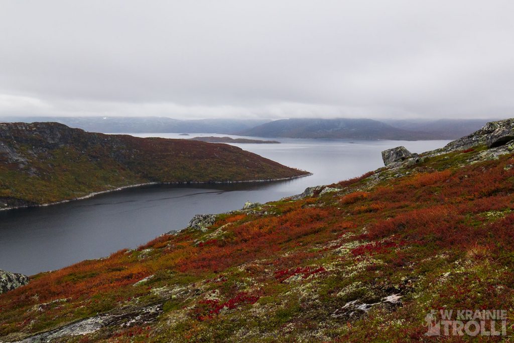
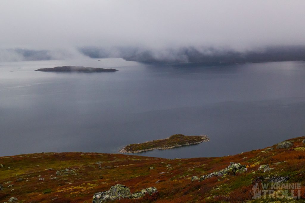
Zszedłem do drogi i uznałem, że wejdę jeszcze na drugą górkę, wspomniany już Reinsgravnuten. Góra jest znacznie niższa i wędrówka była dużo lżejsza. W dodatku od samego początku prowadziła mnie ścieżka. Reinsgravnuten stanowi wąski, wcinający się w wody jeziora półwysep i zapewne w bardziej pogodne dni, widok ze szczytu musi budzić niemały zachwyt. Tego dnia jednak pochmurne niebo nie sprzyjało kontemplacjom krajobrazu. Dotarłem na wierzchołek i niemal natychmiast zawróciłem.
Dotarłem do auta, podjechałem do szlabanu i ponownie zadzwoniłem po budowlańca, który tym razem nie kazał mi zbyt długo czekać. Niedługo potem znów gnałem drogą E134 przecinającą Norwegię ze wschodu na zachód. Jak na złość wkrótce po opuszczeniu rejonu Haukeli, niebo rozchmurzyło się a słońce towarzyszyło mi już do końca podróży.


Accessing Store Nup in recent days has been associated with the journey on the E134 road, which runs through the Haukeli Mountains. A few-hour break and a break to the mountains turned out to be only an addition, not the purpose of that trip. As you can see quite a successful addition. And as my next trip along this route was approaching, I figured it would be fun to repeat the story, but this time with a different hill, preferably less demanding. I grabbed the map and soon had another target defined. It was called Reinsgravnuten (1109m above sea level) and was located only a dozen kilometers north of Edland, on Lake Songavatnet.
In order not to waste all day traveling, I left early in the morning and around seven o’clock I was already in Haukela. It took some time to find the way to the hill that I was interested in, and it turned out that construction works were underway at Lake Songavatnet, building a huge dam and the last section of the road was closed. The area, however, was speckled with holiday houses and I thought that the owners of these houses must somehow commute to their property. I noticed the contact number at the barrier barring the entrance and called. The voice on the other side of the line informed me that he would be arriving soon to open the passage. I waited for about twenty minutes and was about to get back, but finally a man came and opened the padlock at the barrier, let me go to the other side, and told me to follow him. With such assistance, I reached the end of the road, which was far too far from where I wanted to start my journey. Then, however, I noticed that from this place I could climb the hill that interests me, and additionally try to visit the neighboring peak Romtveitnuten (1218m above sea level).
The builder who operated the barrier padlocked the crossing on and on this side, leaving me in the outback, and disappeared. I found a large parking lot to leave the car and almost immediately spotted a path up towards Romtveitnuten. The map in the cell indicated that the trail does not lead directly to the summit, but continues deeper into the wild mountain backwoods. The climb wasn’t steep, so I decided to go this way first and left the original plan to climb Reinsgravnuten for dessert.
I walked the trodden path as far as I could. The terrain quickly turned into a treacherous swamp, so I abandoned the trail and, navigating between the heather-covered slope, the birch trees around and sporadically growing birches, began to climb up.
The view of the lake could look much better if the sun was shining in the sky. As a spite, I found myself on a cloudy day, even though the forecasts only said that it was partially cloudy. By the time I got to the top, the weather was playing another trick on me, bringing me low clouds with the wind. Soon the fog surrounded me, and I could only dream of any sights. It was only thanks to the map in the cell that I knew where I was and managed to get to the top. Soon after, the clouds began to clear and I saw the lake again and some views around. I got to the next peak and decided to go back.
I went down to the road and decided that I would go up the second hill, the already mentioned Reinsgravnuten. The mountain is much lower and the hike was much easier. In addition, a path led me from the very beginning. Reinsgravnuten is a narrow peninsula cutting into the waters of the lake, and probably on more clear days, the view from the top must be quite delightful. On that day, however, the cloudy sky was not conducive to contemplating the landscape. I got to the top and turned back almost immediately.
I got to the car, drove to the barrier and called the builder again, who this time did not make me wait too long. Soon after, I was racing again on the E134 road crossing Norway from east to west. As to spite shortly after leaving the Haukeli region, the sky brightened and the sun was with me until the end of my journey.


Zobacz również

Haglebunatten 1278m n.p.m.

Bitihorn & Sandhaugen
