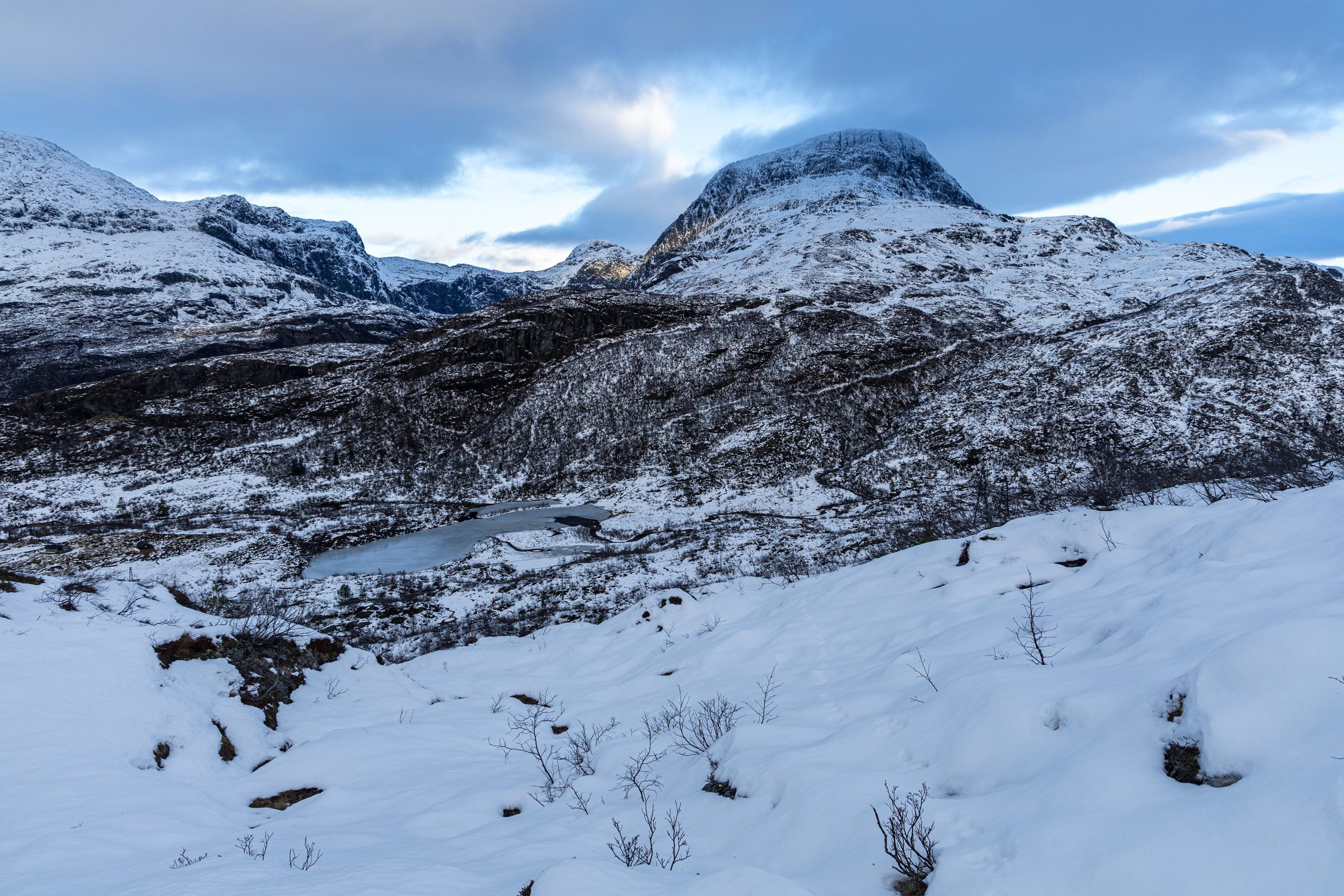
Kristinuten, 901 m n.p.m.
Co zrobić, gdy za oknem mokro, a weekend znów zapowiada się deszczowo? Znaleźć miejscówkę, gdzie nie pada. Nawet jeśli będzie ona oddalona o 6 godzin jazdy, będzie warto. I było. Zresztą rejon Hardanger to miejsce, które zawsze mnie zachwyca, niezależnie od pory roku i warunków atmosferycznych. Tym razem celowałem w dwie możliwe opcje: Husedalen w okolicy Kinsarvik (Już kiedyś próbowałem tej trasy ale w pewnym momencie zatrzymał mnie śnieg zalegający ścieżkę), albo miasteczko Ulvik i jedna z dwóch tras rozpoczynających się właśnie tam. Nie mogłem się zdecydować. W końcu uznałem, że wybór zapadnie już na miejscu.
Na miejscu okazało się, że szczyty gór pokryte są już warstwą śniegu. No kto by się spodziewał. Helloł, mamy w końcu grudzień, trzeba było to przewidzieć wcześniej. Postanowiłem zatem, że wybiorę mniejszą górkę w Ulvik. Kinsarvik i Husedalen odpadło z potencjalnych wyborów już wcześniej bo ze względu na granice parku narodowego, nie można było tam latać dronem.
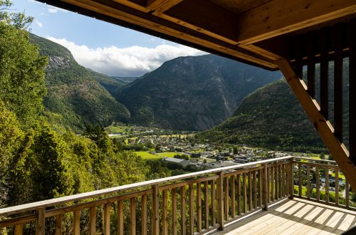
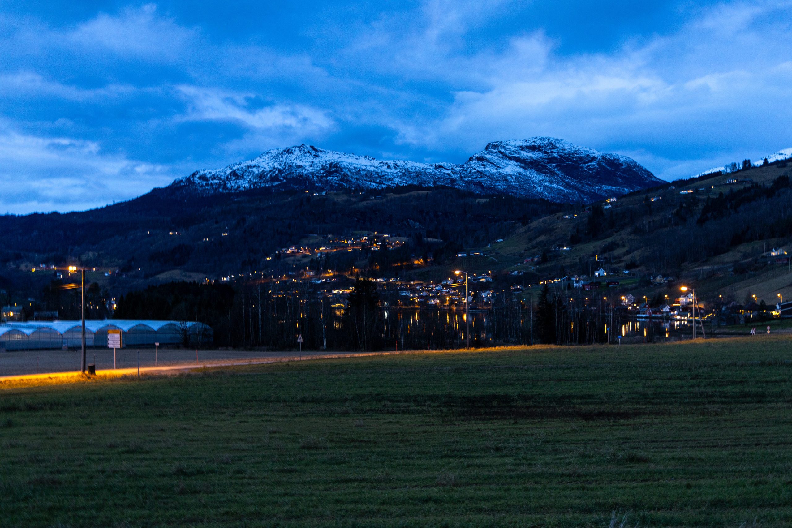
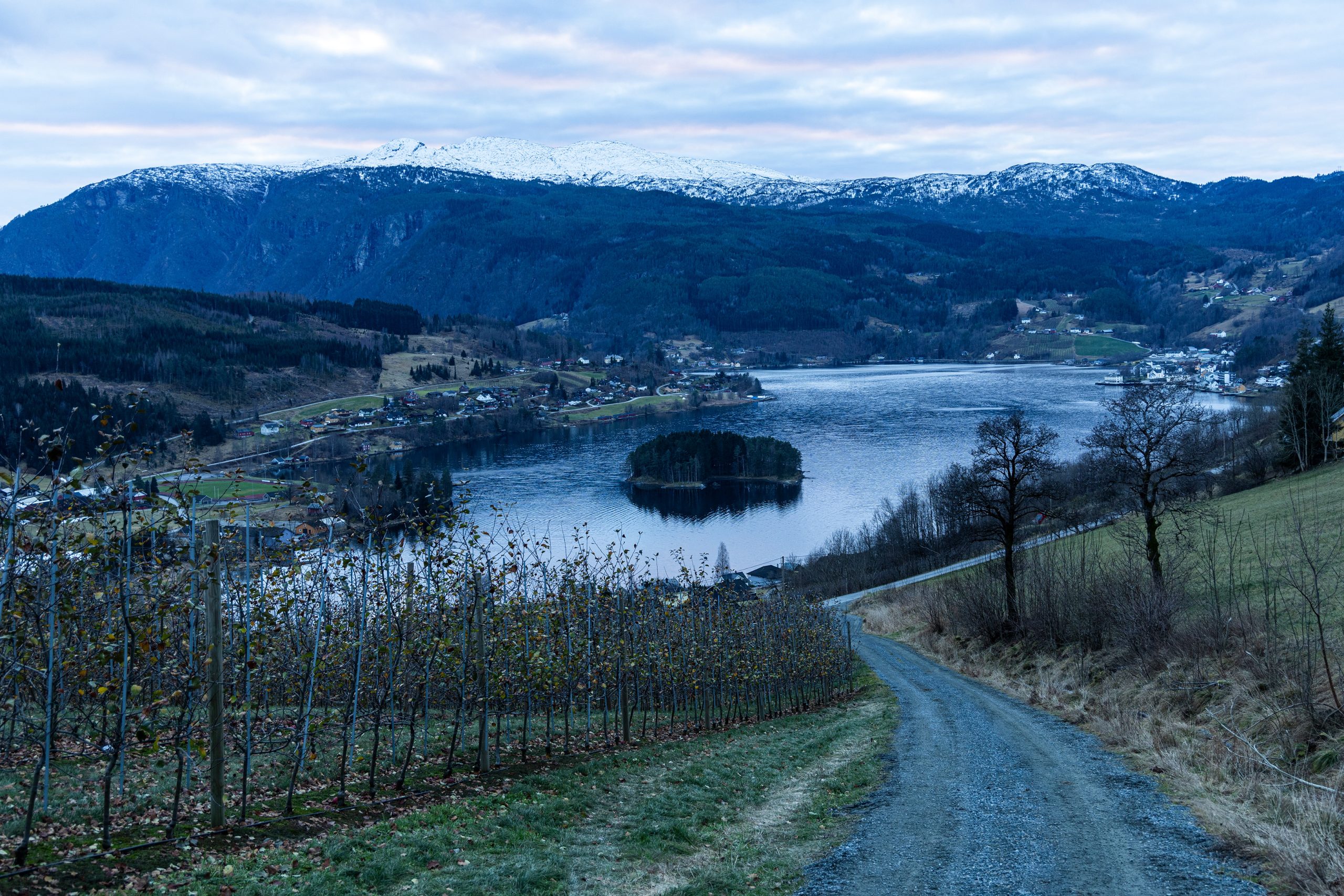
Przejechałem więc przez most Hardangerbrua, skręciłem w tunelu na rondzie w prawo (tak, tak, norweskie tunele mają nawet ronda) i znalazłem się w Ulvik. Wciąż było ciemno, ale to się miało niebawem zmienić. Trasa na Kristinuten, bo to tam miały mnie powieść nogi rozpoczynała się na parkingu przedszkola. Pozostawiłem tam auto, i ruszyłem. Początkowo główną ulicą przebiegającą przez miasteczko, potem wzdłuż spływającej z gór rzeki Gauro, minąłem ogołocone z liści i owoców sady owocowe i parę zabudowań by w końcu wejść wyżej i zagłębić się w las.
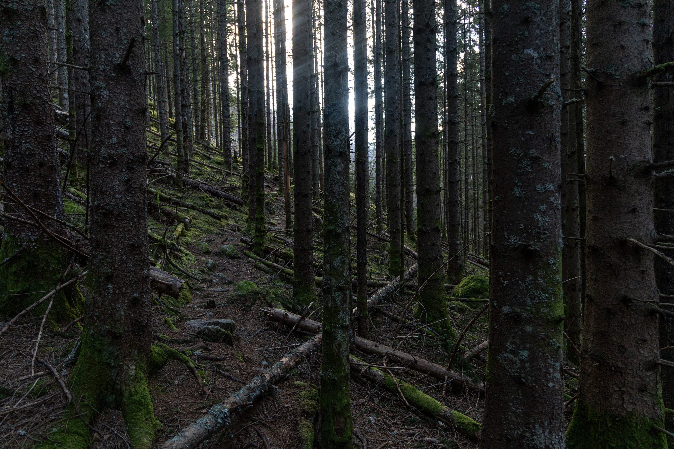
Szło się dobrze. Świeże leśne powietrze działało jak najlepsze lekarstwo na wyciszenie i regenerację umysłu. Wspinałem się po szerokiej leśnej drodze i czułem jak odżywam. W miejscu takim jak to, po ponad miesiącu bezczynności, miesiącu bez gór, w końcu mogłem odetchnąć i poczuć się jak u siebie. Metaforycznie oczywiście.
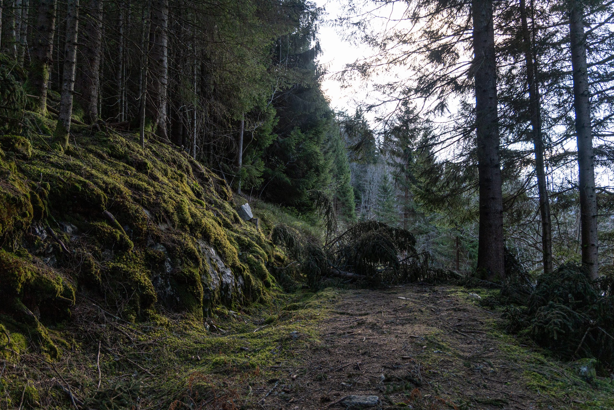
Nie wiem kiedy po raz pierwszy napotkałem zwalone drzewo zagradzające drogę. Może nawet nie zwróciłem na nie większej uwagi. Drzewo to w końcu drzewo, Co jakiś czas, przy silniejszym wietrze zdarza się, że się przewracają. Ominąłem je i poszedłem dalej. Ale wkrótce napotkałem kolejne i kolejne. I każde następne było trudniej obejść. Zwłaszcza, kiedy było ich kilka w jednym miejscu. Ale posuwałem się naprzód i niedługo potem droga się skończyła. I od tego miejsca musiałem polegać na wąskiej ścieżce. A tu również od czasu do czasu zalegały zwalone drzewa. I tym razem było już trudniej. Momentami bardzo trudniej. Przeszkód było więcej, znalezienie właściwej drogi, żeby je obejść, gdy teren staje się naprawdę stromy stanowiło nie lada wyzwanie. Doszedłem do wniosku, że niedawno musiała przejść tędy naprawdę potężna nawałnica. Drzewa były połamane, wyrywane z korzeniami. Było tego naprawdę sporo, Dziesiątki, przynajmniej na mojej trasie. W innych miejscach mogły leżeć kolejne. Widok naprawdę porażający. I nieco smutny, jeśli się pomyśli przez ile lat te drzewa sobie spokojnie rosły i opierały się różnym czynnikom atmosferycznym.
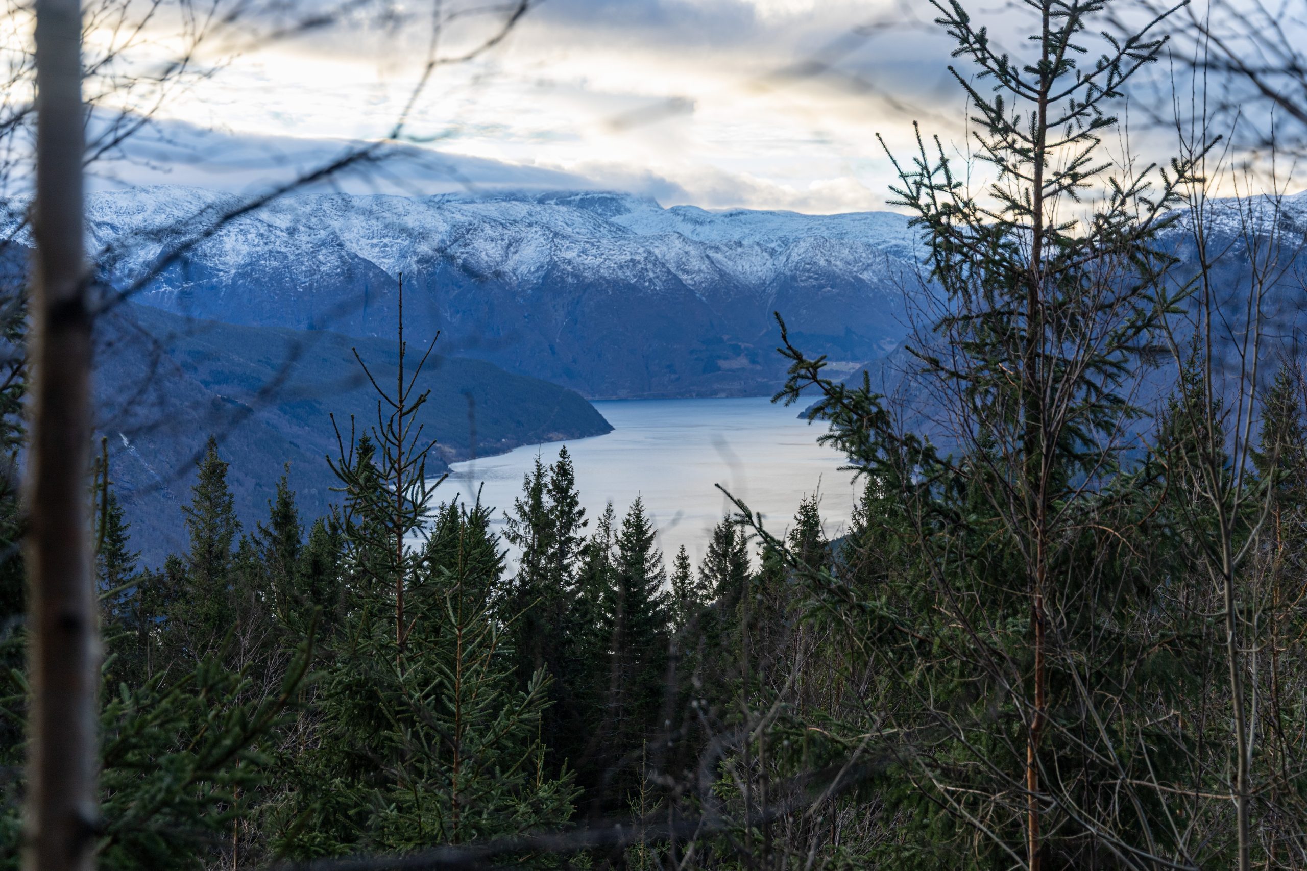
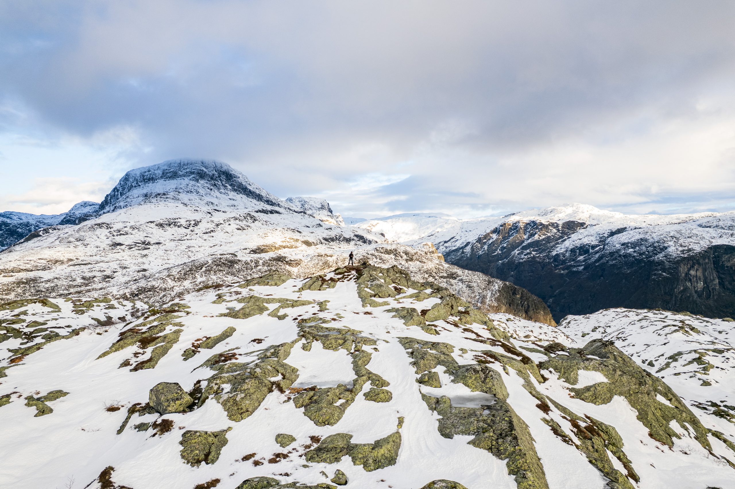
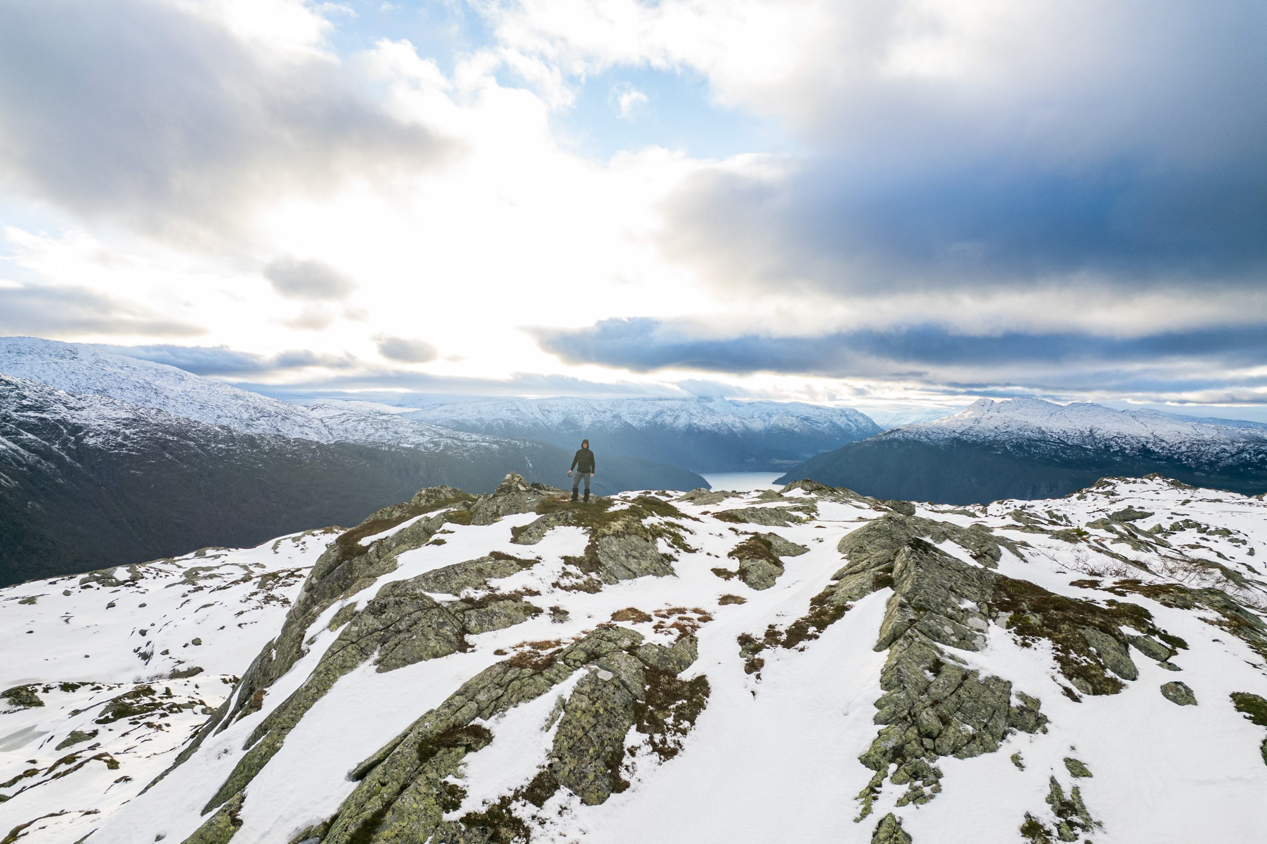
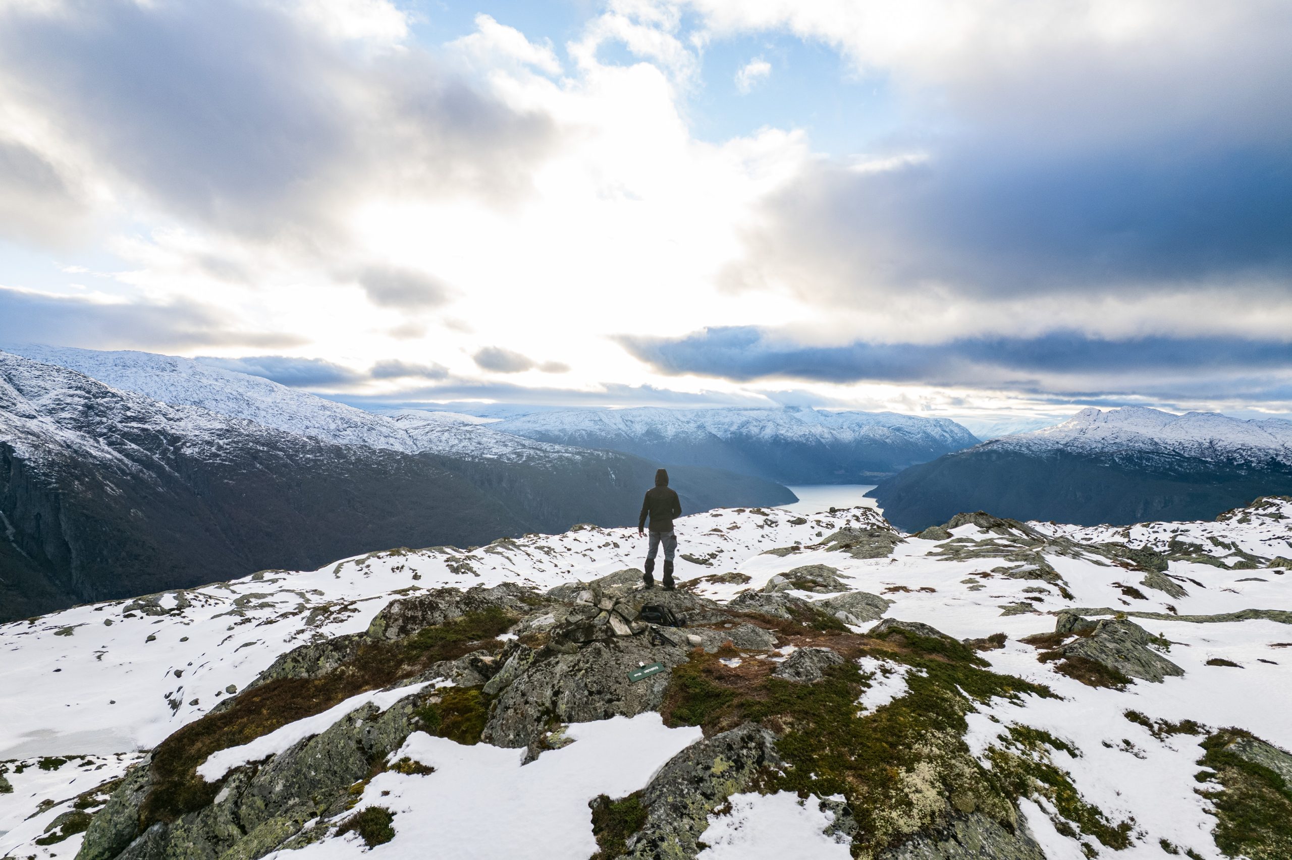
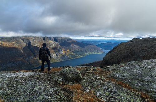
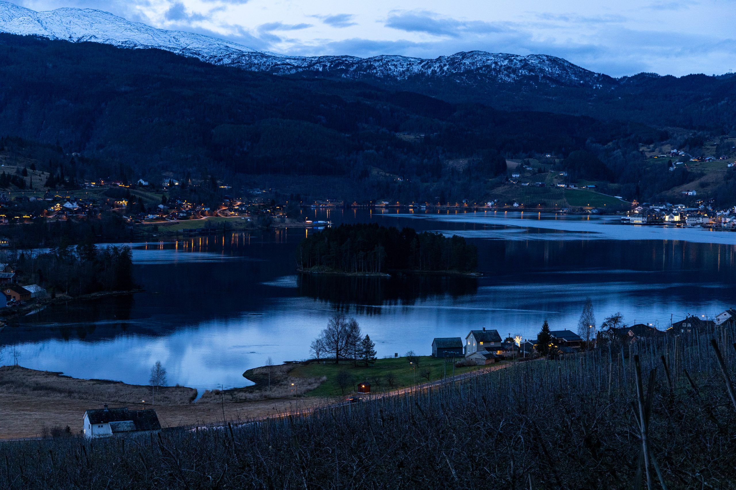
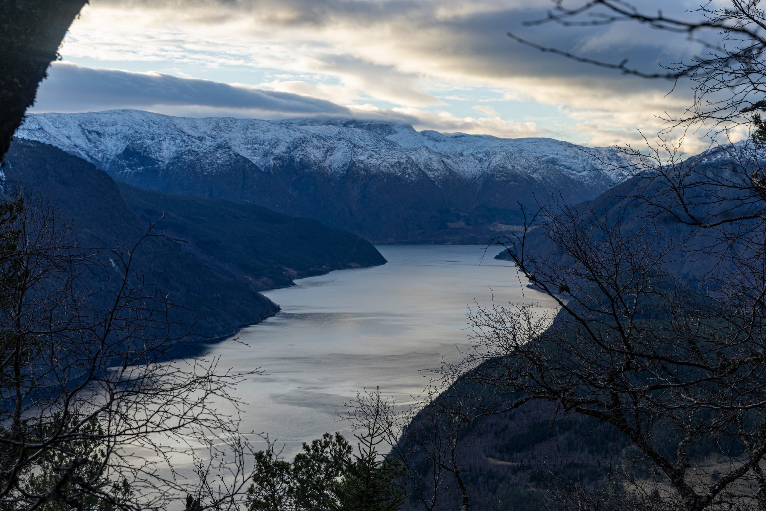
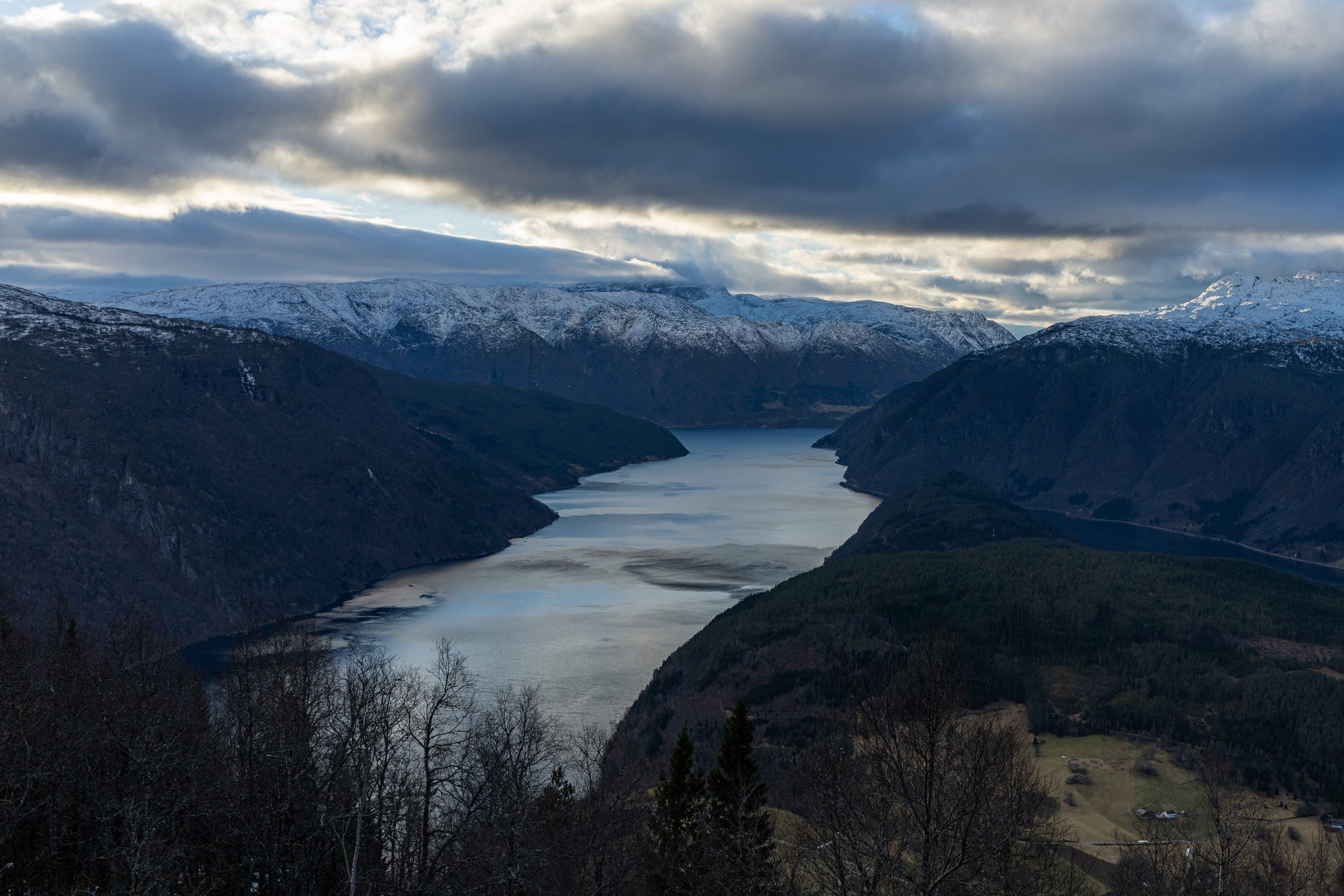
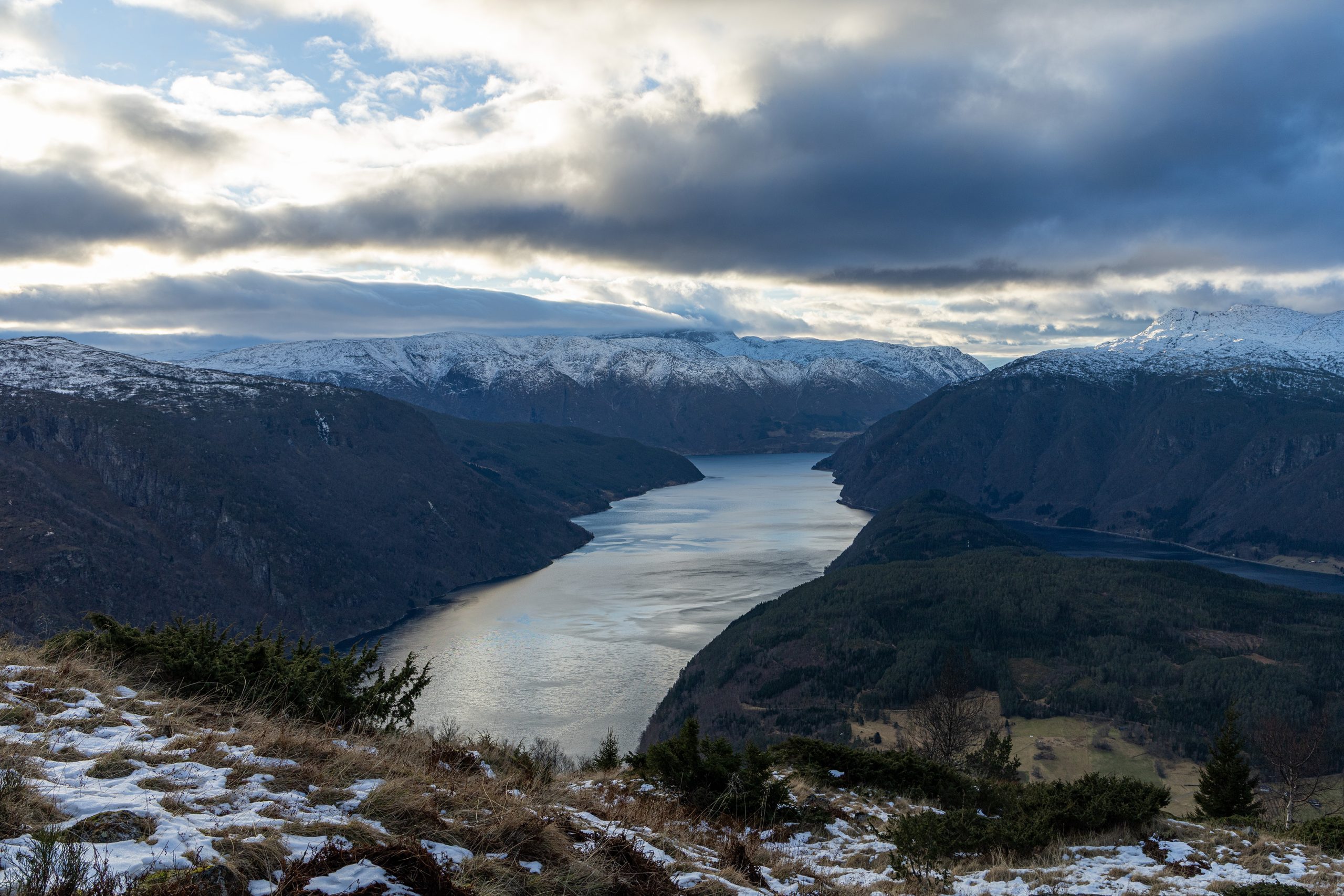
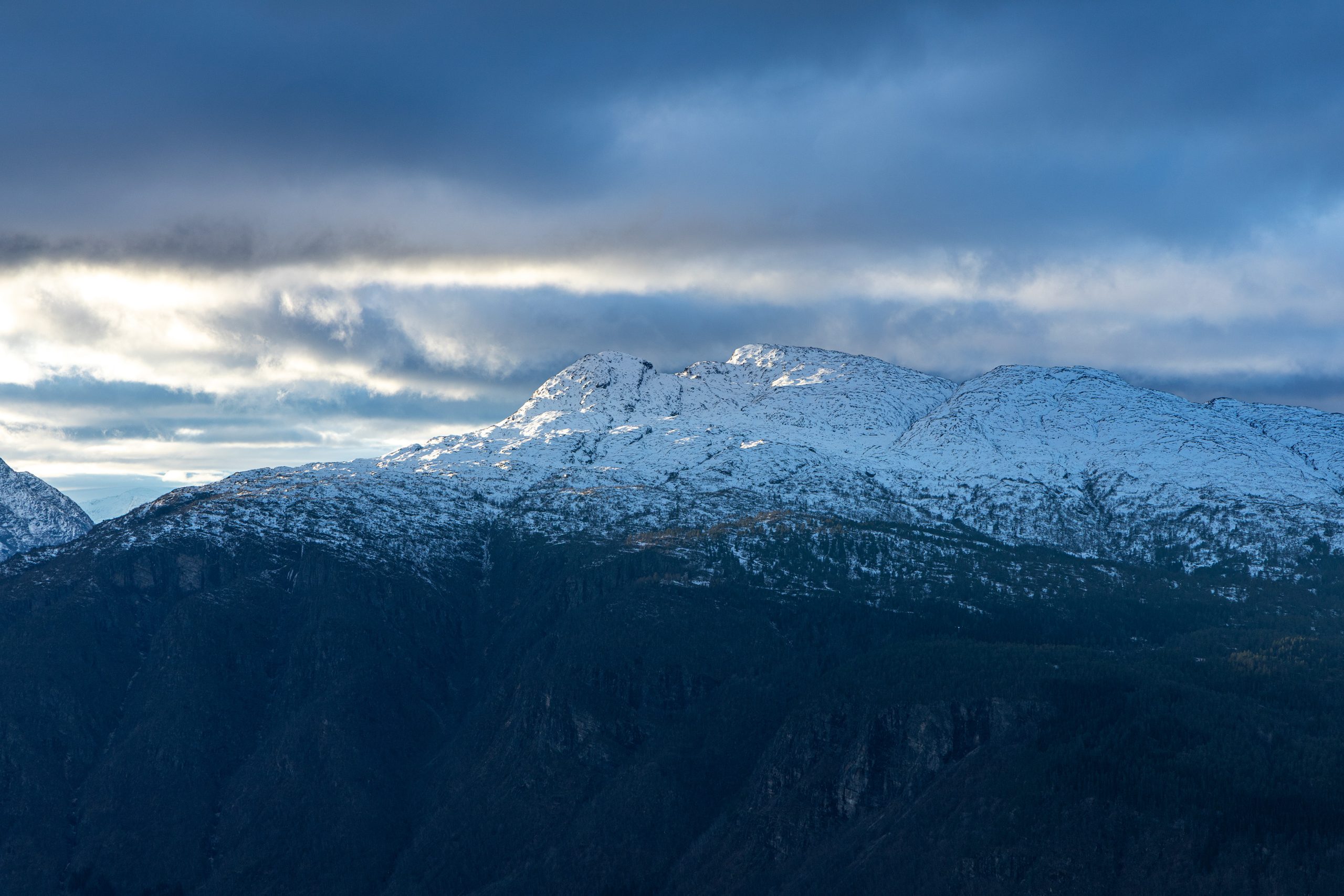
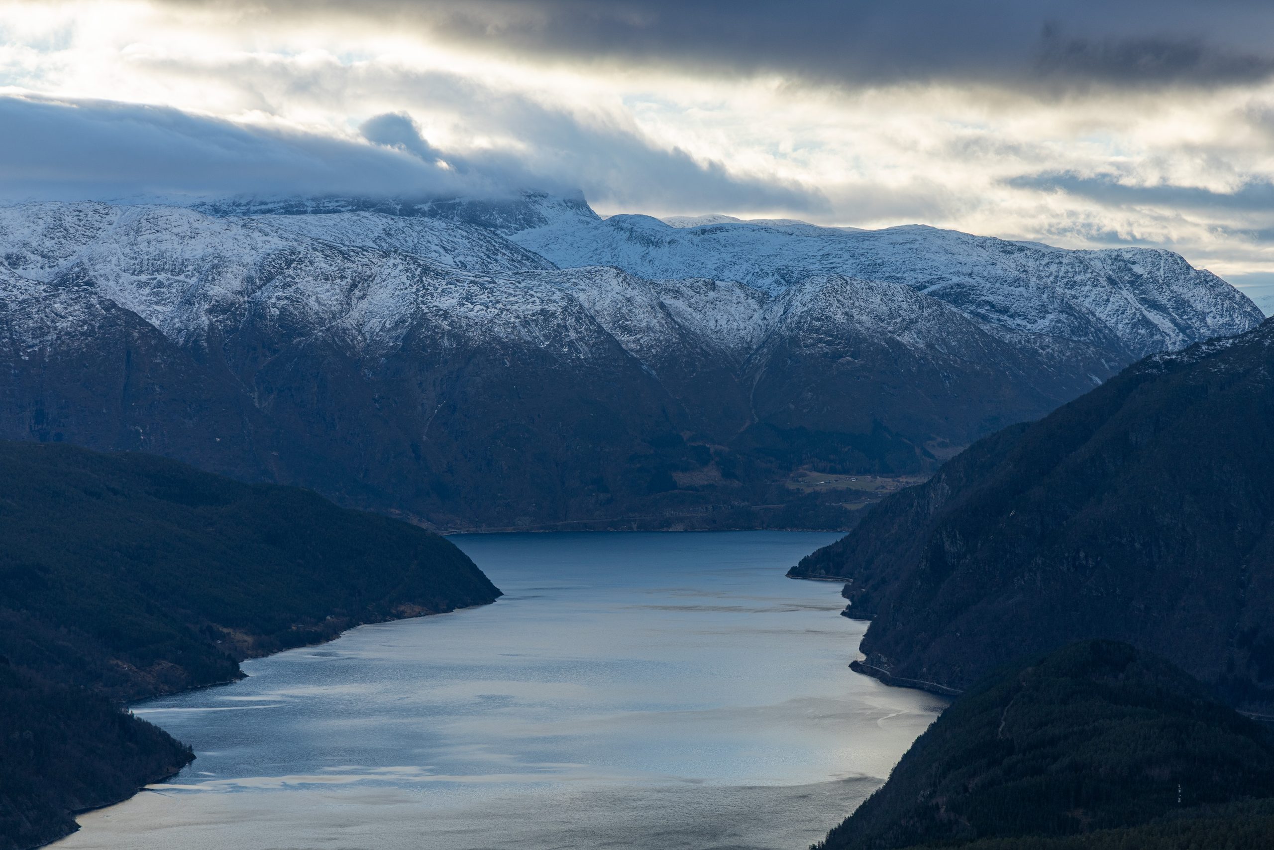
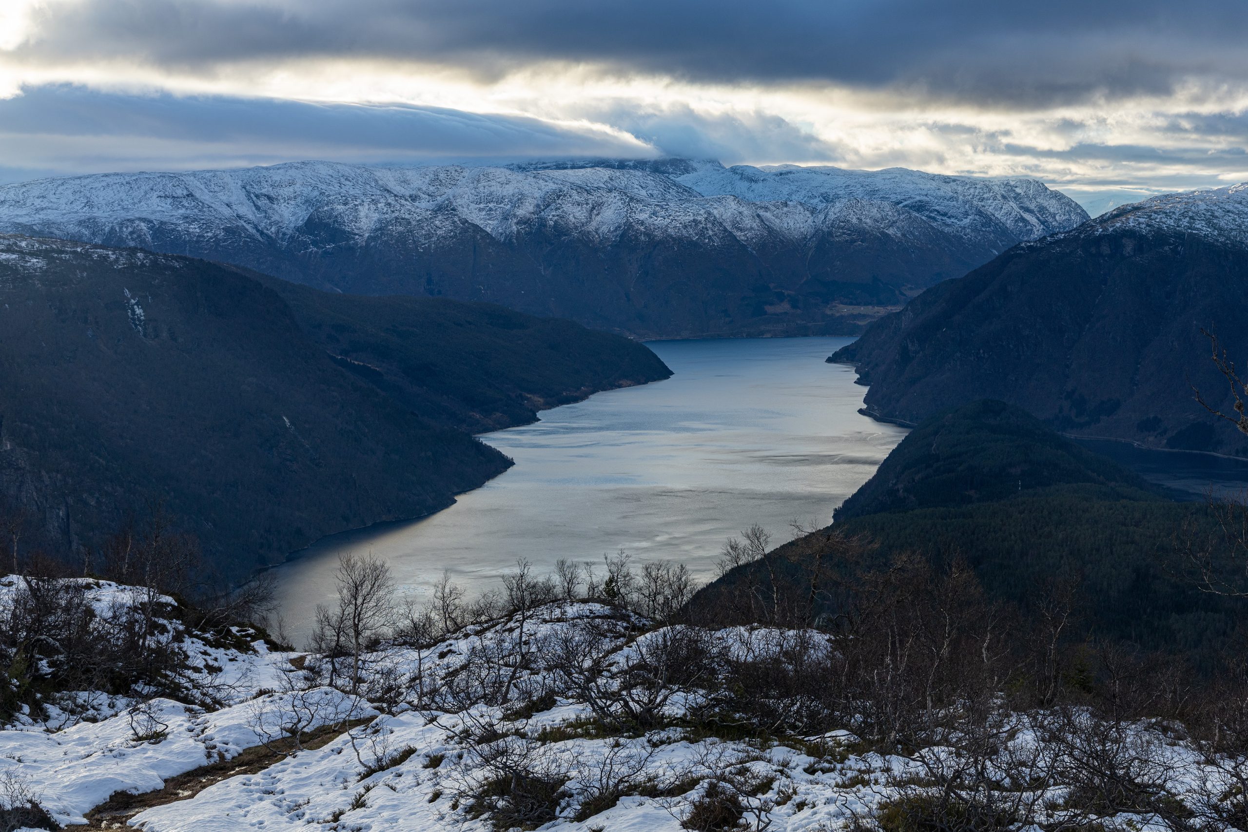
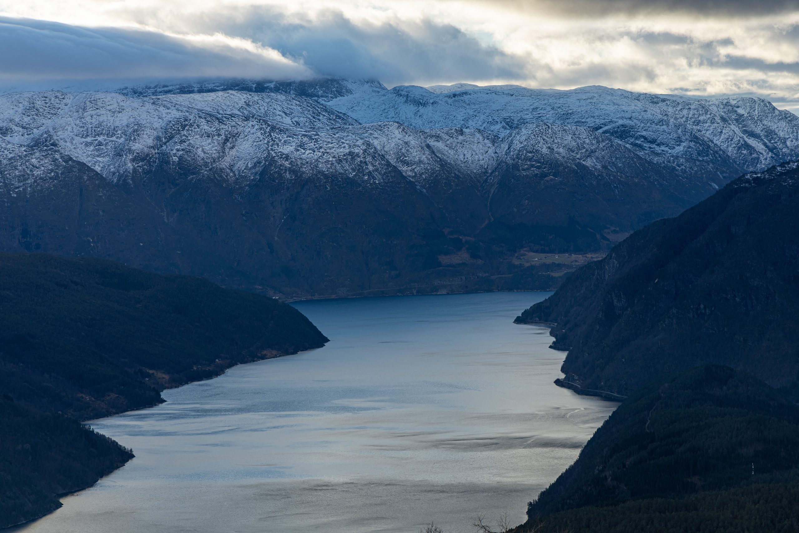
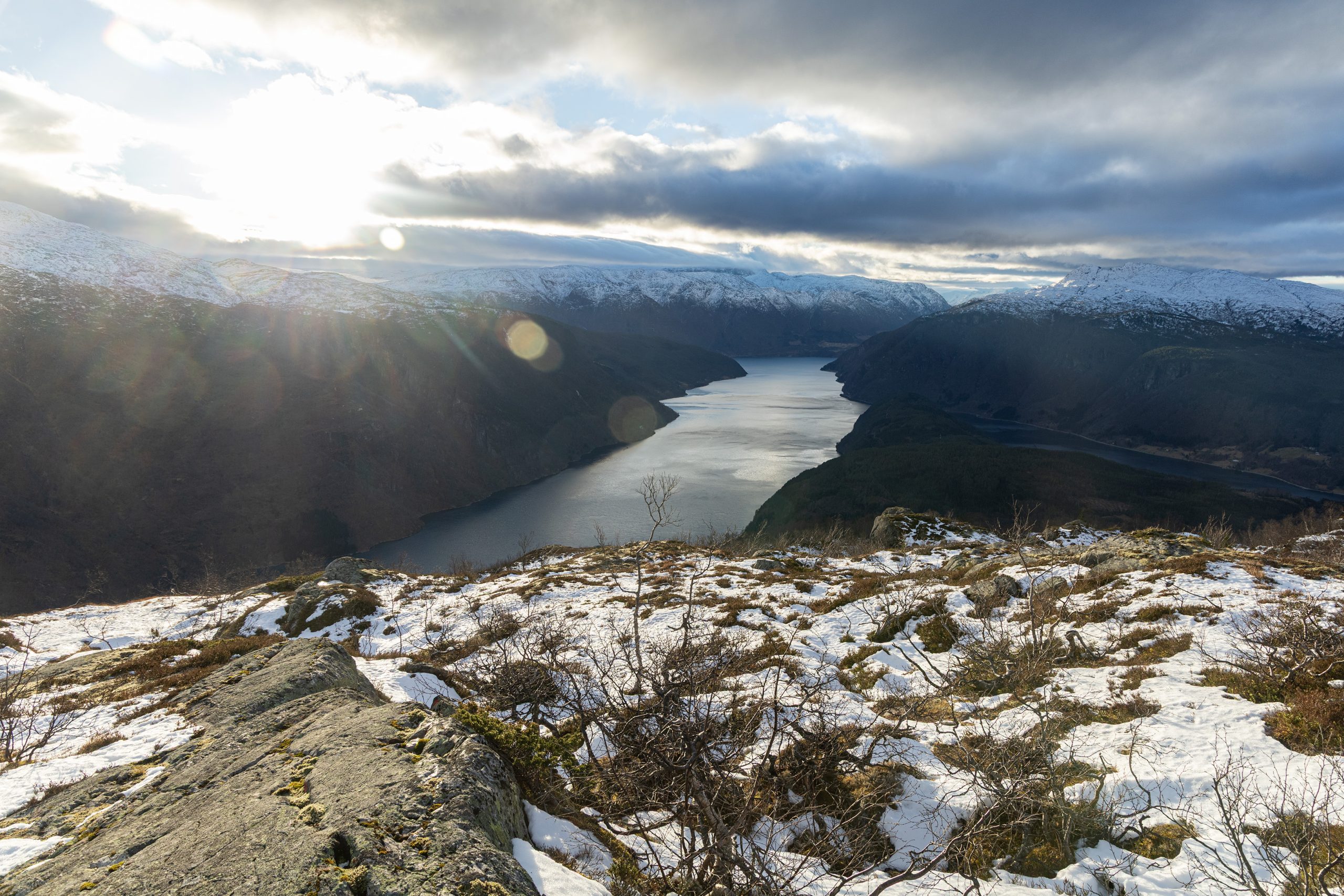
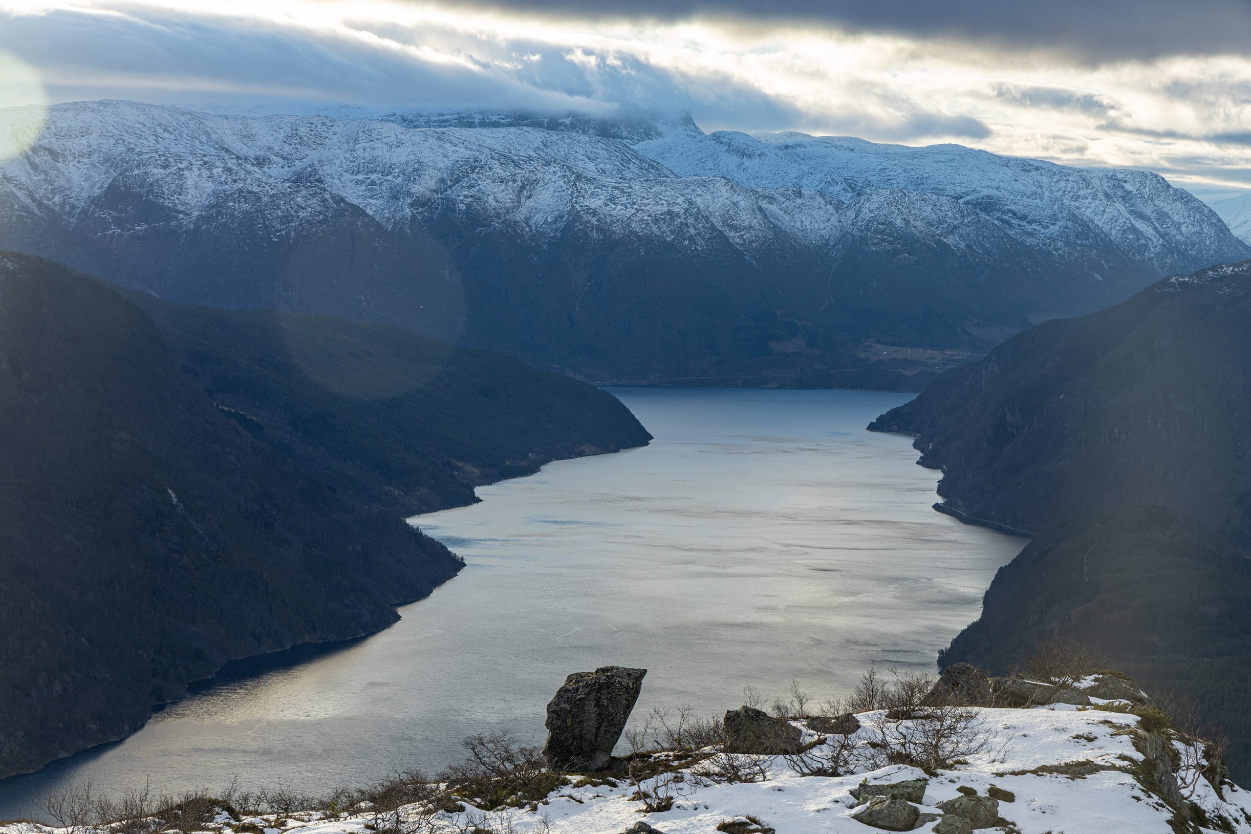
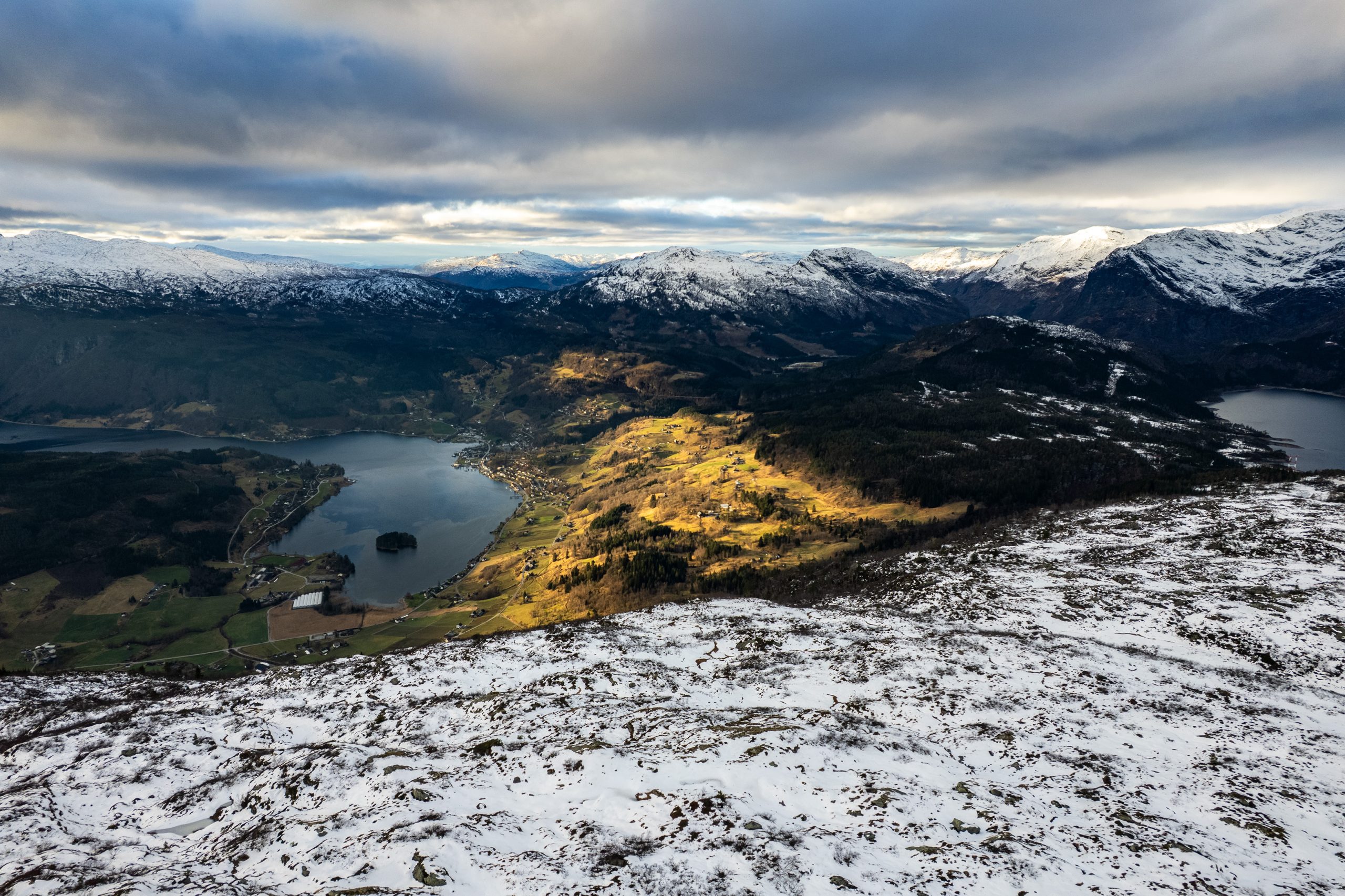
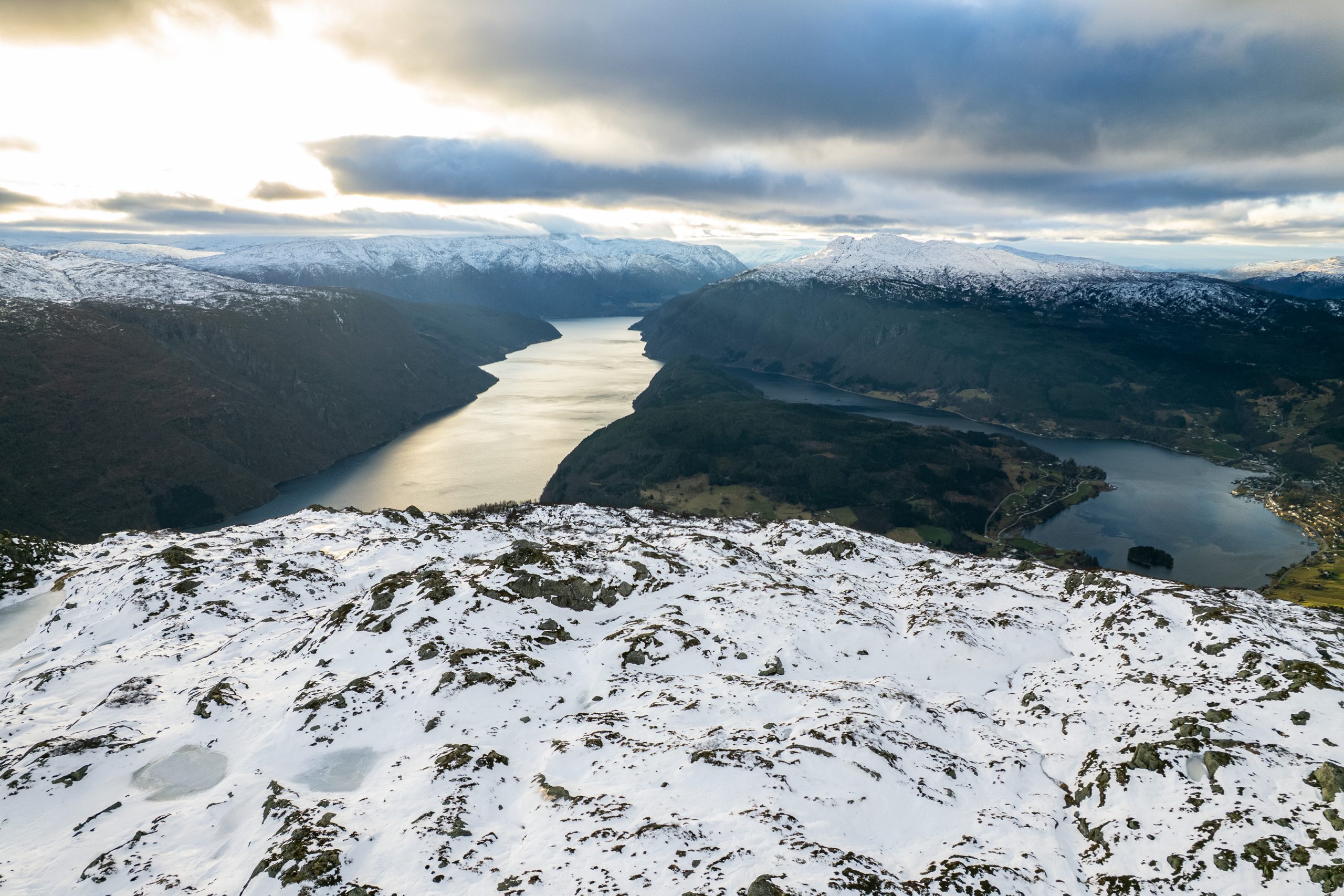
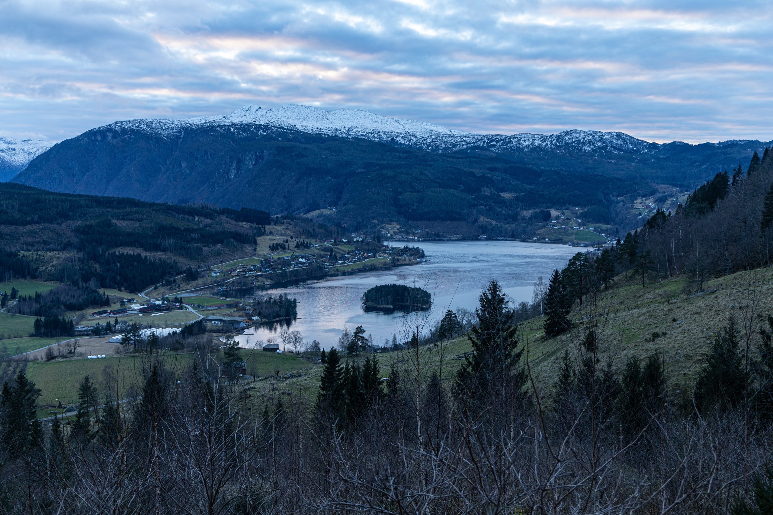
W końcu, udało mi się wejść wyżej. Tam, gdzie kończył się las. Na bardziej otwartą przestrzeń. Za plecami rozciągał się taki widok, że aż dech zapierało. Miałem przed oczami ciągnący się w dal Osafjorden, który łączył się gdzieś tam dalej z Hardangerfjordem. Po obu stronach tej wodnej wstęgi wznosiły się strome zbocza gór, pokryte z wierzchu warstwą śniegu. A w dole przycupnięte w zatoce Ulvikafjorden miasteczko Ulvik. Coś pięknego.
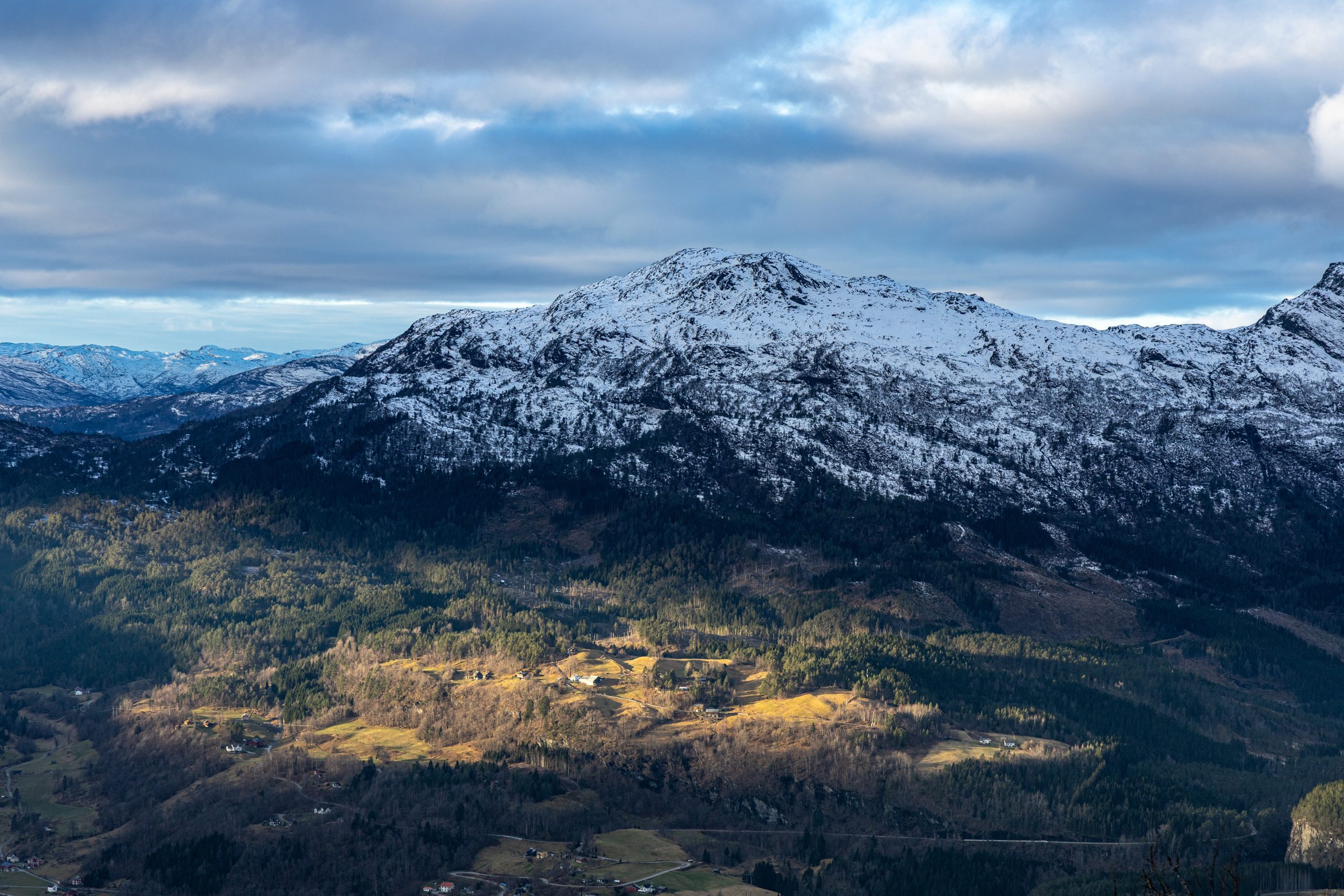
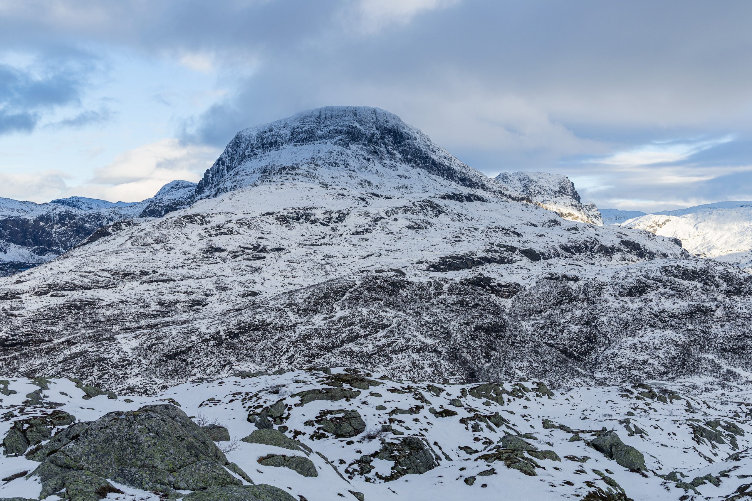
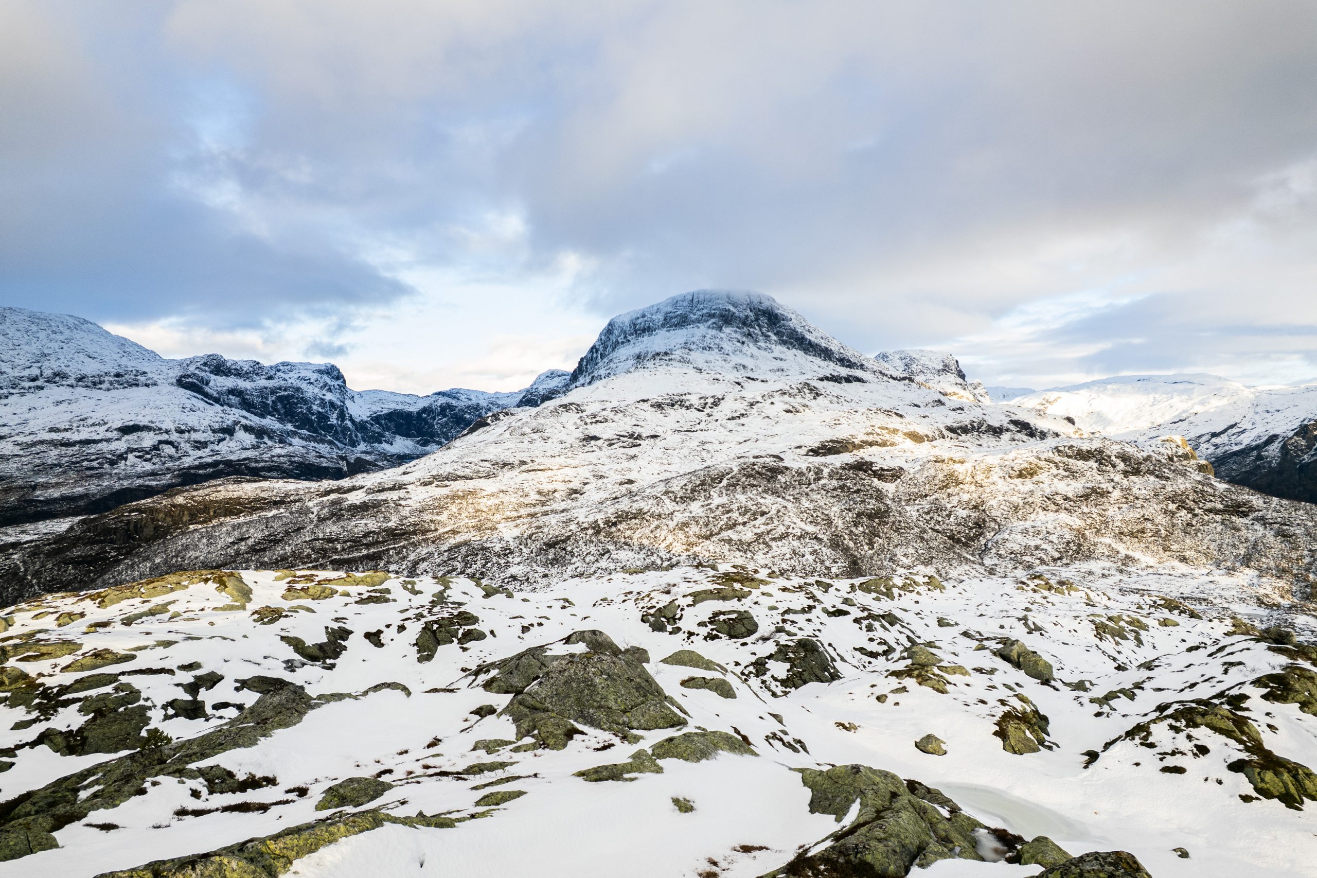
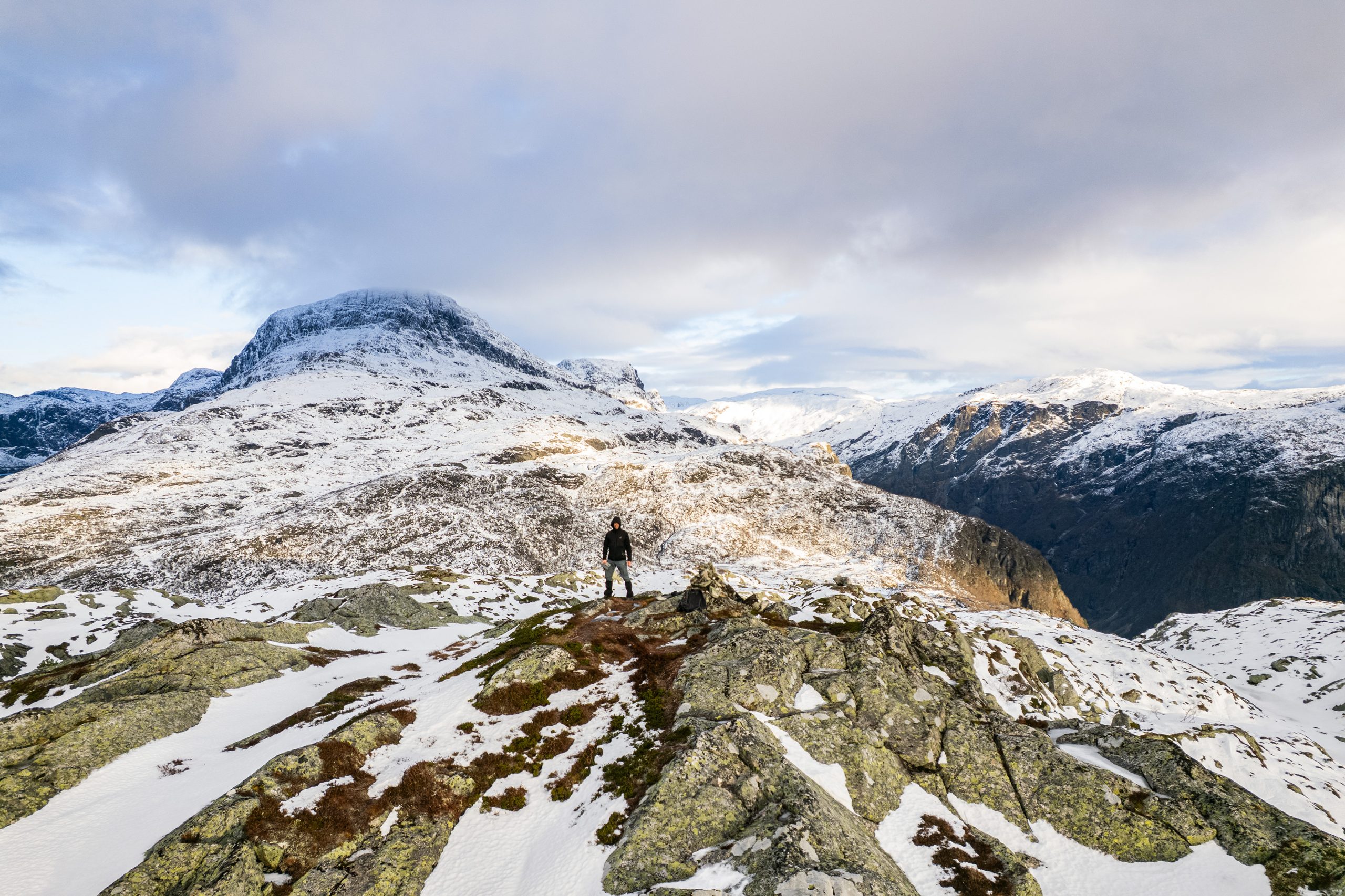
Na tej wysokości leżał już śnieg. Początkowo jeszcze niewiele, ale im wyżej i dalej się posuwałem, było go więcej i więcej. Aż w końcu było go już na tyle dużo, że nie dało się dojrzeć ścieżki. Na szczęście szlak był dobrze oznaczony. Kopczyki kamieni, czerwona farba tu i ówdzie na skale. No i czyjeś ślady, które jak mniemałem, doprowadzą mnie do celu. Z tym ostatnim się pomyliłem. Ślady nie wiodły na szczyt. Gdy się zorientowałem, musiałem odbić nieco i posługując się mapką w telefonie wrócić na szlak. Trasa nie prowadziła na najwyższy punkt, ale mijała go w niewielkiej odległości. Zajęło mi parę minut żeby zajść tam i wrócić (i przy okazji cyknąć kilka fotek i polatać dronem).
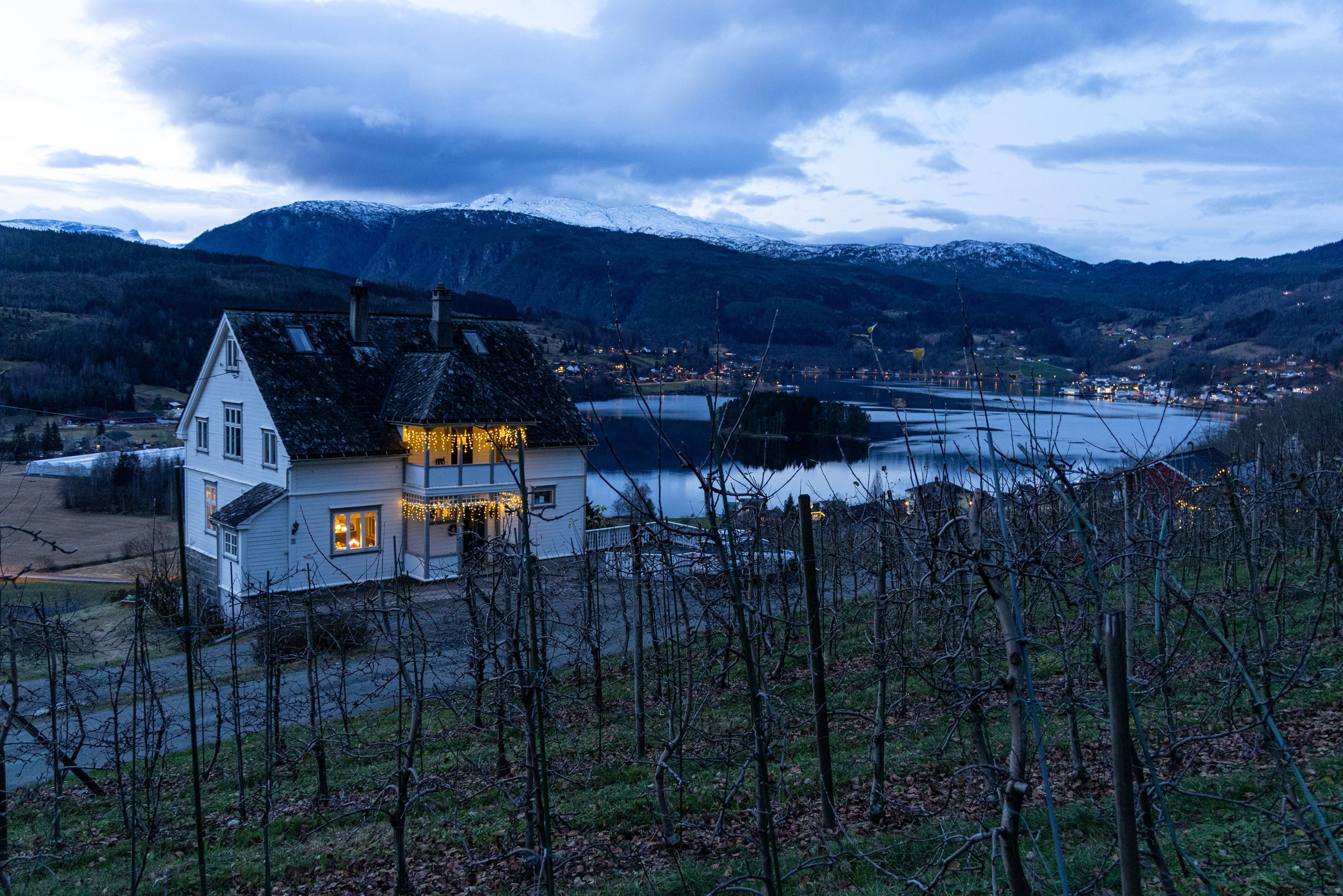
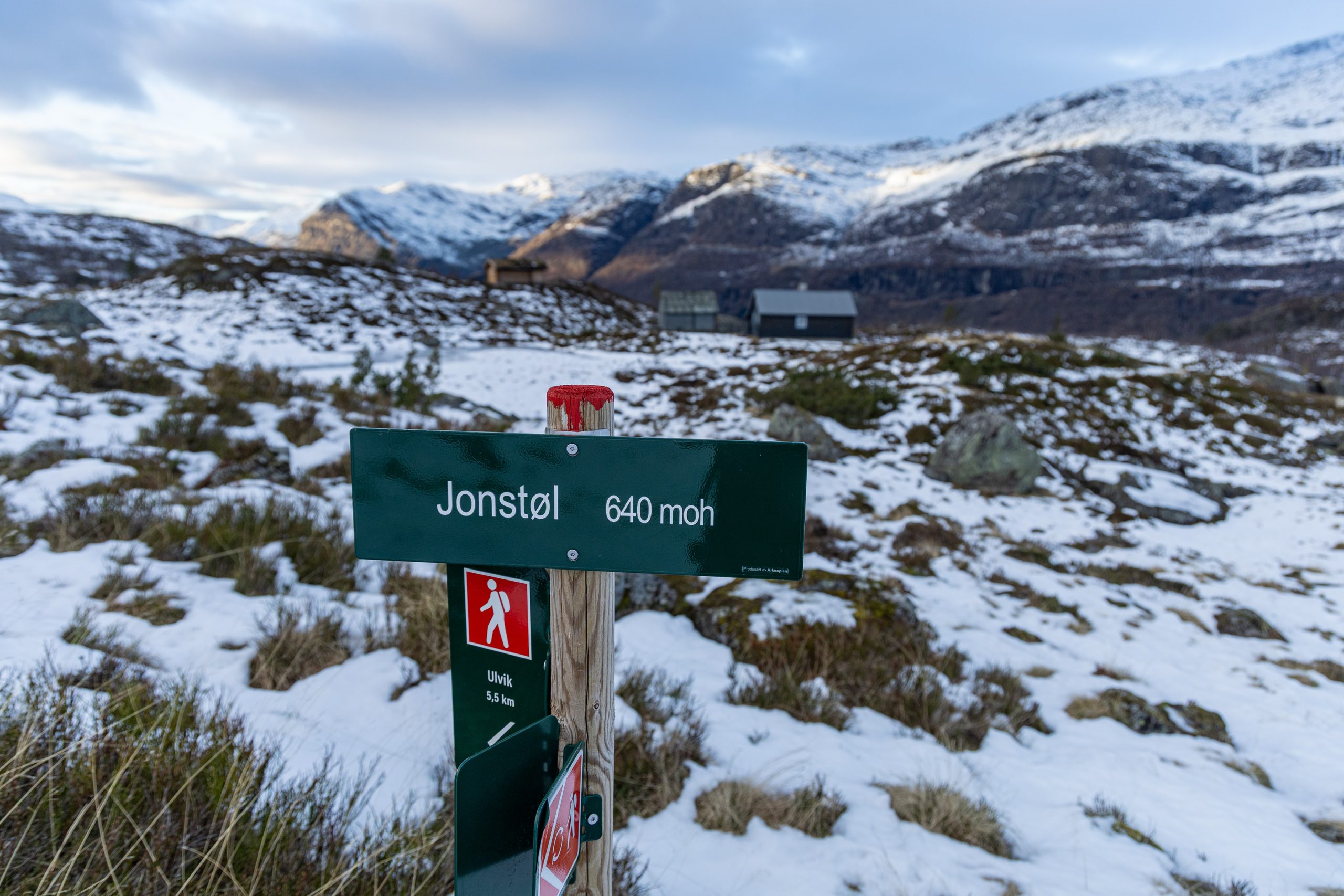
W międzyczasie zorientowałem się, że robi się już późno. Było w okolicach pierwszej po południu a jak wiadomo w grudniu dni są ciut krótsze. Miałem jeszcze co prawda trochę czasu przed zachodem słońca (i w razie czego latarkę w plecaku) ale trzeba było się pośpieszyć. Następny etap wędrówki to marsz w śniegu i zejście do Jonstøl. Jest to jak myślę dawne gospodarstwo, przekształcone w domki wypoczynkowe. Nie zamierzałem wracać tą samą trasą. Przedzieranie się ponownie przez te wszystkie zwalone drzewa trochę mnie przerażało. Od Jonstøl biegła ścieżka bezpośrednio w dół, w kierunku Ulvik, i taki też był mój pierwotny plan wędrówki. Zrobić taką pętlę. Nie zatrzymywałem się więc tylko szybko zacząłem schodzić.
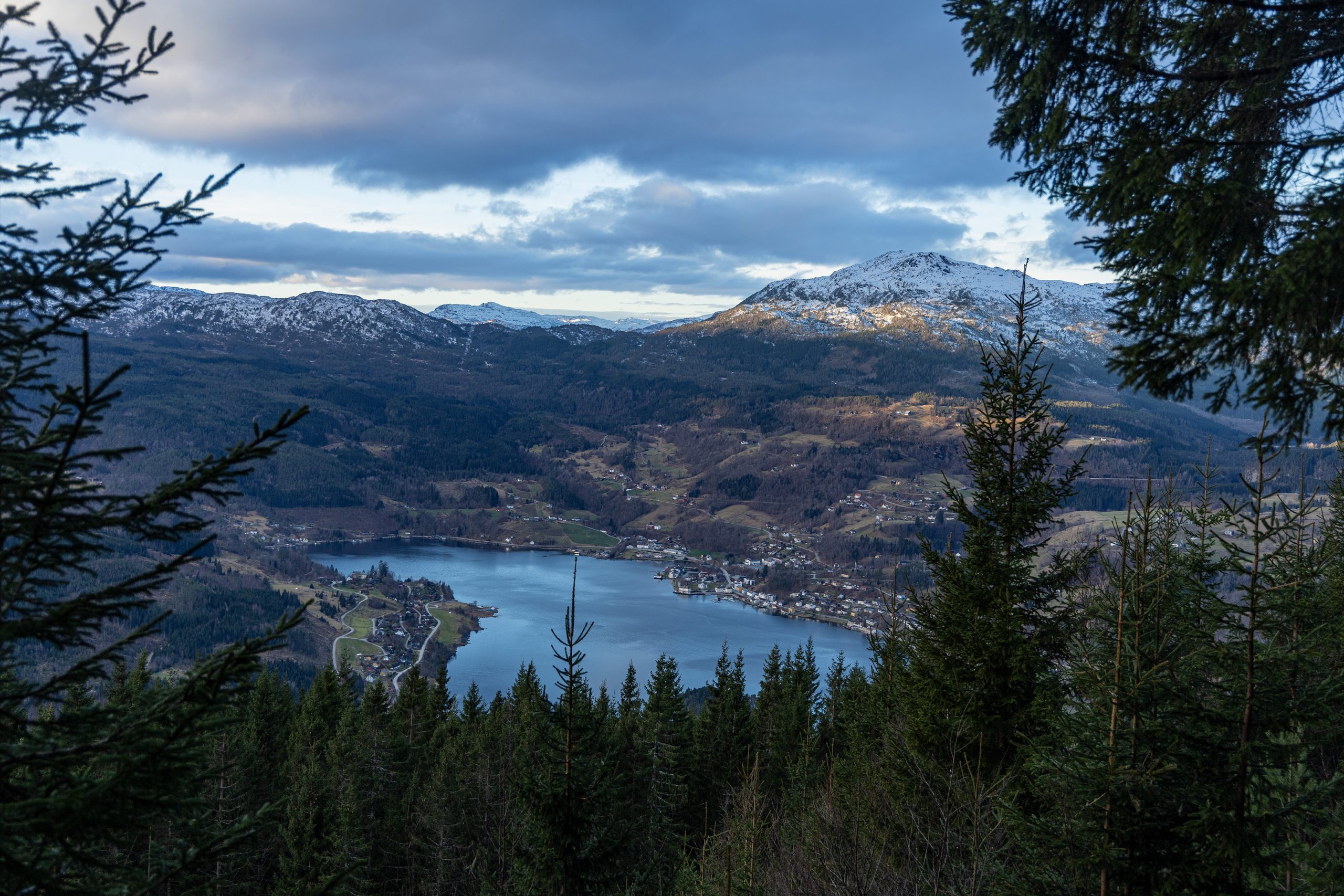
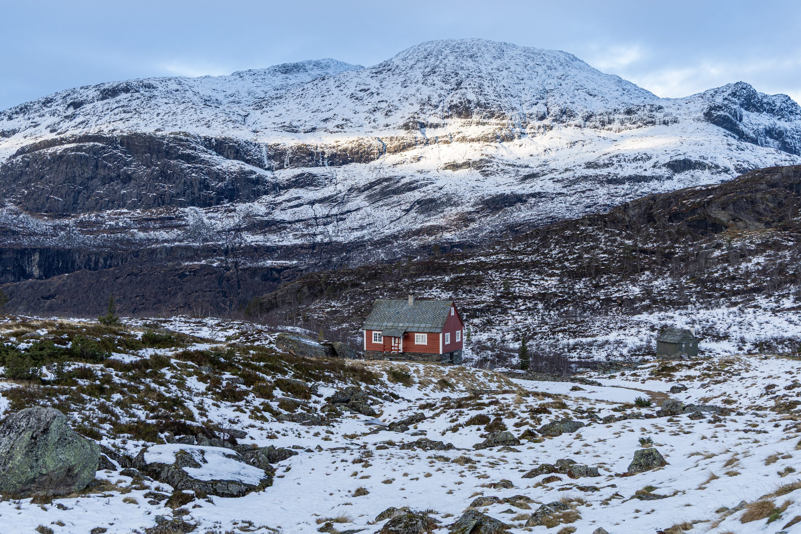
Miałem nadzieję, że ta trasa będzie dużo łatwiejsza (czytaj pozbawiona zwalonych drzew) i się nie zawiodłem. Dojście na dół okazało się łatwe i bezproblemowe. Dotarłem najpierw do szerokiej drogi, potem do gospodarstwa Tunheim, a stamtąd do samochodu przy przedszkolu. Przebrałem się szybko, zjadłem co nieco i mogłem ruszać z powrotem.
What to do when it’s wet outside and the weekend looks set to rain again? Find a spot where it doesn’t rain. Even if it’s a six-hour drive away, it’ll be worth it. And it was. Besides, the Hardanger area is a place that always delights me, regardless of the season or weather conditions. This time, I was aiming for two possible options: Husedalen near Kinsarvik (I’d tried this route before, but at one point, I was stopped by snow covering the path), or the town of Ulvik and one of the two routes starting there. I couldn’t decide. In the end, I decided to make the choice on the spot.
Once there, it turned out that the mountain peaks were already covered with a layer of snow. Who would have guessed? Hello, it’s December after all, I should have planned for this ahead of time. So, I decided to choose a smaller mountain in Ulvik. Kinsarvik and Husedalen were already eliminated from the potential options because, due to the national park boundaries, using a drone wasen’t allowed there.
So I crossed the Hardangerbrua Bridge, turned right in the tunnel at the roundabout (yes, Norwegian tunnels have roundabouts), and found myself in Ulvik. It was still dark, but that would soon change. The route to Kristinuten, where my legs were supposed to lead me, began at the kindergarten parking lot. I left the car there and set off. Initially, along the main street running through the town, then along the Gauro River flowing down from the mountains, I passed orchards stripped of leaves and fruit and a few buildings, before finally climbing higher and entering the forest.
The walk was good. The fresh forest air was like the best medicine for calming and regenerating the mind. I climbed the wide forest road and felt myself revitalized. In a place like this, after more than a month of inactivity, a month without mountains, I could finally breathe and feel at home. Metaphorically, of course.
I don’t know when I first encountered a fallen tree blocking the road. Maybe I didn’t even pay much attention to it. A tree is a tree, after all. Every now and then, in stronger winds, they fall. I avoided them and continued on. But soon I encountered another and another. And each one was harder to avoid. Especially when there were several in one spot. But I kept moving forward, and soon the road ended. And from that point on, I had to rely on the narrow path. And here, too, fallen trees occasionally littered the area. And this time it was harder. At times, very harder. There were more obstacles; finding the right way around them when the terrain became truly steep was quite a challenge. I concluded that a truly powerful storm must have passed through here recently. Trees were broken, uprooted. There were quite a few of them, dozens, at least along my route. There could have been more lying in other places. The view was truly astonishing. And a bit sad, if you think about how many years these trees have been growing peacefully and resisting various weather conditions.
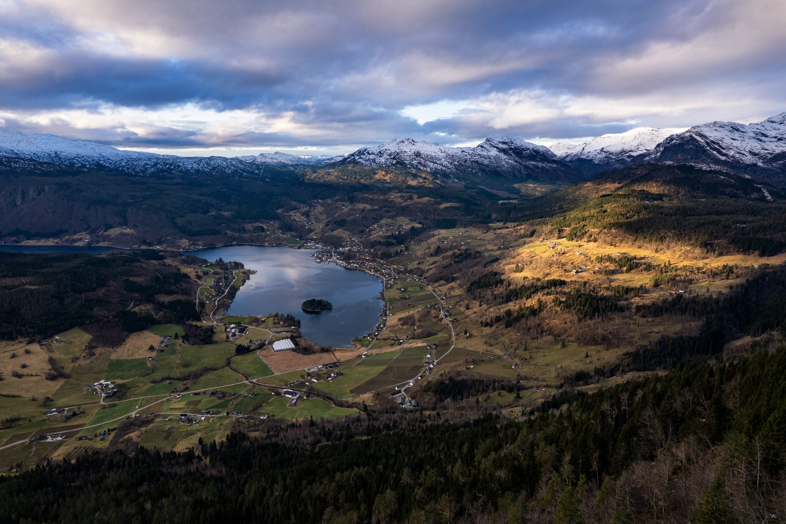
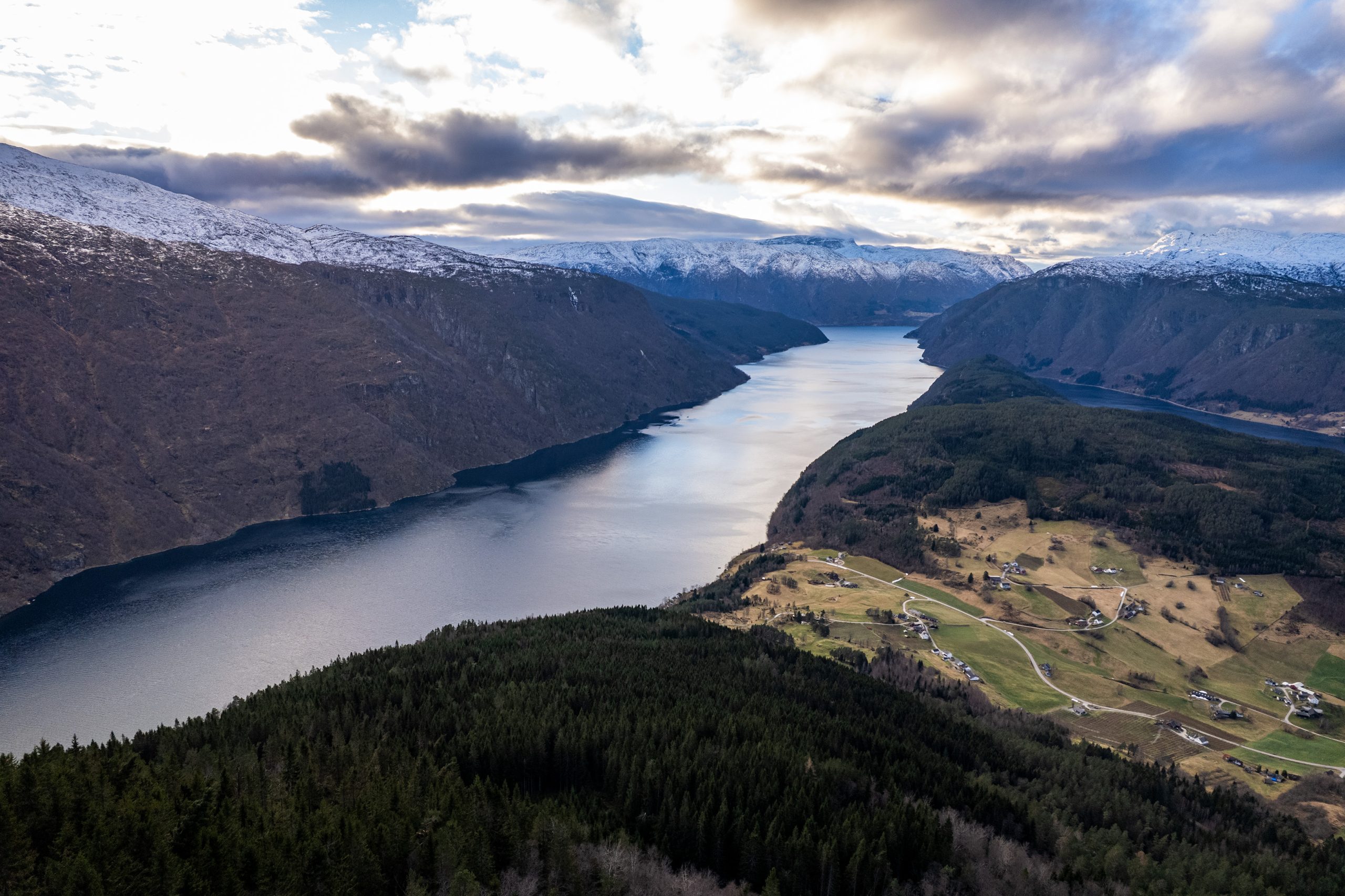
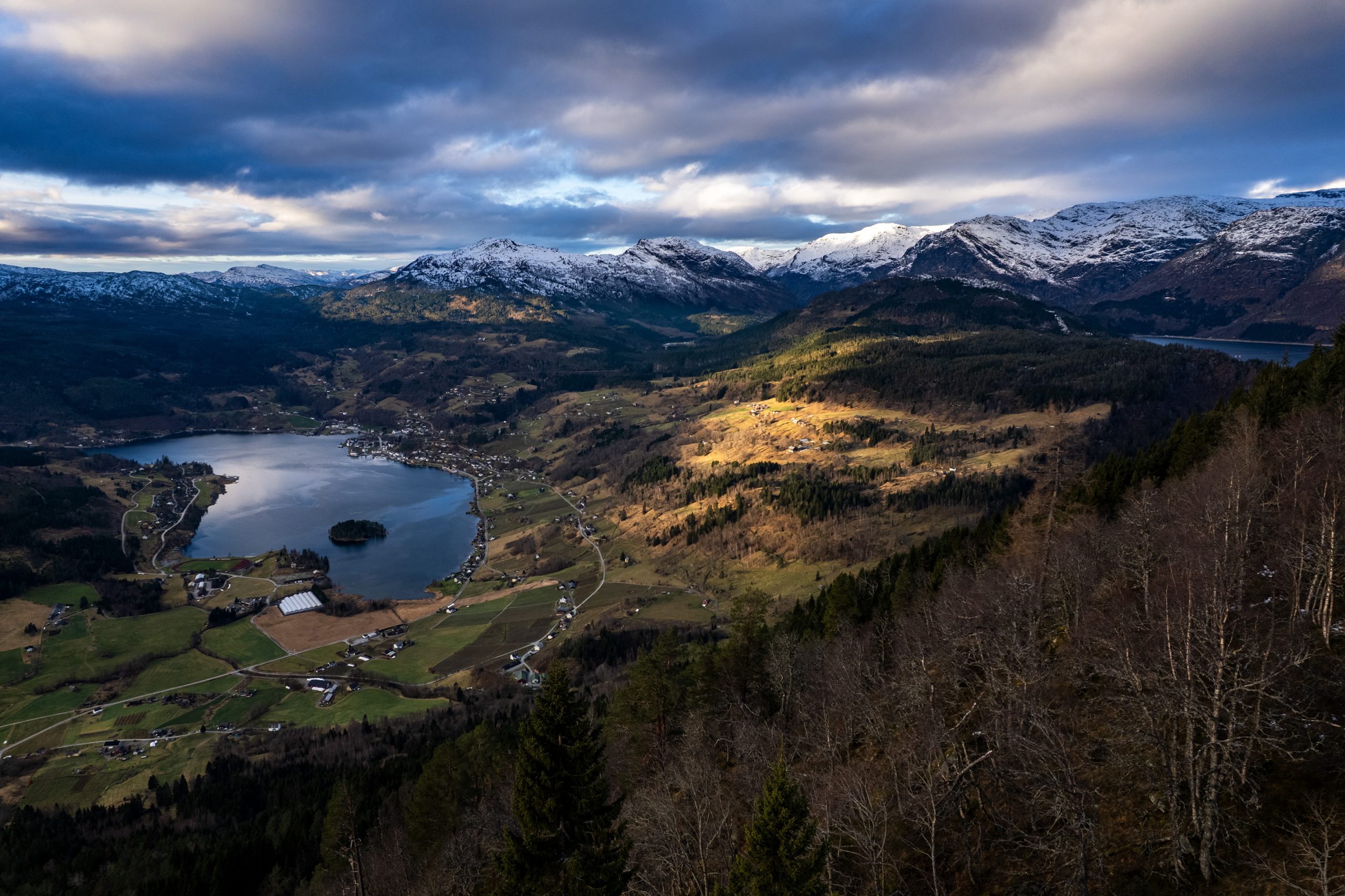
Finally, I managed to climb higher. To where the forest ended. To a more open space. Behind me, the view was breathtaking. I could see the Osafjorden stretching into the distance, connecting with the Hardangerfjord somewhere further on. On both sides of this ribbon of water rose steep mountain slopes, covered with a layer of snow on top. And below, the town of Ulvik, nestled in the Ulvikafjorden bay. Beautiful.
At this altitude, there was already snow. Not much at first, but the higher and further I went, more and more. Until finally, there was so much that I couldn’t see the path. Fortunately, the trail was well marked: mounds of stones, red paint here and there on the rocks. And finally, someone’s footprints, which I assumed would lead me to my destination. I was wrong about that last one. The footprints didn’t lead to the summit. When I realized what I was doing, I had to detour a bit and use my phone’s map to get back to the trail. The route didn’t lead to the highest point, but it passed by it within a short distance. It took me a few minutes to get there and back (and snap a few photos and fly the drone along the way).
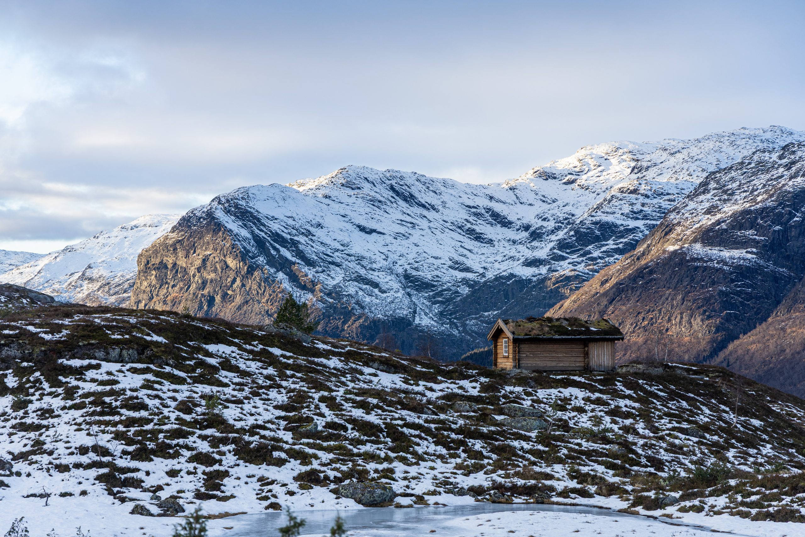
Meanwhile, I realized it was getting late. It was around 1 p.m., and as we all know, the days are a bit shorter in December. I still had some time before sunset (and a flashlight in my backpack, just in case), but I had to hurry. The next leg of the hike involved a snowy walk and a descent to Jonstøl. I think it’s a former farm, converted into vacation cabins. I wasn’t planning on taking the same route back. Going through all those fallen trees again was a bit daunting. From Jonstøl, a path led directly down towards Ulvik, and that was my original plan. To make a loop. So I didn’t stop, just quickly started descending.
I had hoped this route will be much easier (meaning free of fallen trees), and I wasn’t disappointed. The descent proved easy and hassle-free. I reached a wide road, then the Tunheim farm, and from there, the car at the kindergarten. I quickly changed, grabbed a bite to eat, and was ready to head back down.