Skuggenatten
Treungen to niewielka osada w gminie Nissedal, w regionie Telemark, na południu Norwegii. Przycupnięta na południowym skraju jeziora Nisser jest świetną bazą wypadową w okoliczne góry, a tych jest tutaj całkiem sporo. Sąsiedztwo długiego na prawie 35km jeziora gwarantuje niesamowite widoki chyba z każdego szczytu w pobliżu.
Pierwsze, nieudane wejście na Skuggenatten (706 m n.p.m.) miało miejsce w styczniu tego roku. Pomimo słonecznej pogody, poranek przywitał mnie wówczas oblodzonymi drogami i cienką warstwą lodu, pokrywającą szlak. Ten biegł po gładkiej skale, uznałem wiec, że mądrzej będzie sobie odpuścić. Tym razem, w środku lata, nie musiałem martwić się takimi sprawami. Miało być ciepło i słonecznie. I liczyłem na udaną wycieczkę.
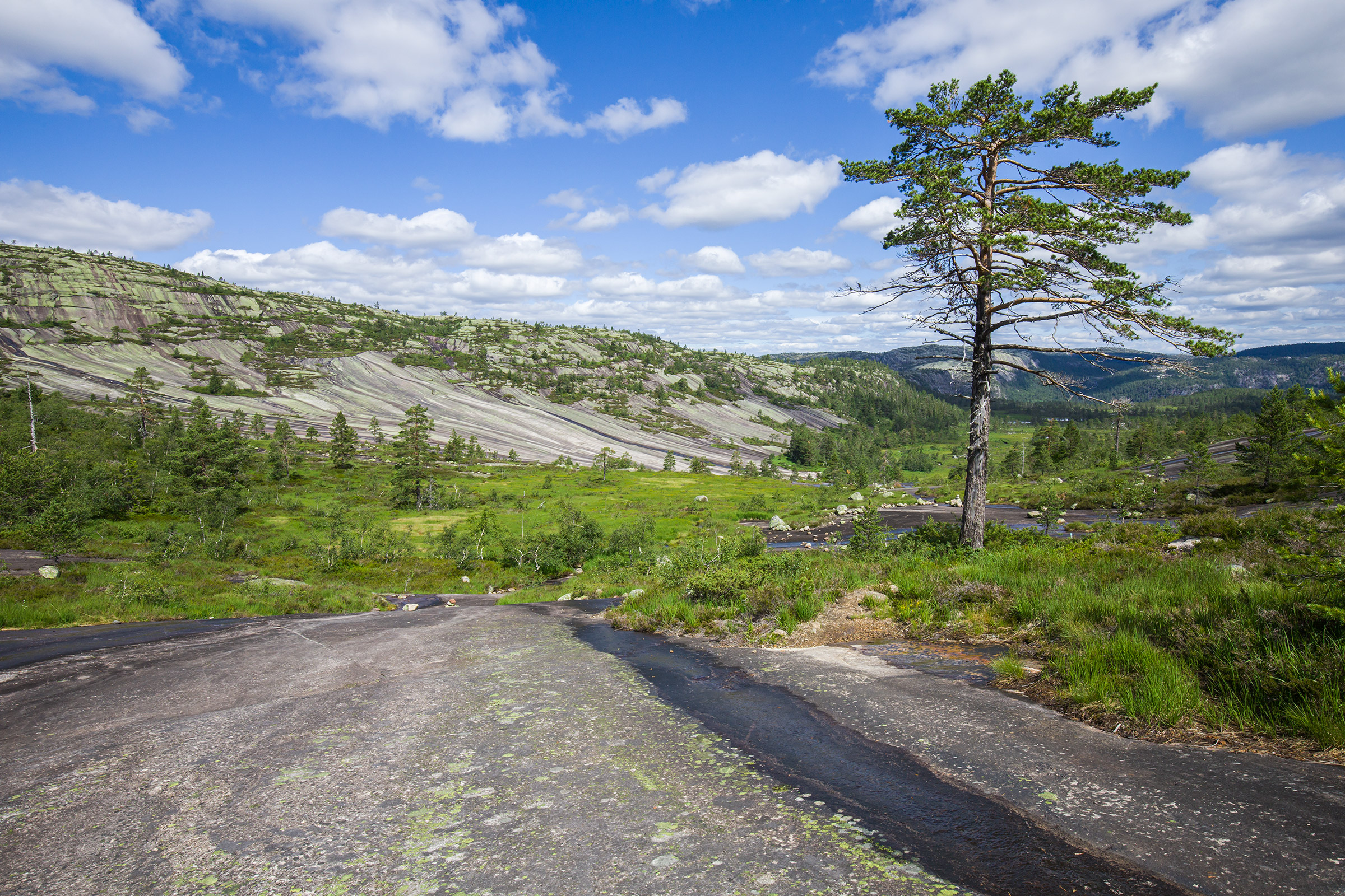
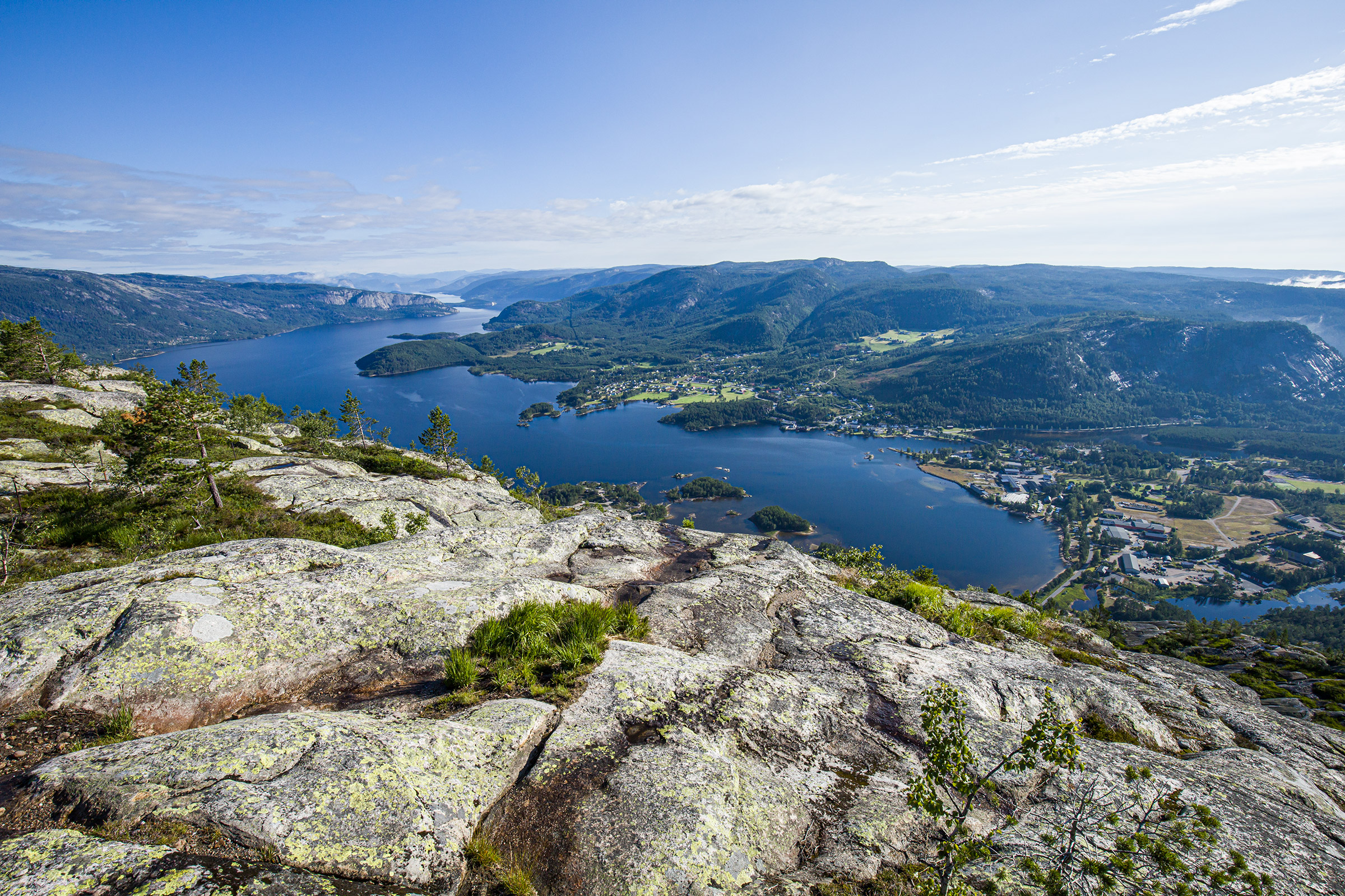
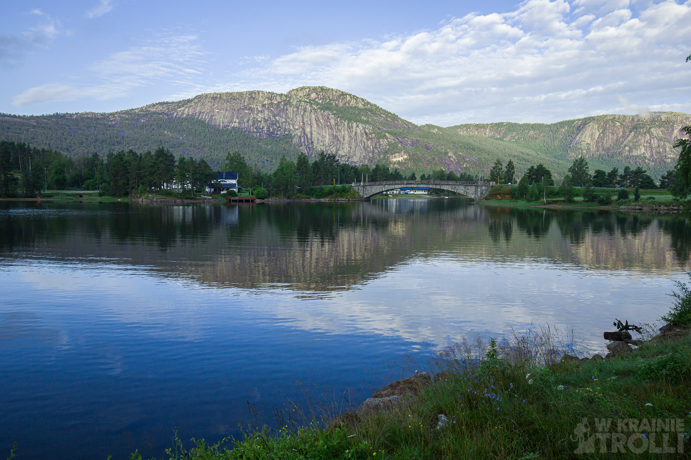
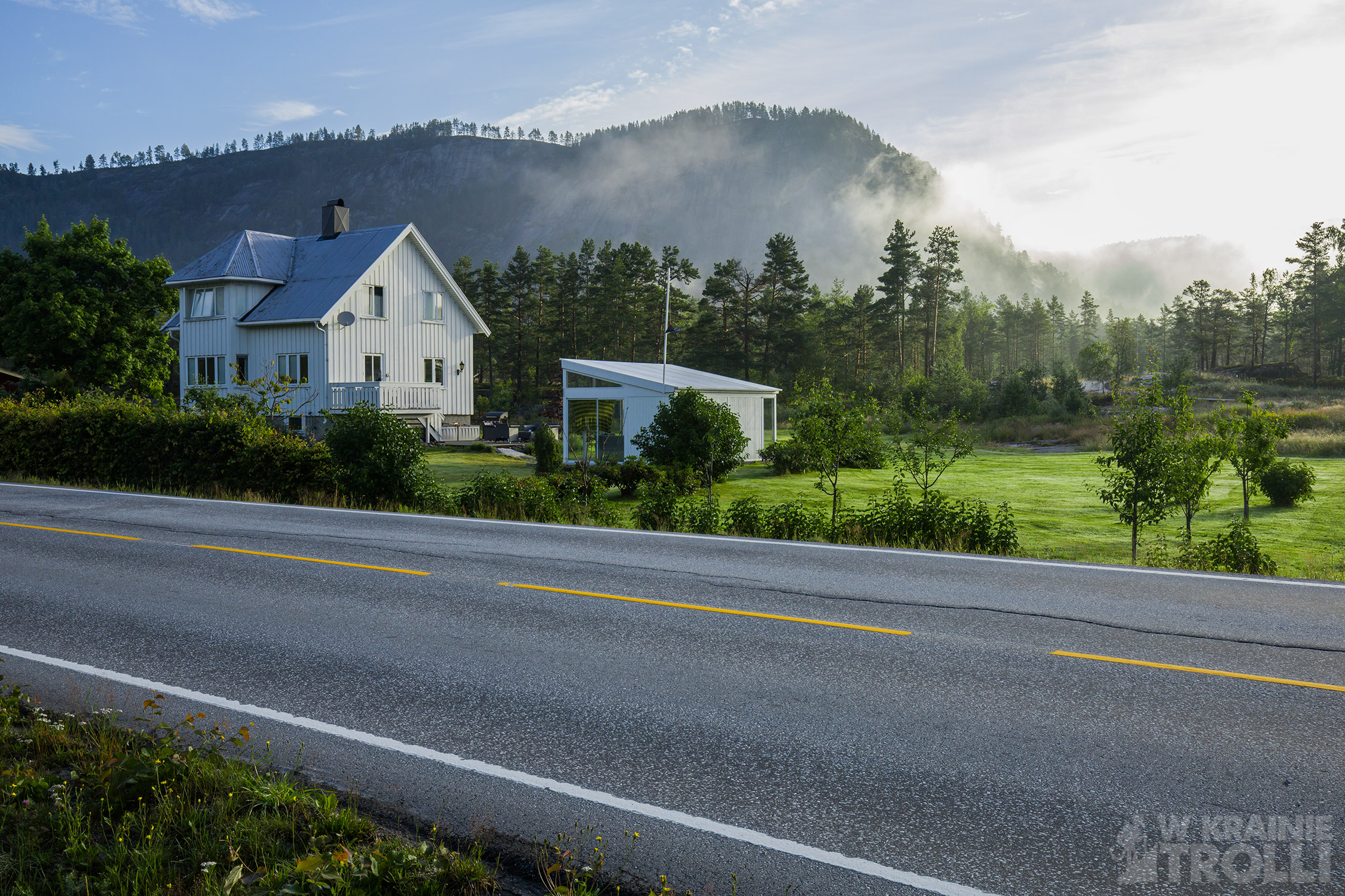
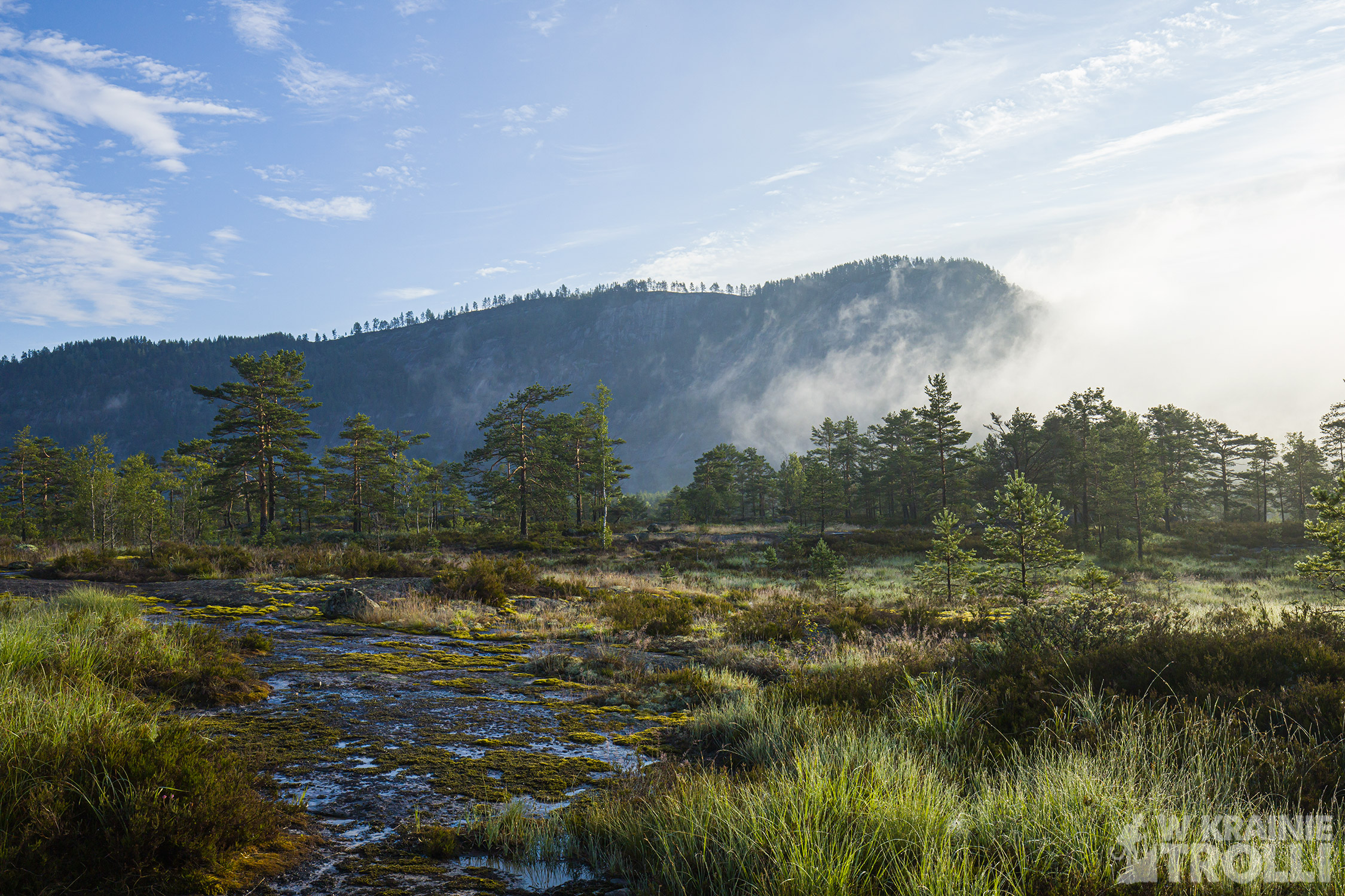
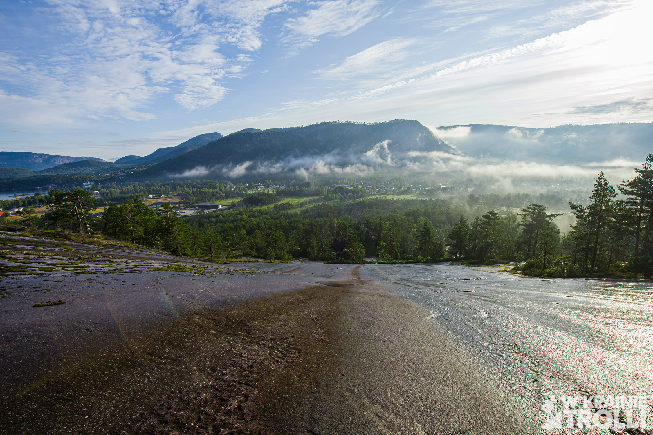
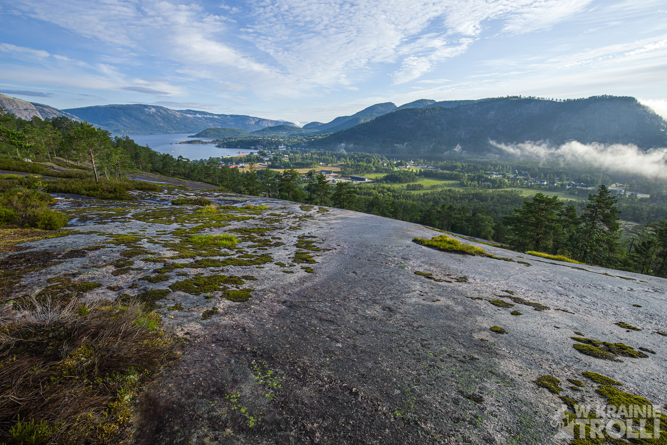
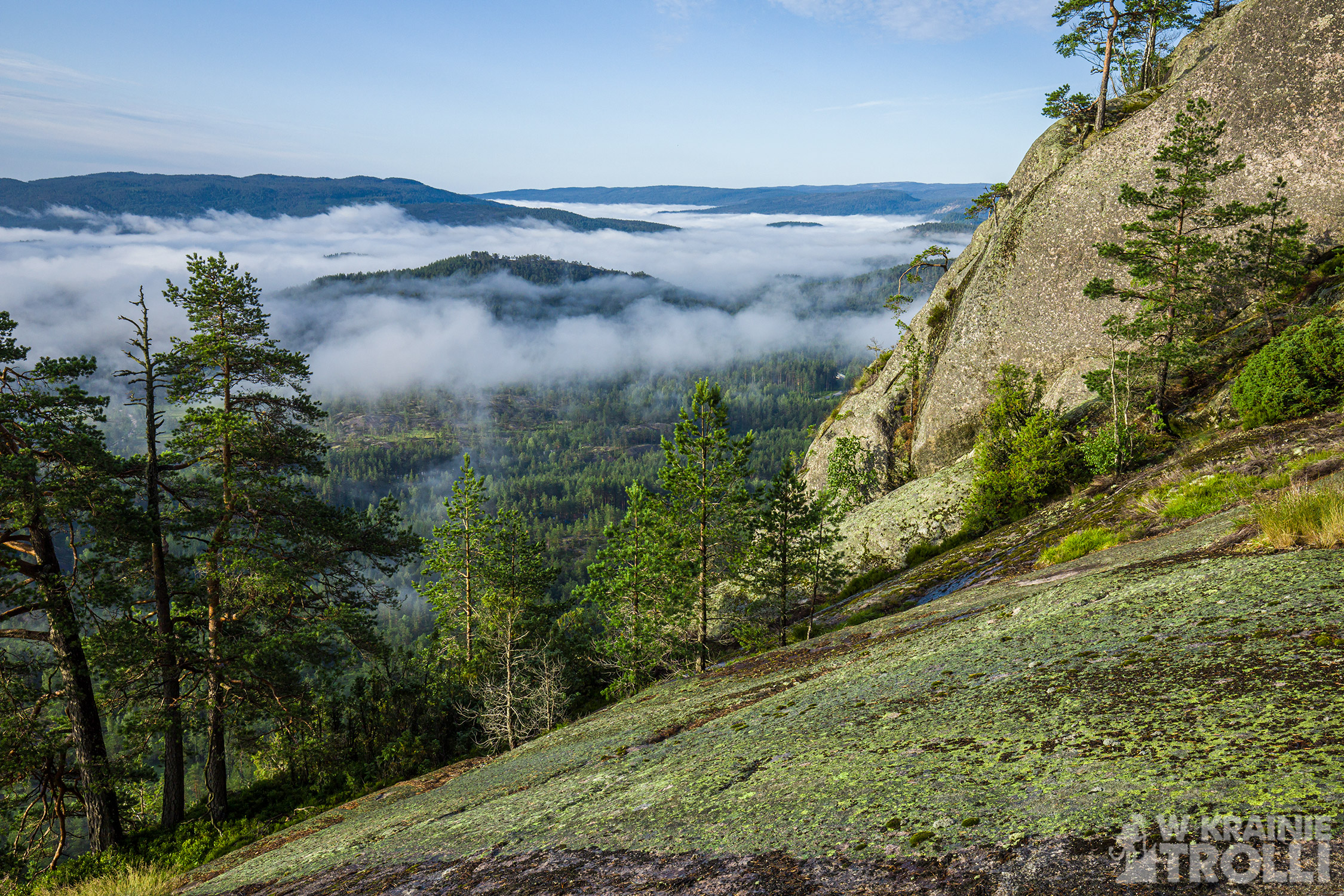
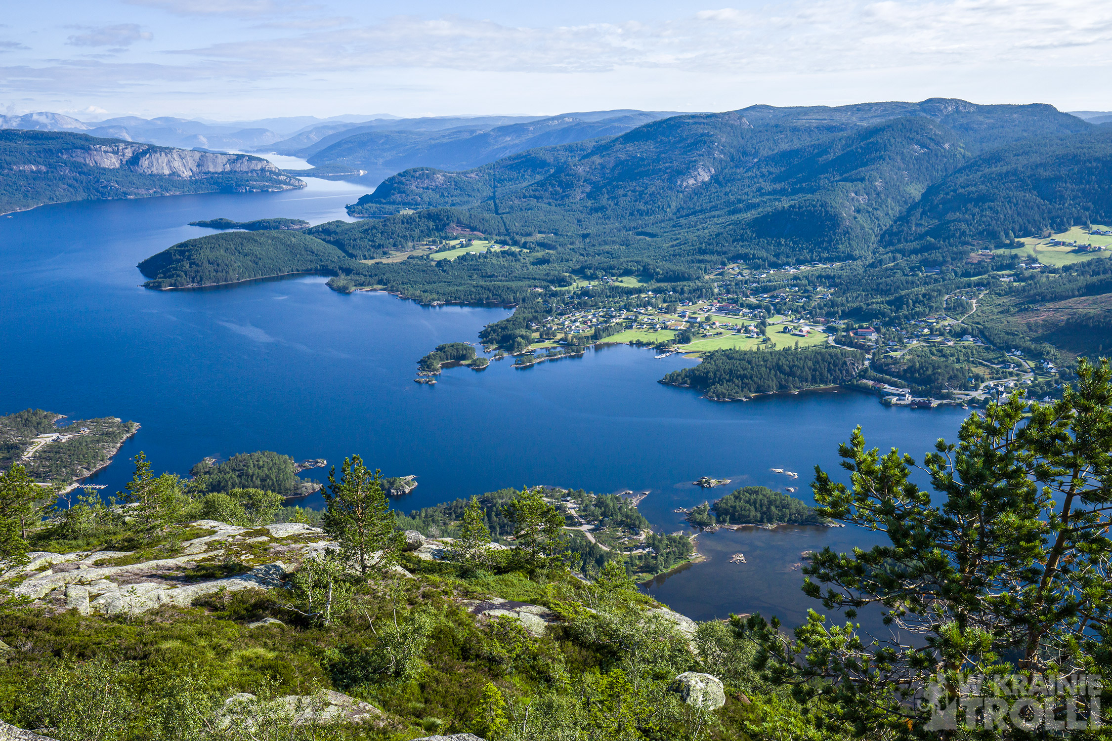
Tak jak ostatnio, pozostawiłem auto na parkingu przy stacji benzynowej Best, przy drodze nr 41, tuż za miejscowością Treungen. Szlak zaczynał się kilkadziesiąt metrów dalej. Gdzieniegdzie zalegały jeszcze poranne mgły, ale zza chmur przebijało już słońce. I choć początkowo było dość chłodno, dość szybko musiałem zrzucić koszulę z długim rękawem. Trasa początkowo biegnie po nagiej skale z obłędnym widokiem na dolinę Lauvdalen i wyróżniający się po drugiej stronie szczyt Skålfjell. Na północy majaczyły oznaki cywilizacji, a dokładniej zabudowania Treungen. Od południa mgły przykrywały dolne partie terenu. Ścieżka poprowadziła mnie w las, potem z powrotem na skały.
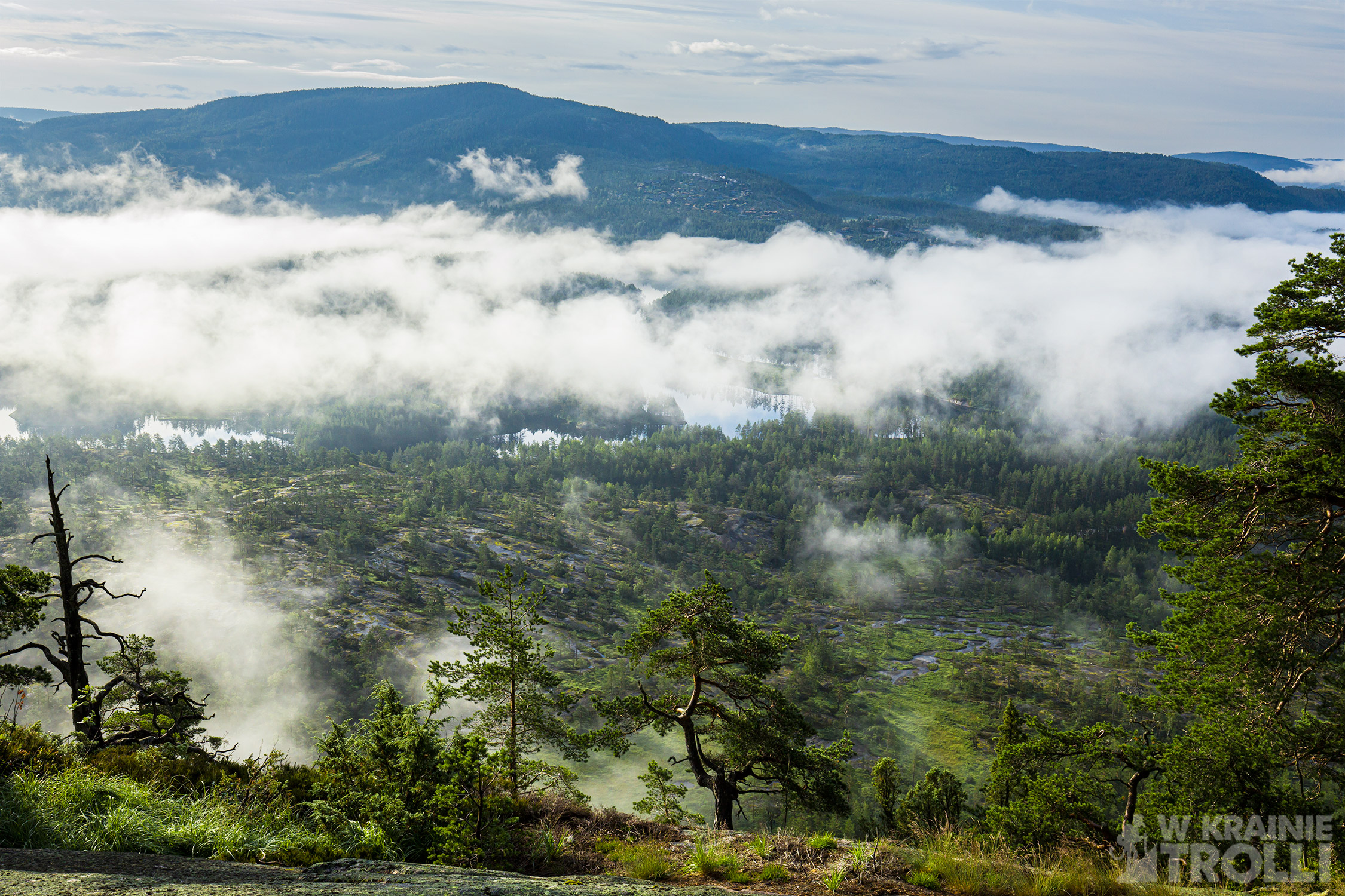
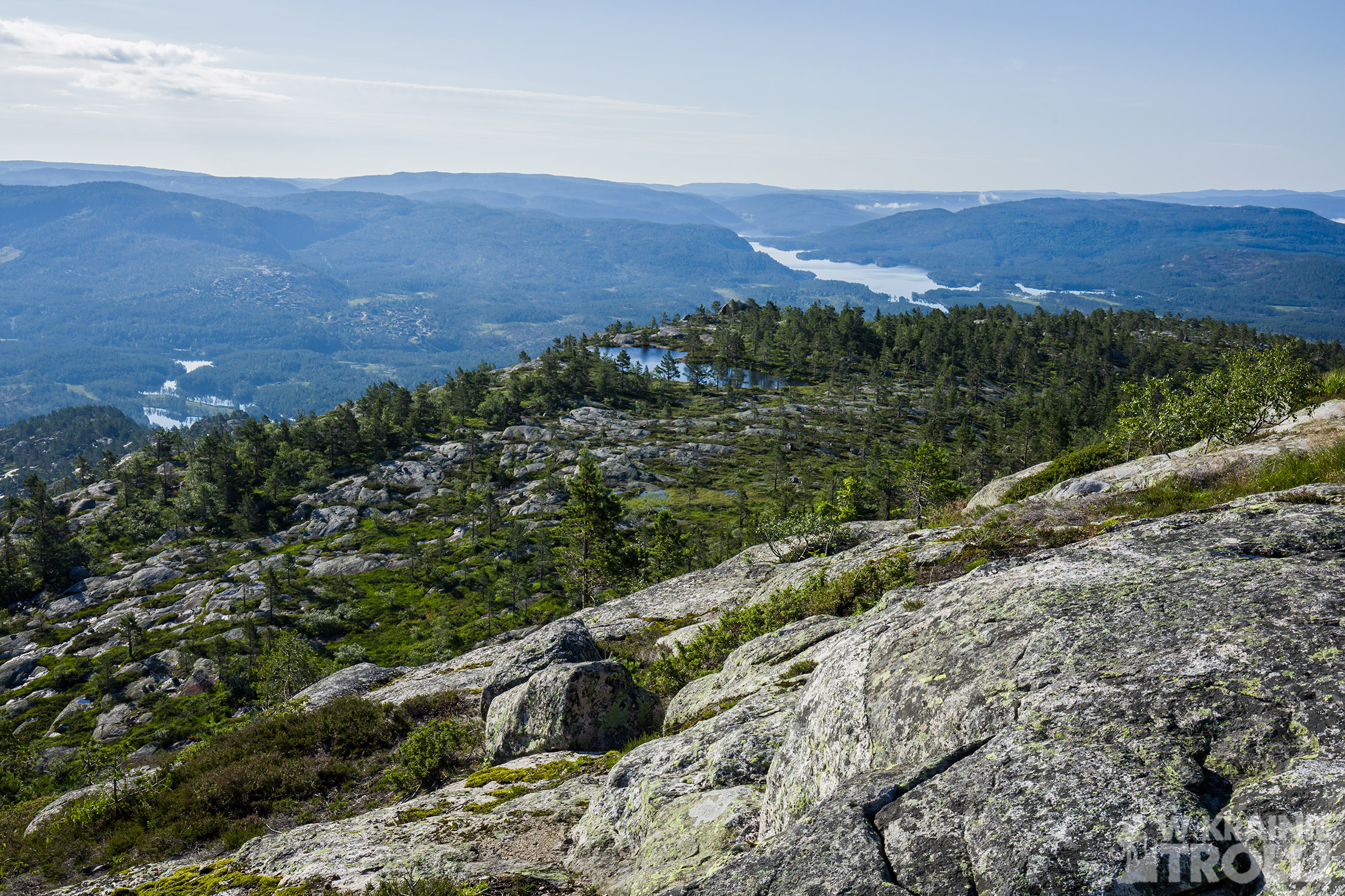
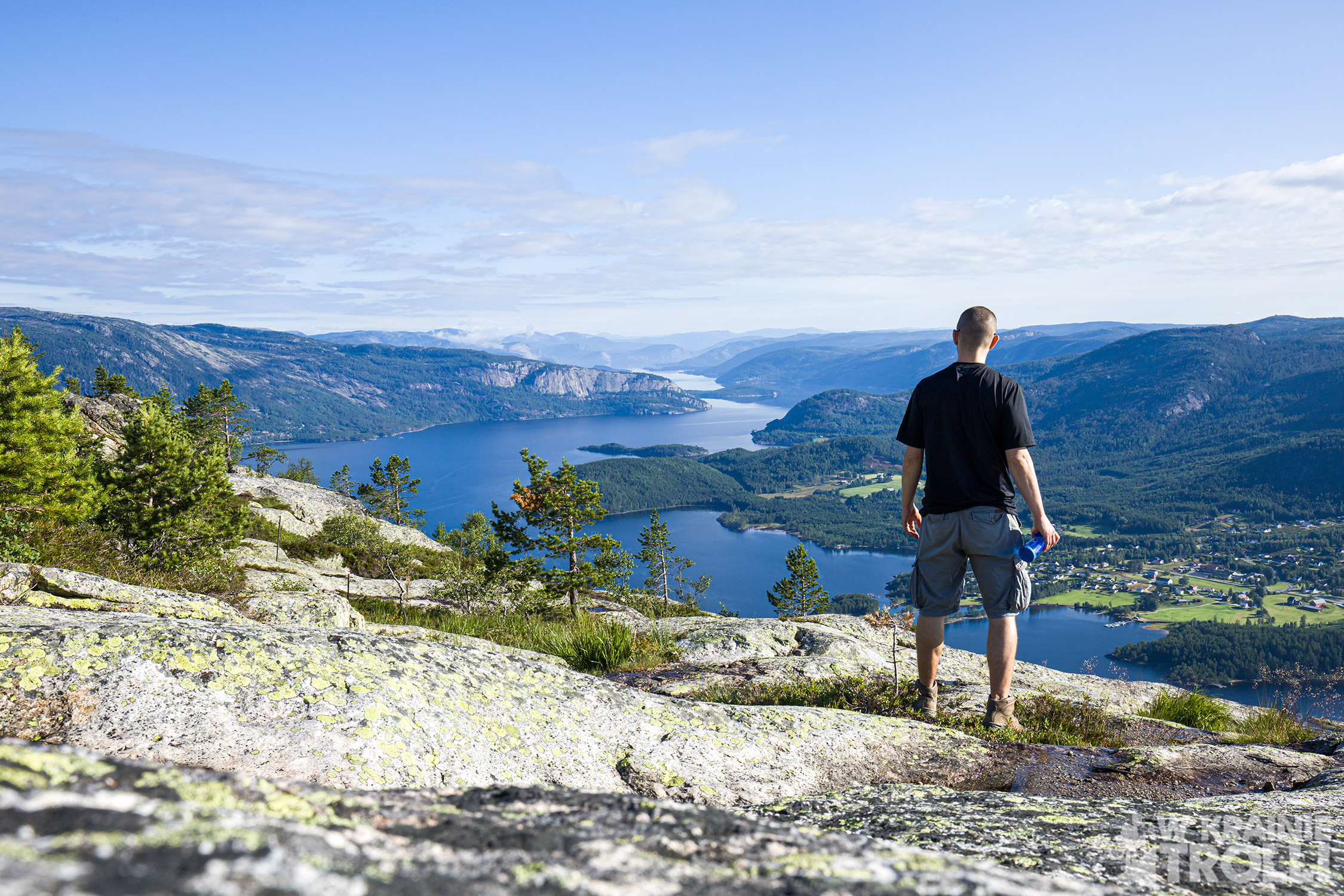
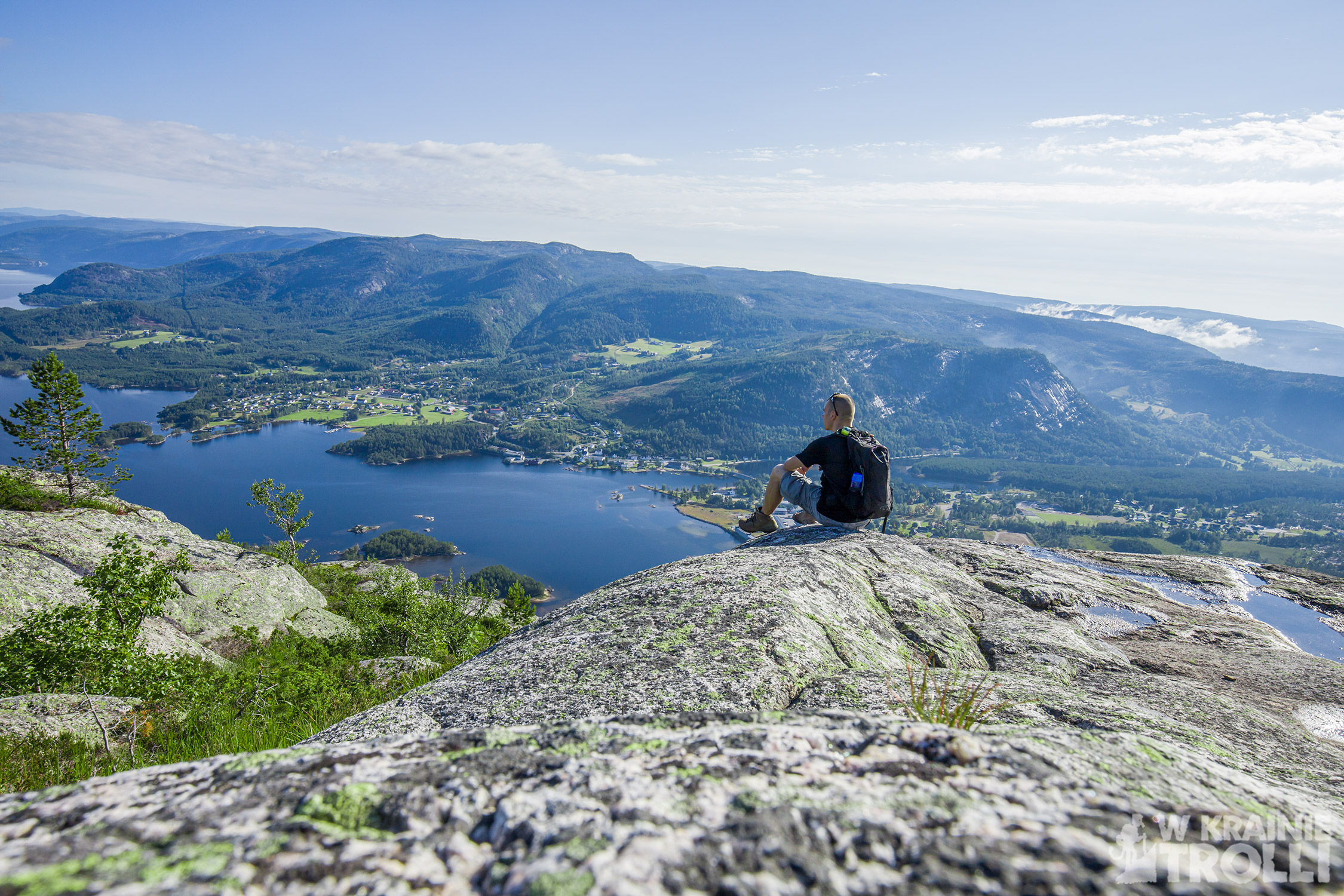
Ani się spostrzegłem a byłem już na szczycie. Tradycyjna kamienna wieża, tuż obok maszt antenowy i stacja przekaźnikowa. Nieco dalej jakaś szopa, zapewne z agregatem w środku i drewniany wychodek. Najważniejsze były jednak widoki ze szczytu, a te prezentowały się rewelacyjnie. Miasteczko Treungen, przycupnięte na końcu ciągnącego się ku północy jeziora Nisser. I otaczające zewsząd inne góry. Czego chcieć więcej?
Pokręciłem się parę minut po szczycie i postanowiłem wracać. Znalazłem ścieżkę biegnącą dalej na zachód, ale zacząłem schodzić tą samą trasą, którą tu wszedłem. Miałem na ten dzień jeszcze inne plany.


Treungen is a small village in the municipality of Nissedal, in the Telemark region in southern Norway. Located on the southern edge of Nisser Lake, it is a great base for trips to the surrounding mountains, and there are quite a few of them here. Nisser Lake has almost 35 km of lenght and it guarantees amazing views from probably every peak in the vicinity.
I left the car at the parking lot at the Best fuel gas station, along the road No. 41, just outside the Treungen. The trail begins several dozen meters away. There were still morning mists there, but the sun was already shining through the clouds. The route initially runs on a bare rock with a stunning view of the Lauvdalen valley and the visible Skålfjell peak on the other side. In the north I could see the buildings of Treungen. From the south, fog covered the lower parts of the area. The path took me into the woods, then back on the rocks.
I didn’t notice when I was already at the top. A traditional stone tower, right next to it is an antenna mast and a relay station. A bit further a shed, probably with a generator inside, and a wooden toilet. The most important, however, were the views from the top, and these were fantastic. The town of Treungen, perched at the end of Lake Nisser. And other mountains around. What more could you want?
I walked a few minutes around the summit and decided to go back. I found a path going toward west, but I chosed to going down the same route I got here.