
Wodospadowa wycieczka
17 maja w tym roku wypadł w piątek. W Norwegii jest to święto państwowe związane z uchwaleniem konstytucji, a więc i dzień wolny od pracy. Społeczeństwo dzieli się wtedy na tych, którzy uczestniczą w pochodach ulicami miast, przebrani w stroje narodowe oraz tych, którzy wyjeżdżają z miast i kierują się w góry, na hytty, lub najogólniej mówiąc z dala od skupisk ludzi. Ja miałem w planach, podobnie jak i w poprzednich latach, wypad w góry, ale niespodziewanie otrzymałem zaproszenie od znajomych na dołączenie do ich wyjazdu w rejon Oddy i odwiedzenie kilku wodospadów w okolicy. A jako, że w grupie zawsze raźniej, to przystałem na tę propozycję.
Uzgodniliśmy, że na pierwszy ogień (choć trochę dziwnie to brzmi w odniesieniu do wodospadu) pójdzie wodospad Langfoss i to tam mieliśmy się spotkać. Wyjechałem od siebie na tyle wcześnie, że po dotarciu na miejsce miałem dość czasu na sesję zdjęciową i drzemkę w aucie w oczekiwaniu na resztę grupy. I choć podczas drogi powieki mi się kleiły z niewyspania, to na miejscu nie mogłem jakoś przysnąć.
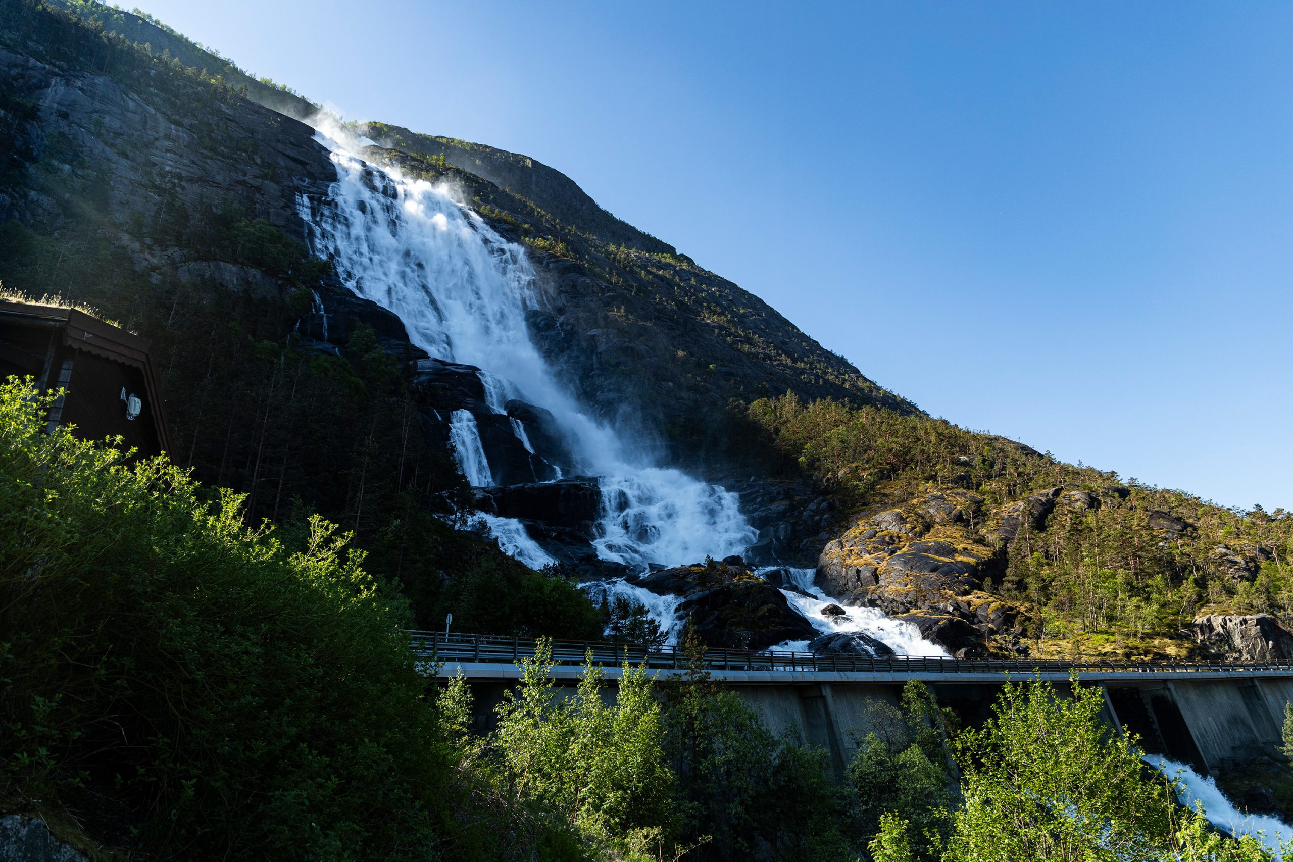
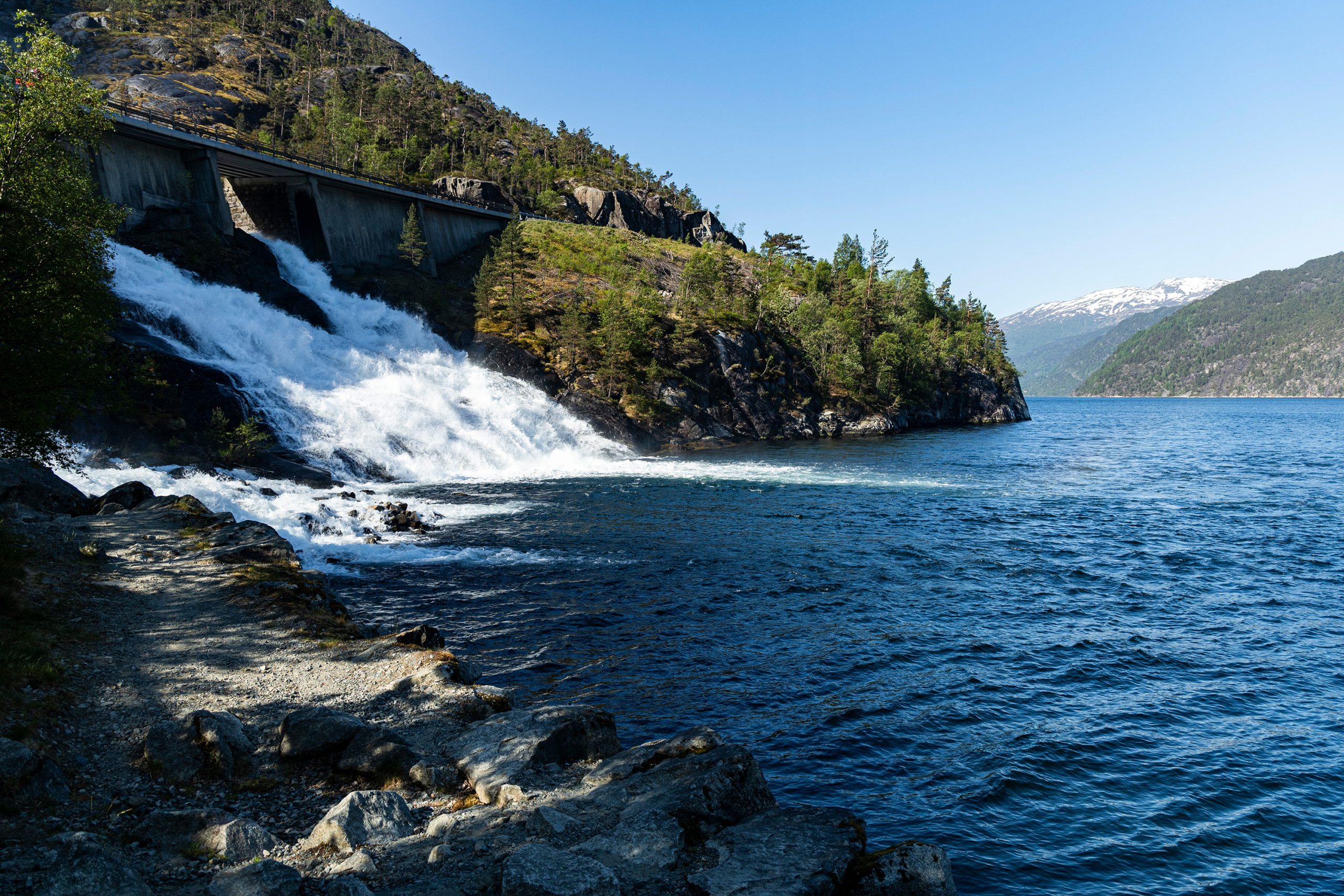
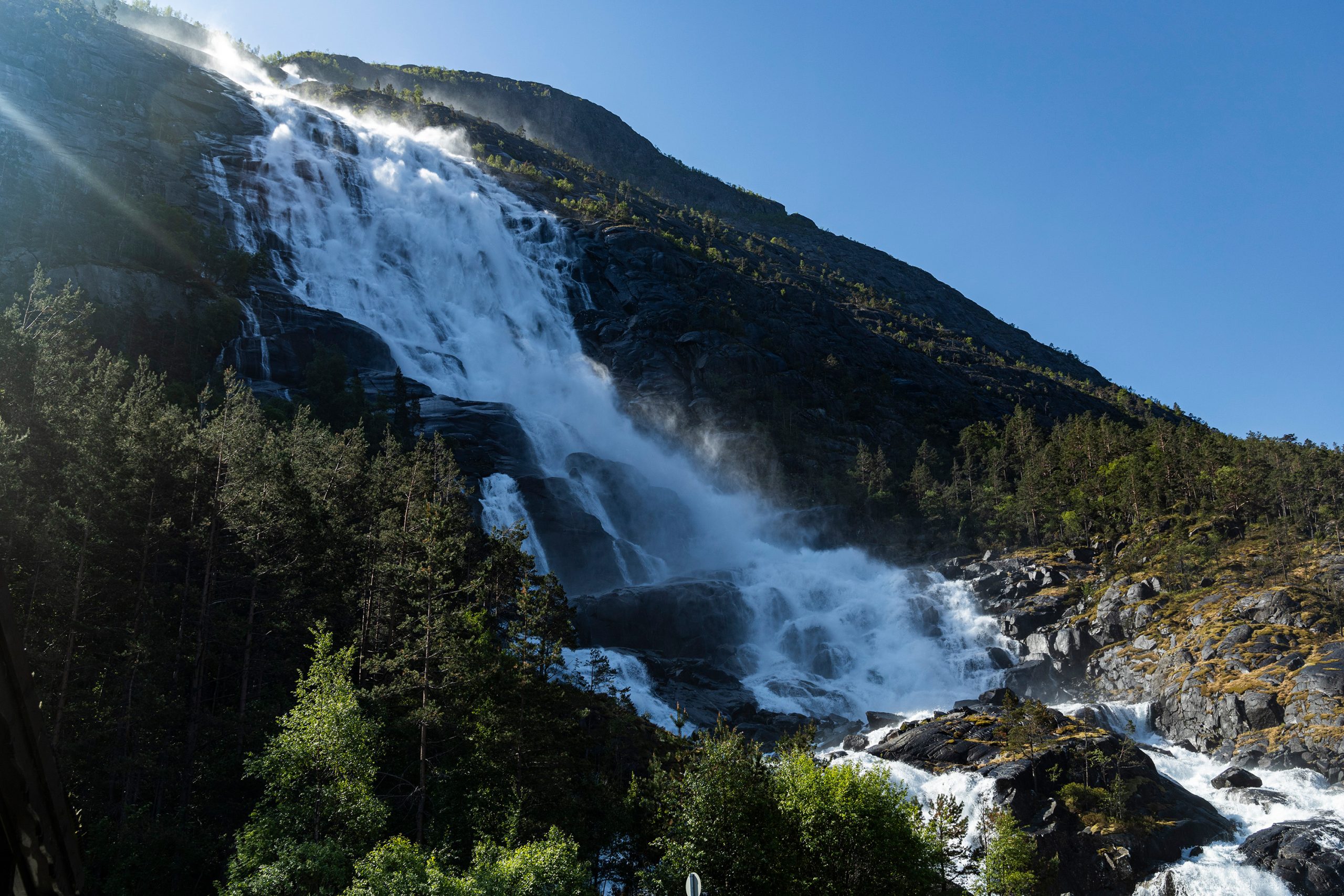
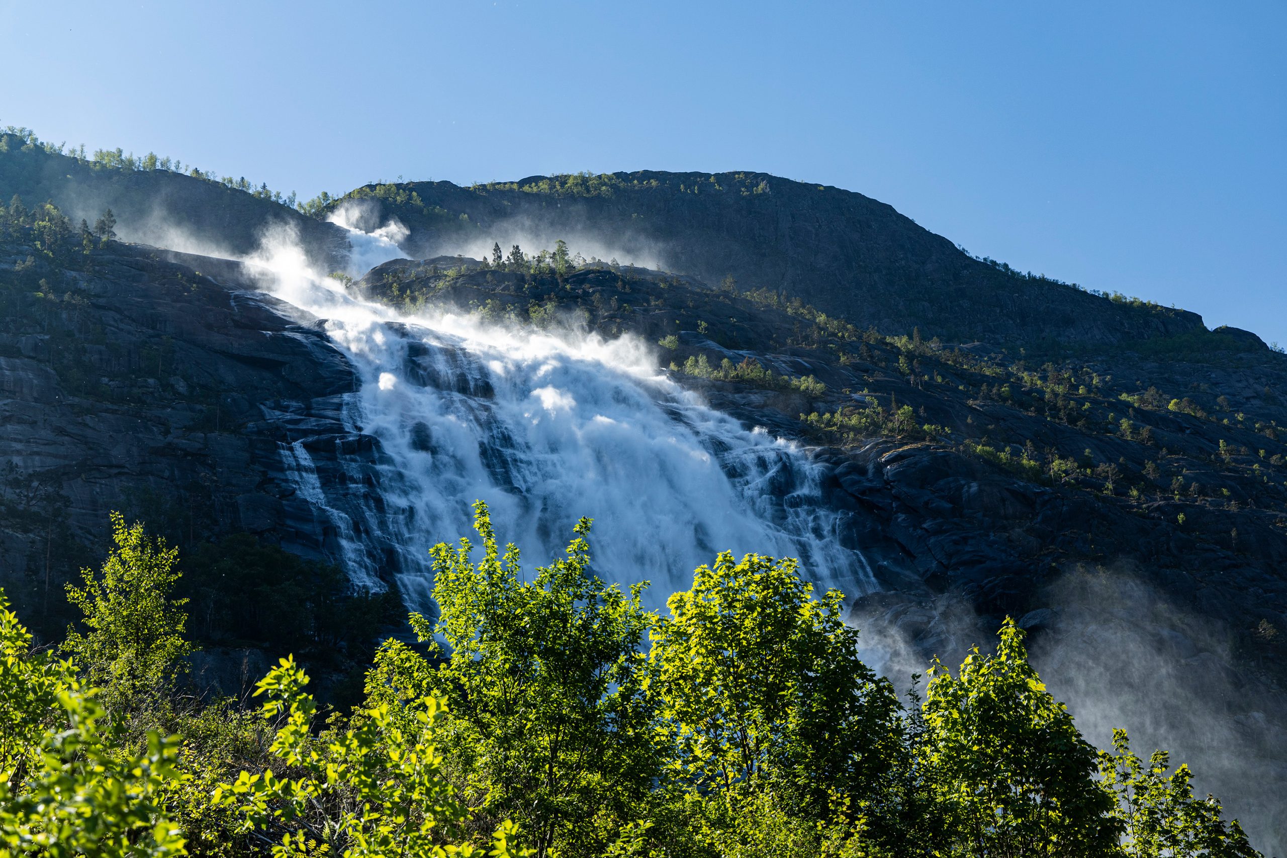
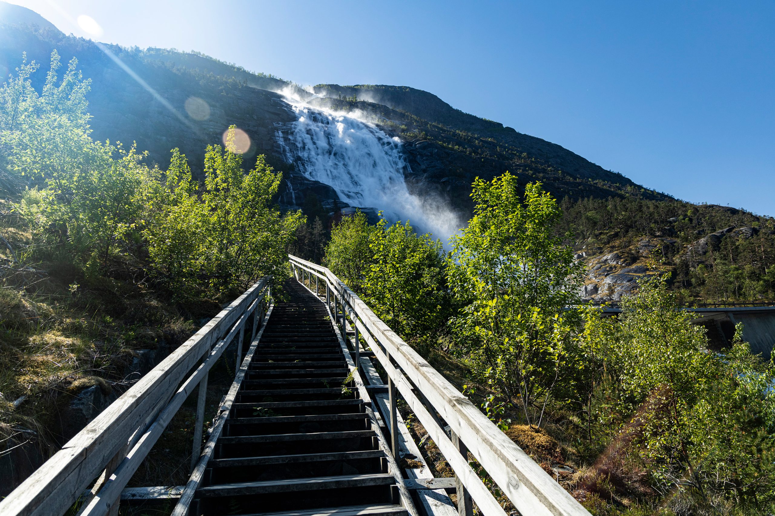
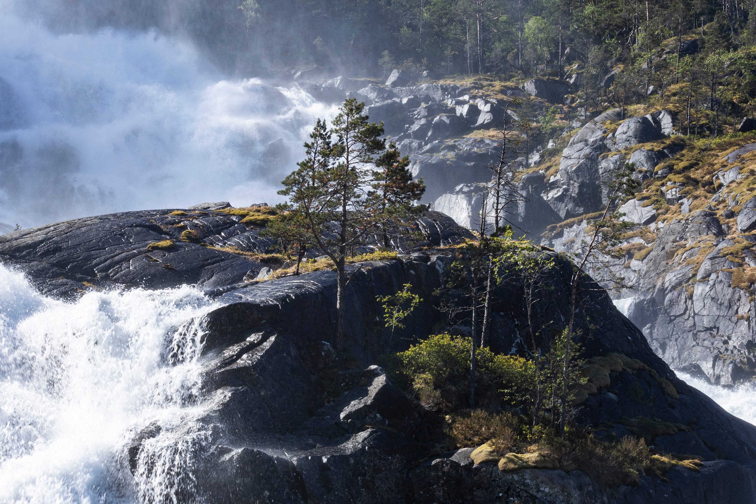
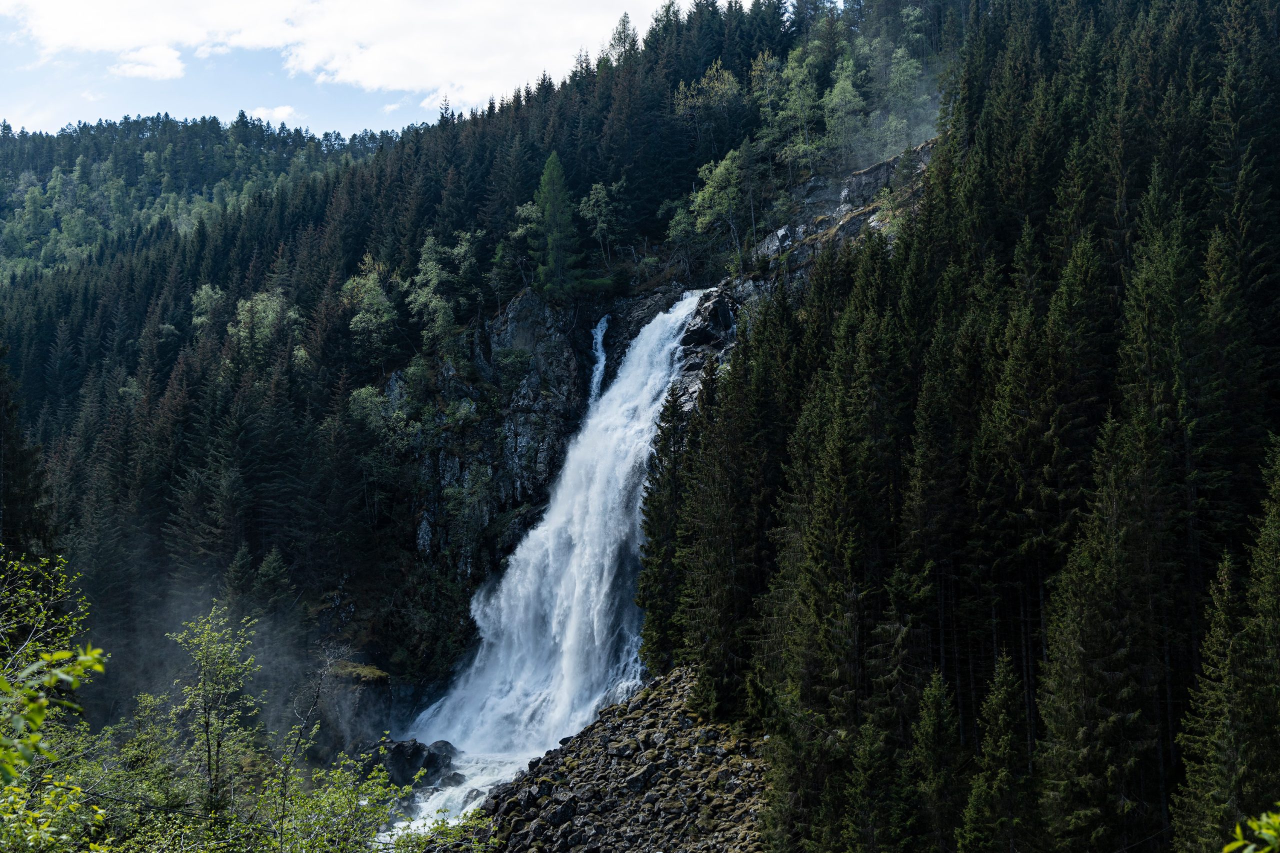
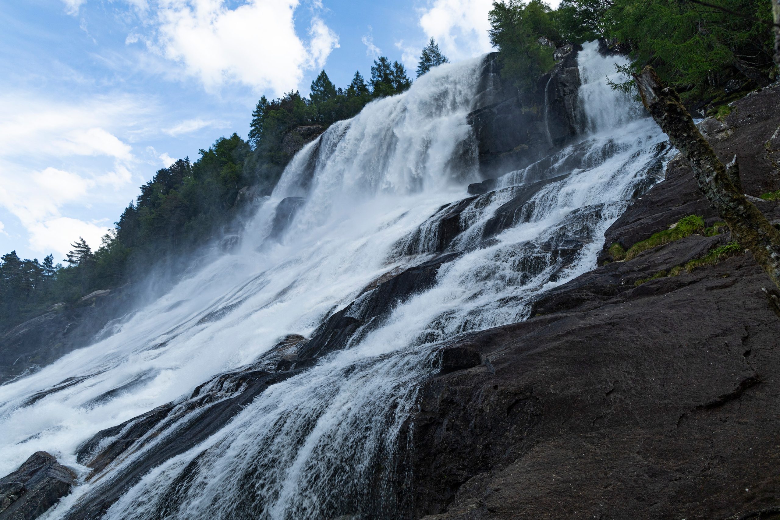
Langfossen to wodospad położony w gminie Etne, w rejonie Vestlandet. Ma wysokość 612m i zasila wody Åkrafjordu tuż pod główną arteria komunikacyjną łączącą zachodnią Norwegię ze wschodnią częścią kraju (czyli drogą E-134). Także nie sposób go przeoczyć przejeżdżając, a parkingi po obu stronach drogi tylko zachęcają do zatrzymania się i zorganizowania sobie przerwy w podróży. Tuż obok wodospadu pnie się po stromym zboczu ścieżka, którą można wejść jakieś 600 metrów w górę (a nawet dalej, jeśli chce się zakosztować uroków gór Etnefjell) i popodziwiać panoramę Åkrafjordu i okolicznych gór.


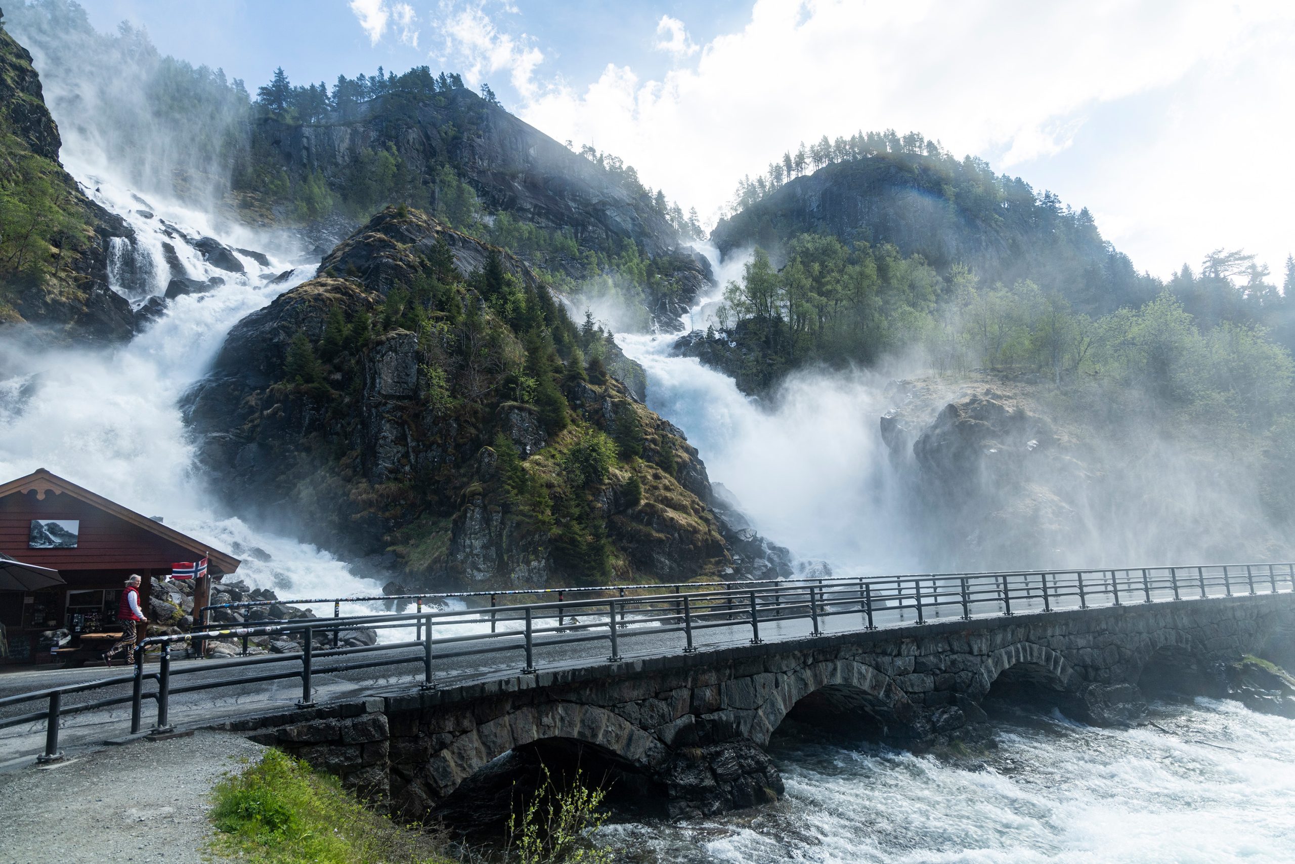
W międzyczasie dojechała reszta ekipy i również zabrała się za fotografowanie Langfossen. Jakiś czas później byliśmy gotowi ruszać dalej. Zahaczyliśmy o niewielki wodospad przy Rullestadvegen i pojechaliśmy na Oddę. Po drodze zatrzymaliśmy się przy jednym z najchętniej fotografowanych wodospadów w Norwegii, czyli przy Låtefossen. Tak, ten też znajduje się przy ulicy (tym razem drodze nr 13), i pewnie stąd ta jego popularność. Co nie znaczy, że nie ma w sobie za grosz uroku. Wręcz przeciwnie. Warto przystanąć i tam i nacieszyć wzrok tym cudem natury. A właściwie to nawet nie jednym, bo nie dość, Låtefossen to jakby dwie spływające z wysokości 300 metrów strugi wody, które łączą się tuż przy drodze i wpadają do rzeki Storelva, to jeszcze po przeciwnej stronie wąwozu znajduje się kolejny olbrzym, Espelandsfossen. Przy tym drugim jednak nie postawiono parkingu ani żadnego miejsca widokowego, trzeba się pieszo cofnąć po wąskiej i ruchliwej (zwłaszcza latem) drodze.
Jadąc dalej na północ, do Oddy mija się kilka innych wodospadów, to z jednej, to z drugiej strony doliny. Wszystkie one zasilają spływającą ku południu rzekę. Jednym z najbardziej widowiskowych wodospadów na tej trasie, oprócz tych już wspomnianych jest Tjørnadalsfossen. Żeby go jednak w pełni docenić, należy zatrzymać się na niewielkim parkingu i przejść kawałek bądź w górę, na Tjørnadalshaugen, bądź też w samą dolinę Tjørnadalen. Ten wodospad zostawiliśmy sobie na kolejny dzień, jako że w planach było wejście na 650 metrowe zbocze.
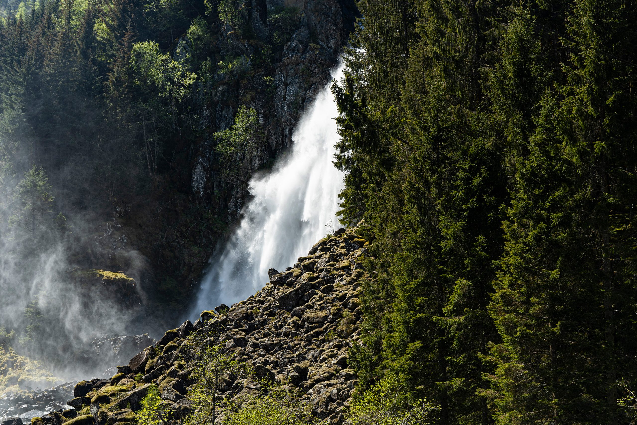
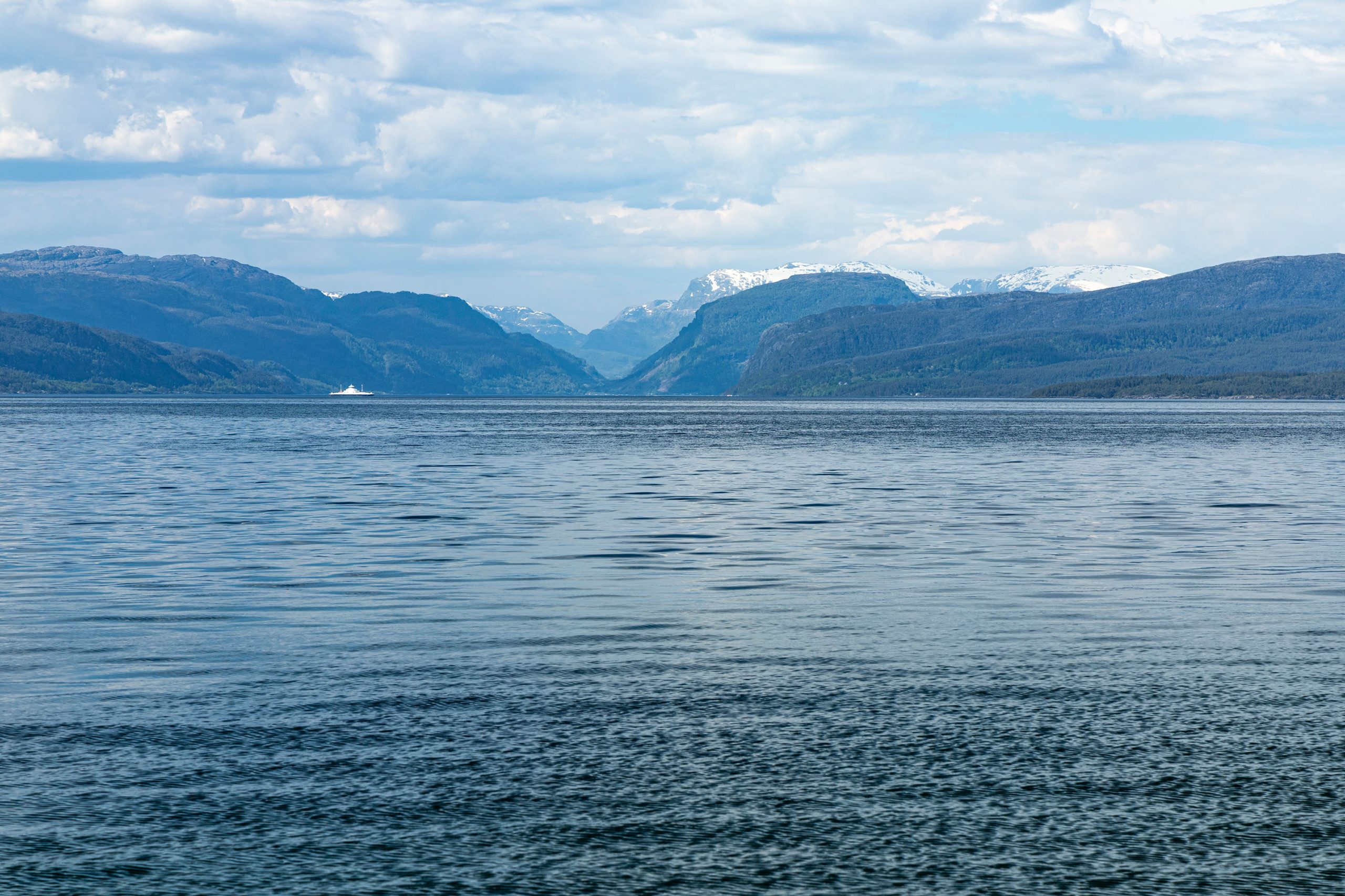
Zatrzymaliśmy się w Oddzie, a jakiś czas potem jechaliśmy już tunelem pod lodowcem Folgefonna na zachód. Tam, południowym brzegiem Maurangerfjordu, dotarliśmy do kolejnej atrakcji, wodospadu Furebergsfossen. Wodospad ma wysokość 90 metrów i 20 metrów spadku pionowego. Niewielka zatoczka tuż za mostem pozwala na zaparkowanie kilku samochodów.
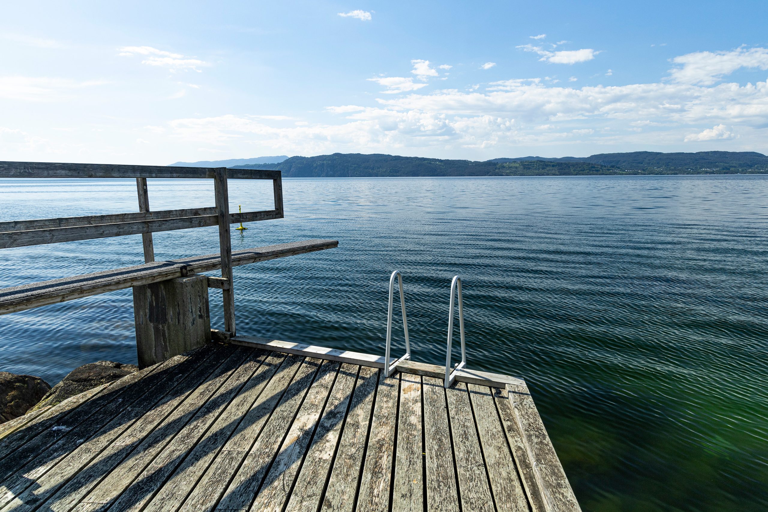
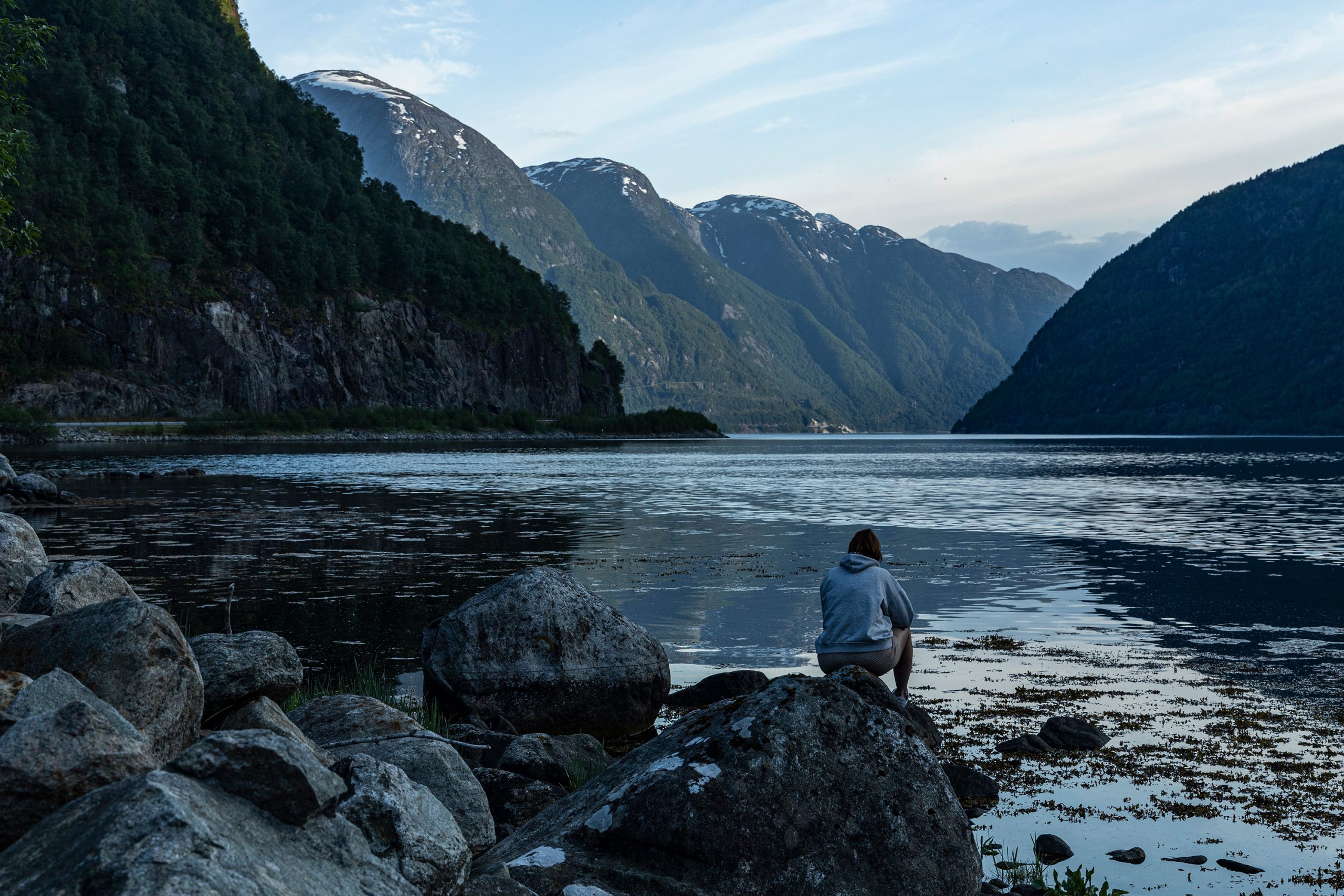
Choć dzień w połowie maja jest długi, a do wieczora wciąż pozostawało sporo czasu, uznaliśmy, że czas pomyśleć o znalezieniu jakiegoś miejsca na nocleg. W okolicy znajdowało się kilka obiecujących miejscówek, ale okazało się, że w większości jest zakaz nocowania, a nie chcieliśmy korzystać z kampingów. Po długich poszukiwaniach i jeżdżeniu w tę i z powrotem drogą 500 (dojechaliśmy prawie pod Rosendal), znaleźliśmy niepozorny parking w Øyre, małej wiosce przy wylocie Jondalstunnelen. Na parkingu znajdowała się toaleta, a niepozorna ścieżka prowadziła nad brzeg fiordu i tam znaleźliśmy idealne miejsce na rozstawienie namiotów.
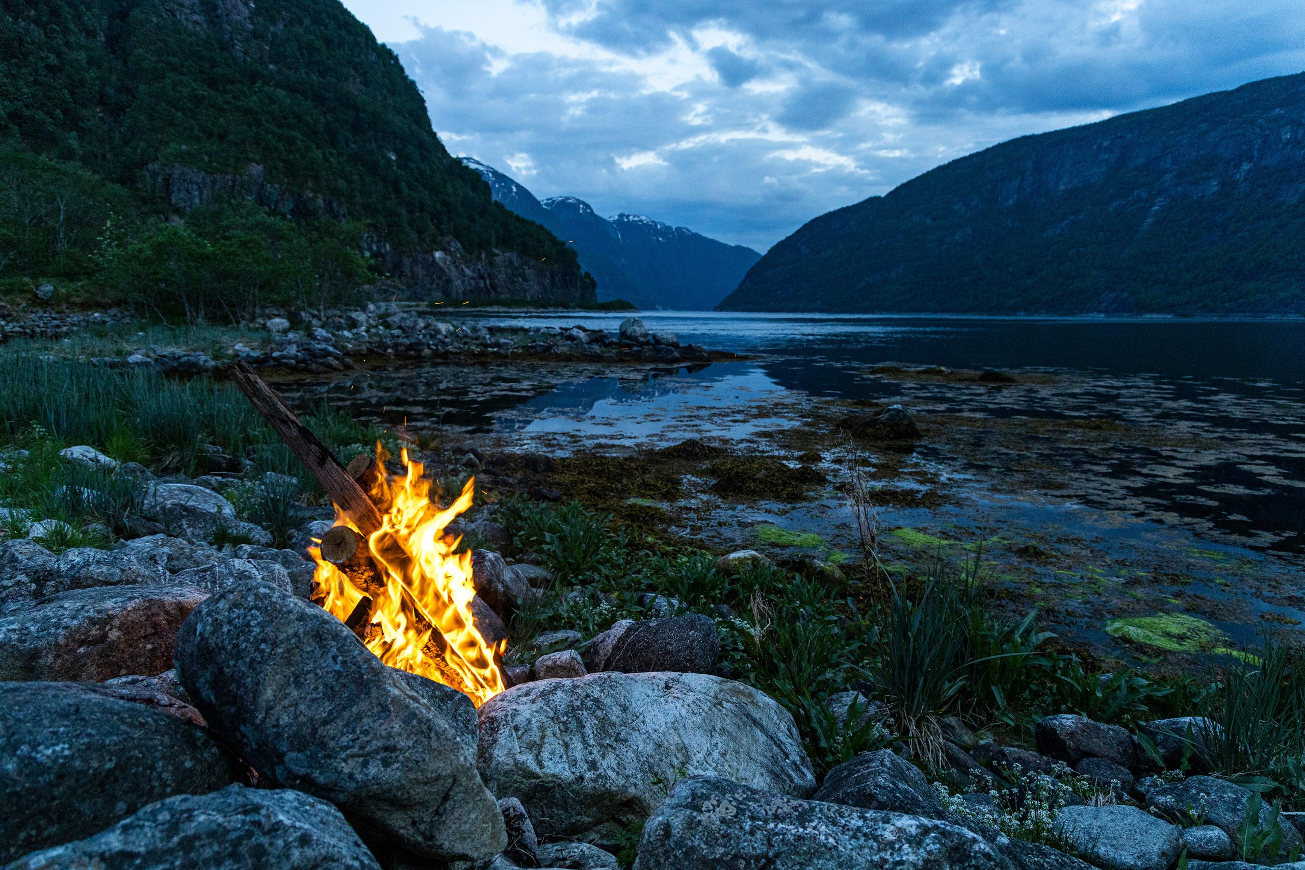
Do zmroku pozostało wciąż sporo czasu, ale zadowoleni z sukcesu jakim było zaanektowanie miejsca do spania nie myśleliśmy wcale aby się przez najbliższe godziny stamtąd ruszać.
Trochę o tych a także i o innych wodospadach możecie przeczytać w jednym ze starszych wpisów, tutaj.


May 17 this year fell on a Friday. In Norway, it is a national holiday known as Constitution Day, and therefore a day off from work. Society is then divided into those who participate in parades through city streets, dressed in national clothes. The second group are those who leave the cities and go to the mountains, to the hills, or just away from crowds. I had plans, as in previous years, to go to the mountains, but unexpectedly I received an invitation from friends to join their trip to the Odda region and visit few waterfalls in that area. And since it’s always more fun in a group, I agreed to this proposal.
We agreed that the Langfoss waterfall would be the first point of that trip and that’s where we were supposed to meet. I left early enough that when I got there I had enough time for a photo session and a nap in the car while waiting for the rest of the group. And although my eyelids were sticky from lack of sleep during the journey, I couldn’t fall asleep once I got there.
Langfossen is a waterfall located in the commune of Etne, in the Vestlandet county. It is 612 m high and feeds the waters of Åkrafjord right under the main communication artery connecting western Norway with the eastern part of the country, i.e. the E-134 road. It is also impossible to miss it when passing by, and the parking lots on both sides of the road only encourage you to stop and take a break during your journey. Right next to the waterfall, there is a path going up a steep slope, along which you can go up about 600 meters (or even further, if you want to taste the charms of the Etnefjell Mountains) and admire the panorama of Åkrafjord and the surrounding mountains.
In the meantime, the rest of the team arrived and started photographing the waterfall. Sometime later we were ready to move on. We stopped at a small waterfall near Rullestadvegen and then went in Odda direction. On the way, we stopped at one of the most photographed waterfalls in Norway, Låtefossen. Yes, this one is also located on the main road (this time road no. 13), which is probably why it is so popular. That doesn’t mean it doesn’t have a bit of charm to it. On the contrary. It is worth stopping there and enjoying this wonder of nature. Or actually not even one, because Låtefossen is like two streams of water flowing down from 300 meters, which join together right next to the road and flow into the Storelva River. And on the opposite side of the gorge there is another giant, Espelandsfossen. However, at the latter one there is no parking lot or any viewing area, you have to go back on foot along a narrow and busy road (especially in summer) to take a closer look.
Driving further north to Odda, you pass several other waterfalls, sometimes on one side, sometimes on the other side of the valley. They all feed the river flowing south. One of the most spectacular waterfalls on this route, apart from those already mentioned, is Tjørnadalsfossen. However, to fully appreciate it, you need to stop at a small parking lot and walk a short distance either up to Tjørnadalshaugen or into the Tjørnadalen valley. We left this waterfall for another day, as we planned to climb a 650-meter slope there.
We stopped in Odda, and sometime later we drove west through a tunnel under the Folgefonna glacier. There, along the southern bank of the Maurangerfjord, we reached another attraction, the Furebergsfossen waterfall. The waterfall is 90 meters high and has a vertical drop of 20 meters. A small bay just behind the bridge allows parking for several cars.


Although the days in mid-May are long and there was still a lot of time until the evening, we decided it was time to think about finding a place to stay overnight. There were a few promising spots in the area, but it turned out that most of them prohibited overnight stays and we didn’t want to stay in the campsites. After a long search and driving up and down route 500 (we almost reached Rosendal), we found an inconspicuous parking lot in Øyre, a small village at the exit of Jondalstunnelen. There was a toilet in the parking lot, and an inostensible path led to the shore of the fjord, where we found the perfect place to set up our tents.
There was still a lot of time left until dusk, but happy with our success in taking over a place to sleep, we didn’t think about leaving there in the next few hours.
You can read a little more about these and other waterfalls in one of the older posts, here.


Jeden komentarz
Lidia Ogrodowczyk
Pięknie, Pamiętam te widoki.