
Hydalen, Hemsedal i renifery
Moja ostatnia górska wycieczka była całkiem niezła, ale nie wszystko przebiegło tam po mojej myśli. Było zdecydowanie za dużo ludzi, potrzebowałem dłuższej trasy i miejsca do polatania dronem. W kolejny dostępny weekend postanowiłem wybrać się do Hemsedal. I tym razem nie po to by wleźć na któryś z tamtejszych szczytów. Moim zamierzeniem było przejść się dnem doliny Hydalen, przejść na drugą stronę rzeki Hydalsåne a następnie obejść szczyty Hydalsbergi i Harahorn od południa, dojść do drogi wzdłuż wschodniego brzegu jeziora Vavatn i wrócić do punktu początkowego. Trasa liczyła przeszło 20 kilometrów i powinna mi zająć cały dzień.


Na miejsce, czyli niewielki parking przy Hydalsvegen dotarłem wcześnie rano. Słońce niedawno wstało i górski krajobraz w jego świetle wydawał się szczególnie piękny. Zmieniłem buty, sprawdziłem plecak i upewniłem się, że mam wszystko czego potrzebuję, po czym wyruszyłem.
Przez dolinę Hydalen prowadzi szeroka, szutrowa droga, a cały ten obszar znajduje się w granicach rezerwatu przyrody. Oznaczało to, że musiałem się wstrzymać z użyciem drona do czasu aż znajdę się w sąsiedniej dolinie, po drugiej stronie Hydalsbergi. Szedłem na wschód, otaczały mnie wznoszące się strome skaliste zbocza gór po obu stronach drogi. Od południa minąłem pionowy klif Hydalshjallen, na północy wznosił się masyw górski, którym kiedyś wędrowałem do Ranastongi. Niedługo potem napotkałem sympatyczną owczą rodzinkę.
Słońce skryło się za chmurami ale nie zapowiadało się na deszcz. Minąłem jezioro Nord-Hydalsvatnet, a wkrótce potem kolejne, Geitevatnet. Droga hydalsvegen ciągnie się przez około 6,5 kilometra, i przez cały ten czas można sycić oczy pięknymi widokami. Kolejne owce pasące się lub wędrujące tą samą drogą, pojawiały się sporadycznie na trasie. Przy końcu drogi znajduje się skupisko domków wypoczynkowych. Dalej, czekała na mnie już wąska, prowadząca brzegiem kolejnego jeziora (Sør-Hydalsvatnet) ścieżka.
Nie miałem pewności czy w miejscu, gdzie chciałem się przeprawić przez rzekę znajduje się most. Na mapie nie sposób było stwierdzić czy jest taka możliwość. Liczyłem na to, że most tam jest. W ostateczności czekała mnie droga powrotna tą samą trasą. Ścieżka była dobrze widoczna, choć moje buty i nogawki spodni zdążyły zmoknąć od wilgotnej trawy i niskiej roślinności. W końcu, jakieś 3 kilometry po tym, jak opuściłem Hydalsvegen, dostrzegłem most. A raczej kładkę nad wzburzoną rzeką Hydalsåne. Przeszedłem na drugą stronę.
Teraz pozostało odnaleźć właściwą trasę prowadzącą na południe, w kolejną dolinę, pomiędzy górami. Początkowo oczywiście wybrałem nie tę ścieżkę co powinienem. Dostrzegłem tę właściwą, ale poszedłem tą bardziej wydeptaną wzdłuż brzegu. Ta jednak doprowadziła mnie donikąd i musiałem się wrócić. Ta właściwa poprowadziła mnie przez las w górę po zboczu w kierunku przełęczy.


Gdzieś w tym momencie, kiedy dyszałem ciężko wspinając się po ścieżce, pokazało się słońce. A niedługo potem usłyszałem charakterystyczny dzwonek, jakie noszą na szyi owce. Kolejne owce, pomyślałem. Kiedy jednak rozejrzałem się wokół, nie dostrzegłem owiec. Ujrzałem za to stadko reniferów. Kilkadziesiąt metrów od miejsca, którym stałem pasło się kilka sztuk, jeden z nich (a może to była ona) miał na szyi dzwonek. Miło było dla odmiany ujrzeć inne zwierzęta, a zwłaszcza renifery. Były zbyt daleko by próbować choćby zrobić im udane zdjęcie, ruszyłem więc dalej.
A dalej było jeszcze ciekawiej. Nie upłynęło nawet 5 minut, kiedy minęło mnie kolejne stado. Kilka lub kilkanaście sztuk. Gdy odkryły że jestem w pobliżu, oddaliły się na bezpieczną odległość. Tam, dwa osobniki obserwowały mnie przez moment, po czym i one czmychnęły za wzniesieniem i podążyły za resztą stada.
Okazało się, że znalazłem się w reniferowym raju. W oddali na wschodzie ujrzałem kolejne malutkie czworonożne sylwetki. Odnalazłem swoją ścieżkę i kontynuowałem marsz. Przez całą drogę przez tę dolinę, kierując się na zachód widziałem stada reniferów. Nie dały się podejść. Wyczuwały moją obecność i oddalały się na bezpieczną odległość. Niektóre zaciekawione obserwowały mnie z dystansu. Może strzegąc swojego stada, przed potencjalnym zagrożeniem. Bądź co bądź, to ja tu byłem obcym, intruzem, gościem. Nie zamierzałem naruszać ich spokoju. Trzymałem się ścieżki i tylko na tyle na ile mogłem z dystansu, obserwowałem te piękne zwierzęta.
A nie tylko renifery miałem do podziwiania. Dolina, którą wędrowałem była piękna sama w sobie. Góry po obu stronach, pojedyncza ścieżka prowadząca przez środek, żadnych innych ludzi wokół, sama natura i ja. W dodatku wypogodziło się i przyświecało przyjemne słońce. Miałem w nogach już grubo ponad 10 kilometrów, ale nawet tego nie czułem. To była czysta radość wędrować w takim miejscu.
Dotarłem do jeziora położonego w samym środku doliny. Nazywało się Langetjerne i przez jakiś czas szedłem jego skrajem. Teren usiany był większymi i mniejszymi kamieniami. Ścieżka prowadziła między nimi odbijając lekko na południe. Niedaleko dostrzegłem kolejne stada reniferów. Były obecne w zasięgu wzroku. Cały czas czujne, przemieszczając się i obserwując mnie z daleka.
Minąłem następne jezioro, mniejsze od poprzedniego i samotną chatkę stojącą w pobliżu. Teren tutaj był płaski ale tuż za jeziorem moja trasa odbijała na zachód i znów zrobiło się stromo. Właśnie obchodziłem Harahorn od południa.
I gdy tylko zostawiłem ten szczyt za sobą uderzył we mnie wiatr. Zimny i silny. Polar z którym zaczynałem wędrówkę, a potem go wpakowałem do plecaka znów był potrzebny. Wąska ścieżka prowadziła mnie teraz po zboczu Harahorn i moim oczom ukazał się widok największego jeziora podczas tej wędrówki. Vavatn. Zmierzałem właśnie w jego kierunku.
Dotarcie do drogi biegnącej wzdłuż brzegu zajęło mi trochę czasu, ale gdy już tam dotarłem, mogłem odetchnąć i … wciąż cieszyć oczy świetnymi widokami. Słońce pomału zachodziło i tworzyło wspaniały spektakl na niebie za jeziorem. Do miejsca, gdzie pozostawiłem auto pozostało wciąż jakieś 3 kilometry marszu, ale była to wędrówka po względnie płaskim terenie, ze świetnymi widokami i pomimo ponad 20 kilometrów i zmęczenia w nogach czułem się świetnie. Przebyta trasa pomogła mi naładować wewnętrzne baterie. Psychicznie czułem się świetnie. Wszystkie te widoki, góry, przyroda, owce i renifery, świeże powietrze i fantastyczna pogoda uczyniły ten dzień naprawdę pięknym przeżyciem. I z pewnością, to miejsce, ta ukryta i odludna dolina ze stadami reniferów będzie czymś, do czego chciałbym jeszcze kiedyś wrócić.
Dotarłem w końcu do samochodu. Zmieniłem buty, zjadłem coś, a potem wsiadłem za kierownicę i ruszyłem w drogę powrotną.


My last mountain trip was pretty good, but not everything went quite as planned. There were far too many people; I needed a longer route and a spot where I could fly my drone. I decided to head to Hemsedal. This time, however, the goal wasn’t to summit any of the local peaks. Instead, I planned to walk along the floor of the Hydalen Valley, cross the Hydalsåne River, skirt the southern flanks of Hydalsbergi and Harahorn, reach the road running along the eastern shore of Lake Vavatn, and finally return to the starting point. The route covered over 20 kilometers and was expected to take the entire day.
I arrived at the location—a small parking area off Hydalsvegen—early in the morning. The sun had just risen, casting a particularly beautiful light over the mountain landscape. I changed my shoes, checked my backpack to ensure I had everything I needed, and set off.
A wide gravel road runs through the Hydalen Valley, and the entire area lies within a nature reserve. This meant I had to hold off on flying my drone until I reached the neighboring valley on the other side of Hydalsberg. As I walked east, steep, rocky mountain slopes rose up on both sides of the road. To the south, I passed the sheer cliff of Hydalshjallen, while to the north rose the mountain massif I had once traversed on my way to Ranastongi. Shortly afterwards, I came across a friendly family of sheep.
The sun had slipped behind the clouds, though there was no sign of rain. I passed Lake Nord-Hydalsvatnet, and soon after, another one: Geitevatnet. The Hydalsvegen road stretches for about 6.5 kilometers, offering beautiful views the entire way. Sheep—either grazing or wandering along the road—appeared sporadically on the route. A cluster of holiday cabins sits at the end of the road. Beyond that, a narrow path awaited me, winding along the shore of yet another lake (Sør-Hydalsvatnet).
I wasn’t sure if there was a bridge where I wanted to cross the river; the map made it impossible to tell if such a crossing existed. I was hoping there would be one. As a last resort, I would have to turn back and retrace my steps. The path was clearly visible, though my boots and trouser legs had already gotten wet from the damp grass and low-lying vegetation. Finally, about three kilometers after leaving Hydalsvegen, I spotted the bridge—or rather, a footbridge spanning the turbulent Hydalsåne River. I crossed over to the other side.
Now I had to find the right route leading south into the next valley, nestled between the mountains. Naturally, I initially chose the wrong path; I had spotted the correct one but followed a more well-trodden trail along the riverbank instead. That path led nowhere, however, so I had to turn back. The correct route took me up the wooded slope toward the mountain pass.
Somewhere around that moment—as I was panting heavily while climbing the path—the sun came out. Shortly after, I heard the distinctive sound of a bell, the kind sheep wear around their necks. „More sheep,” I thought. But when I looked around, I didn’t see any sheep. Instead, I spotted a small herd of reindeer. A few of them were grazing just a few dozen meters away, and one—a male or perhaps a female—was wearing a bell around its neck. It was a nice change of pace to see different animals, especially reindeer. They were too far away to even attempt a decent photo, so I moved on.
And what lay ahead was even more interesting. Less than five minutes later, another herd passed me—a group of perhaps a dozen or so. Once they realized I was nearby, they retreated to a safe distance. There, two of them watched me for a moment before darting behind a rise to follow the rest of the herd.It turned out I had stumbled into a reindeer paradise. In the distance to the east, I spotted more tiny, four-legged silhouettes.
I found my path again and continued my trek. All the way through the valley, as I headed west, I kept seeing herds of reindeer. They wouldn’t let me get close; sensing my presence, they would move away to a safe distance. Some watched me curiously from afar—perhaps guarding their herd against a potential threat. After all, I was the stranger here—an intruder, a guest. I had no intention of disturbing their peace. I stuck to the path and observed these beautiful animals only from a distance.
It wasn’t just the reindeer I had to admire; the valley I was hiking through was beautiful in its own right. Mountains rose on either side, a single path wound through the middle, and there wasn’t another soul around—just nature and me. To top it off, the weather had cleared, and the sun was shining pleasantly. I had already covered well over ten kilometers, yet I didn’t even feel the fatigue; hiking in a place like this was pure joy.
I reached a lake situated right in the heart of the valley. It was called Langetjerne, and for a while, I walked along its shore. The terrain was strewn with rocks of various sizes. The path threaded its way between them, veering slightly south. Nearby, I spotted more herds of reindeer—they were clearly visible, constantly alert, moving about and watching me from a distance.
I passed another lake—smaller than the previous one—and a solitary cabin standing close by. The ground here was flat, but just beyond the lake, my route turned west, and the terrain grew steep again. I was skirting the southern side of Harahorn peak.


No sooner had I left that peak behind than the wind hit me—cold and strong. I once again needed the fleece jacket I had started the hike with but had later stowed in my backpack. A narrow path now led me along the slopes of Harahorn, revealing the view of the largest lake of the entire hike: Vavatn. That was exactly where I was headed. It took me a while to reach the road running along the shore, but once I got there, I could catch my breath and… continue feasting my eyes on the magnificent views. The sun was slowly setting, putting on a spectacular show in the sky beyond the lake. I still had about a three-kilometer walk back to where I’d left my car, but the terrain was relatively flat and the scenery stunning; despite having covered over twenty kilometers and feeling the fatigue in my legs, I felt great. The hike helped me recharge my batteries. Mentally, I felt fantastic. All those views—the mountains, the nature, the sheep and reindeer, the fresh air, and the fantastic weather—made the day a truly beautiful experience. And this place—this hidden, secluded valley with its herds of reindeer—is certainly somewhere I would love to return to someday.
I finally reached the car. I changed my shoes, had a bite to eat, then got behind the wheel and started the drive back.


Zobacz również

Storenut & Håvfallskarnutane, czyli jak nie chodzić po górach
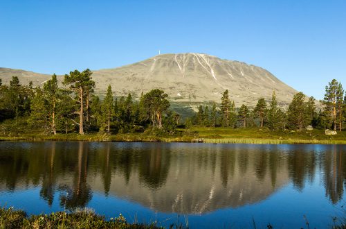
Gaustatoppen 1883m n.p.m.
